sign
logo Arizona Trailblazers
Home
Outdoor Links
Hike Arizona
Trip Planning Guide
Trip Report Index
Calendar of Events
Library
#1 Adero Canyon Ridgeline Trail,
Overlook and Lower Ridgeline

Fountain Hills, McDowell Sonoran Preserve
November 2, 2022
by Robbi Fowler
  GPS Map 
group
Trailblazers. [photo by Robbi]
Robbi, Teena, Yu-Ling.
view
The Adero Canyon Trailhead. [photo by Robbi]

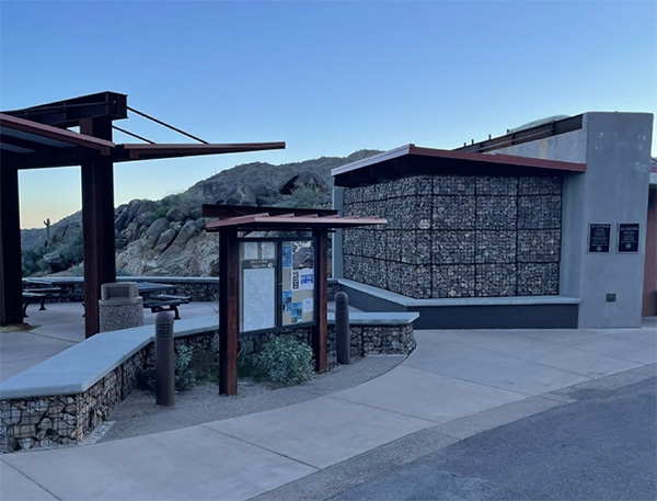
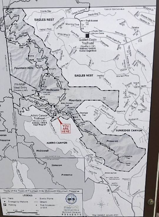
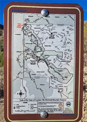
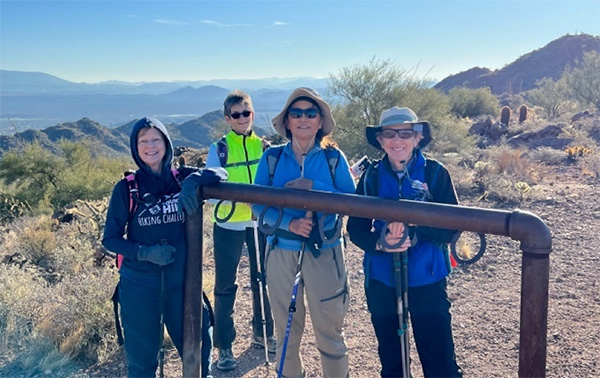
At the Adero Canyon Trailhead, we discussed the brisk weather and took a picture of the map as Fountain Hills suggests and of our little group.

Alas, I did not know as yet that the cover over my camera lens was shattered. Thus, the blurry group photo.

view
Sign at the Adero Canyon Trailhead. [photo by Robbi]

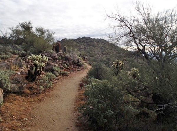
We started through the gate. The signposted Overlook/Ridgeline trail began on our right. This trail follows a ridge overlooking Adero Canyon. It is extremely well groomed – almost landscaped. We bypassed the Overlook on the way out knowing we would catch it on our return. The Lower Ridgeline, a new addition and on that day, unsigned, gave us an additional 1-mile loop starting at mile marker R2 and ending at mile marker R4, with stupendous views of the valley, the mountains beyond and Fountain Hills. Lots of quartz and interesting rock formations on this trail.

view
Valley of the Sun. [photo by Robbi]
trail
Trail to the summit. [photo by Robbi]

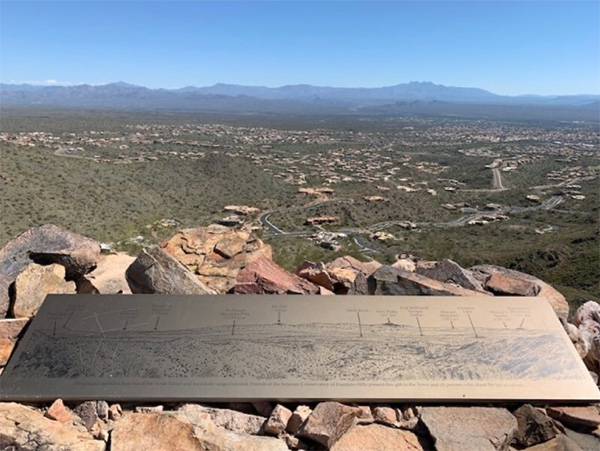
The Overlook is a short trail up a small foothill summit. To my delight every time I visit this spot, it provides a map of the vista in front of you. Always a plus – to know what you are looking at.


#3 Western/Promenade Loop
Fountain Hills
November 8, 2022
by Robbi Fowler
  GPS Map 
  GPS Map 
by Robbi
Hike Leader: Robbi Fowler
Trailblazer Hikers:  Robbi Fowler, Yu-Ling Langford
Others: Marie Fritz, Cathy Cavallaro Pepperd, Linda C. Ryan, Jennifer Guthrie

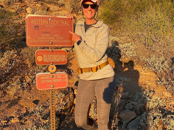
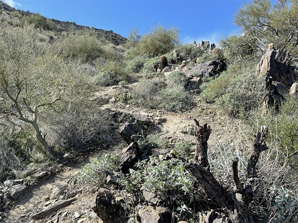
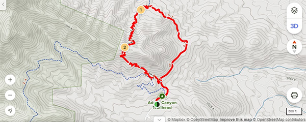
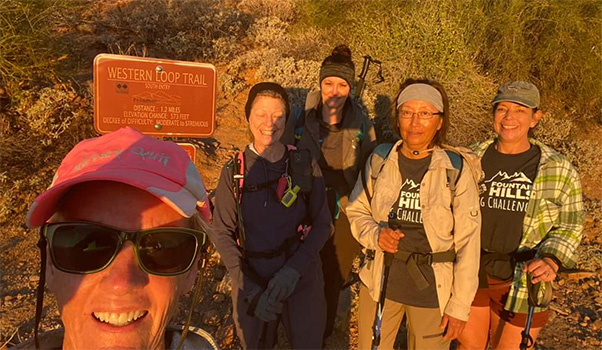
From the Adero Canyon Trailhead parking lot, the Promenade Trail begins after the gate. It follows the same old jeep road we have begun on since the beginning of the month. We bypassed the Western Bike Trail on this outing to reach the signposted Andrews Kinsey Trail. This we followed, with numerous stops for scenery gazing, past a Overlook with bench to the Western Loop Trail. The Western Loop Trail climbs to a scenic view.

Linda
Linda C Ryan. [photo by Robbi]
view
The Western Loop Trail. [photo by Robbi]
map

The trail meets up again at a higher spot with the Promenade Trail, where we had parted from Bill Craig last hike and descends to the parking lot on Promenade. This trail is listed as Difficult by Fountain Hills, and Hard by AllTrails. This hike was described on the AZTC events page as a D. In our humble opinion it was Moderate at most, but short. We traveled clockwise this day. The trail is beautiful. Enjoyable. Twisty and a steady ascent. FUN! It was not hard or difficult. Do not be discouraged by the ratings this hike has been given.


#4 Dixie Mine to Adero Canyon
Fountain Hills
November 11, 2022
by Robbi Fowler
Hike Leader: Robbi Fowler
Trailblazer Hikers: Robbi Fowler, Yu-Ling Langford
Others: Marie Fritz, Cathy Cavallaro Pepperd, John Ryan, Linda C. Ryan, Jennifer Guthrie
group
Trailblazers at the Western Loop sign. [photo by Robbi]
Linda, Robbi, Jennifer, Yu-Ling, Cathy.
sign
Sign showing where the trails are. [photo by Robbi]
Robbi
Robbi. [photo by Robbi]

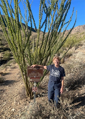
From the Adero Canyon Trailhead parking lot, we followed the Promenade Trail in what we would have described at the time as gale force frigid wind that gentled the more we proceeded into the canyon. This trail begins going uphill and then undulates up and down once you reach the signposted Sonoran Trails.

On this day we chose to hike the Lower Sonoran Trail a short distance to the sign posted Scenic Overlook. Then we continued, past the posted end of the Fountain Hills Park, into the McDowell Mountain Regional Park. We stopped to gaze at the views and take selfies. When we reached the Dixie Mine Trail T intersection, we crossed paths with a Conservancy Hike doing the Challenge that we headed to Dixie Mine that day. They continued on the Dixie Mine Trail and we turned right to travel towards the Golden Eagle Trailhead. At Golden Eagle we shuttled back to Adero by car in batches for an enjoyable end to this hike.


#5 Andrew Kinsey Trail to the Hitching Post
Fountain Hills
November 21, 2022
by Robbi Fowler
  GPS Map 
by Robbi
Hike Leader: Robbi Fowler
Trailblazer Hikers: Robbi Fowler, Yu-Ling Langford, Gene Bentz
Others: Toni Vallee, Deb Barr
Gene
Gene Bentz, [photo by Robbi]
We did introductions and group photos and set off at 7:20 AM. From the Adero Canyon Trailhead, we went through the gate and took the signposted Western Bike Trail on our left. When the trail met the Andrews Kinsey Trail, we turned left. This we followed, with frequent stops for scenery gazing, past an Overlook with bench, past the turn to the Western Loop Trail and on to Scottsdale. This is a well maintained easy to moderate grade with a crushed granite trail surface. The trail is ups and downs, no steep climbs, unless you go beyond the Hitching Post to the Sunrise Peak summit.

The Fountain Hills segment of this hike (from the trailhead) is less than a mile. There will be a sign that says you are leaving Fountain Hills and entering Scottsdale. At that point, we are in The Scottsdale Mountain Preserve where the trail continues for >2 miles with 214' of elevation change and is rated moderately difficult.

hikers
At the Hitching Post: Robbi, Gene, Yu-Ling. [photo by Robbi]
hikers
At the Hitching Post: Robbi, Deb, Yu-Ling, Toni. [photo by Robbi]

#6 Dixie Mine
Fountain Hills
November 27, 2022
by Robbi Fowler
  GPS Map 
by Robbi
Hike Leader: Robbi Fowler
Trailblazer Hikers: Robbi Fowler, Yu-Ling Langford, Gene Bentz, Tamar Gottfried,
Eileen Root, Mimi T, Cindy Duke

We did introductions and a countdown before setting off at 9:07 AM from the Golden Eagle Parking Lot. On this hike we went down Golden Eagle Blvd past the guard house to a turn right onto another street that leads through a gate and to the Dixie Mine Trail inside McDowell Mountain Regional Park.

The trail is full of interesting vegetation, rock formations and long-distance views. Thompson Peaks cell tower is inviting you to investigate. When we reached the end of the trail T’ing into an old mining road, we headed down the scree hill and took a left into a narrow wash. The trail widens and dips up and down through shade until it opens into an area in front of the lower mine entrance. After exploring here we headed down the wash a bit, bouldering, scrambling but we turned back before the “dry” waterfall climb back to the upper road. We returned to the turn into the wash and headed up the mine trailings hill to the upper mine entrance. We investigated awhile, looked out at the scenery, 2-3 headed up behind us to find petroglyphs, but the trail was too overgrown. Soon we headed back down the path towards the road returning to the left onto the Dixie Mine trail to backtrack our route from the parking lot.

Gene
Gene Bentz. [photo by Robbi]
      top Top of Page
Arizona Trailblazers Hiking Club, Phoenix, Arizona
Comments? Send them to the AZHC .

updated December 12, 2022