
Outdoor Links
Hike Arizona
Trip Planning Guide
Trip Report Index
Calendar of Events
Library
|
Northwest Goldfield Bajada Day Hike Goldfield Mountains November 7, 2015 by Ted Tenny |
|
||||||
 Trailblazers assemble at Blue Point. [photo by Quy] |
||||
|
||||
|
When I set eyes on the Goldfields for the first time in 1991, it was love at first sight. Today’s hike was the same way, with great weather and ample picture opportunities. 18 nimble Trailblazers set out from Blue Point Trailhead on a gorgeous autumn day. We started walking south on Forest Road 10, then walked a horse trail that looked promising until, alas, it took us back to FR 10. Later we left the road, bushwhacking, eastward. |
||||
 Dawn paints Red Mountain in soft colors. [photo by Bruce] |
||||
 Off to a good start on Forest Road 10. [photo by Quy] |
||||
|
Bajadas are formed when alluvial fans flowing down from the mountains coalesce. As we soon found out, crossing a bajada against the grain involves a lot of ups and downs to get across washes. |
||||
 Hmmm. What sort of critter do we have here? |
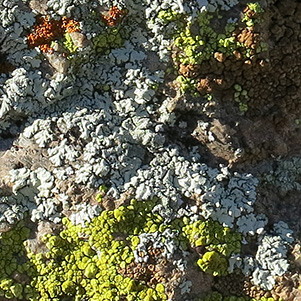 I took a likin’ to the lichens. |
 Crested saguaro captures our imagination. |
 First crested saguaro. [photo by Bruce] |
 First crested saguaro before Red Mountain. [photo by Bruce] |
|
Onward! Ted pointed out Peaks 2290, 2662, and 2578, all glistening in the morning sun. Most peaks in the Goldfields aren’t named, so we have to rely on the numbers printed on the USGS topographic map. Each number is the elevation of the peak in feet above sea level. |
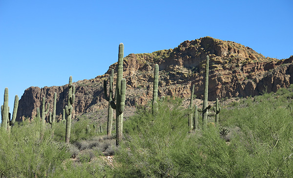 Ted has climbed Peak 2290. |
 Peak 2662 looks doable, on the map anyway. |
 Never heard of anyone climbing Peak 2578. |
 Where we went last time (although we didn’t actually climb the slickrock). |
|
Continuing east, Ted dropped down into the wash he had hiked last time, when he saw the elusive Overlook Arch. The arch was high up on the left side of the canyon that flows down from Peak 3192. That hike also featured an attempt to climb the slickrock wall southeast of Peak 2578. We didn’t go there today. Everyone else climbed up the south slope of the canyon. There they found another arch, and a cave. |
 Yes, we found an arch! |
 This arch is inconspicuous. [photo by Quy] |
 Sally gets through the arch we found. [photo by Bruce] |
 Interesting, but not really an arch. It lacks closure. |
|
We decided to split the group. Quy, Lance, Jim, Monika, Suzanna, Debbie, John, and Tamar would walk back to the trailhead with Ted, while Lin, Chris, Sally, Chip, Jessica, Mark, Eileen, Bruce, and Michael would explore the cave and try to find the Overlook Arch. Ted’s group went down to cross the canyon, then up on the north side. Here we found smooth walking, since we were traversing a bajada with the grain. It didn’t last. So we dropped down into a wash which wasn’t too bad. It took us to the power line which goes from Stewart Mountain Dam to Apache Junction. Just beyond the power line was a dirt road used for maintenance. |
 Christmas cactus. |
 Lichens in school colors. |
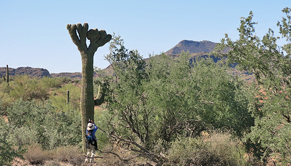 Quy photographs a second crested saguaro. |
 Second crested saguaro. [photo by Quy] |
 Saguaro with a burl. [photo by Quy] |
 The going gets easier on the down grade. [photo by Quy] |
 Four Peaks loom behind the power lines. |
|
We walked the road for a short distance. But it goes northeast and we were going northwest, so we left the road and climbed up on a smooth ridge. There we found a horse trail going the right direction! The horse trail took us down to a wash, then an unmarked road branched off to the northwest, toward the trailhead. The road took us across Bulldog Canyon, to a confusing maze of roads and trails. Soon we were back at Blue Point Trailhead. |
 The home stretch. |
|
The Overlook Arch? No one saw it. Other hikers have looked for the arch, without success. Apparently it’s no longer there. Thanks to Bruce Wilczynski and to Michael Humphrey for serving as deputy leaders for the cave group. Thanks to Quy, Lance, Jim, Monika, Suzanna, Debbie, John, and Tamar for walking back to the trailhead with me. Each group included a worn-out hiker on the way back. Thanks to everyone for helping. |
|
|
|
| Pictures from the exploratory hike: | |
 Cave explorers Lin, Chris, Sally, Chip, Jessica, Mark, Eileen, Michael. [photo by Bruce] |
|
 OK, where do we go from here? [photo by Bruce] |
 Where the Overlook Arch isn’t. [photo by Mark] |
 Second crested saguaro. [photo by Bruce] |
 Friendly tarantula. [photo by Bruce] |
|
→ More pictures, by Lin → More pictures, by Quy |
|
|
Supplemental Report by Jim Buyens |
|||||||||||||||||||||||||||||||||||||||||||||||||
|
Thanks again, everyone, for supporting Arizona Trailblazers on this hike, and you, Ted, for leading it. Everyone seemed to be smiling the whole way through, so I guess we did it right. Jim |
|||||||||||||||||||||||||||||||||||||||||||||||||
|

|
||||||||||||||||||||||||||||||||||||||||||||||||
 Top of Page
Arizona Trailblazers Hiking Club, Phoenix, Arizona
Comments? Send them to the AZHC .
updated November 13, 2019