Outdoor Links
Hike Arizona
Trip Planning Guide
Trip Report Index
Calendar of Events
Library
|
Rim to Highline Day Hike Mogollon Rim August 13, 2005 by Ted Tenny |
|
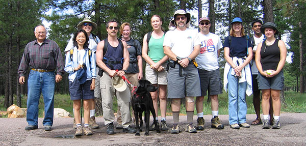 Trailblazers start from Rim Top Trailhead. |
|
A new book, Day Hikes & Trail Rides in Payson’s Rim Country, by Roger and Ethel Freeman, describes the second half of this hike on pages 114-115. Ted found their description accurate and helpful. 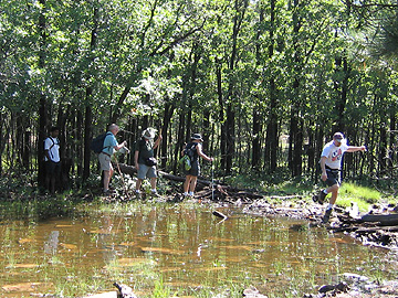 Step lively, to keep your feet dry. 13 lighthearted hikers enjoyed this Mogollon Rim adventure – Alan, Debbie, Joe, Stan, Nicol, Mike, Sam, Jenni, Susan, Steve, Jon, Clara, and hike leader Ted Tenny. The trail to the Rim was wet. We needed fancy footwork to get around the puddles and ponds. Finally we made it past the water and were rewarded with a glorious view from the top of the Mogollon Rim to much of central Arizona. The Rim Lakes Vista Trail is marked with white diamond signs nailed to the tree trunks. |
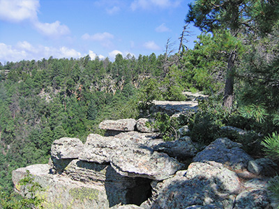 Mighty rocks overlook the Mogollon Rim. 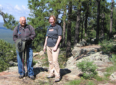 Clara and her father. Two miles into the hike we arrived at the Military Sinkhole Trailhead, a popular picnic spot where the Military Sinkhole Trail crosses the Rim Lakes Vista Trail. Some bicycle riders passed us on the way in. We wondered how they would do on the wet trail. Previous club hikes had turned right on the Military Sinkhole Trail and returned to Rim Top Trailhead. We turned left and stated downhill for Two Sixty Trailhead instead. For the first mile the trail goes downhill at an angle. We stopped for lunch at a junction where the trail branches off to the right from a primitive road. From there to the trailhead we went up and down as we crossed a series of washes. The hike ended suddenly as we went around a bend and found ourselves at Two Sixty Trailhead. Everyone was in high sprits. |
|
This hike is described in Footloose from Phoenix, by Ted Tenny, pages 235-240. |
 Top of Page
Arizona Trailblazers Hiking Club, Phoenix, Arizona
Comments? Send them to the AZHC .
updated August 19, 2018