Outdoor Links
Hike Arizona
Trip Planning Guide
Trip Report Index
Calendar of Events
Library
|
Pivot Rock Canyon Day Hike Mogollon Rim August 16, 2008 by Ted Tenny |
|
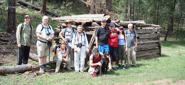 Trailblazers pause briefly at the pioneer’s cabin. |
|
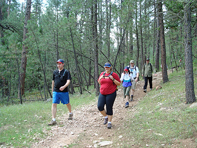
Thirteen terrific Trailblazers set out for Pivot Rock Canyon on a steamy summer day. It’s a pure delight to watch the car thermometer drop from the 90s to the 70s as we drive north through Payson, Pine, and Strawberry to our turnoff for Pivot Rock Canyon. Ted has never been there before, and is thankful to have Jan serving as navigator. Jan makes sure that we never lose our way along the trail. |
 The Pivot Rock Canyon Trail starts on an abandoned road. |
The trail starts at a campground off Forest Road 616. Campers are cooking on a wood fire. Recent rains have left puddles of water on the trail. Our trail was once a road. It parallels the streambed for the first half mile before taking a sharp bend to the west to get around a side canyon. There’s another road coming in from the other side, so Jan tells us to remember the intersection for our walk back. |
|
The trail divides. One branch continues north, well above the streambed. We take the streamside route down to a lovely little canyon with flowing water and lots of green vegetation. |
 Lush greenery highlights varied rock formations. |
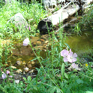 Summer flowers grace the water’s edge. |
|
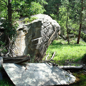
The rock formations are layered, some in imaginative shapes. “Look for a rock with a face in it,” Ted advises. No one sees it. “Well, maybe it’s on downstream.” |
|
The streambed varies from slickrock to cobblestones. There are caves on the west side, one of them big enough to suggest an archaeological site. Some of our hikers climb up to explore the biggest cave, but find no sign of past or present inhabitants. We continue on past the junction with Hicks and Duncan Canyon, which flows in from the west, then we pick a shady spot for lunch. The trail continues on for another half mile to the place where Forest Road 142 dips down to cross the canyon. But the best scenery is behind us, so we make this our turnaround point. The day which started out clear has turned partly cloudy. Summer thunderstorms usually happen in the afternoon. We felt a few tiny sprinkles on the way down. Why chance it? We start walking back. |
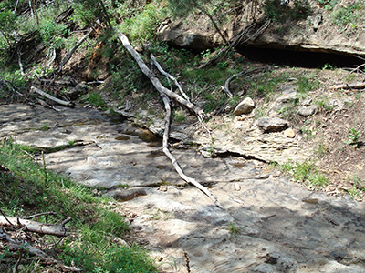 Part of the canyon is slickrock. Is that cave inhabited? 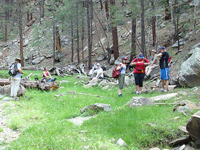 We found the perfect picnic area. |
|
Pivot Rock Canyon was inhabited at one time. The cabin is still standing—sort of—but the hardy pioneers who lived here are long gone. |
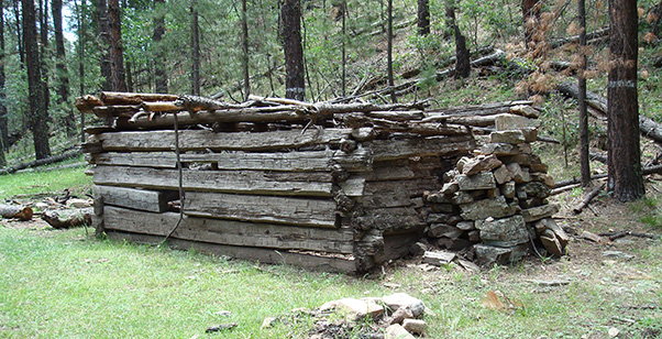 The cabin’s still standing, but nobody’s home. |
|
Hikers can find their way back on an easy trail, so Ted decides to sweep. Chuck and Jan walk with him. Although the direction is obvious, the trail braids in several places, usually with one branch going down to the water’s edge and another up on the hillside. A pleasant breeze cheers us along. |
|
Natural forces continually re-shape this canyon. Tall trees have fallen down, some recently and some so long ago that most of the wood is gone. Evidence of past floods is everywhere. One of the mysteries of Pivot Rock Canyon is a patch of loose dirt along the side of the stream. It should have washed away in the spring floods. Another mystery is the rock with a face. Where is it? |
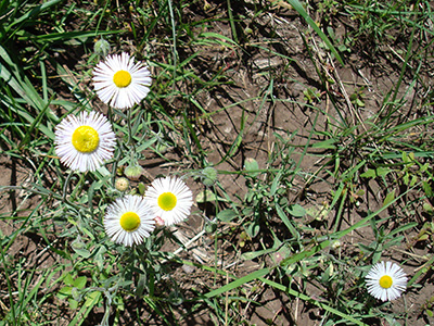 Hello, Daisy. You look so cool in your summer attire. |
|
Cyd took a picture of the rock on a previous hike in this canyon. Now Jan, Chuck and Ted can’t find it. But there’s plenty to see, especially on the section of trail that goes right beside the stream and crosses it many times. All is well as we arrive back at the trailhead and round up the two-way radios. It was a pleasant hike and a welcome escape from our sizzling central Arizona summer. |
 Top of Page
Arizona Trailblazers Hiking Club, Phoenix, Arizona
Comments? Send them to the AZHC .
updated September 15, 2018