Outdoor Links
Hike Arizona
Trip Planning Guide
Trip Report Index
Calendar of Events
Library
Superstition Mountains
February 16, 2013
by Scott Green
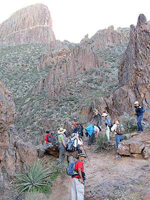
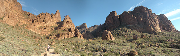
 Trailblazers begin their climb at the wilderness boundary. [photo by Wendy] |
|
A perfect time of year for this trail – not too warm but the day was long enough for everyone to visit their particular areas of interest along the way and at the top. The day started with about half of the group meeting at the carpool location and the other half at the Mining Camp Restaurant. |
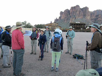 Here’s the map. Now you all pay attention. [photo by Wayne] |
After warm greetings among the club members and many guests, the administrative tasks were soon done including the distribution of the club’s two-way radios. We left the parking lot and followed the fence line of the property to a seldom-used road, which is mostly a horse path, on the short way to the formal trail. After a few easy passes past a gate and a fence entrance, we had a clear view of our destination, the Flatiron, off in the far and high distance. |
|
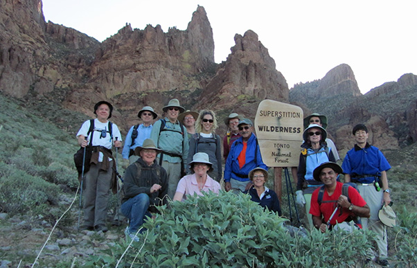
Once at the formal trail, we were greeted by the colorful map and warning information signage about the Superstition Wilderness often found at the trailheads. Traversing from the sign slightly (relative to the remainder of the day) uphill, we passed the area of some previous ranch and mining activity to the left which is barely visible due to overgrowth. A little further brought us to the formal posted Wilderness boundary where we gathered for our group picture in all our glory. |
 Scott gives careful instructions as we approach the Teaspoon. [photo by Wayne] |
|
|
| The Teaspoon is like climbing a steep roof. [photos by Ajay] | |
 Trailblazers get ready for a big boulder scramble. |
 This is rugged country! [photos by Wayne] |
|
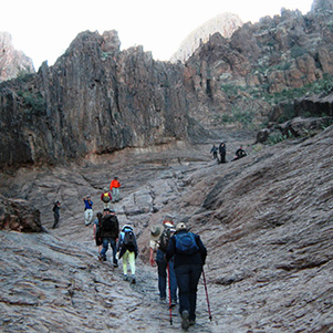
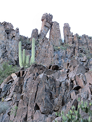
From the boundary line we trekked toward the small valley referred to as Siphon Draw with our much higher destination looking out over us. At this point of the trail, the Forest Service has improved the trail by placing railroad ties as steps, which indicates the gentle but firm increase of the trail’s incline. From here, we could see a line of large rocks which perhaps was the foundation of an old road which provided the ranchers access to periodic and unreliable water via a spring up the creek. The entrance is marked by a mini-Weaver’s Needle rock formation which, although is tiny compared to the actual Needle, is impressive as a lone sentry to what lies ahead. |
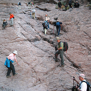
 How did you get up there? [photo by Wayne] As we all gather near Siphon Draw, we were fortunate that the area is dry with no worries of wet granite as the first large and steep face of rock is our next obstacle. |
 Lest we forget. [photos by Wayne] |
 I live here. Won’t you feed me? |
|
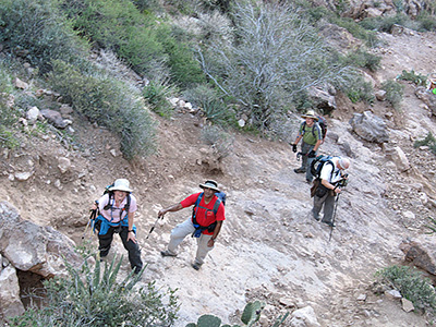
From here forwards the two-way radios ensured the leaders and sweep (and those in between) were well communicating. The next many miles are fuzzy and difficult to recollect. There are blurry images of boulders, white dots, and children saying “pardon me” as they politely gave credit for me standing aside. There were voices from the radio saying that most had already reached the top and were visiting various interesting sights and views. This concert of events continued for quite a while until a vision of Bruce appeared standing on top of a 10 foot wall saying that the end was near, which I knew was true. |
 Whew! Made it to the top. What a long way down. [photo by Wayne] |
 Agave and prickly pear thrive on the Superstition Ridgeline. [photo by Wayne] |
|
With Bruce’s help, the whole group was then safely on the top! The radio confirmed that small groups had already visited the memorial area of the tragic plane crash, the point on Flatiron looking out over the tiny cities, and the top of the hoodoos where a while flag gave people the satisfaction of reaching the pinnacle with views to the north. |
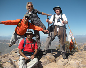
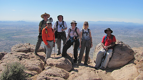 Scott, George, Chuck, Wendy, Lori, and Ajay on top of the world – the Flatiron. [photo by Wendy] |
 George, Ajay, Lori, Chuck celebrate Peak 5024. |
 Aye, but we have to get down. [photos by Ajay] |
|
Throughout the afternoon, as hikers had finished seeing what they came to see, they descended the way they came. Back down the narrow slip of a trail, back down the wall (again with Bruce’s help), back down the multiple foot high “steps” to the next bolder or tilted slab of sandy rock. Back down the many areas which, if one is not careful, will suck a hiker with wobbling legs downward faster than one’s ability and desire. As to accentuate the precarious nature of the trail, we were reminded near the bottom of our good future at the expense of someone who had injured their ankle and was waiting with their friends for Search and Rescue to transfer them to medical help before darkness. |
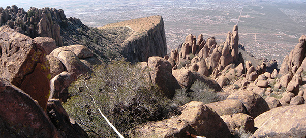 Looking down on the Flatiron from the North Peak. [photos by Ajay] |
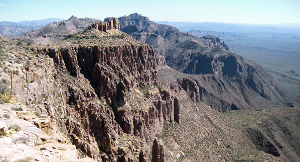 Looking southeast to the Birthday Cake and Peak 5057. |
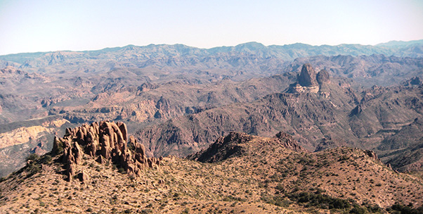 We’re high above Weaver’s Needle on Peak 5024. |
|
All in all – it is a hike that once done is not easily forgotten. And when the mountain and Flatiron are seen from the cities, they are deservedly well respected for their grandeur. |
 Siphon Draw, in retrospect. [photo by Ajay] |
 Top of Page
Arizona Trailblazers Hiking Club, Phoenix, Arizona
Comments? Send them to the AZHC .
updated March 10, 2019