Outdoor Links
Hike Arizona
Trip Planning Guide
Trip Report Index
Calendar of Events
Library
|
Mesquite Ridge Day Hike Tonto National Forest January 8, 2011 by Ted Tenny |
|
 Sandy, Mike, Bobbi, Quy, Sally, Dave, Alice, Ted, Wendy, Michael, Steve, Bill [photo by Bill] |
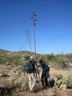 Wendy and Bill straighten a century plant. |
A dozen daring Trailblazers set out from Tortilla Trailhead on a bright, cool morning without a cloud in the sky. For this one-way hike we spotted Ted’s car back at Mesquite Flat, then drove to to the trailhead in the other cars. Most of our climbing is over with at the beginning of the hike as we walk south on Forest Road 213. Although the road is very steep at the beginning, some folks have managed to drive on it. To the east we enjoy a distant view of 3910' Fish Creek Peak and 4806' Black Cross Butte – an "A" hike any day. Most of today’s route is visible to the west, with two buttes at the foot of hill 3420 as our navigation landmark for the first half of the hike. |
|
We turn left and walk west on an unmarked dirt road, which kind of follows the ridgeline until it dead ends. From here the buttes are no longer visible. “Keep the hill on your left and the canyon on your right,” Ted advises as we start to bushwhack our way down to the buttes. This is no place to make a wrong turn! Finally the buttes come back into view. We are too high, so we start losing elevation as we continue to contour diagonally toward them. After passing the buttes on the right, we turn north and then west to get on the main part of Mesquite Ridge. The next mile is a pure delight! We are walking in the sky on a smooth ridge with wild, expansive views of the northern Superstition Wilderness on every side. Our picnic area is on the top of the ridge, near some game trails. After lunch we decide to follow them counterclockwise around the western end of Mesquite Ridge. The animals know how to find a good view! Although the ridge is smooth on top, its north and west sides are too steep to climb down. We wouldn’t want to go there anyway, because Stay Away Canyon is so full of boulders and thorns. So we walk eastward and cast about for a way to climb down on the south side. Bill and Steve scout the route, with Michael giving us directions. |
Photos by Bill Zimmermann: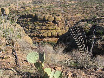 Stay Away Canyon, from atop Mesquite Ridge.  Trailblazers begin their rocky descent to the streambed.  See, there’s stairsteps at the bottom. |
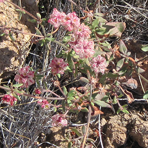 Eriogonum polycladon – Sorrel Buckwheat |
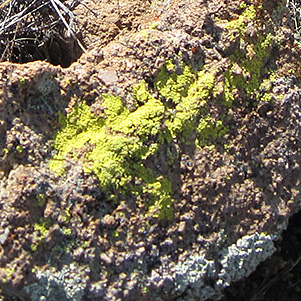 Lichens leave the rocks pockmarked. |
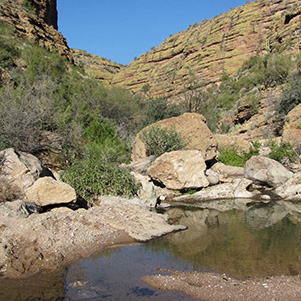 Water flows at the canyon junction. [photo by Bill] |
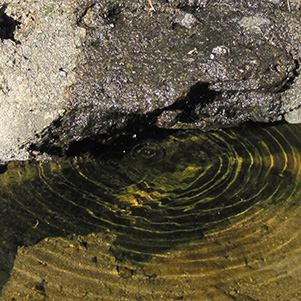 Phase velocity, or group velocity? [photo by Ted] |
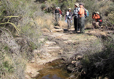 ... but you didn’t know how wet it was going to be? [photo by Bill] 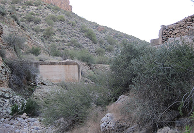 Oh, those lovely bridge supports! |
Our steep, rocky descent lands us on a ledge above a waterfall. The side canyon is full of boulders and thorny brush, prompting us to climb a little way above it to make our way downstream. Pools of water are intermittent until we reach the canyon junction. From there on the water flows freely, except for a place where it goes underground and then re-emerges. We boulder-hop, bushwhack, and try to keep our boots dry as we gradually make our way westward. The end of our off-trail adventure appears suddenly as round a bend and see the support structures of a bridge long gone. A short climb puts us on a road that leads back to the Arizona Trail highway and Mesquite Flat. Late afternoon sun paints the mountains in vivid colors as we walk back. |
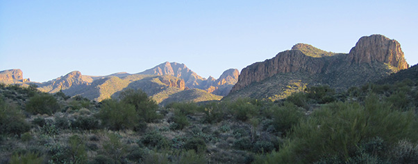 Looking back on the northern Superstition Wilderness. |
| This hike is described in Footloose from Phoenix, by Ted Tenny, pages 99-103. |
 Top of Page
Comments? Send them to the AZHC .
updated November 22, 2019