Outdoor Links
Hike Arizona
Trip Planning Guide
Trip Report Index
Calendar of Events
Library
|
Round Mountain Park Day Hike Globe February 20, 2022 by Wendy Rennert |
|
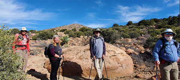
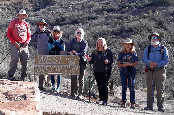 Trailblazers ready to hike. [photo by Bill] |
| Bill, Bud, Deirdre, Wendy, Diane, Kim, Chip |
|
On a beautiful Sunday morning, 7 curious hikers set off to explore the trails of Round Mountain Park in Globe, AZ. While the 386-acre park was dedicated back in May of 1997, this is the first time our club has hiked this park. I never even knew it existed until I read about it recently in Mare Czinar’s The Hike Book Volume I. There are 6 different trails in this park, totaling 6.7 miles, and a total of 16 benches along the way. The park also has restrooms and picnic ramadas. |
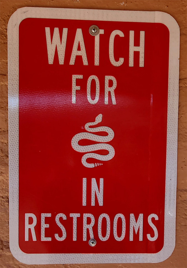 Now THAT’s a first - keep your wits about you in these restrooms! [photo by Deirdre] |
|
Apparently, most people only hike the short 2 mile loop hike, made up of the West and East Trails, because that is the only route that shows up in All Trails, but our goal today was to hike ALL of the trails. We started off on the West Trail, and before too long we made our way up to our first junction at the Lion’s Club picnic ramada. This is the point (“B” on the Park Map) where the Bull’s Eye Rock Loop Trail begins. |
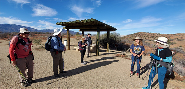 Beautiful day for a picnic! [photo by Wendy] |
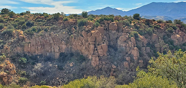
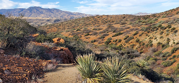 Great views and old mine shafts along the Bull’s Eye Rock Trail. [photo by Wendy] |
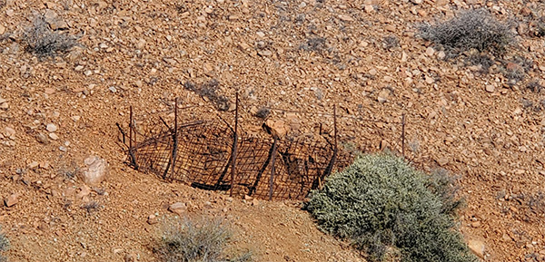 Great views and old mine shafts along the Bull’s Eye Rock Trail. [photo by Wendy] |
|
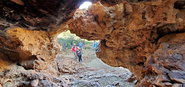
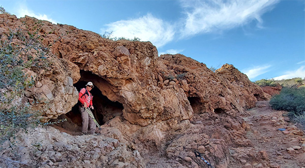
Bull’s Eye Rock Trail is, in my opinion, the one of the main highlights of the park. We see an arch and a hole in a rock wall, and an area of shallow caves. |
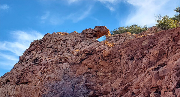 Found it! Here is Bull’s Eye Rock. [photo by Wendy] |
 The shallow caves. [photo by Wendy] |
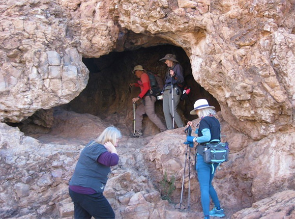 Let’s just take a quick peek inside. [photo by Chip] |
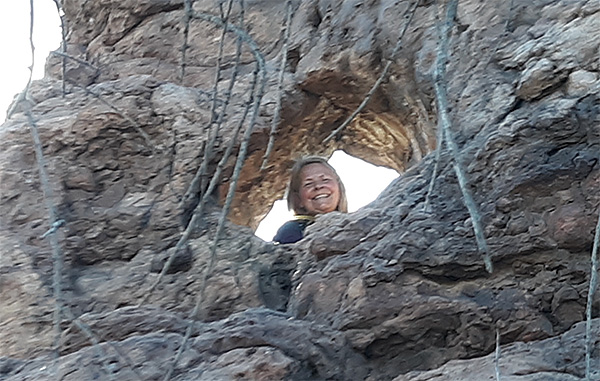
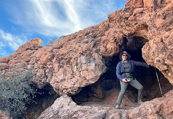 Wendy strikes a pose. [photo by Deirdre] |
 The view looking out from the cave. [photo by Wendy] |
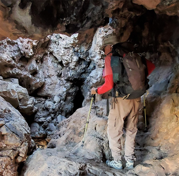 Bill, captain of the cozy cave. [photo by Wendy] |
 A series of small holes along this rock wall. [photo by Wendy] |
|
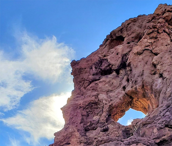
As we emerge from the cave area, we continue heading up the hill and come across another hole in a rock wall—this one looks more like an eye than an arch. We take turns snapping photos and peeking through the hole. |
 A bit of welcome shade. [photo by Wendy] |
 Here’s looking at you, rock wall. [photo by Wendy] |
 Hi, Diane! [photo by Bill] |
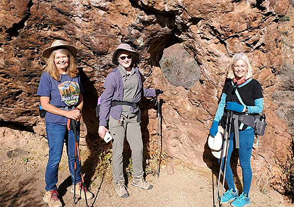 Kim, Wendy, and Deirdre at the hole in the rock. [photo by Diane] |
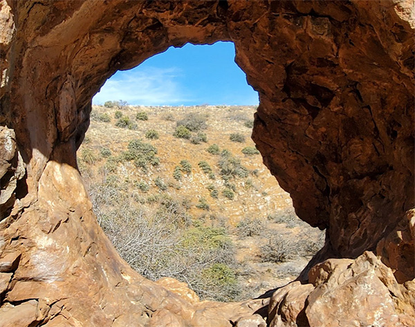 Beautiful views and blue skies through the hole. [photo by Wendy] |
|
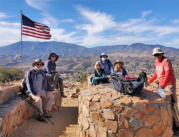
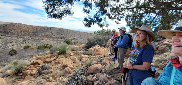
After Bull’s Eye Rock Trail, we continue on the West Trail, then head up to the summit (point D on the Park Map). At the top, there is a nice circular seating area (for maybe 20 people or so) made of local stone, a directional sign showing us which way is N, S, E and W, and an American flag. Wonderful 360-degree views from this location! We can see the town of Globe, the Pinal mountains, and the mining area in the distance. This is my other favorite spot in the park. |
 Enjoying the views from the nice seating area. [photo by Diane] |
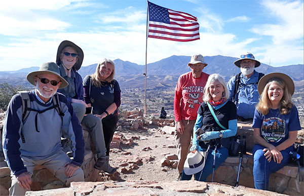 Bud, Wendy, Diane, Bill, Deirdre, Chip, Kim. [photo by Bill] |
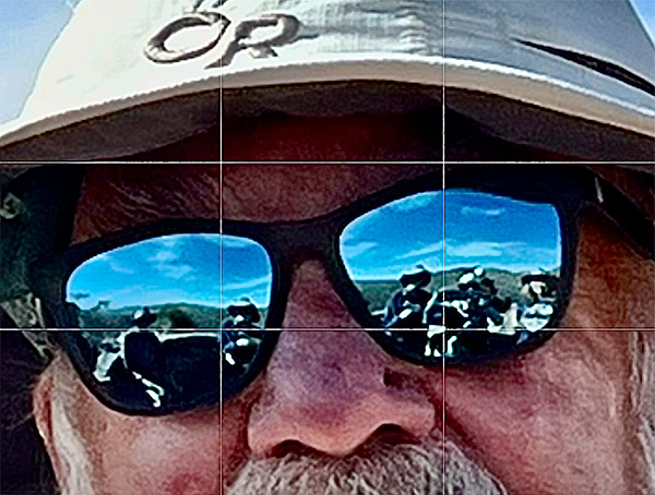 I spy some AZ Trailblazers in Chip’s sunglasses! [photo by Deirdre] |
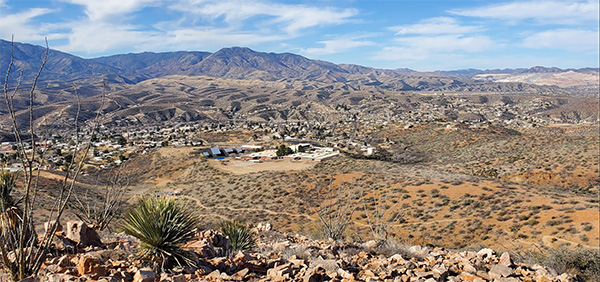 Mighty fine views! We can even see the Lion’s Club ramada from here. [photo by Wendy] |
 Mighty fine views! We can even see the Lion’s Club ramada from here. [photo by Wendy] |
|
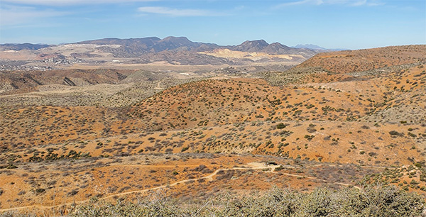
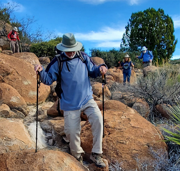
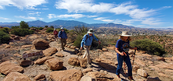
After the summit, we continue along the East Trail, and purposely pass by the first intersection with Boulder Canyon Trail (BCT), so that we can pick up the BCT from the southern end (going from points D to C to E to F on map). We noticed that the scenery changed from a fairly sparse landscape to one with much more vegetation and lots of large boulders everywhere. We enjoyed the change of scenery, and the change from flatter gravel pathways to some minor boulder hopping. At the junction of the Boulder Canyon and Box Canyon Trails (N on map), we turn left to remain on the Boulder Canyon Trail (to go from point N to O on map). Just before we meet up with the Ridge Trail, we find a nice spot to rest up and have a snack, as there are many chair-height boulders to sit on at this point. |
 The pretty boulder-strewn section begins. [photo by Wendy] |
 The pretty boulder-strewn section begins. [photo by Wendy] |
 Certain trails in the park have signs identifying the nearby plants. [photo by Wendy] |
 Watch your step! [photo by Wendy] |
 Snack break. [photo by Wendy] |
|
Just moments after the snack break, we arrive at the intersection of the Ridge Trail. It runs both north and south from here - on this trip we head north (from O to J on map). It is nice and breezy up here! If you are thinking of hiking at this park and wanting to hike all of the trails like we did, you will want to know that hitting all of the trails means multiple ups and downs. So despite it being rated as an easy–to-moderate trail system, we actually get in a good workout, and when all is said and done, we accumulated about 1,000-1,100 feet of elevation gain overall. |
 Ridgeline trek. Note the nice large trail signs. [photo by Wendy] |
|
There are nice large trail signs throughout the park, the only slightly tricky part was near the top of the Ridge Trail, because there is 1 small section there that is not signed (around points H and I on the map). We inadvertently started to repeat part of the trail, then quickly backtracked and found which way we needed to go. We were treated to a bonus by going north instead of south on the Ridge trail, because at the top of the Ridge Trail loop, we spotted about 10-15 deer! |
 The deer blend in so well, we can barely see them. [photo by Wendy] |
 We all pause for several minutes to watch the parade of deer go by. [photo by Wendy] |
|
We come across another junction with the Boulder Canyon Trail, and take that along the far eastern edge of the trail system (from J to K, L, M, and N). This leads us to the eastern edge of the Box Canyon Trail, which we take for its entire length. Then it’s a repeat of part of the Boulder Canyon Trail (from N to F), since there is no way to hike the whole trail system without repeating at least one section. And finally, the last part of the East Trail back to the trailhead (F to A on map). One hiker had some issues with the afternoon heat and the multiple uphill stretches, as there is not a lot of shade in this park, but thankfully we all returned back to the trailhead safely. We ended up hiking a total of 6.5 miles. |
 Beauty along the Box Canyon Trail. [photo by Wendy] |
 This rock formation looks like a dinosaur head. [photo by Wendy] |
|
This is a very nice park. I would recommend it if you have not yet hiked here! |
 Top of Page
Arizona Trailblazers Hiking Club, Phoenix, Arizona
Comments? Send them to the AZHC .
updated February 28, 2022