Outdoor Links
Hike Arizona
Trip Planning Guide
Trip Report Index
Calendar of Events
Library
|
Flatiron with 5024 Peak Option Superstition Mountains March 5, 2022 by Chris Everett |
|
 Group, on their way to the Flatiron, with the Flatiron to the left. [photo by Robyn] |
||||
|
|
We started this day at Lost Dutchman State Park. The trail from Dutchman State Park starts out easy, basically flat, it gives you time to warm up a little and admire the views of the Superstition Mountain Range. The group reached the Bowl and took a few pictures before starting our journey up Siphon Draw. Luckily for us it hadn’t rained very hard the day before, because going up the bowl when it is wet could be very slippery. Several of our group had done this trail when wet but only coming down. We had made it about ¾ of the way up when we saw some other hikers we all recognized going up. They were going to do the Ridgeline hike. |
 Sunrise. [photo by Robyn] |
 Sunrise. [photo by Robyn] |
 Flatiron. [photo by Robyn] |
 View of the Flatiron from below. [photo by Robyn] |
 Robyn and Chris going up the Bowl. [photo by Robyn] |
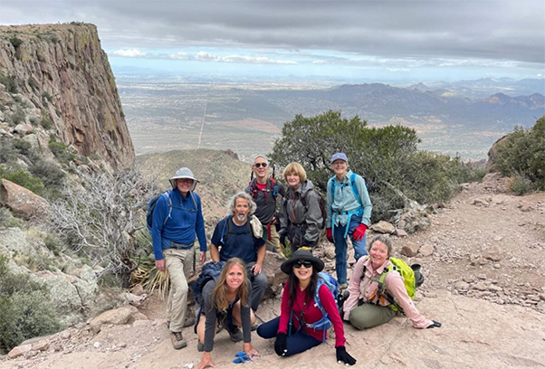
 Tom, Joyce, Terry, Barbara, LI, Chris, Debbie, and Robyn, with the hoodoos. [photo by Robyn] |
 Trailside flowers grace our passage. [photo by Robyn] |
 Clouds. [photo by Robyn] |
|
Sometime later we made it to the Wall, we all then made it to the top. We walked over to Flatiron, were we took a lunch break and admired the views of the Valley. After this everyone decided to do the 5024 peak. The path is sometimes a tricky, but we were able to follow it under boulders and over several too, finally reaching the peak. You could see Weaver’s Needle, Miners Needle, 5057 Peak, Roosevelt Lake, and more. We took several pictures up there and were able to get a couple group pictures, too. |
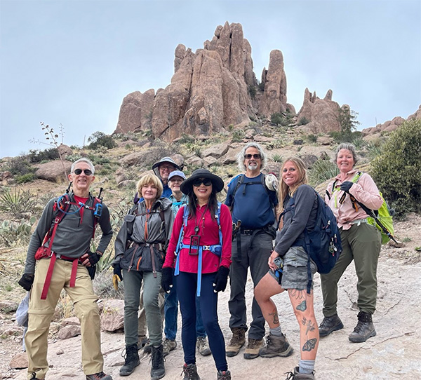
 Li, Tom, Joyce, Robyn, Barbara, Terry, Debbie, Chris, with views of the Flatiron below, from Peak 5024. [photo by Robyn] |
 Taking a break at the peak. [photo by Robyn] |
 Joyce and Robyn taking in some scenery. [photo by Robyn] |
 Barbara crawling under the boulders. [photo by Tom] |
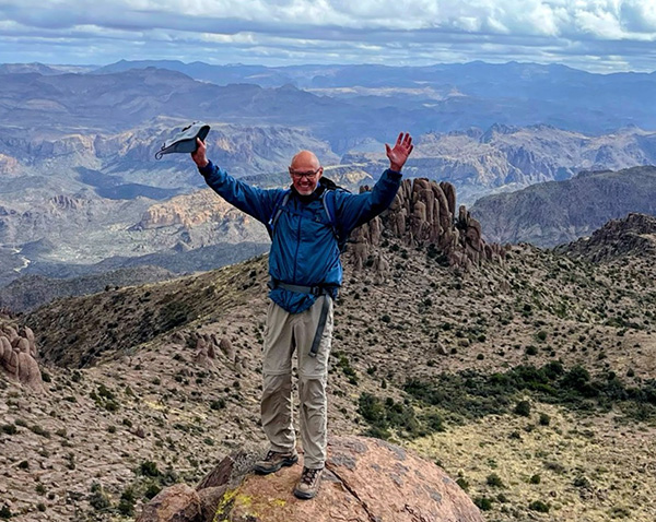 Terry on top of the world. [photo by Robyn] |
|
It was staring to get windy and cold, so we headed down the path. Somehow our path was a little different than the way we came up. About half way down we took a short snack break. We reached the saddle and decided to see the Memorial up to the left. Afterwards we all stared down. At this time we saw Vicki and Janet, getting ready to come down. Never saw them again. Down the Wall we went. There were lot of people going down and up this trail at this time. |
 Chris, Debbie, Robyn and Terry at the Wall. [photo by Robyn] |
 Tom and Li on the way down. [photo by Robyn] |
 Terry, Robyn, Barbara, Joyce, Li, and Tom. [photo by Robyn] |
|
Somehow going down seemed harder than coming up, maybe we were a little tired. After some time, we made it back down to the Bowl where we took a well-deserved break before finishing this track. |
 Taking a break on the way down. [photo by Robyn] |
 LI and Debbie on the edge. [photo by Tom] |
|
The group started the last segment down towards the cars, yes we all made it back. Some of us decided to go to Uncle Bears for some food and talk about the adventure. The food was great and the company. I always enjoy this part of our hikes. |
 On our way to the cars. [photo by Robyn] |
|
The hike was 7.15 miles long with +-3020 feet of elevation gain. |
 Top of Page
Arizona Trailblazers Hiking Club, Phoenix, Arizona
Comments? Send them to the AZHC .
updated March 10, 2022