Outdoor Links
Hike Arizona
Trip Planning Guide
Trip Report Index
Calendar of Events
Library
Canyon Lake
December 13, 2022
by Chuck Parsons
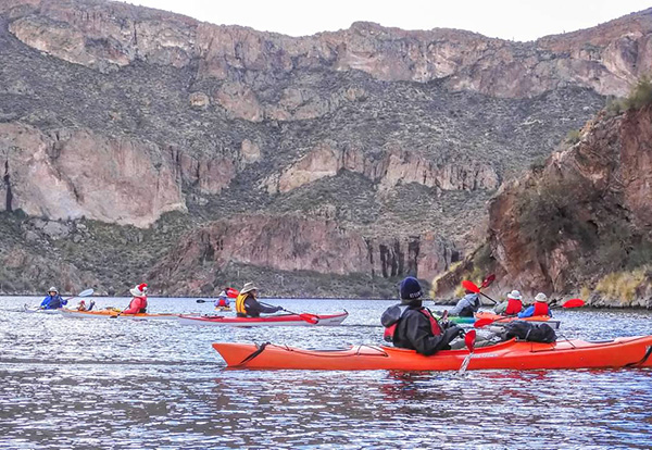
 Ten Trailblazers are ready to brave the elements on Canyon Lake. [photo by Wayne] |
| Wayne, Burt, Ron, Anna, Barbara, Scott, Mimi, Norma, Eva, Chuck. |
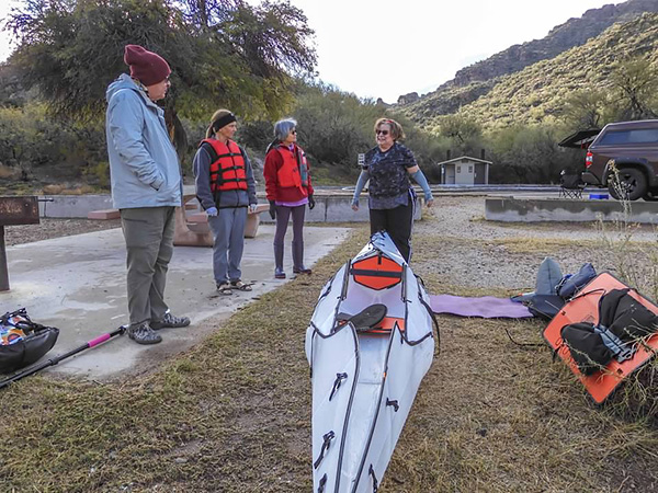
The time is 9:45 AM on an overcast and chilly 47 degree morning in mid-December, as ten Arizona Trailblazers get ready to push off from the Acacia Picnic area on Canyon Lake. Most of Arizona is in the grips of a major winter storm that has plunged temperatures to 15 degrees or more below normal, dropping lots of snow in the high country and rain in the lower desert elevations. With temperatures in the mid-40s forecasted throughout the day, I was expecting at least a few cancellations, but this is a hardy group of kayakers ready to start paddling.
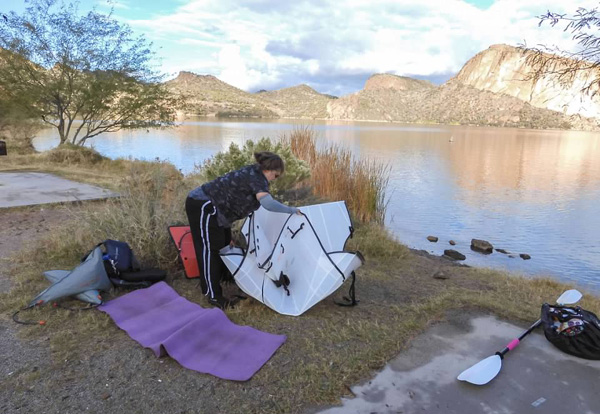
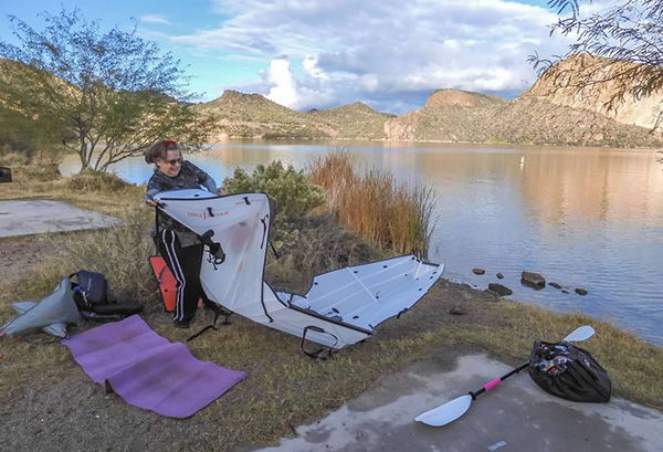
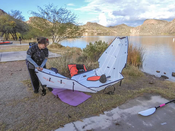
But before we start launching our kayaks, some of us watch as our newest kayaker, Eva, assembles her Beach LT Oru kayak, an unusual origami style kayak. For those who may not be familiar with the term, origami is the ancient Japanese art of paper folding that goes back roughly a thousand years in time. As seen in the first picture, this kayak starts out completely folded up in small square package about 3' by 3'. Then Eva methodically begins a step-by-step process of unfolding, clipping and snapping sections together, and then tying off until she has a completed kayak ready for the water.
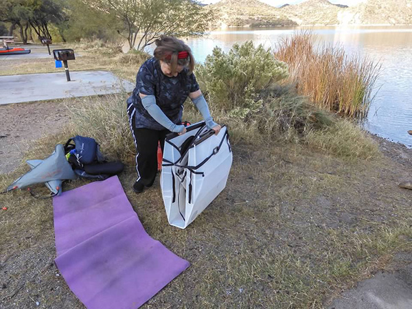 The Beach LT Oru kayak starts out as a small square package. [photo by Wayne] |
 Eva begins the unfolding process. [photo by Wayne] |
 Still more unfolding. [photo by Wayne] |
 Eva snaps the bow section together. [photo by Wayne] |
 Working the mid-section now. [photo by Wayne] |
 Now it’s looking more like a kayak. [photo by Wayne] |
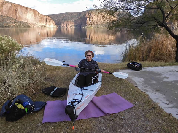 Finally, a completed kayak, with the owner ready to start paddling. [photo by Wayne] |
 Beautiful view of Canyon Lake, under mostly cloudy skies. [photo by Wayne] |
 Preparing to push off from the Acacia launch area. [photo by Wayne] |
 Barbara is already paddling away from the beach. [photo by Wayne] |
The lake surface is almost mirror-smooth, with hardly a ripple, as we start paddling in the direction of Mormon Flat Dam. On the opposite side of this dam is Saguaro Lake, the most popular of the four lakes on the Salt River. And about 6 miles up the Salt River Channel is Horse Mesa Dam on Apache Lake. Saguaro Lake is the last of four reservoirs on the Salt River, created with the completion of Stewart Mountain Dam in 1930.
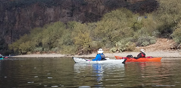
 Most of us are in the water at this point. [photo by Wayne] |
 Eva, Chuck, and Norma are paddling toward the dam. [photo by Wayne] |
 Barbara and Mimi are about to collide. [photo by Wayne] |
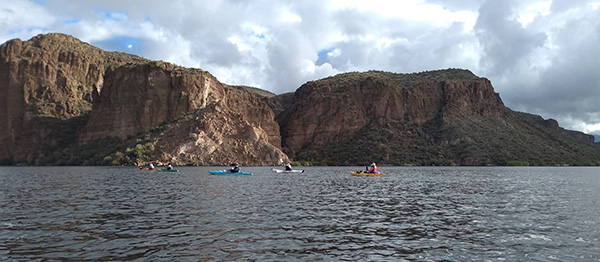 Five kayakers are making their way across the lake. [photo by Barbara] |
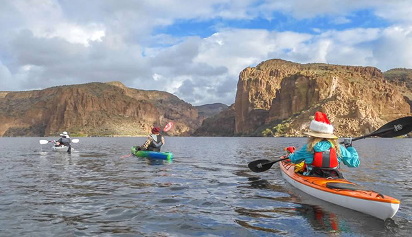
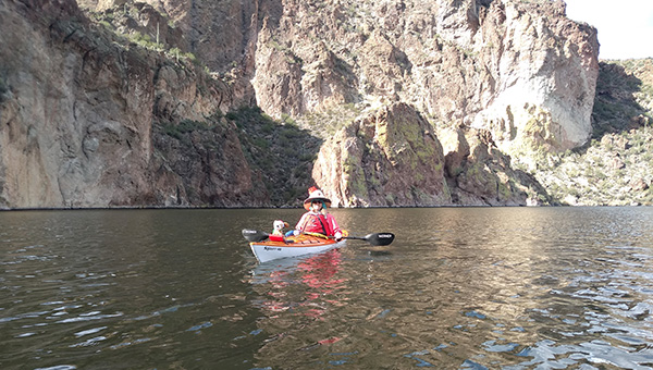 Norma, with her mascot, Santa Bear. [photo by Barbara] |
 Santa Bear keeps a close eye on all of us today. [photo by Norma] |
Theodore Roosevelt Dam on Roosevelt Lake was the first dam built on the Salt River, completed in 1911 and dedicated by President Theodore Roosevelt the following year, when Arizona became the nation’s 48th state. Mormon Flat Dam on Canyon Lake was completed in 1925, followed by Horse Mesa Dam on Apache Lake, completed in 1927. The Salt River Valley Water Users Association, today’s SRP, created these four multipurpose dams for flood control, irrigation water, and generating hydroelectric power.
With ten kayakers and nine kayaks (one tandem) finally in the water, we all begin paddling toward the dam. In all of our previous kayak outings on Canyon Lake, somehow we missed seeing and taking at least one picture of Mormon Flat Dam. So I asked Wayne to take a picture of the dam for this trip report. Although nowhere near the scale of Hoover Dam or Glen Canyon Dam on the Colorado River, Mormon Flat, along with the other three dams on the Salt River, is nevertheless critical for flood control and water storage for the Phoenix metro area.
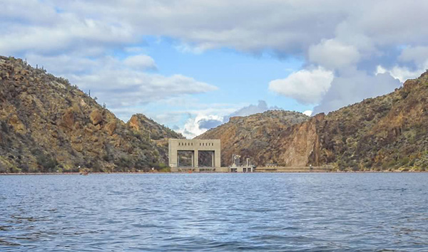 Mormon Flat Dam on Canyon Lake. [photo by Wayne] |
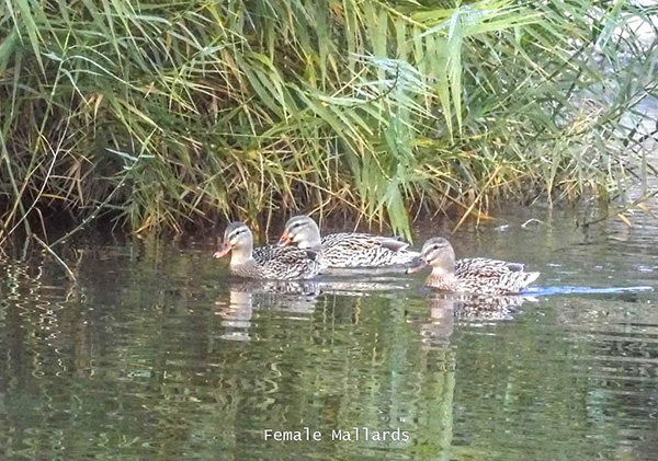 A trio of female mallards. [photo by Wayne] |
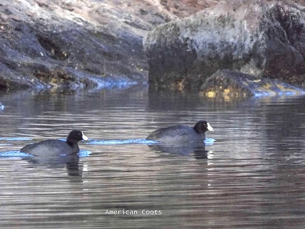 American Coots. [photo by Wayne] |
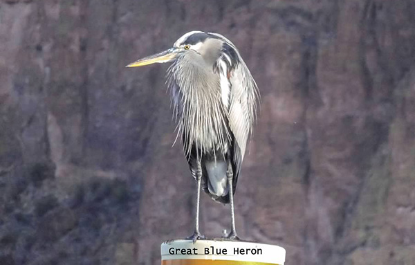 Great Blue Heron. [photo by Wayne] |
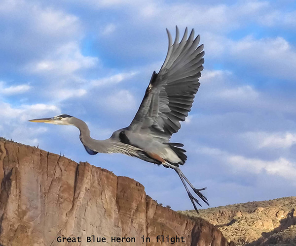 Blue Heron in flight. [photo by Wayne] |
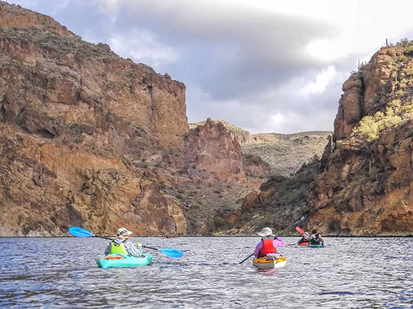
After viewing the dam, we start paddling up the main canyon at the north end of the lake, where the Salt River once flowed freely for millennia before any dams were ever built. If time travel was possible, I would like to go back just briefly in time about 125 years, when Roosevelt and Hoover Dams were only concepts and ideas in the minds of a small handful of men, just to see what the landscape looked like when the mighty Colorado River and the Salt River and every single river in the West flowed freely, completely unshackled by concrete and iron.
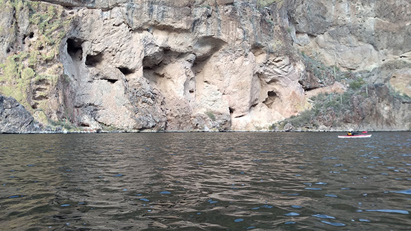 Eroded and pockmarked cliffs along the shore. [photo by Barbara] |
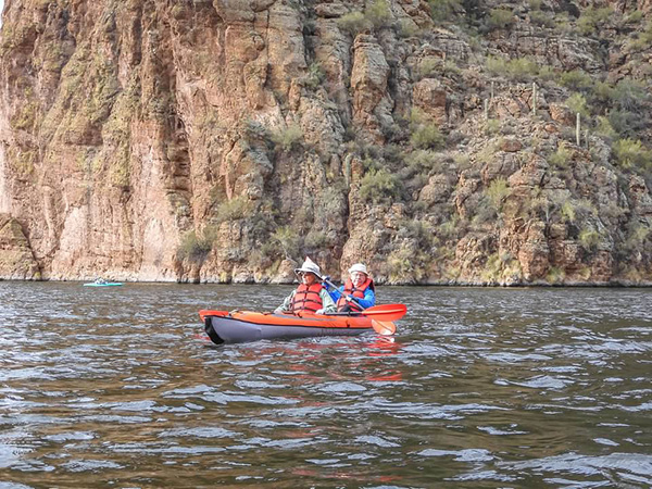 Anna and Ron in their tandem kayak. [photo by Wayne] |
 Barbara, Mimi, Chuck, and Burt. [photo by Wayne] |
 Scott and Burt. [photo by Wayne] |
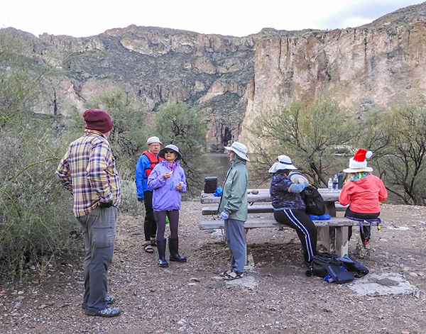
But getting back to reality, we seem to be making record time when the Point Campground finally comes into view just around the next bend of the channel. By 11:15 we all pull ashore, beach our kayaks, and climb a short hill to reach the campground restroom and picnic tables at the top of the hill, overlooking the lake. And, as usual, we seem to have the entire place to ourselves. An obvious advantage to kayaking on a weekday, when the lakes are typically far less crowded than they are on the weekend.
 We begin pulling into shore at the Point Campground. [photo by Wayne] |
 We’re all ashore now, with the pier in the background. [photo by Wayne] |
 The Point Campground has restrooms and concrete picnic tables. [photo by Wayne] |
After a relaxing snack and lunch break, we carefully make our way back down the hill, load our gear back into the kayaks, make a valiant attempt to gracefully climb aboard, and then begin paddling. But instead of heading back to the Acacia launch area as we normally do, Mimi suggests continuing up the canyon for a short distance. So we paddle upstream for a few hundred yards, before reversing course and heading back to the main body of the lake.
 Are we about ready to leave, guys? [photo by Wayne] |
 Expansive view of Canyon Lake from the campground. [photo by Wayne] |
 Second lake view from a different prospective. [photo by Wayne] |
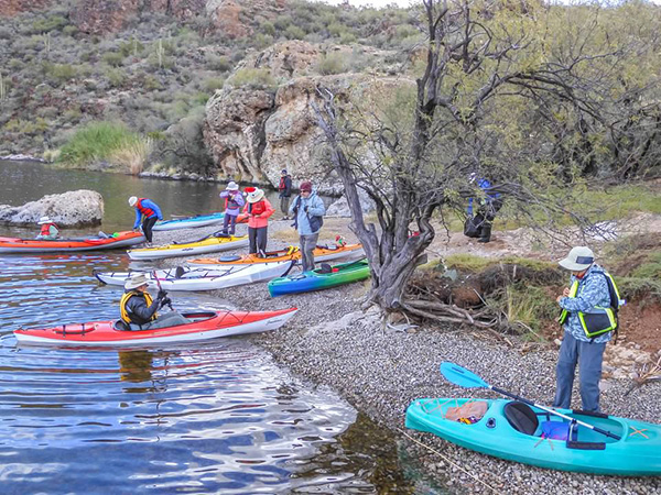 Preparing for our second launch of the day. [photo by Wayne] |
 Time to move out, kayakers. [photo by Wayne] |
A kayaking trip all the way up the channel to Horse Mesa Dam on Apache Lake would certainly be interesting, not to mention quite scenic, but we would be looking at a tough and very challenging 15-mile round trip kayak to do so. Perhaps on a future trip.
 Eva and Burt paddle close to the shoreline. [photo by Norma] |
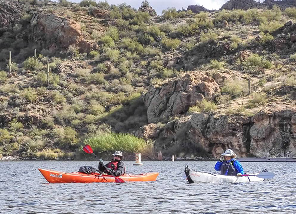
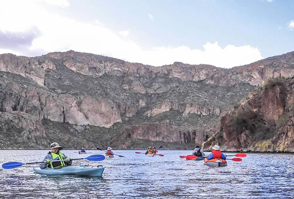 Kayakers are moving across the lake. [photo by Wayne] |
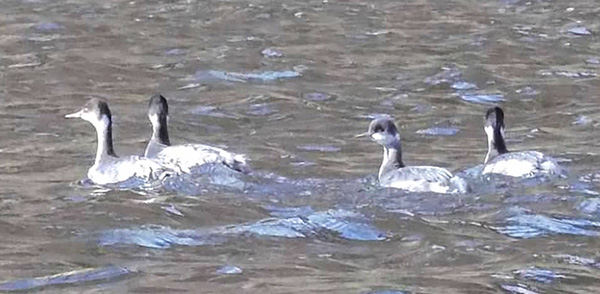 Four Grebes are in their element. [photo by Wayne] |
Despite the last couple of weather forecasts just before this trip calling for only slight breezes of 2 to 6 mph, which we have enjoyed for most of the day so far, we start to encounter stronger and stronger head winds as we continue making our way back to the Acacia launch area. At one point I remark to anyone within earshot that the weather people apparently left off the leading digit in their wind forecasts and actually meant to say winds of 12 to 16 mph. But in reality I believe we’re being slammed by wind gusts approaching 20 mph or more, as we begin entering the main body of the lake.
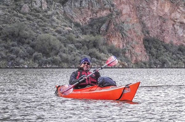 Burt is certainly having a great time on the lake today. [photo by Wayne] |
 Kayakers seem to be going in all directions here. [photo by Wayne] |
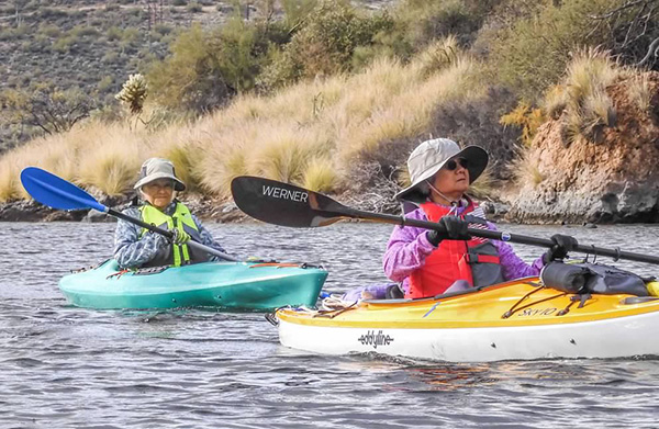
 Norma, Chuck, and Barbara. [photo by Wayne] |
 Burt and Eva. [photo by Wayne] |
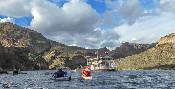 Here comes the Dolly excursion boat. [photo by Wayne] |
The lake surface is becoming increasingly rough and choppy, approaching whitecap conditions, and we’re all being sprayed with cold water as we struggle against the strong winds. We have to paddle harder and harder just to maintain our positions. Resting for just a few seconds results in the head winds and the rough chop pushing us backwards, causing us to lose ground.
Finally, about halfway across the main lake body, the winds begin to ease up and the lake surface begins to calm down a little. Acacia is actually beginning to look a bit more attainable now.
As the winds ease, I start paddling even harder to gain some headway before they come roaring back once again. Fortunately, that doesn’t happen, and by about 1:20 most of us have made it back to our launch site at Acacia. The temperature has warmed all the way up to a balmy 55 degrees, under increasingly cloudy skies.
 It looks like we’re getting off this lake just in time. [photo by Barbara] |
 Six of us enjoy a late lunch at Tortilla Flat. [photo by Mimi] |
| Burt, Mimi, Eva, Chuck, Norma, Scott. |
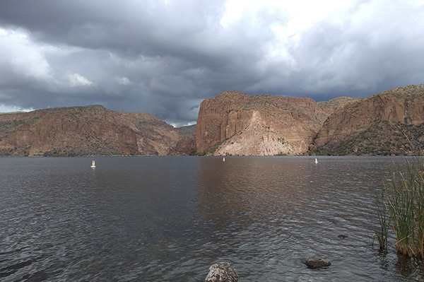
In this last picture by Barbara, dark and ominous looking skies move in over Canyon Lake. We’re back just in the nick of time. After we load up all our gear and our kayaks, six of us head to Tortilla Flat for a late lunch, while the others head for home.
After I got back home, I received a text message from Norma that she, Barbara, and Eva saw three bighorn sheep high up in the cliffs, as they were approaching the main lake. On our Saguaro Lake kayaking trip just last month we also saw three mature bighorn sheep navigating the cliffs and ridgelines, high above the lake. It looks like these magnificent animals are finally gaining a solid foothold in their traditional territories along the Salt River canyons after becoming nearly extinct decades earlier. Many years of hard work and dedication by countless people in rehab and relocation efforts are finally paying off, and hopefully these bighorn sheep are here to stay for centuries into the future.
 Top of Page
Arizona Trailblazers Hiking Club, Phoenix, Arizona
Comments? Send them to the AZHC .
updated December 18, 2022