Outdoor Links
Hike Arizona
Trip Planning Guide
Trip Report Index
Calendar of Events
Library
|
Flatiron Day Hike Superstition Mountains March 3, 2019 by Tom Simonick |
|
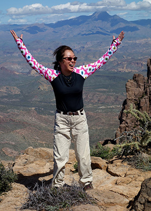
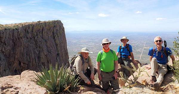
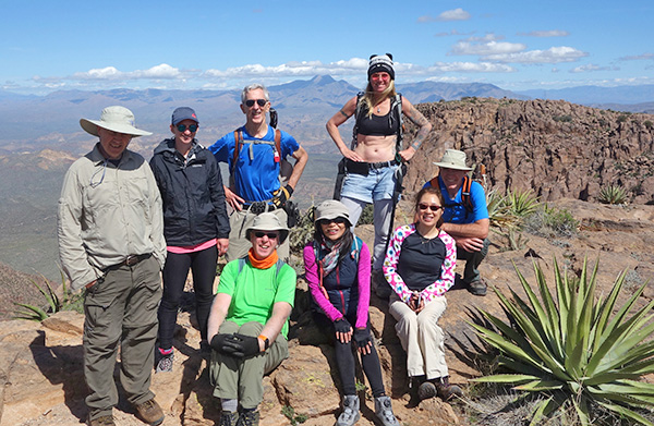 We made it! Trailblazers on the Flatiron. [photo by Kevin] |
||||||
|
||||||
|
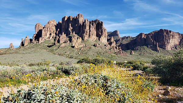
On a morning perfect for hiking, nine Trailblazers started from Lost Dutchman State Park heading up Siphon Draw trail towards our goal, the Flatiron on the western front of the Superstitions. Crossing the desert we see the Flatiron looming above us. |
||||||
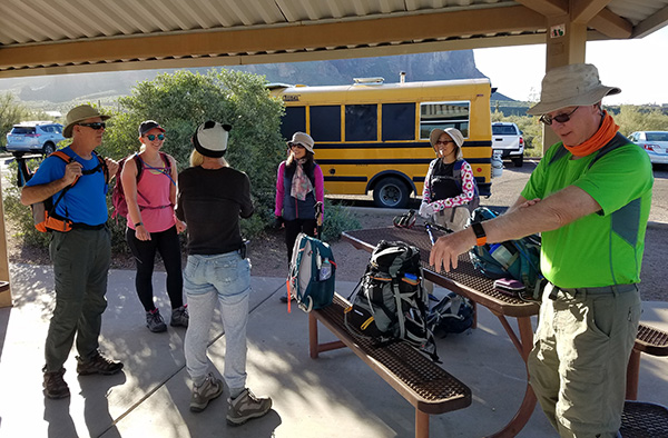 We started from Siphon Draw Trailhead. [photo by Tom] |
||||||
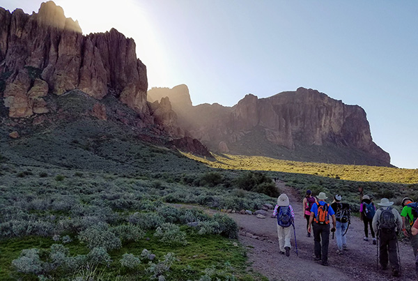 At over 4600 feet, the Flatiron looms above us. [photo by Tom] |
||||||
|
Passing Thumb Rock, we leave the desert and begin ascending Siphon Draw. |
||||||
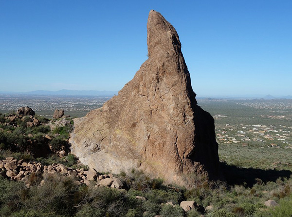 Thumb Rock. [photo by Kevin] |
||||||
|
The previous week the Superstitions were covered in snow, but this morning the snow is gone and there are small rivulets running across the rocks. An hour after beginning the hike we reach the Bowl at the base of the waterfall. |
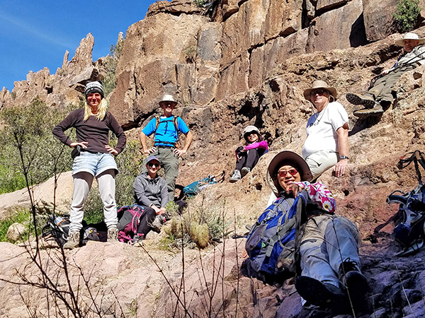
 Debbie and Kevin at the Bowl. [photo by Li] |
 Li and Lin at the waterfall. [photo by Li] |
|
There is a trickle of water coming down and there is other seepage into the Bowl. We take to care to keep our boots dry, otherwise it will be even more difficult to climb the very smooth walls. This is the place that some of us put away hiking poles and pull out gloves for the scramble ahead. |
 Onward and Upward. [photo by Kevin] |
|
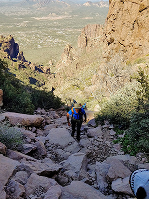
After taking a break and getting some photos, we are ready for the real challenge. We started the hike at an elevation of 2000 feet, we are now at an elevation of 3000 feet, so that means we only have 1600 vertical feet to climb and we will be on the Flatiron. Of course we have to do that climb by scrambling 1.5 miles over and around boulders and scree! |
 Lin leaving the Bowl. [photo by Tom] |
 Debbie shows us how it’s done. [photo by Kevin] |
|
Leaving the Bowl, we climb to Rock Ridge, from which you can see much of the route ahead. |
 Why, nothing to it. [photo by Tom] |
 A short but steep downhill section. [Kevin] |
|
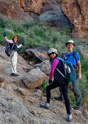
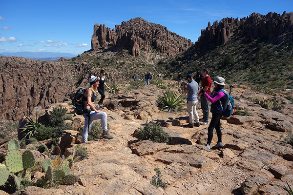
By this time Carolyn and Peter have taken off, setting a fast pace up the mountain, while the rest of us take pictures and begin a more leisurely climb. There are many people hiking today, including dogs. Because there’s no trail each person or group makes their own way, usually arriving at the same location. |
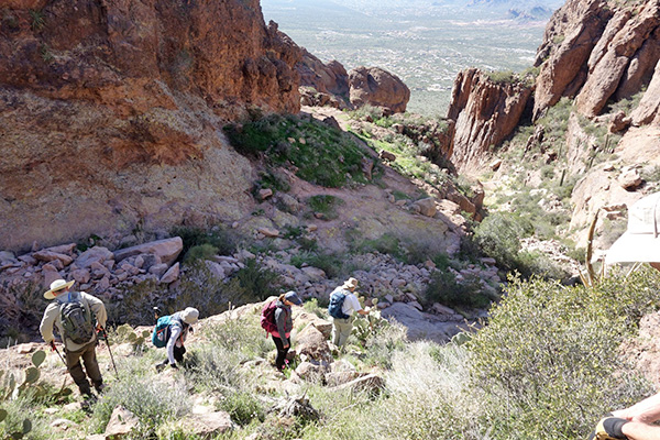
 We have to boulder-scramble. [photo by Li] |
 Climbing Siphon Draw. [photo by Tom] |
|
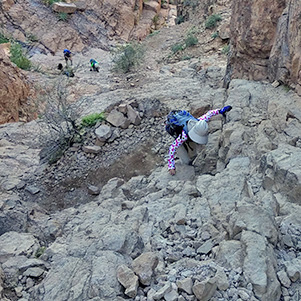
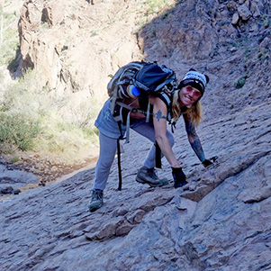
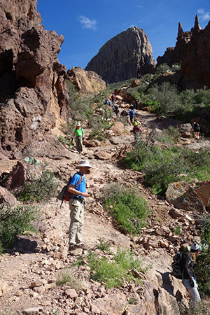
There is an occasional white or silver paint dot that marks a good route, saving time. Due to the snow, many of the small trees have lost branches thus blocking some of the routes. We stay closer to the north wall of the draw, deviating as necessary. Throughout the climb, there is camaraderie as Trailblazers and other hikers suggest handholds or routes. Not to be missed are the great views looking down the draw and out over the desert and Goldfield Mountains. It is also a good excuse to stop climbing and breath, allowing your heart rate to drop. We reach the next challenge, the Wall, a little over a mile from the Bowl. At the Wall you have three climbing choices: directly up using holes in the rock and tree branches, using an ascending crevice on the right, or going left and scrambling up. |
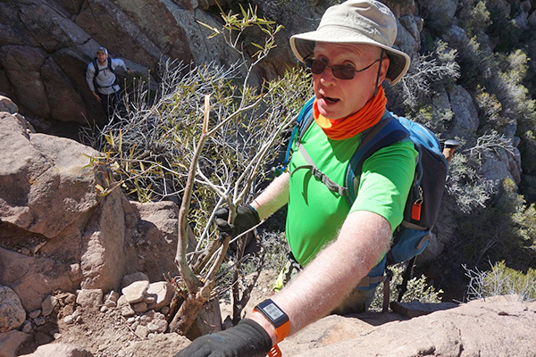 Terry made it to the Wall. [photo by Kevin] |
|
We use all of these routes and pretty soon we are above the Wall and climb a short distance to the trail leading to the Flatiron. |
 We’re almost to the Flatiron. [photo by Li] |
 What a great place! [photo by Kevin] |
 And there it is. [photo by Kevin] |
 We have something to celebrate! [photo by Tom] |
|
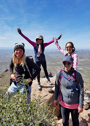
We meet up with our two fast hikers who have already been out to the Flatiron, but turn around and accompany the rest for a group picture. There are many people on the edge, be we find a spot and with the help of another hiker, get our group picture. |
 Yes, I’m here! [photo by Kevin] |
 Bring on the food. [photo by Kevin] |
|
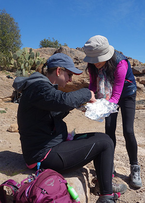
We are now at an approximate elevation of 4650 feet. Walking over to the less popular southern edge, we have lunch, looking out over the Gold Canyon area and south along the Ridgeline to Peak 5057. Li has made a special dish which she shares with everybody. We all agree that it is delicious. Some people decide a particular rock is comfortable to stretch out and get some sun. |
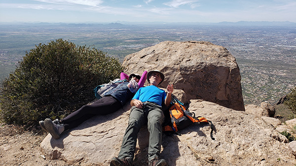 The rocks are so soft and cushiony. [photo by Lin] |
|
Others practice yoga or start jumping up and down because they have so much energy. Really? |
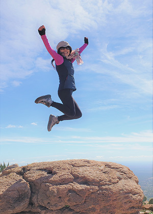 Li jumps for joy! [photo by Lin] |
 Lin practices Yoga. [photo by LI] |
|
I decided it was too late to find our way up Peak 5024, but we do walk off the Flatiron, heading north towards Peak 5024 and the air crash memorial where six people were killed the night of November 23, 2011. |
 Lest we forget. [photo by Kevin] |
|
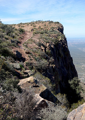
Leaving the memorial, we stop to take more pictures at the cliff edge and admire the view down Siphon Draw. |
 Peter, Terry, Kevin, Tom. [photo by Lin] |
 Debbie, Li, Carolyn, Lin. [photo by Li] |
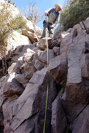 How high is the Wall? [photo by Kevin] |
|
Working our way down to the top of the Wall, we have the same three choices to get down. The Wall is described as being 10 to 12 feet high, but I have brought a tape measure to make my own determination. Since I’m not going down over the Wall, Peter volunteers to take the measurement with Kevin’s assistance. They determine the Wall is 13 ft. 4 inches high. Great! The hike is a success, we can go home! Now begins the challenges of the steep descent down the draw. We spread out, going at our own pace, enjoying the changing views, while alternating between feet, hands and butt. I’m impressed on how fast and sure-footed many of my companions are, leaping from rock to rock, while I slowly slide over the same rocks. I get on the radio and ask that the faster groups wait for the slower group to catch up. We continue down, nearing the top of the waterfall area with Rock Ridge ahead of us. A turn in trail reveals our companions waiting for us, finding good seating off the trail with a choice of sun or shade. |
 Wait for everyone to catch up. [photo by Tom] |
 Michael knows the way. [photo by Kevin] |
|
We take a short break for a snack and sunscreen, and then follow Michael as he leads us on a side trail/bushwhack that leads us down and towards a wide area behind the waterfall. This results in bypassing the climb up Rock Ridge, rejoining the main route twenty or thirty feet below the ridge. After that, we continue hiking downward until we’re above the Bowl. Various techniques are displayed getting down the wall resulting in everyone down safely, more or less with their pants intact. |
 Lin sliding into the Bowl. [photo by Tom] |
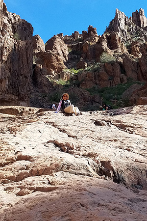
 We were up there. [photo by Kevin] |
|
We have two miles of hiking ahead of us, but the difficult part is behind us. |
 Looking back. [photo by Lin] |
|
We continue to the trailhead parking lot, and head off to dinner at Uncle Bear’s Grill and Taproom to celebrate a great day of hiking. |
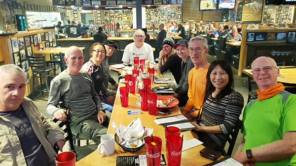 Uncle Bear’s Grill and Taproom. [photo by Lin] |
|
According to my GPS we hiked 7.6 miles in 8 hours, with an elevation change of 2658 feet and an accumulated elevation gain of 3579 feet. We had several hundred wonderful photos. Here are the links to those albums: → More pictures, by Kevin.→ More pictures, by Lin. → More pictures, by Li. → More pictures, by Tom. |
 Top of Page
Arizona Trailblazers Hiking Club, Phoenix, Arizona
Comments? Send them to the AZHC .
updated March 10, 2019