Outdoor Links
Hike Arizona
Trip Planning Guide
Trip Report Index
Calendar of Events
Library
|
Washington Park to Camp Geronimo Mogollon Rim May 19, 2018 by David French |
|
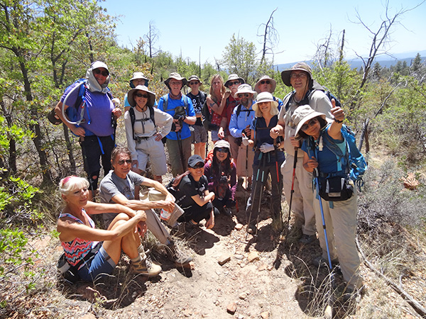
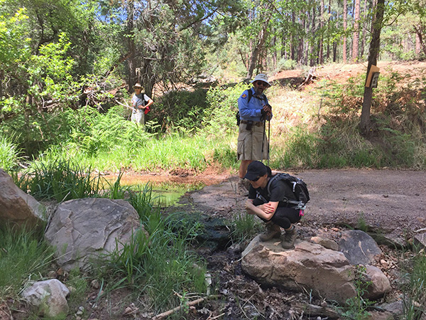
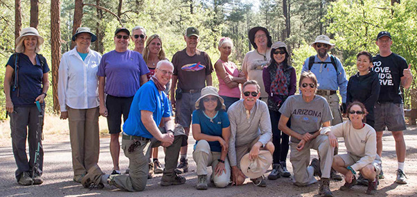 Trailblazers all together. [photo by Quy] |
||||
|
||||
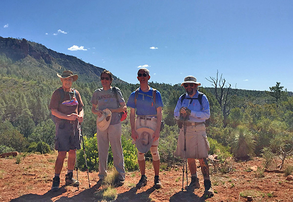
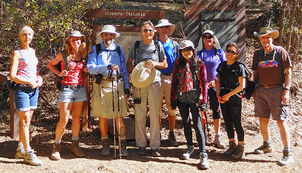 Geronimo Trailhead to Washington Park group, eastbound Ramona, Debbie, Jim, Yanis, Tom, Li, Michelle, Molly, Dave |
||||
 Washington Park to Geronimo Trailhead group, westbound. [photo by Quy] Quy, Deirdre, Darrell, Terry, Randy, Heather, Barbara, Michael |
||||
|
This was an important hike for me: it completed Passage 26 (Highline) and topped out my 50 miles on the Arizona Trail so far this year. Since this is the 50th anniversary of the AZT, those who hike 50 miles on the trail can submit on aztrail.org for a special commemorative patch. Note the AZT and the Highline Trail overlap from Pine Trailhead to Washington Park, so this hike was on both trails. To cover the whole 10 miles of this section, we did a one way hike with a key swap in the middle. We had 17 Trailblazers show up at the Target parking lot before 6:30 and we sorted out into 4 vehicles. We met again at McDonald’s in Payson for our customary stop, then proceeded up Houston Mesa Road to FR 64 (Control Road). There we took a group photo and exchanged cars so that the westbound hikers took the eastbound hikers cars to Washington Park and vice versa. It was a very pleasant day with starting temperatures in the 60s and ending temps in the upper 70s. I led a group of 9 from Geronimo Trailhead eastward, and Michael led a group of 8 from Washington Park westward. I will describe the hike from west to east. Photos from the westbound group are by Quy, Randy, and Darrell. |
||||
 Trailblazers pause in the forest. |
||||
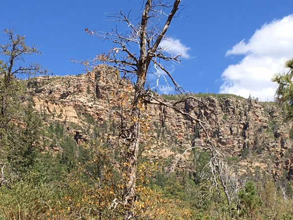
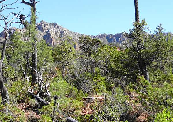 The Mogollon Rim looms ever above us. |
||||
 We get a distant view of the Mazatzals. |
||||
 Well, we know which way to go by Yanis. |
||||
 Across the red rock country. [photo by Yanis] |
||||
 Mogollon Rim. |
||||
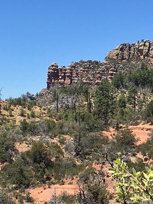
 Unique red rock spire. |
||||
|
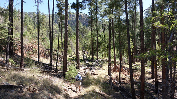
Geronimo Trailhead is located down in a valley where there is an active Boy Scout camp and lots of casual camping. We took a photo of our smaller group and then headed up the trail. West to east is the tougher direction because we had over 1000 foot climb in the first 3 miles of the hike. This portion of the trail is through a very nice forest with views of the Mogollon Rim looming above us to the north and occasionally a beautiful view to the west of the Mazatzals and other mountains to the south. |
||||
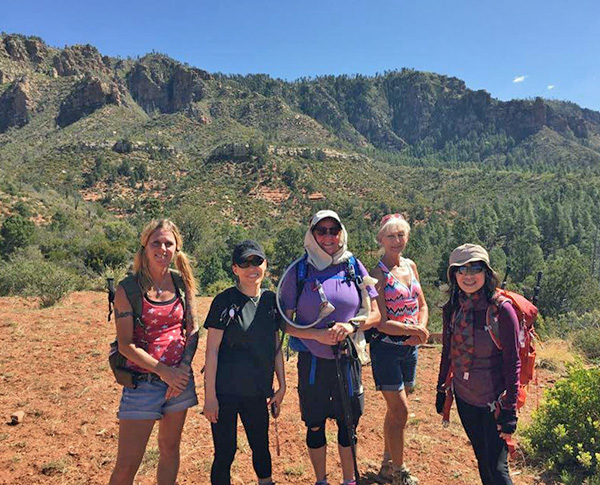 Debbie, Molly, Michelle, Ramona, Li. |
||||
 Dave, Yanis, Tom, Jim. |
||||
 The two groups meet and exchange car keys. |
||||
 Jim looks lonely among the tall pines. [photo by Yanis] |
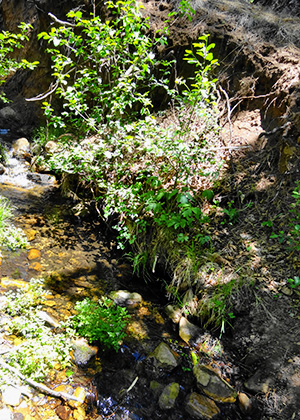 A little creek in the forest. |
 Viewing the river. [photo by Randy] |
|
As we neared the highest part of this trail we passed through a burned area. I think this was part of the Dude fire that happened in the 2000’s. The tall pines were gone but oaks and other vegetation had recovered well. We also passed through some smooth red rock area that looked very much like hiking near Sedona. |
 What is that swimming in the creek? [photo by Li] |
 East Verde River near Washington Park. [photo by Quy] |
 Yep, we have 10 miles to go. [photo by Quy] |
 Are we in Sedona? [photo by Randy] |
 Much of the trail passes through lush forest. [photo by Quy] |
 Hey, a cloud! Pull out the poncho! [photo by Darrell] |
 Evidence of the burn. [photo by Darrell] |
 Rugged Ridge. [photo by Darrell] |
 The burn area. [photo by Randy] |
 A waterfall cascades through the forest. [photo by Quy] |
 Meeting of the two groups. [photo by Quy] |
 This group found a great snack place. [photo by Quy] |
 Wildflowers. [photo by Quy] |
 The rock stops here. [photo by Randy] |

|

|
| Signs for the trail and the trailhead. [photos by Randy] | |
|
We met Michael and the westbound hikers at about 4.5 miles in. This meeting spot was near the summit and did not offer a good place to sit and have a snack. So we took another group photo, exchanged keys, and headed on our way. Both groups found shaded areas with rocks to sit on in a short distance after the meet up. The rest of the trail was rolling—down into a wash and then up over a hill. By this time my uphill legs were barking at me, so I was most grateful for the downhill parts. Plus the downhills usually led to more trees and occasionally a small stream. It was nice to see some water flowing after such an extraordinarily dry winter. |
 On the trail. [photo by Tom] |
|
We reached Washington Park Trailhead after 5½ hours of hiking. We suspected that we were a little behind the other group so we did not go to the East Verde River. Michael’s group did that before they started the hike. We drove back to the meeting place at Houston Mesa Road and FR 64 and got there about 5 minutes after the other group. Five hikers did not want to go to lunch, so they sorted into one vehicle. The remaining 12 hikers got into 3 cars and headed for Buffalo Grill in Payson, where we got great service, good food and cold beer. |
 Buffalo Grill. [photo by Tom] |
|
Statistics: 10 miles, 5 hours and 30 minutes hiking, 1976 feet elevation gain and 1378 descent. Those numbers are for the eastbound group. The westbound group’s elevation gain and descent should be the reverse. Max and min elevations were 6419' and 5460'. Thanks to Michael for being deputy hike leader and to Terry, Michelle, and Randy for driving. |
|
Supplemental Report by Jim Buyens |
|||||||||||||||||||||||||||||||||||||||||||||||||||||||
|
Once again it was great seeing everyone and enjoying a great hike in the pines. People really don’t know Arizona until they’ve gone out and seen it as we have. I was on the west-to-east (Geronimo to Washington Park) route and here are the statistics I recorded. If you were on the east-to-west (Washington Park to Geronimo) route, your total ascent and descent will be the opposite of those shown. Jim |
|||||||||||||||||||||||||||||||||||||||||||||||||||||||
|

|
||||||||||||||||||||||||||||||||||||||||||||||||||||||
 Top of Page
Arizona Trailblazers Hiking Club, Phoenix, Arizona
Comments? Send them to the AZHC .
updated May 23, 2018