Outdoor Links
Hike Arizona
Trip Planning Guide
Trip Report Index
Calendar of Events
Library
Sedona
October 8, 2016
by Scott Green
 Tamar, April, Tom, Ralph, Michelle, Mark. [photo by Scott] |
|
Today’s hike was a modern recreation of the wagon trains which traveled from the Midwest to what is now named Winslow, southwest towards the Stoneman Lake area, down to current day Camp Verde, with an eventual end point at Prescott. While we traveled only 9 miles, they traveled a much longer distance over many weeks over rocky terrain in uncomfortable wagons. For our trail experience we, the Steady Seven, had a much easier go. About half of us traveled in comfort from Phoenix to the trail’s end point on the road from I-17 to Sedona. Leaving one car there, we traveled to the starting point at the I-17 and Stoneman Lake turnoff where we met the others, readied ourselves, completed introductions, and headed down a forest road which provided an easy warm-up. |
 Tom, Michelle, and Ralph. [photo by Tamar] |
 The trees form a tunnel. [photo by Tamar] |
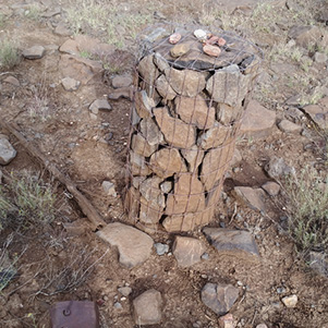 A cairn! This must be the trail. [photo by Mark] |
 Tom overlooks the vista point. [photo by Tamar] |
|
After less than a mile on the forest road, it turned sharply right in front of an expansive meadow with a single cairn in the distance. This was the first of many well placed markers which we used as breadcrumbs throughout the day. Since this was an early October hike, it was anticipated to be cool but the cloud cover all day kept the air warm and a little humid. At least the day was not spent squinting at the sun. |
 Dry Beaver Creek on a cloudy afternoon. [photo by Mark] |
 This part of the trail is a double-track. [Tom] |
 Ralph at the overlook. [photo by April] |
|
Due to perhaps the cloudy, shady day or perhaps in preparation for Halloween, Tarantulas and other medium sized hairy spiders were often crawling across and near the trail, which provided opportunities for hikers to fully show their bravery by picking up the specimens, but no one did. |
 A friendly tarantula. [photo by Mark] |
 Oh come on, I’m not poisonous. [photo by Mark] |
 The safe approach to getting close to a tarantula. [photo by Tom] |
 (left half) Don’t let rain dampen your spirits. [photo by Mark] |
 (right half) Don’t let rain dampen your spirits. [photo by Mark] |
 The Steady Seven: Tamar, April, Tom, Ralph, Scott, Michelle, Mark. [photo by Mark] |
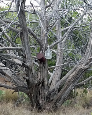 Jug Tree. [photo by Mark] |
 This part of the trail is rocky. [photo by Tom] |
|
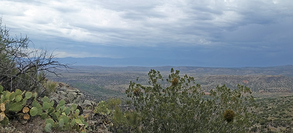
At a few sections, the trail paralleled the rim of Dry Beaver Creek providing scenic and unique views of the red rock area and glimpses of Sedona. The romantic views were special for Michelle and Mark celebrating their wedding anniversary. |
 Mark and Michelle. [photo by Mark] |
 Courthouse Butte. [photo by April] |
 Panorama of Bell Rock and Courthouse Butte. [photo by April] |
 Zooming in on Bell Rock and Courthouse Butte. [photo by Mark] |
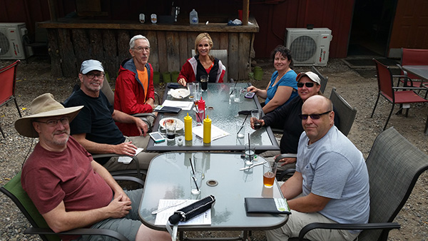 We’re done hiking. Now let’s eat. [photo by Mark] |
|
Leaving the rim area and following the trail down the bluffs toward the south, dark storm clouds gathered in the Verde Valley sweeping around the southern end of Sedona. As some of the perimeter clouds moved over our heads rain started, which triggered everyone to unpack raingear and keep themselves dry. The rain continued to the end of the trail where half of group had to wait in the rain as the drivers road back in the one initial car to the starting point to retrieve the other cars. Fortunately, the rain did stop for the left behind group and allowed us all to regroup and travel to Verde Valley for an outside patio lunch and rehydration. |
 Top of Page
Arizona Trailblazers Hiking Club, Phoenix, Arizona
Comments? Send them to the AZHC .
updated June 19, 2020