
Outdoor Links
Hike Arizona
Trip Planning Guide
Trip Report Index
Calendar of Events
Library
Phoenix
February 3, 2001
by Mike Wargel
|
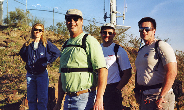
| Lisa, Steve, Adam, Mike |
|
On Sat, February 3rd, six hikers met next to the Ranger Station at the North Mountain Preserve. We started a few minutes late to let others arrive, plus, the parking lot at our trailhead was closed for maintenance (Maricopa Trailhead). We parked near the ranger station just down the road from the Maricopa point. At 9 AM, Mike Wargel, Adam Kostewicz, Chuck Giovanniello, Lisa Hall, and Steve Shaw (and Julia), headed up the trail from the Maricopa point. The trail took a rather steep grade right away, very similar in grade and rock to the beginning of the Go-John trail. In a few minutes, we reached a saddle from which we could view the north valley, 7th St, and a service road to the top of North Mountain. |
 Beam me up! About 100 yards from the end of the road was an overlook which yielded tremendous views to the east and south. We could see and hear the traffic on the Squaw Peak freeway in the distance. Across 7th St, we could easily see the Pointe North Mountain Resort. Behind us, the North valley, Cave Creek Recreation Area and mountains came to view. Another 15 minutes up the road, literally, we were up as high as the road would take us, to the fence surrounding the towers at the top of the mountain. A narrow trail heads up and to the left from here. This takes hikers to the south end of the peak of North Mountain. From here, the entire South, East, and West valley come into view. we could easily make out the Estrellas, White Tanks, South Mountain, Camelback, and Squaw Peak, the latter in a terrific late morning silhouette from the rising sun. Steve brought a new pair of binoculars and was able to point out Weavers Needle and Flatiron, all the way to the Superstitions! |
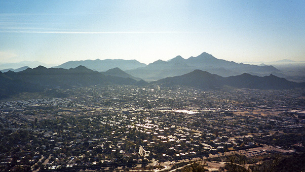 The view from the top, southeastward. |
|
After a short rest at the top for pictures, water, and views, we headed down the south face of the mountain. We quickly realized that, although it was steep, the walk up was not nearly as steep as the walk down. Terrain very similar to the top of Squaw Peak greeted us. Sharp turns with little room to the sides, step downs requiring balancing by using the arms to stabilize, and several portions covered in loose shale rock. Unfortunately, none of us had done this hike before and were unaware of the terrain. |
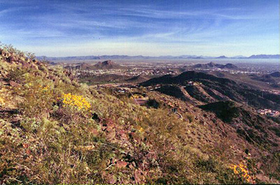 Spring comes early to North Mountain. |
About halfway down, we paused under the shade of what must have been the only tree on the face of the mountain. As we headed down, the trail appeared to lead right to the end of a housing subdivision that seemed to be carved right out of the mountain. About 100 ft above the houses, the trail took a sharp left, then a gradual, but steep, downhill into the ramada at the end of the trail. |
|
On the way down, we ran into (for the second time) a pair heading up the trail for the their THIRD! roundtrip. Obviously training for an event, or gluttons for punishment, as it were. The trail was not terribly bad. Very similar to Squaw Peak, but with more shale rock and not as carved out. With the two rests, we were still done in 1.5 hrs, saw terrific views, got the heart rate up for good exercise, and saw several others doing the same. This hike is highly recommended for those short on time, don’t want to travel far, but still want to work up a sweat. |
 Top of Page
Arizona Trailblazers Hiking Club, Phoenix, Arizona
Comments? Send them to the AZHC .
updated May 29, 2020