Outdoor Links
Hike Arizona
Trip Planning Guide
Trip Report Index
Calendar of Events
Library
|
Tom’s Thumb Day Hike McDowell Sonoran Preserve January 16, 2010 by Wendy Rennert |
|
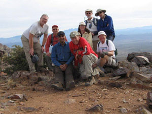
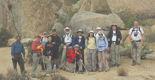 Ajay, Elmer, Elizabeth, Alexis, Brock, Chip, Bill, David, Wendy, Sandy, Dick, Chuck, Michael |
|
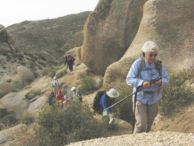
The clouds made for a very colorful sunrise at our carpooling point. On a mostly overcast but otherwise pleasant day, thirteen lucky Trailblazers began their journey up the shorter trail to Tom’s Thumb in the McDowell Mountains. Of course, shorter does not necessarily mean easier, as this is a fairly steep trail on slick pea-sized gravel, but it has a more unique terrain than the rest of the mountain range, which made for an interesting hike. |
 Pinnacle Peak sure looks a lot smaller from here! |
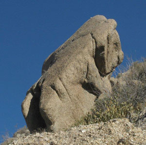 Bears in the McDowells! A Koala bear shaped rock, that is ... |
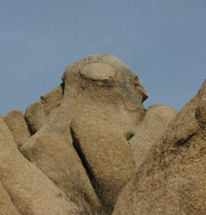 Our consensus? A monkey! |
 A little bit of a climb at the end to reach Tom’s Thumb. |
The sun poked through the clouds here and there, spotlighting the neighboring Pinnacle Peak, and softly lighting our way. Huge boulders dot the landscape, and the imaginative group had fun trying to convince each other what the various shapes looked like – human faces, a monkey, a koala bear, a vulture, etc. |
|
The trails are well maintained and well signed, with several options along the way. We made our way to the base of the monolithic Tom’s Thumb, conveniently passing another hiker who graciously took photos of our group. We spent some time here checking out the views and having a snack break. There was a decent breeze here, so even though it was 62 degrees by this time, it almost felt cooler than our 48 degree starting point. Then we did a little bit of exploring, and poked around a mass of huge boulders to find the opening to a cave-like shelter with some obvious signs of past activity. We took turns squeezing through the narrow passageways to check it out. |
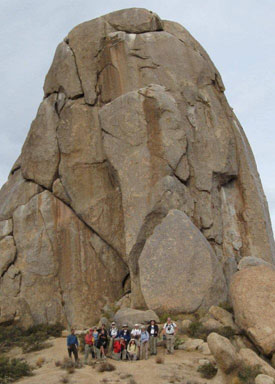 Our group at the base of Tom’s Thumb. We’re not sure what’s holding this fragmented cluster of boulders together, but we sure hope it continues to hold! |
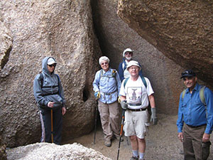 Not really a cave, but still a nice little hangout! |
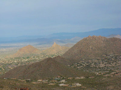
 A stunning view of Four Peaks |
|
After that, some of our group decided to head back to the trailhead in order to ensure getting home by the start of the Cardinals playoff game. The remaining 8 Trailblazers headed off to the next part of the adventure, to a half-mile side trail called The Lookout. |
 The Lookout [Bill Zimmermann photo] |
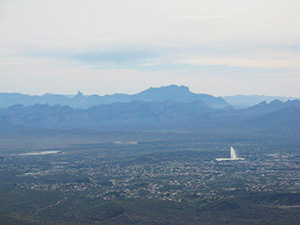 Weaver's Needle, Superstitions, Fountain Hills |
|
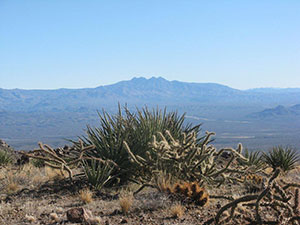
Both from Tom’s Thumb and at The Lookout, the combined range of views was impressive – the mountains north of Cave Creek, Bartlett Dam, Four Peaks, Weaver’s Needle, the town of Rio Verde, Fountain Hills, downtown Phoenix, Camelback Mountain, Shaw Butte, North Mountain, South Mountain, the University of Phoenix stadium, and beyond. As far as the McDowells themselves, we learned that although Thompson Peak has all the antennas, at 3,969 ft. it is only the 3rd largest peak in the range, surpassed by 3,995' McDowell Peak and 4,059' East End Peak. |
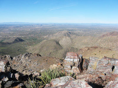 Many colors and textures can be seen west of The Lookout. |
We all enjoyed the hike – it was a great way to spend the morning! Total time for the trip was about 4 hours, we covered a roundtrip distance of 5 ½ miles and a 1,645 ft. elevation change. A few of us wrapped up the hike by having an alfresco lunch at nearby Gordon Biersch. I highly recommend the garlic fries! |
 Top of Page
Arizona Trailblazers Hiking Club, Phoenix, Arizona
Comments? Send them to the AZHC .
updated December 26, 2017