
Outdoor Links
Hike Arizona
Trip Planning Guide
Trip Report Index
Calendar of Events
Library
White Mountains
June 18-20, 2010
by Chuck Parsons
|
Rainbow Campground, a full-service campground with 152 campsites, is the largest of the five campgrounds nestled around Big Lake in the beautiful White Mountains of eastern Arizona. The campground sits at a lofty 9,200 feet in elevation and offers a cool and relaxing retreat from the scorching desert heat of southern Arizona. |
 Big Lake Rainbow Campground, Group Site # 80 (Photo by Ajay) |
|
Amid the tall pines and aspens, seven Arizona Trailblazers set up camp here for three days in mid-June, 2010. Two more of our tents are just out of sight to the left in this picture. |
 Big Lake in the White Mountains (Photo by Ajay) |
|
Big Lake is a short ten-minute walk from our campsite, and we visit it almost every day during our camping trips here. This is by far the most popular and well stocked of the many trout lakes throughout the White Mountains, and fishing is serious business here. On a typical busy weekend hundreds of hopeful anglers are drawn to Big Lake in search of the large rainbow, brook, brown, and cutthroat trout that prowl the icy depths of this large alpine lake. You can bring your own boat or rent one of the many available at the Big Lake General Store that can be seen in the lower middle part of this picture. The early morning light casts long shadows across the grassy meadows surrounding Big Lake. A few remaining patches of last winter’s heavy snowfall can still be seen along the upper ridges of the mountains overlooking the lake. I awoke early before the others on Saturday morning and walked down to the lake to check out the photo opportunities and savor the peace and quite of the beginning of a brand new day in paradise. |
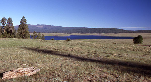 Early morning on Big Lake (Photo by Chuck) |
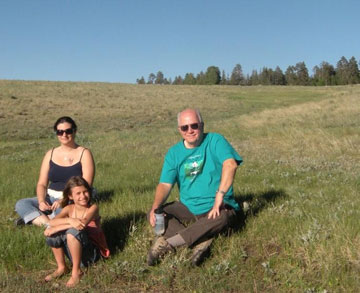 Sunny, Amber, and Chuck taking a break (Photo by Ajay) 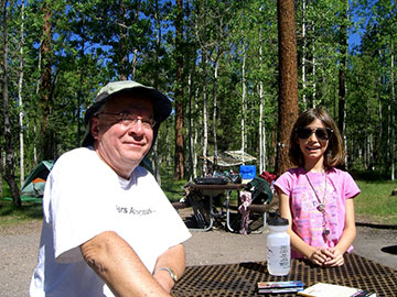 Swapping eye glasses (Photo by Sunny) |
Despite the frigid waters that discourage swimming in the lake, nine-year-old Amber loves to wade in the shallows up to her knees with little minnows and crawdads nibbling at her pinkies. This adventurous and energetic young Arizona Trailblazer has just returned from another wading venture along the shore to dry out and warm up in the sun. Today is an unusual day in the White Mountains, with not even a wisp of a cloud in the clear blue skies over the mountains. While preparing for our big hike of the day, Amber picks up my sunglasses lying on the table and discovers that she can see almost as well as she can with her own glasses. I try her glasses on for size and also discover that I can see as good, if not better, with her pair of glasses. Interesting. Despite our obvious age difference, it appears that our eye glasses have almost identical prescriptions. They both fit their new temporary owners pretty darned good also. Want to trade, Amber? |
|
Lisa, Ajay, Sunny, Amber, Karen, Cyd (poking her head over the trailhead sign), and Chuck gather in front of the West Fork Trailhead sign for the customary group picture before hitting the trail. |
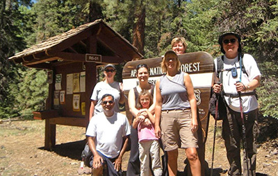 The Magnificent Seven hikes again. (Photo by Ajay) |
Amber Rose is restless and can’t wait to get started on today’s hike. The West Fork Trail begins at an elevation of 8,925 feet as it winds up and down through thick stands of towering Douglas-fir, blue spruce, ponderosa pine, and quacking aspen, interspersed by lush expansive meadows filled with grasses and wildflowers. This is Arizona alpine mountain hiking at its finest. |
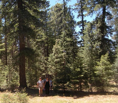 Hiking the West Fork Trail. (Photo by Ajay) |
Arizona Trailblazers, with Karen and Amber in the lead and out of the picture, emerge into a clearing and bright sunshine after hiking in the deep shade of the forest. The West Fork Trail runs for three miles, dropping 400 feet in elevation over its course, before terminating at the West Fork of the Black River. On the other side of the river the trail continues on as the Thompson Trail. The big question of the day is just how deep this crossing will be. |
|
On our trip here two years ago, the river was running fast and over knee deep at the crossing. Record amounts of snow fell this past winter in the White Mountains, some remnants still visible in the higher reaches of the mountains. All that snowmelt still coming down might pose a major challenge for us today. |
|
Three quarters of a mile from the West Fork Trailhead, hundreds of tall Mountain Iris nod gently in the cool breeze blowing across this expansive meadow known as Neck Tank. The abundant snow pack of the past winter has soaked deeply into the meadows and grasslands throughout the White Mountains, especially the low-lying tanks, helping to ensure an explosion of summer wildflowers this year. The colorful Mountain Iris is one of the first to emerge after a long winter’s sleep when the moist ground is warmed sufficiently by the increasingly longer days of late spring and early summer. Many more varieties of wildflowers will spring from the earth as summer progresses in these mountains. |
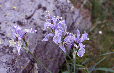 Close-up of Mountain Iris (Photo by Chuck) 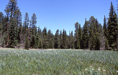 Neck Tank (Photo by Chuck) |
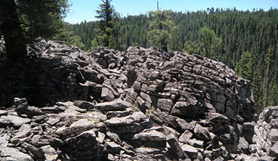 On the rim of West Fork Black River Canyon (Photo by Ajay) |
Bizarre stacks of fractured and weathered basalt line sections of the rim overlooking West Fork Black River Canyon. Born out of a volatile mix of fire and ice, extensive volcanic activity over a period of millions of years, followed by four periods of glaciation during the last Ice Age, shaped and formed these rugged mountains. |
|
The Springerville-White Mountain Volcanic Field is the second largest after the San Francisco Volcanic Field, and is comprised of hundreds of basaltic cinder cones throughout the White Mountains. Mount Baldy, at 11,403 feet, is the highest point in the White Mountains and is Arizona’s highest and largest shield volcano. |
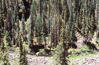 West Fork of the Black River (Photo by Chuck) |
From this vantage point about 2.5 miles from the West Fork Trailhead, the West Fork can be seen far below the trail meandering through a thick forest of Douglas fir, Colorado blue spruce, and ponderosa pine as it works its way through rugged mountain terrain and continues on its journey to the confluence with the East Fork of the Black River about five miles north of Hannigan Meadow. |
|
Where these two forks merge, the Black River begins its fifty-mile journey through the White Mountains, dropping 2,000 feet in elevation before joining forces with the White River. The confluence of these two rivers then marks the beginning of the Salt River. |
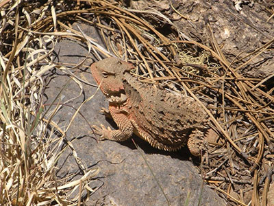 Horned Toad greets Arizona Trailblazers (Photo by Ajay) |
We run across this colorful and well-armed horned toad (a bit of a misnomer since it’s really classified as a short-horned lizard) somewhere along our trek on the West Fork Trail near the canyon rim. None of us recalls ever seeing such a colorful and spiked horny toad on any of our previous hikes throughout Arizona, and it may actually represent a species endemic only to these mountains. |
|
But it certainly doesn’t take too much imagination to think back to the reign of dinosaurs during the Mesozoic Era and envision an armor-plated creature perhaps 100 times the size of this little guy lumbering through the tropics and swamps with the likes of T-Rex, Triceratops, and Stegosaurus. |
|
This dilapidated and decaying footbridge delivers hikers over a rough and rocky landslide area about a half mile from the West Fork of the Black River and our long-awaited river crossing to the junction with the Thompson Trail. Pieces of the bridge, including a long-collapsed hand rail, can be seen in the lower left portion of this picture. |
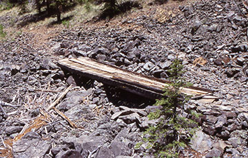 Footbridge on the West Fork Trail (Photo by Chuck) |
|
For those not quite stout-hearted enough to brave the bridge, there is also a secondary crossing over the rocks just above the bridge. Time and weathering will eventually collapse this entire structure into the rocks below, eliminating a familiar icon on the West Fork Trail. |
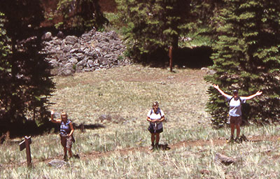 Final approach to the river crossing (Photo by Chuck) |
Karen, Cyd, and Lisa wave to Ajay and me, a couple of switchbacks above them as we all make one last push for the crossing and a well-deserved lunch break on the opposite side. This last quarter-mile section of the West Fork Trail involves a rapid descent to the river via a relatively steep series of switchbacks. |
|
We are only a few hundred yards away now and closing in fast, anxious to find out just how deep the water will be and how safe the crossing. Not knowing just what to expect at the river and prepared for the worse, I had warned Amber’s mom earlier that she might have to hang tightly onto her daughter or even carry her across in the event of high water. Obviously, if the water was flowing too fast and too high, we wouldn’t even attempt a crossing and would simply backtrack to the West Fork Trailhead. Fortunately for us tough, the water is much lower than expected, given the heavy snowfall of the past winter. In the deeper areas mid-stream the water is up to Amber’s knees, but as she carefully hangs onto her hiking shoes she has no trouble picking her way across the water to the other side. |
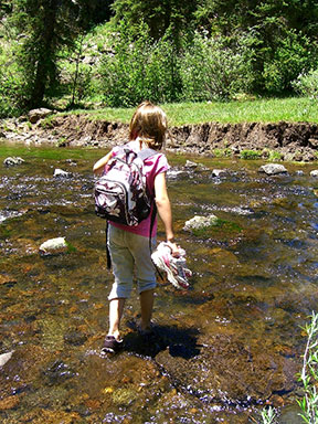 Amber Rose crosses West Fork (by Sunny) |
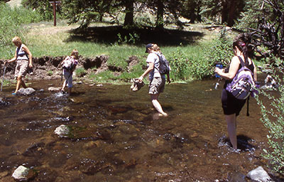 Trailblazers crossing the West Fork (Photo by Chuck) |
Karen, Amber (probably on her second crossing by now), Lisa, and Sunny all carefully pick their way across the river. The river rocks are all slippery with moss and algae, so our biggest challenge is to avoid slipping and falling into the icy-cold water. I worry more about submerging my camera than getting wet myself. A soaked camera would put me out of commission for the rest of the trip for taking pictures. |
|
Almost every time I have to hike through water with my camera gear, I think back to an unfortunate incident where one of our former hiking club members took a dunking in Oak Creek with his fairly new Nikon camera and wound up paying several hundred dollars getting it dried out, repaired, and back into service. Amber must be reading my mind, since she offers to help guide me across the river, telling me exactly where to put my feet to avoid the slippery areas. Either that or she must feel sorry for the old man of the group and wants to make sure that I don’t fall down face first into the water. H’mm — Boy Scouts used to get some sort of credit for helping old women across the street. So do Girl Scouts get any kind of credit for helping old men across the river? At any rate, with Amber’s expert guidance, we both make it safely across without incident. Thanks Amber! You’re a trooper and a team player. |
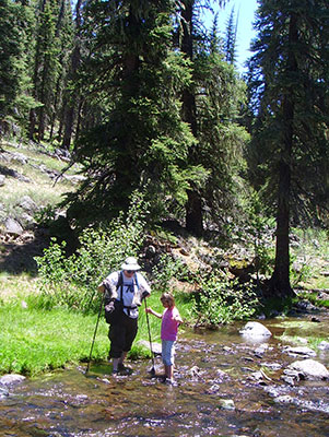 Amber helps guide Chuck across the river (by Cyd) |
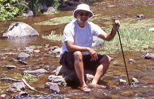 Ajay |
 Karen |
|
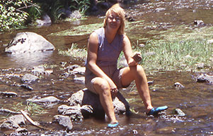
Ajay and then Karen take a break mid-stream for a brief photo-op. What a great place to sit down and cool off for a while, especially those sore, tired feet that have been pounding the trail continuously over three long miles of often rough and rocky terrain to get to this point. But the biggest problem with this particular location is once you sit down to soak in the spectacular scenery, breathe in the clean, refreshing mountain air, and enjoy a little R & R, you just don’t want to leave, ever. |
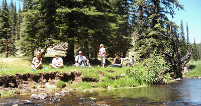 Lunch break on the river bank (Photo by Ajay) |
Karen, Cyd, Chuck, Amber, Sunny, and Lisa enjoy a relaxing lunch break on the grassy and shady bank of the West Fork, with Ajay behind the camera and perched on his favorite rock in the river. We are in no real hurry and have all day to do this hike. |
|
The goal is simply to get back to camp in time to clean up and rest for a while before making preparations for the special potluck dinner tonight. So we take our time, soak in the surroundings, snap a few more pictures, and relax to the max before packing up and moving on once again to begin the second half of our journey of the day. |
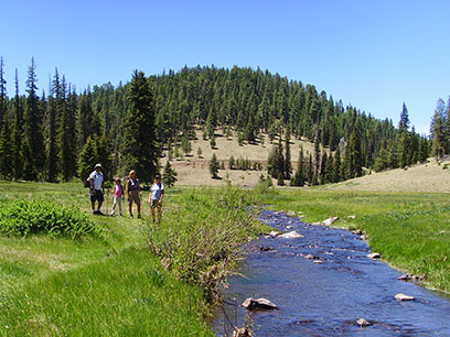 Arizona Trailblazers on the Thompson Trail (Photo by Cyd) |
Ajay, Amber, Karen, and Lisa pause for a quick picture by the West Fork as we begin our three-mile hike to the Thompson Trailhead and our waiting vehicles that we had dropped off earlier. The Thompson Trail rides shotgun alongside the West Fork of the Black River all the way back to the trailhead, providing the quintessential riparian hiking experience in these mountains. |
|
The West Fork and Thompson trails have been a favorite of mine for many years and are fast becoming a favorite among many of our hikers who join us on these trips. Together, they offer some of the most spectacular and diverse scenery to be found in the White Mountains of eastern Arizona. |
|
Amber poses for her mom with the West Fork and the beautiful scenery of the White Mountains as the backdrop behind her. No one among us, least of all me, can begin to keep pace with this super-charged little dynamo. She and her mom have been on several multi-day backpacking trips in their home state of Wyoming and on many day hikes much longer than this one, so today’s six-mile trek through the White Mountains of Arizona is a mere cakewalk in the park for super hiker Amber. |
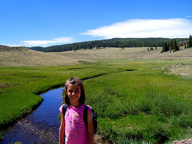 Amber Rose – Princess of the Pampas (Photo by Sunny) |
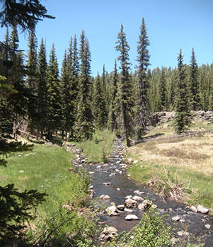 Branching of the West Fork (Photo by Ajay) |
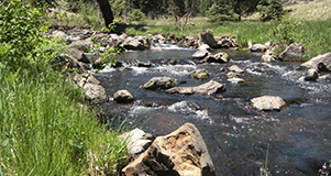 White water on the West Fork (Photo by Ajay) The West Fork temporarily splits at this location, rejoining farther upstream. The Thompson Trail closely parallels the sparkling West Fork of the Black River for three miles, passing through lush, flower-filled meadows and steep, heavily timbered canyons along the way. We will gain almost 300 feet of elevation over the length of the trail before we exit at the Thompson Trailhead, elevation 8,825'. |
|
Although this is ideal habitat for black bears and bears inhabit most of the White Mountains, we have never spotted a single bear on any of our hikes in this area. Nor have we ever had any bear incidents at the campground. Bears are typically extremely wary of people and will do their best to stay out of your way and avoid confrontation. On the flip side, we humans need to take some responsibility and be more “bear aware” ourselves. We should realize that we are only temporary visitors in their environment and need to be respectful of that, as well as use a little common sense, good judgment, and caution. |
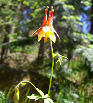 Golden Columbine (Photo by Sunny) |
As warm and sunny as it’s been lately in these mountains, the elevation is still too high and the nights are still too cold for most wildflowers to emerge this early in the season. In the lower desert regions of southern Arizona, wildflower season usually peaks in March and early April. But here we’re almost 8,000 feet above the lower deserts, so wildflower season at this elevation usually peaks in July and early August. Golden Columbine is one of the few wildflowers we will see on today’s hike, with the exception of the plentiful and early-blooming Mountain Iris. |
|
Large and leafy skunk cabbage thrives in riparian habitats like the West Fork, and we see quite a few of them today along the Thompson Trail. Their broad leaves serve as ideal solar collectors, soaking up the warmth and energy of the afternoon sun and, with the help of the plants chlorophyll, initiating the photosynthesis process. |
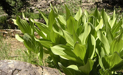 Skunk Cabbage (Photo by Ajay) |
|
But enough of Botany 101 already. The big question of the day remains unanswered. Is this stuff good to eat? Can we boil it with corned beef or use it in a salad in place of traditional lettuce? No one seems to know. But we’ve never seen any skunk cabbage leaves that have been nibbled or shredded by the local four-legged residents, so I think it’s probably a safe bet to assume the name itself implies that skunk cabbage must not be too tasty or edible after all. A good rule of thumb with wild plants is if the local animals avoid it, we probably should too. |
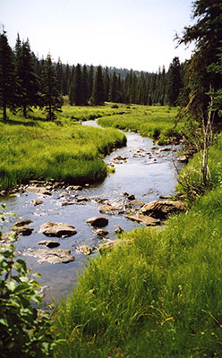 The West Fork keeps on rolling along. (Photo by Chuck) |
The West Fork of the Black River, winding its way through the meadows, forests, and canyons of the White Mountains, is so picturesque and scenic that it’s often featured in Arizona Highways and other publications and has no doubt been used as backdrop scenery for more than a few movies over the years. There are few other mountain streams in the world that can match its breathtaking beauty and bucolic charm. It is truly in a class by itself and one of the major attractions for hikers and backpackers in the White Mountains of Arizona. 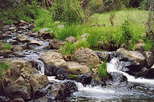 Cascades along the West Fork (Photo by Chuck) |
|
Karen and Amber stand atop one of the two concrete fish barriers along this stretch of the West Fork of the Black River. The barriers primary function is to separate the native trout from the non-natives. There are only two trout species that are native to Arizona: Apache trout and Gila trout. All other trout species here, including the ubiquitous rainbow, brook, brown, cutthroat, brook char, and grayling, are introduced species and non-native to the state. |
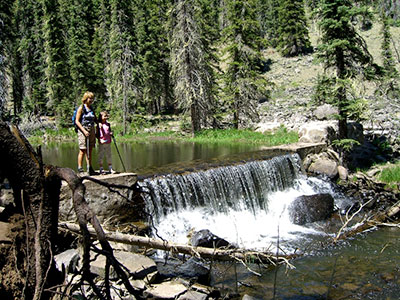 Fish barrier on the West Fork (Photo by Sunny) |
|
These non-natives compete with the native populations for food and habitat, eat large numbers of their offspring, and introduce diseases as well. Over the years both Apache and Gila trout have become nearly extinct in Arizona. This stretch of the West Fork between the barriers is home to the rare golden Apache trout and currently off-limits to all fishing. It is one of thirty such protected areas throughout northern and eastern Arizona where the Apache trout is trying to make a comeback and reach self-sustaining levels. |
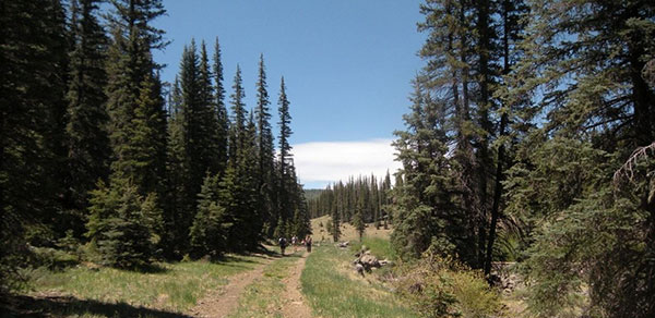 Closing in on the Thompson Trailhead (Photo by Ajay) 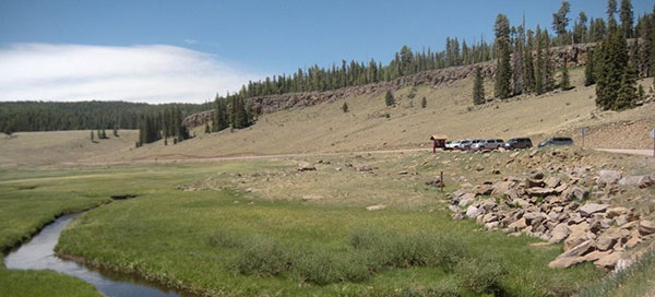 Waiting vehicles at the trailhead (Photo by Ajay) |
|
The last few hundred yards of the Thompson Trail follow an old forest road back to the trailhead. Ajay and I are snapping a few last-minute pictures and trailing the rest of the group just ahead of us. Despite our 8,800 foot elevation, it’s warmer than we had anticipated. After hiking over six miles we are all anxious to get back to our two waiting vehicles at the Thompson Trailhead and make the 30-minute drive back to the campground. Fortunately, we’ve enjoyed a nice cool breeze for most of the day, but some of those longer, open stretches in full sun got just a bit too toasty whenever the wind died down completely. Most of us got a little sunburn today as well. Despite using plenty of sunscreen, you still burn easier and quicker at these higher elevations. But all in all this has been an almost perfect day for hiking the White Mountains. |
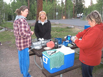 Yes, we have the kitchen sink too! (Photo by Ajay) |
Who says you can’t bring the kitchen sink with you on a camping trip? For years now it’s been a standing joke that we usually bring everything with us on these multi-day car camping trips except for the kitchen sink. Now that’s suddenly changed since Karen has actually managed to bring a portable kitchen sink with her on this trip. |
|
So with the aid of her brand new sink (yes, it works like a champ), she, Lisa, and Cyd are doing a little clean up work after our Saturday night pot luck. We enjoy a scrumptious feast of BBQ chicken, BBQ baked beans, shrimp, rice, macaroni salad, dinner rolls, a veggie and fruit plate, and brownies for desert. We probably have enough food for at least twenty people, so there’s going to be an awful lot of leftovers for tomorrow’s breakfast and lunch. |
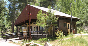 Big Lake Visitor Center (Photo by Ajay) |
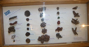 Yikes! Is that real scat? (Photo by Ajay) |
|
Sunday morning dawns bright and clear at Rainbow Campground. After breakfast, we bid goodbye to Cyd and Karen since they want to get an early start on the long drive back to Phoenix. The rest of us decide to check out the Visitor Center just down the road from our campsite, do a short hike from there, and then hike back down to the lake one last time before heading back to camp for pack-up and lunch. The Visitor Center is small but has some interesting displays inside, including this bizarre collection of various animal scat from the local residents. Obviously the bigger the animal, the bigger the calling card they leave behind. So there’s no question who deposited the largest pile in the bottom center of this picture. You got it—our furry, long-clawed and big-toothed friend, big bruin. Amber is absolutely fascinated by this display and asks a couple of us to take some pictures for her. Ajay is quick to oblige. |
|
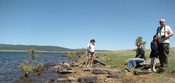 Lisa, Sunny, Amber, and Chuck at the lake (Photo by Ajay) |
Just a few more parting shots: |
|
Thanks once again to Cyd, Karen, Lisa, Sunny, Amber, and Ajay for your participation in this trip and thanks also for those of you who sent me some of your pictures to include in this report. We all had a great time and hopefully these words and pictures will help preserve the memories of all those special moments we shared together on the White Mountain/Big Lake June 2010 car camping trip. |
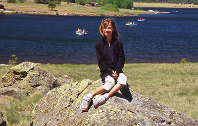 Amber Rose at Big Lake (Photo by Chuck) |
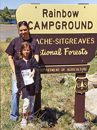 Sunny and Amber |
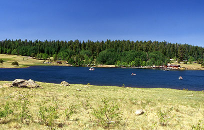 Last picture of Big Lake (Photo by Chuck) |
 Top of Page
Arizona Trailblazers Hiking Club, Phoenix, Arizona
Comments? Send them to the AZHC .
updated October 25, 2017