Outdoor Links
Hike Arizona
Trip Planning Guide
Trip Report Index
Calendar of Events
Library
|
Mint Spring/Marshall Gulch/ Aspen Loop Day Hike Mount Lemmon, Tucson August 8, 2015 by Lance Ware |
|
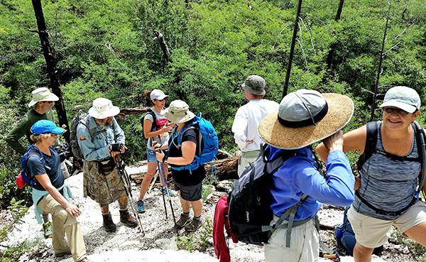
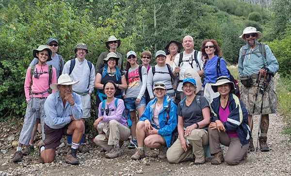 At the trailhead. [photo by Quy] |
|
Kneeling (left to right): Rudy, Lin, Anikó, Irene, Quy. Standing (left to right): Jade, Al, Lance, Tamar, Steven, Maya, Carol, Sana, Michael, Chuck, Heather, Jim |
|
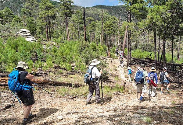
On a pleasant day in August, seventeen hikers gathered on top of Mount Lemmon, outside of Tucson, for an agreeable excursion through the woodlands. The weather forecast called for thunderstorms likely, but we never felt a raindrop or heard a thunderclap the entire day. |
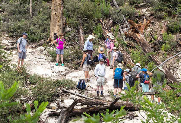
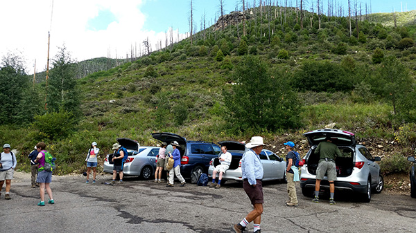 At the trailhead, getting ready to head out. [photo by Lin] |
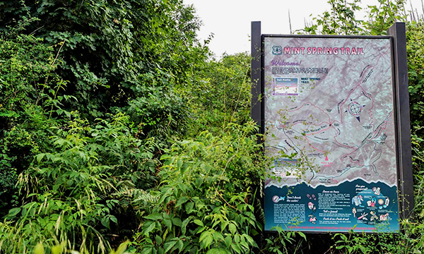 Sign at the trailhead. [photo by Quy] |
|
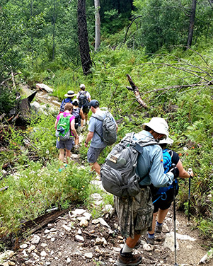
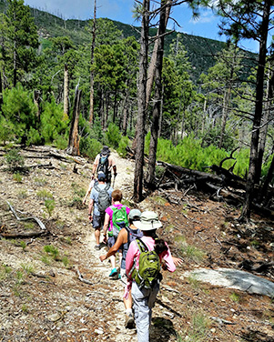
We started at the Mint Spring trailhead at the end of Carter Canyon Road. This took us up and over some hills with lush vegetation. Some of the trail was a bit wet from recent rainfall, but nothing to worry about. There were mushrooms, ferns, and wildflowers growing abundantly along the way. |
 Heading out. [photo by Quy] |
 Fire damage along the way. [photo by Quy] |
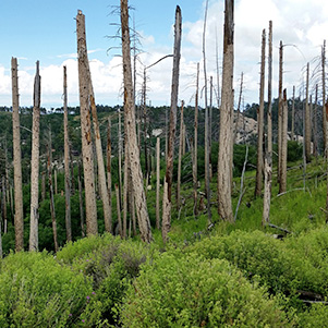 Tree trunks are still standing. [photo by Lin] |
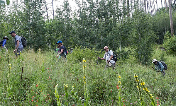
 Following the Mint Spring trail. [photo by Lin] |
 Heading down into Marshall Gulch. [photo by Lin] |
 Taking a break along the Mint Spring Trail. [photo by Lin] |
 What a fine walk in the woods! [photo by Quy] |
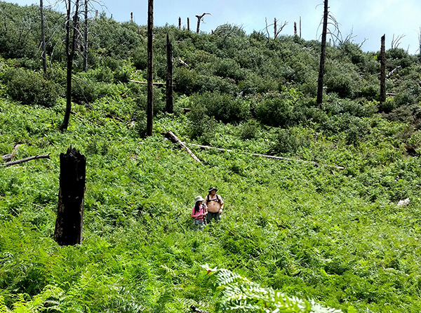 A meadow of ferns. [photo by Lin] |
|
After about 1.7 miles we reached Marshall Saddle, a crossroads of several trails. Per plan we took the Marshall Gulch trail downhill through a valley with flowing water. We crossed the creek several times along the way, making our way to the picnic area at the bottom. Here we stopped for a bite to eat and a short rest before we set out again. |
 Taking a break at Marshall Saddle. [photo by Lin] |
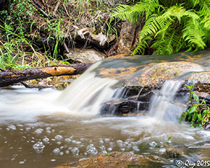 Water flowing over Marshall Gulch. [photo by Quy]  The stream has polished those rocks. [photo by Quy] |
 Water flowing in Marshall Gulch. [photo by Lin] |
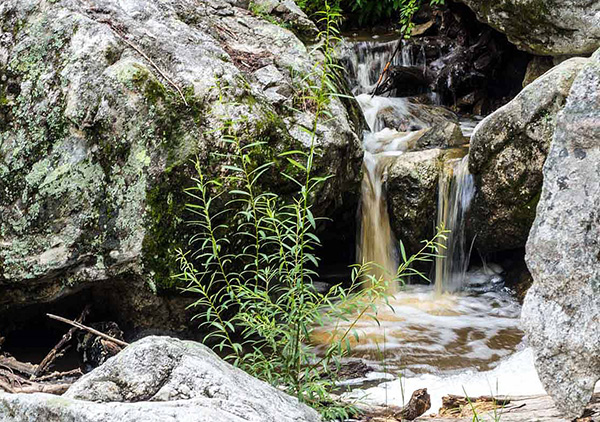 Watefall in Marshall Gulch. [photo by Quy] |
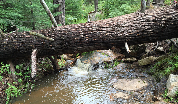 Why, it’s as easy as falling off a log. [photo by Lance] |
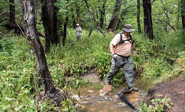 Michael crossing the creek. [photo by Quy] |
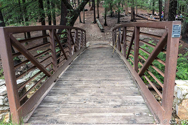 Bridge to the Marshall Gulch picnic area where we stopped to eat. [photo by Quy] |
|
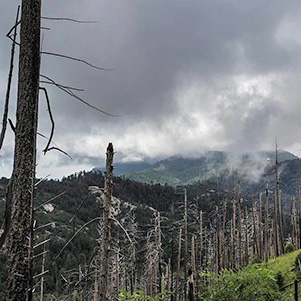
After relaxing for a bit, we continued our trek. This time we took the Aspen trail which led uphill, giving us great views of the granite boulders in the surrounding valleys. There was ample evidence along the way of the Aspen wildfire that had burned large portions of the region in 2003. The forest is slowly recovering from this devastation. |
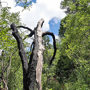 A heavily burned corpse of a tree along the Aspen Trail. [photo by Quy] |
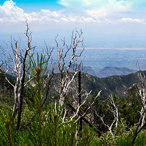 View of Tucson from the Aspen trail. [photo by Quy] |
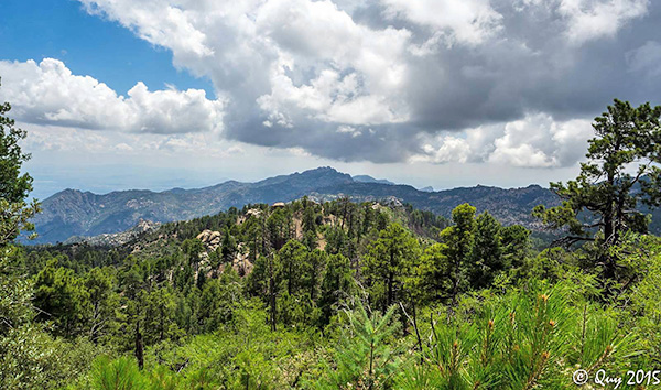 We might have some weather brewing. [photo by Quy] |
|
After a fair amount of climbing we made our way back around to the Marshall Saddle. We stopped here for a short break while some explored and climbed on the large boulders nearby. Then we set out on the Mint Spring trail again, finally arriving back at our cars. |
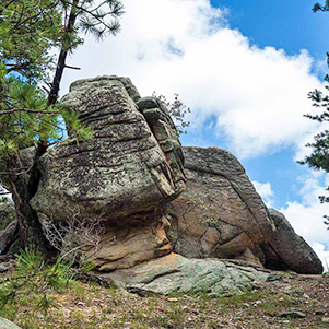 Boulders at Marshall Saddle. [photo by Quy] |
 Jade climbing on the boulders. [photo by Quy] |
 Heading back on the Mint Spring trail. [photo by Quy] |
|

|
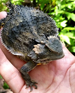
| Short-horned lizard (aka “horney toad”) taking a piggy-back ride with Jade. [photos by Lin] | |
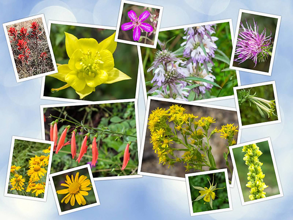 A selection of wildflowers. [photos by Quy] |
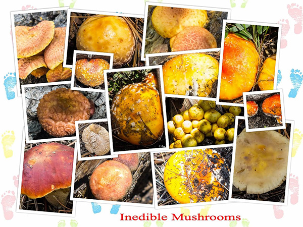 We saw a surprising number of mushrooms. [photos by Quy] |
|
|
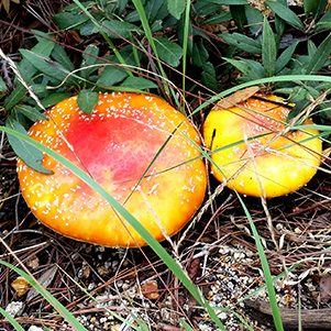
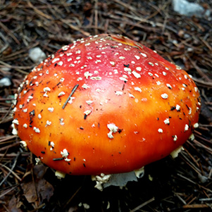
| Look, but don’t touch. [photos by Lin] | |
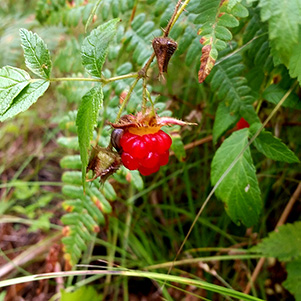 Berry bush. [photo by Lin] |
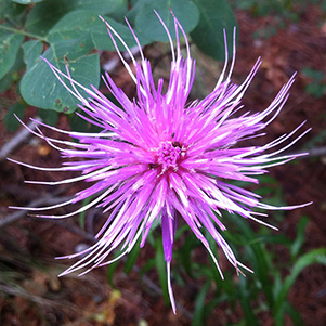 Thistle. [photo by Carol] |
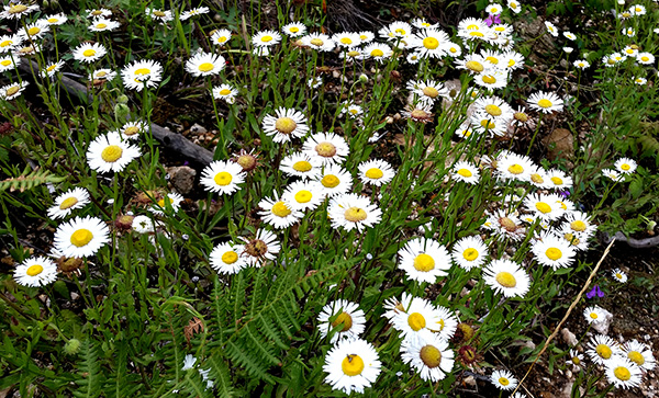 A field of fleabane. [photo by Lin] |
|
Afterwards we all stopped at the Sawmill Run Restaurant in the nearby town of Summerhaven to have a meal and reminisce about the hike. Then we headed back home. |
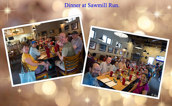 Meal at Sawmill Run Restaurant in Summerhaven. [photos by Quy] |
|
|
||||||||||||||||||||||||||||||||||||||||||||||||
 Top of Page
Arizona Trailblazers Hiking Club, Phoenix, Arizona
Comments? Send them to the AZHC .
updated September 9, 2018