Outdoor Links
Hike Arizona
Trip Planning Guide
Trip Report Index
Calendar of Events
Library
|
Adobe Jack Day Hike Sedona September 13, 2014 by Mark Purcell |
|
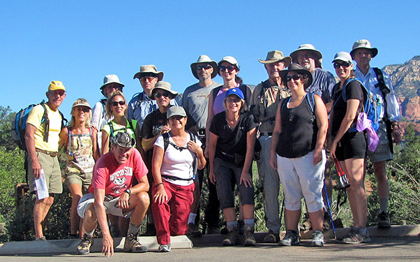 left to right: Ben, Donna, Sheila, Lori, Bill, Mark, Dave B., Sana, Steve E., Biljana, Irene, Dave F., Pamela, Steve R., Diana, Andy [photo by Bill] |
|
After needing to postpone in 2013 my first occasion to lead a hike for the Trailblazers, I was able to finally able to fill an opening in the schedule. Although I had another Sedona trail in mind previously, after a pleasant trek recently around Adobe Jack my thought was this one was more scenic and better suited to the prospective climatic challenges with mid-September weather. |
 Trailhead signing. [photo by Sheila] |
The trailhead right off of 89A in West Sedona was constructed in 2012 and was a combined effort of the Forest Service and private property owners, and enabled the carving of seven miles of new trails in the Soldiers Pass area. A majority of our steps were trod on the recent additions. |
|
Since I also reside in Sedona, I needed a veteran to organize the meet in Phoenix and I want to thank Bill for facilitation. With another multi-day club camping event simultaneously occurring in Utah, I pondered whether I would be able to count my adventurers on one hand or maybe two. So, I was pleasantly surprised when the tally at the trailhead was sixteen (I was able to determine this without removing my boots and socks). |
 Chimney Rock. [photo by Steve R.] |
 Halfway up Cibola Pass – rest-stop! [photo by Bill] |
 Landscape – previous, new, and permanent. [photo by Bill] |
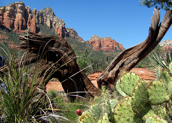
 Diana and Biljana strike a pose along the Javelina Trail. [Dave F.] Indeed, this section was unremarkable as it largely followed a wash paralleling 89A and soon intersected with the also recently christened Javelina. Although I had no report of its namesake being spotted, a gentle climb east led us towards Mormon Canyon and a gradual unveiling of the splendor of that area of Sedona. Even those of us blessed enough to live there still wonder at the natural beauty of Steamboat and Coffeepot Rocks as well as the Wilson and Munds Mountains peaks which dominated the skyline from our vantage. |
|
After a brief residency on the Jordan trail and a rest stop at the Jim Thompson trailhead, we tackled the most arduous segment – Cibola Pass. After a brief photo op at its highest point, and somewhat gratified I STILL had not lost a hiker, we descended to another rendezvous with the Jordan trail and a short walk to Devil’s Kitchen. This large sinkhole expanded by 1/3 relatively recently in 1989 and there are two additional areas in its geography that have been identified as prone to imminent collapse within a few years. Could have been bad timing ’cause I did not bring a rope to hoist up a hiker suddenly experiencing a loss in elevation (actually, the more vulnerable areas are not readily accessible). By this time the temperature had climbed into the mid-80s, and the lack of shade at DK hastened our desire to return to the trailhead which we accomplished entirely on another young 2-mile trail which possessed the same name as our starting point. |
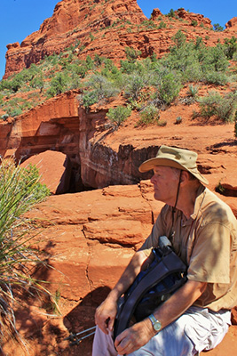 Dave F. looks contemplative at the Kitchen. [photo by Sheila] |
 Sana walks away from Steve’s Closest to the Edge challenge at Devil’s Kitchen. [photo by Steve R.] |
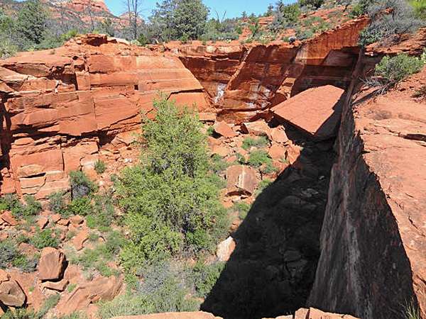 Looking towards the rear of Devils Kitchen — the next probable area of collapse. [photo by Dave F.] |
 Ben, Lori, and Donna stop for a photo op with Sugarloaf, Coffeepot, and Thunder Mountain as a backdrop. [photo by Bill] |
|
Upon a final head count at the terminus with all accounted for, and after granting permission to DRIVE there, all but one of the group enjoyed a pleasant later lunch at Cafe Jose in West Sedona. I believe a few people then attended the Festival in Tlaquepaque, which after several years in the Verde Valley I can finally pronounce. |
 Looking towards Steamboat Rock with Oak Creek Canyon beyond. [photo by Sana] |
 Winding through the switchbacks. [photo by Sheila] |
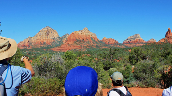 Trailblazers marvel at the geology draped by blue skies. [photo by Sheila] |
 Steve and Irene chill out on the Javelina trail. [photo by Bill] |
Certainly, although this was my first attempt at spearheading a hike for the Trailblazers, I was well prepared by both the training available and osmotic observation of the many able individuals who donate considerable hours in hike leader preparation and reporting. Hopefully, this will be published before the accounting from the organizer of the aforementioned concurrent Utah hike, whose mastery of prose based on precedence will render mine of secondary interest to those who visit the trip reports. And I project acquiring a better first aid kit than my initial investment in the Dora the Explorer model that I fortunately did not have to access. |
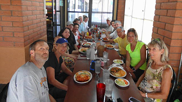 Post hike lunch at Cafe Jose. [photo by Dave F.] |
|
In closing, I had a great group of spirited hikers, cooperative weather, and hey, it’s Sedona. And spanning two different counties, none the less! Hopefully, in the chasm between benevolent dictator and tyrant I gravitated as a leader towards the former. If you are reading this report from near or far, and have not yet hiked with the Trailblazers, there is likely an event on the calendar that should coincide with your schedule and/or endurance. |
 Top of Page
Arizona Trailblazers Hiking Club, Phoenix, Arizona
Comments? Send them to the AZHC .
updated September 4, 2017