Outdoor Links
Hike Arizona
Trip Planning Guide
Trip Report Index
Calendar of Events
Library
|
Grand Canyon - Bright Angel Trailhead to Plateau Point Grand Canyon National Park October 25-27, 2013 by Chuck Parsons |
|
|
Back in the days of our predecessor club, the Motorola Hiking Club (pre-2003), we used to do an annual Grand Canyon backpacking trip from either the North Rim or the South Rim, and for many of us it was the most highly anticipated hiking event of the entire year. Our last backpacking adventure in the canyon was in October, 2004 and actually the only one we have done as the Arizona Trailblazers. For a variety of reasons, we no longer do backpacking trips into the Grand Canyon, although we do talk about it occasionally. And according to our vast Trip Reports archive, our last day hike from Bright Angel Trailhead out to Plateau Point took place way back in October, 2003. So I decided that ten years was long enough, and it was finally time for another day hike out to Plateau Point. So get ready to gear up, lace up those hiking boots, and join us for one of our greatest hiking adventures of 2013. And hopefully we won’t wait another ten years to do this again. Not sure if my knees can handle a 2023 hike out to Plateau Point. But we’re putting the cart before the horse here. Our first objective is to hit the road and get ourselves to Mather Campground on the South Rim. Thirteen Arizona Trailblazers in five vehicles meet at our usual I-17 & Bell Road location at 8:00 AM on Friday morning, October 25, to caravan together to the Grand Canyon. Three more Trailblazers will join us later at the campground. As seen from the following pictures, one of the biggest challenges toward that end is packing all of that camping and hiking gear into our vehicles. And Eileen, along with her three passengers – Sandy, Quy, and Florence, faced the biggest challenge of all. It’s a good thing they all recently took the on-line course “How to Pack Your SUV Efficiently and Thoroughly 101”. |
 “Is all this stuff going to fit in there, Eileen?” [photo by Quy] |
 “See Sandy – I told you everything would fit.” [photo by Quy] |
 OK – who’s riding up on the roof? [photo by Quy] |
 Evidently not Quy. So who drew the short straw? [photo by Quy] |
|
Terrific job, guys. You are all to be commended, although it’s a shame someone will have to ride all the way up to the canyon strapped to the roof. Hopefully we won’t run into heavy rain or a hailstorm on the way. We leave around 8:30 with a couple of stops along the way, including gas and lunch in Flagstaff, and finally arrive at Mather Campground around 1:30 in the afternoon. Our next challenge is unloading most of this gear and setting up our tent homes for the next two nights. |
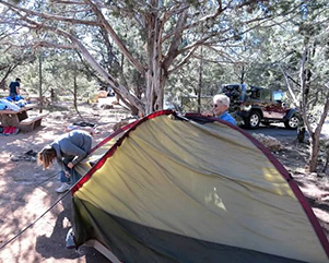 “Are you sure we’re doing this right Sandy?” [photo by Wayne] |
 All the comforts of home – almost. [photo by Eileen] |
 Barry and Danny’s home away from home. [photo by Quy] |
 Yup – it’s a tent all right. [photo by Wayne] |
 Barry and Danny kick back and enjoy a cold one. [photo by Eileen] |
 John R. admires his handiwork. [photo by Eileen] |
 Cyd – “No dirt is going to get in my tent!” [photo by Eileen] |
 Chuck – “Aw, who cares about a little dirt anyway?” [photo by Eileen] |
|
A recent issue of Backpacker magazine named the Bright Angel Trail one of America’s “Ten Most Dangerous Hikes”. Oops – what the heck are we letting ourselves in for tomorrow? But wait. Let’s be rational about this and think about it for a minute. I’ve hiked this trail many times over the years without incident, as have several other hikers on this trip. Yet this is the first time I’ve ever heard it described as one of the most dangerous hikes in the country. But when you actually stop to look at the stats for a minute or two the reason quickly becomes obvious. The Bright Angel Trail is by far the most popular hike and heavily used trail within the Grand Canyon’s vast trail system, with several hundred thousand people from all over the world and all walks of life hiking all or parts of the trail every year. And many of those hike it during the brutal summer months when temperatures in the canyon, particularly along the lower stretches of the Bright Angel Trail and along the Colorado River, routinely reach 110 degrees or higher. The result – over 200 heat-related rescues each year in the Grand Canyon, the vast majority of them on the Bright Angel Trail. And the total number of search and rescue missions within Grand Canyon National Park is currently averaging around 500 per year. Unfortunately, a few of those rescues result in hikers – most inexperienced and unprepared – being brought out of the canyon under the cover of darkness in heavy black body bags. On average, fifteen to twenty people die in the Grand Canyon every year from dehydration, heat stroke, heart attack, falling into the canyon, lightning strikes (three this year alone), and even committing suicide. A grisly statistic the National Park Service does not wish to publicize for obvious reasons. But the Grand Canyon is not a playground, nor is it a Disneyland theme park which some people mistakenly and sometimes tragically assume it to be. It is beautiful and it is breathtaking, but at the same time it can be deadly and very unforgiving for the careless, the inexperienced, and the unprepared. For those inclined to explore that topic a bit further, take a look at the book Over the Edge: Death in Grand Canyon by Michael Ghiglieri and Thomas Myers. This gripping book documents over 600 known fatal mishaps in the Grand Canyon, going all the way back to John Wesley Powell’s perilous and daring expedition of 1869, when his was the first group of explorers to navigate the treacherous and deadly Colorado River through the full 277 mile length of the Grand Canyon. Fortunately severe injuries and fatalities are relatively rare in the Grand Canyon, and the vast majority of the canyon’s five million annual visitors come and go without incident. Being prepared, arming yourself with as much knowledge as possible, and knowing exactly what you are letting yourself in for certainly increases your odds. |
 Discussing the day’s options. [photo by Wayne] |
 Corinne with her compact tear-drop trailer. [photo by Eileen] |
 Eileen, Florence, and Sandy admire Corinne’s tear-drop. [photo by Quy] |
 Two elk take up residence in a nearby campsite. [photo by Quy] |
 Capturing the grandeur of the Grand Canyon. [photo by Quy] |
 A California Condor overlooks his vast domain. [photo by Quy] |
|
After we set up camp and rest for a bit, Cyd suggests driving out to Shoshone Point. Most people seem to be more interested in staying around camp and thinking about tonight’s potluck dinner, so it’s just Cyd, Scott, Wayne, and me, as the four of us squeeze into my Dodge Dakota and head out to the point. Although I have heard about Shoshone Point over the years and have seen the spectacular images in Arizona Highways magazine, I’ve never seen it in person. Apparently few others have seen it as well – and for very good reason. Turns out it’s one of the best kept secrets of the Grand Canyon. But Cyd knows about it, has been there before, and most important she knows the way. So off we go in search of Shoshone Point. Unfortunately, I can’t divulge its exact location since Cyd has blindfolded all of us (with me driving no less!) and made us take a vow of absolute secrecy, threatening to throw me into the deepest abyss of the canyon if I ever say anything. But since the point is already shown on some maps anyway, including the official National Park Service map, I can reveal that the location is somewhere around Yaki Point. |
 Chuck, Cyd, Wayne, and Scott on Shoshone Point. [photo by Cyd] |
 Colors of the canyon begin to emerge near sunset. [photo by Cyd] |
 Lengthening shadows in the canyon near sunset. [photo by Wayne] |
|
The point is spectacular all right, especially in the setting sun, and we take lots of pictures. By the time we finally hike back to the parking area and then roll back into camp, the sun is well below the horizon and the chill of night has begun to descent on the South Rim. The crew already has a nice hot fire going, and we all gather around to soak up its warmth, as preparations are being finalized for the Great Friday Night Potluck Extravaganza. Our mouth-watering and eclectic menu for tonight and tomorrow night includes grilled pork loin steaks, mashed potatoes, BBQ baked beans, chili, fried rice, Mac & cheese, black bean salad, three-bean salad, crab salad, cole slaw, deviled eggs, guacamole and chips, salsa, cheese, pickles, olives, cucumber and carrot slices, and dinner rolls, with apple cake, brownies (with and without nuts), and cookies for desert – all washed down with beer, wine, soda, tea, and hot mulled cider (Cyd’s secret recipe). Remember the Baldwin Sisters’ famous “Recipe” from The Waltons TV series? Something like that, only with a bit more kick. And it goes down good and smooth on a cold fall night on the rim, warming us up all the way. It just doesn’t get much better than this, people! |
 Pork loin steaks sizzle over a bed of hot coals. [photo by Quy] |
 John S. whips up a batch of mashed potatoes. [photo by Sandy] |
 Trailblazers gather around a roaring campfire. [photo by Quy] |
 Schmoozing around the old campfire. [photo by John R.] |
|
It’s been a long day with a long drive and a 4.5 mile hike thrown in for extra measure for the four of us who drove out to Shoshone Point. We talk around the campfire for a while longer after dinner and discuss plans for tomorrow’s big hike down to Indian Garden and out to Plateau Point. The plan is to get up early, eat a hearty breakfast, and rendezvous at exactly 7:00 AM to hike the short trail over to the Park Shuttle pick-up point for the ride out to Bright Angel Trailhead. Our goal is to hit the trail as close as possible to 8:00 in the morning since we’re looking at an all-day 8-10 hour hike tomorrow. So once things are cleaned up and secured and all food is put away for the night, the crowd around the campfire diminishes rapidly as everyone begins to drift off to bed and a night of either sweet dreams or nightmares about tomorrow’s hiking venture on the Bright Angel Trail. Most of us roll out of our tents in the early pre-dawn hours on Saturday morning to a bone-chilling 33 degrees. B'rrr!! Actually, though, we’re a bit lucky since the low temperatures on the South Rim have been in the upper-teens to lower-20s over the past couple of weeks. So we timed this trip pretty good, which doesn’t always happen. We eat a quick breakfast, gather our gear, and hoof it over to the shuttle pick-up point just in time to catch the 7:15 shuttle to Bright Angel Trailhead. After our last hiker Doug arrives at the trailhead, we gather around the large sandstone trailhead sign for our group picture. But before we start heading down the trail, I pass on some last minute advice and tips to the troops, most of it personally hard earned through the school of hard knocks. And the Grand Canyon is one of the toughest of all schools of hard knocks as well as a demanding taskmaster. You either learn from your mistakes in the canyon or you can suffer the consequences in a major way. And the unlucky few don’t even get a second chance. |
 Saturday morning, and Eileen is ready to go. [photo by Cyd] |
 Scott and Quy are ready, willing, and able as well. [photo by Cyd] |
 We board the canyon shuttle for Bright Angel Trailhead. [photo by Quy] |
|
Hike at your own pace and do not try to keep up with anyone else on the trail. Take your time – this is not a marathon run, and we have all day to complete the hike. |
 Trailblazers gather near the trailhead, bundled against the cold. [photo by Wayne] |
 Seeing the Grand Canyon the easy way. [photo by John S.] |
 Hey – where the heck is my rider? [photo by John S.] |
 Trailblazers are ready to rock and roll! [photo by Eileen] |
|
John S., Scott, Quy, Chuck, Barry, Florence, Dottie, Danny,
Eileen, Sandy, John R., Dan, Wayne. Doug is on his way to join us, while Cyd and Corinne are staying topside today and exploring the rim. |
|
OK Trailblazers – lets move out! We’ll regroup at the Three-Mile Resthouse and then once again at Plateau Point before turning around and heading back. |
 Goal for the day – Indian Garden & Plateau Point. [photo by Chuck] |
 We start the long descent on the Bright Angel Trail. [photo by Wayne] |
|
The Bright Angel Trail follows a natural break in the cliffs formed by the Bright Angel Fault, as it descends a total of 4,380 feet in 9.3 miles from the trailhead to Bright Angel Campground on the opposite side of the Colorado River. Here it joins the North Kaibab Trail that runs the full length of Bright Angel Canyon up to the North Kaibab Trailhead on the North Rim. |
 Down and down we go into the depths of the canyon. [photo by Quy] |
 Coming to the first of two tunnels on the trail. [photo by Chuck] |
But today we are only hiking a portion of that. We will hike down to Indian Garden and then out to Plateau Point overlooking the Colorado River, a total distance of 6.1 miles one way with an elevation drop of 3,120 feet between the trailhead and Plateau Point. Except for the knees and lower leg muscles and navigating the steeper sections of trail, hiking out to Plateau Point will be the easy part. The really tough and challenging part of this hike will be the return route, when we’re already tired from the exertion of hiking out to the point and then have to turn around and hike another 6.1 miles through 3,120 feet of hard-earned elevation gain to get back to the trailhead. This is where the hike starts to become as much of a mental challenge as it is a physical challenge. The name Bright Angel originated with Major John Wesley Powell on his historic 1869 expedition through the Grand Canyon. He was so impressed with the clear, sparkling waters of the creek emptying into the muddy Colorado River south of Phantom Ranch that he christened the creek “Bright Angel.” |
|
The name stuck and was later adopted for the trail as well. The present-day Bright Angel Trail roughly follows an ancient route that was used for millennia by numerous Native American groups living along the rim and down in the canyon itself. The upper portions of the trail were gradually improved on by later-day Havasupai Indians to access the waters of Garden Creek. The Havasupai settled seasonally in Indian Garden to raise their crops of beans, corn, and squash. |
 Sandy and Florence emerge from the first tunnel. [photo by Eileen] |
 Dottie and Sandy are on the move. [photo by John R.] |
 Wayne, undaunted by redwall. [photo by Eileen] |
 Florence enjoys the view. [photo by Sandy] |
 Some excellent advice here. [photo by John S.] Soon afterward they registered the trail as a toll road to enable them to legally charge a fee for use of the trail. Cameron later gained official control of the trail and started charging a $1 toll fee to access it, in addition to fees for drinking water and the use of outhouses. After a lengthy series of legal battles that lasted nearly thirty years between private citizens, government officials, and the Santa Fe Railway over ownership of the trail, the newly formed National Park Service finally gained full control over the trail in 1928. In that same year the NPS also forced out all remaining Havasupai still living in the Indian Garden area since the Grand Canyon had been granted National Park status nine years earlier in 1919. Once through both tunnels, we continue hiking in a steady descent until we start hitting a long series of switchbacks on the trail. But this, my friends, is only a teaser and a cruel one at that, since the mother lode of switchbacks, including the infamous Jacob’s Ladder, still lies ahead between Mile-and-a-Half Resthouse and Three-Mile Resthouse. |
 Hitting the first series of switchbacks. [photo by Wayne] |
 Switchbacks and more switchbacks. [photo by Quy] |
|
This 1.5 mile stretch of the Bright Angel Trail between the two rest houses is the crowning achievement of trail switchback construction within the Grand Canyon and the gold standard against which all trail switchback construction is measured for now and forever more. A straight-line flight path from the Bright Angel Trailhead down to Plateau Point would probably measure a mile or so at best, while it’s a grueling 6.1 miles of torturous knee-blowing and muscle shearing trail of tears for us two and four-legged beasts of burden. Anyone got a hang glider I can borrow for a while? |
 Soaring cliffs of Kaibab Limestone reach for the sky. [photo by Wayne] |
 Mules and riders descending the switchbacks. [photo by Wayne] |
 Hey, why are we walking instead of riding? [photo by Quy] |
 Mule train, dead ahead! [photo by John R.] |
 A half-moon sits majestically over the canyon rim. [photo by Wayne] |
 Sandy and Barry continue down the trail. [photo by Quy] |
 View of Indian Garden and Plateau Point. We still have a long way to go. [photo by Wayne] |
|
The exposed water line we see occasionally near the trail is the reason for water being shut off usually by mid-October at the first rest house and than a few weeks later at the second and lower rest house. Water is always available at Indian Garden since it lies over 3,000 feet below the rim. Fortunately for us, water will remain available at both rest houses until at least November 1. This is something to consider whenever hiking in the canyon during the colder fall and winter months. Water from Roaring Springs, located 4.7 miles down the North Kaibab Trail, is the primary water source for this entire area of the Grand Canyon. It is piped to both rims of the canyon, Phantom Ranch, Bright Angel Campground, Cottonwood Campground, and Indian Garden Campground, in addition to both rest houses on the Bright Angel Trail. But because of the complex canyon topography and a lot of solid rock, some sections of the water distribution network out of Roaring Springs cannot be buried below ground. |
 Water — the lifeblood of the Grand Canyon. [photo by Quy] |
 1.5 Mile Resthouse — what a welcome site! [photo by Quy] |
 Dan, Danny, and Barry are ready to take a break. [photo by Eileen] |
 John S., Scott, Florence, Sandy, and Barry take five. [photo by John R.] |
|
As we reach the Mile-and-a-Half Resthouse in waves, most of us stop for a short rest break to refuel and replenish our water supplies if necessary. And I’m sure most are thinking the same thing I am after reaching the rest house: Wow – that is sure one long mile and a half of trail! It seems like we should be at the Three-Mile Resthouse by now. We still have a lot of trail to cover, so we gear up once again and head back down the trail to the next rest stop. Jacob’s Ladder, here we come. |
|
If you look closely at a map of the Bright Angel Trail, particularly the section between Mile-and-a-Half Resthouse and Three-Mile Resthouse, it appears drawn by a drunken snail that can’t move in a straight line to save its life, as it squiggles and squirms all over the map. Nothing but an endless series of sharp hairpin turns and tight switchbacks that double back on one another for mile after mile after mile (or so it feels like anyway). |
 “Think we’re getting any closer, Wayne?” [photo by Wayne] |
|
What demented and twisted mind was behind this bizarre trail design anyway? Was the intention to drive hikers insane? A straight line between these two structures would doubtless be well under a quarter-mile as the crow flies. By the time we finally reach the Three-Mile Resthouse it feels like we have hiked through at least five miles of switchbacks to get there. Next stop: Indian Garden. |
 Jacob’s Ladder, the gold standard of switchbacks. [photo by Chuck] |
 Three-Mile Resthouse coming into view at last. [photo by Eileen] |
 And yes, it finally has a toilet! [photo by John R.] |
 Dottie, Dan, and Barry take a break. [photo by John R.] |
|
After several more long and seemingly endless series of switchbacks drop us several hundred feet lower into the canyon and the trail begins to straighten out a little, we finally get a better view of the Indian Garden area beckoning us in the distance. As the sun steadily climbs higher over the Grand Canyon, the shade along most of the trail up to this point gradually gives way to full sunshine on the trail and it warms up fast. Layers begin to come off and soon most of us are down to T-shirts as the temperature slowly climbs into the mid-70s and higher. Blizzards, snow and ice, and frigid Arctic temperatures are already plaguing some parts of the country, and here we are almost into November and hiking the Grand Canyon in T-shirts with some hikers in shorts. Only in Arizona. |
 We’re getting close now! [photo by Quy] |
 Almost there. [photo by Sandy] |
 No question now where we are. [photo by Wayne] |
 Are we really still in the Grand Canyon? [photo by Wayne] |
 A sobering reminder of excessive heat. [photo by Wayne] |
|
For tired and heat-weary hikers, especially those coming up from the Colorado River on a hot and sunny day, Indian Garden is one of the most welcome sights in the Grand Canyon. Sitting only 1300 feet above the scorching desert environment of the Colorado River and completely surrounded by the desert-like environment of the Grand Canyon’s Inner Gorge, Indian Garden offers the only escape from the sun and the heat for miles around. It is a cool and shady oasis with towering cottonwood and sycamore trees, spring-fed and blessed with the cool and inviting waters of Garden Creek flowing year around through the area. |
 The most popular place at Indian Garden. [photo by John R.] |
 Hikers take a break at Indian Garden. [photo by John R.] |
 This is one big cottonwood tree. [photo by John R.] |
 This sign needs no explanation at all. [photo by Eileen] |
 Aster [photo by Quy] |
 Globemallow [photo by Quy] |
 Brittlebush [photo by Quy] |
 Cliffrose [photo by Quy] |
|
Long before European explorers, long before the miners, and way long before hikers ever discovered the Grand Canyon, this oasis in the desert was used for many centuries by Ancestral Puebloans and then later by Havasupai Indians who lived here throughout the year or seasonally, hunting deer, rabbits, quail and other small game in the area and raising their crops of corn, beans, and squash, using the same source of water that has flowed through this lush oasis for thousands of years. So us modern-day explorers of the Grand Canyon stop and rest in the shade of Indian Garden for a short time, have a bite or two to eat, replenish our water supplies, and then push on to our last major point of interest for the day, Plateau Point, 1.5 miles from Indian Garden. From Indian Garden it’s a relatively easy and flat 1.5 mile hike out to Plateau Point. Long before we hit the Three-Mile Resthouse, we are so spread out over the trail it becomes impossible to regroup all hikers at any specific location in the canyon. So we arrive at both Indian Garden and Plateau Point in small waves of hikers and end up hiking out of the canyon the same way. Some Trailblazers arrive at the point as early as 11:15, while the last group arrives about noon, and we pass each other coming and going along the trail like ships in the night. After leaving the last stand of trees and last bit of shade behind at Indian Garden, we are in full sun exposure all the way out to the point and back. On the sun-baked rocks of Plateau Point, where we break for lunch and lots of photo opportunities, we see our highest temperature for the day at 82 degrees. You can point your camera in virtually any direction out here and not go wrong. |
 Hikers on the trail to Plateau Point. [photo by Eileen] |
 Extreme minimalist hiking. “What more do I need besides water, hat, and shoes?” [photo by John R.] |
 Dottie, John R., and Chuck on the approach to Plateau Point. [photo by Eileen] |
 Plateau Point at last! [photo by Chuck] |
 The mighty Colorado River below Plateau Point. [photo by Chuck] |
|
Camera shutters are tripping all around as hundreds of pictures are taken from the point, trying to capture the magic of the moment and the grandeur of the canyon. |
 Two questions beg to be answered here: (1) How? and (2) Why? [photo by John R.] From this aerie perch of solid rock, we can look straight down into the swirling blue-green waters of the great river as it rolls by 1,300 feet beneath the soles of our boots, winding its way between soaring canyon walls and thousand-foot cliffs. The eerie silence, far from the noisy crowds on the rim or back at Indian Garden, is broken only by the wind whistling softly through the canyon and the muffled roar of the rapids far below as the Colorado makes swift passage through the Grand Canyon and continues on its ceaseless journey to the sea. |
 Crazy photographer stands on the very edge of Plateau Point. [photo by Quy] |
|
The last group of Trailblazers packs up and departs Plateau Point at 12:45 in the afternoon. From here we have a long road to travel back to the South Rim and Bright Angel Trailhead, so there is a new urgency to our footsteps as we begin to negotiate over 6.1 miles of tough terrain and have to regain that 3,120 feet of elevation we lost dropping into the canyon. And many of us are already tiring out. |
 Second view of the river from Plateau Point. [photo by Eileen] |
 Panoramic view of the canyon and Plateau Point. [photo by John S.] |
 John R. and Dottie at Plateau Point. [photo by Quy] |
 Wayne enjoys a post-lunch bask in the sun. [Quy] |
 Dan, Danny, Doug, Quy, and Eileen at Plateau Point. [photo by Quy] |
 The last group of Trailblazers on Plateau Point. [photo by John R.] |
|
Front Row: Quy, Dottie, John R., Chuck, John S. Back Row: Dan, Scott, Doug, Barry, Wayne. |
|
Hiking out of the Grand Canyon is the perfect example of hiking to the top of a mountain in reverse order, and that’s what makes it such a challenging venture. No mules and no chopper rides for us Trailblazers though. We are hoofing it out of here under our own muscle power, fueled by shots of adrenaline and sheer will power. The goal is for all of us to exit the canyon before dark. So once again Arizona Trailblazers are on the move. |
 Parting shot of Plateau Point. [photo by Quy] |
 Trailblazers head back to Indian Garden. [photo by Wayne] |
 Parting shot of Plateau Point. [photo by Chuck] |
We all make it back to Indian Garden in good time, pause for a quick rest break, and top off our Camelbacks once again for the hike back out. Shortly past Indian Garden we are back in full shade once again for most of the remainder of the hike. Only 4.5 miles and 3,060 vertical feet to go before reaching the South Rim. Here is where the Bright Angel Trail separates the men from the boys and the women from the girls, and the weak and the unprepared fall by the wayside. It will take lots of stamina, will power, and sheer determination to get us to the top now, along with plenty of muscle power, lung capacity, and a little luck thrown in for extra measure. For most people, hiking out of the Grand Canyon through thousands of feet of elevation change becomes as much of a mental challenge as it is a physical challenge. |
 Making the final approach to Indian Garden. [photo by Chuck] |
|
We finally make Three-Mile Resthouse, stop for another rest break while refueling and re-hydrating, and hit the trail once again to face the dreaded endless switchbacks of the Jacob’s Ladder labyrinth that will carry us up through several thick layers of Redwall Limestone. But we’re not doing a lot of sightseeing at this point. This is where hikers should stop looking up toward the Rim, since it’s just too darned discouraging. You hike through switchback after switchback after switchback, only to look up and discover that you aren’t any closer to the Rim than you were thirty to forty-five minutes ago. Lots of lateral movement with very little vertical gain to show for it. But such is the nature of the beast and all part of the challenge of hiking out of the Grand Canyon. |
 Wayne, Dottie, Chuck, and Scott at Three-Mile Resthouse. [photo by John R.] |
 Danny takes five at Mile-and-a-Half Resthouse. [photo by Eileen] |
 As cute as they are, please don’t feed the animals. [photo by Quy] |
 Lengthening shadows spread steadily through the canyon. [photo by Quy] |
 Meanwhile back on the Rim, Corrine pauses to reflect. [photo by Cyd] |
 Quy is coming down the final stretch. [photo by Eileen] |
Mile-and-a-Half Resthouse and many of us are spent, exhausted, wiped out. Then those of us in the rear column begin to hear chatter over the TalkAbout radios that several of our lead hikers are already coming out of the canyon well before 4:00 PM. Good Grief! Who are these people anyway? Iron Man Triathlon competitors? Guess I never realized I was such a wimp hiker. Damn! After a long rest break while elevating our legs and feet to help drain away the lactic acid building up in overworked muscle tissues, we push on with renewed determination to make it out of the canyon before dark. But this last mile and a half stretch of trail to the Rim is the toughest one of all, with the most elevation gain of the three segments from Indian Garden to the Rim – 1,140 feet to be exact. Holy Smokes! That means we’re climbing to the top of a 114 story building to get back to the South Rim! Get me out of here! Legs and feet – please don’t fail us now or we might wind up as buzzard food by morning. |
 Florence and Sandy are right behind her. [photo by Eileen] |
 Dottie and John give the thumbs us sign for success. [photo by John R.] |
|
The closer we get to the Rim, the emptier our tanks become and the heavier our backpacks seem to be. By the time we finally hit the first tunnel most of us are running on fumes. |
 A silhouetted hiker is in the home stretch. [photo by John S.] |
Before reaching the second and last tunnel (which for some odd reason is a lot further away then it was on the way down this morning) some of us are already joking about the possibility of crawling out of the canyon on our hands and knees. Thankfully we don’t have to resort to that drastic measure, but it’s almost 6:00 PM by the time the last of the Trailblazers finally exit the canyon and just barely light enough to see without the use of flashlights. As we take one last look back down the trail into the now-dark recesses of the canyon, we can make out numerous points of light bobbing in the darkness as the last of the canyon hikers bravely make their way back to the top. What an amazing day this has been. |
|
By the time the last canyon hikers finally arrive back at the campground, a roaring fire is going and the potluck dinner is already underway. Perfect timing, as we all sit down to another feast of delights and make a valiant effort to finish everything off so we don’t have to carry any of it back with us. But as usual on these car camping trips, we don’t quite make it and will have to finish some of it later at home. |
 Bundled against the cold on Saturday night. [photo by Sandy] |
|
We gather around the fire trying to stay warm and discuss the day’s hike. This has been quite a challenge for many of us, but I don’t believe a single person who made the hike wished that he or she hadn’t. I doubt that anyone would want to do it all over again tomorrow, but probably at a later date. |
 A roaring campfire helps ward off the night chill. [photo by Wayne] |
|
The Grand Canyon has a unique and mysterious pull on most hikers and has a way of drawing you back again and again, no matter how much you insist that you will never do it again. I have personally done six multi-day backpacking trips into the canyon from both the North and South Rims and numerous day hikes down to Indian Garden or Plateau Point and back. And on every single one of those trips I swear to myself that I am never doing this again because it is just too hard and it is just too exhausting, and it is just too ... etc., etc. Will I ever do it again? Just as surely as the sun rises in the morning and the stars come out at night. |
 Trailblazers pose for one last group picture on Sunday morning. [photo by Wayne] |
|
Front Row: Dan, Quy, Eileen, Cyd, Florence, Corinne, Wayne. Back Row: John R., Chuck, Dottie, Barry, Sandy, Danny, Scott, Doug, John S. |
|
Sunday morning and a heavy layer of white frost covers our vehicles and camp stoves and any other exposed metal surfaces. The temperature stands at a teeth-chattering 33 degrees, about the same as Saturday morning. We eat breakfast and then begin the arduous task of breaking down camp and trying to pack everything back into our vehicles as neatly and efficiently as we did back home. And somehow we manage to at least come close. Sixteen Arizona Trailblazers pose for one last group picture at the campground, and then we say our goodbyes to one another as we part company and head off in different directions. Seven people are heading back home, while nine of us are driving out to Shoshone Point for one last view of the Grand Canyon. |
 Eileen and Quy lead the way out to Shoshone Point. [photo by Cyd] |
 Trailblazers at the Shoshone Point Overlook. [photo by Quy] |
 Nine Trailblazers gather for a group picture at Shoshone Point. [photo by Wayne] |
|
Front: Quy and Eileen. Center: Florence, Wayne, Cyd, John S., Sandy. Rear: Chuck and Scott. |
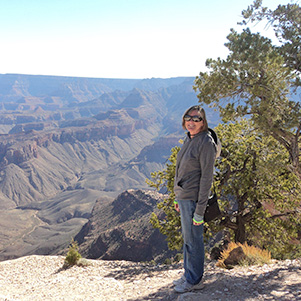
 The view from Shoshone Point is stunning. [photo by Quy] |
 Eileen, don’t get any closer to the edge! [photo by Eileen] |
 John S. stands next to Balanced Rock. [photo by John S.] |
 Florence admires the view from Shoshone Point. [photo by Eileen] |
 Another stunning view of the Grand Canyon. [photo by Cyd] |
 Don’t do it, Quy! We’ll have to turn you in. [photo by Cyd] |
 Shoshone Point — one of the best views from the South Rim. [photo by Wayne] |
 Parting shot of the Grand Canyon from Shoshone Point. [photo by Chuck] |
 Cyd takes in the view from her rocky perch. [photo by Eileen] |
 Sandy pauses for a break on a stone bench. [photo by Eileen] |
 Trailblazers sit down to lunch at Bun Huggers in Flagstaff. [photo by Cyd] |
 Refueling for the long trip back home. [photo by Cyd] |
 Top of Page
Arizona Trailblazers Hiking Club, Phoenix, Arizona
Comments? Send them to the AZHC .
updated April 26, 2020