Outdoor Links
Hike Arizona
Trip Planning Guide
Trip Report Index
Calendar of Events
Library
|
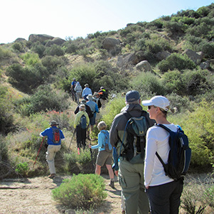
Marcus Landslide Day Hike McDowell Sonoran Preserve March 10, 2012 by Wendy Rennert |
|
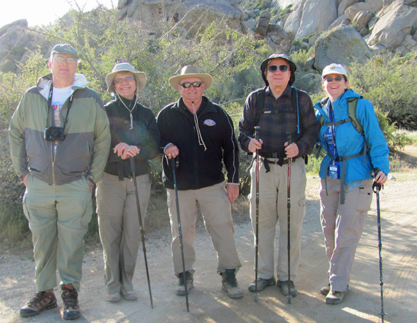 Michael, Darlene, Lyle, Chuck and Wendy |
|
Although we were a small group of 5 Trailblazers today, we were part of a larger group of 20 lucky participants in the tour of Marcus Landslide at the north end of the McDowell Mountains. Led and assisted by several volunteer Stewards with the McDowell Sonoran Conservancy (MSC), we started out on a chilly and breezy morning listening to hike leader/ MSC Steward Dan give us a brief geology lesson and some geohistory. The basic underlying rock in this area is metamorphic from about 1.7 Billion Years Ago, intruded by granite formed about 1.4 Billion Years Ago. |
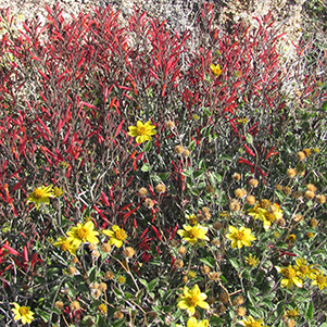 Chuparosa and Brittlebush galore! |
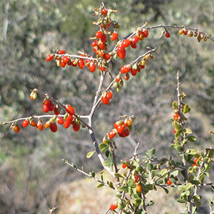 The Wolfberry bushes were all chock full of fruit. |
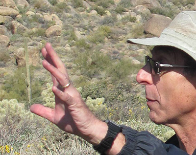 Dan reaches for a miniature saguaro ; ) |
There is a defined but not marked trail for the first part of the hike, followed by an off-trail scramble along some trail ribbon markers up to the top of the actual slidemass. There are several stops along the way, where Dan points out clues as to what factors may have contributed to the massive landslide some 500,000 years ago. |
|
One of the early stops was in a wash, where we were instructed to pick up some of the material and inspect it. “What do you see?” asks Dan. Tiny pieces of granite...quartz...One of our new terms for the day was “grus” – which is the technical name for all of this granitic gravel. “Where did it come from?” We point above us – “Up there,” was the reply. Yes, erosion from the huge granite boulders higher up on the mountain. Water is the key ingredient that breaks down the granite, and was the first clue on our hike. |
|
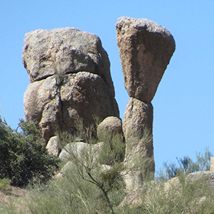
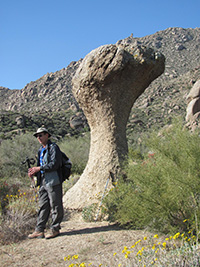 Front view looks like a dinosaur head. |
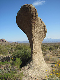 Rear view looks like an anvil. |
 Side view curvature helps make an interesting composition. |
|
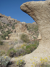
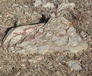
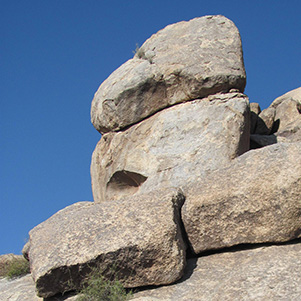
The formation in the above photos is made of the same material throughout, so the next question posed was why did it erode more on the bottom than the top? It is thought that the very top part was the only part above ground long ago, so the moisture from the ground helped make the lower part softer and thus more subject to erosion. We note that the granite has a spheroidal weathering as opposed to the metamorphic rocks, which break off in linear layers/sheets. We reach a location where there is a lengthy line of metamorphic rock running up the mountain, through the part of the mountain where the landslide occurred. Another clue, perhaps? |
|
|
| Sheet-like layers of metamorphic rock. | |
|
We look near the top of the mountain and locate a kind of bowl shaped depression, which ends up being the breakaway scar of the landslide. |
 Looking up at where the land gave way 500,000 years ago. |
|
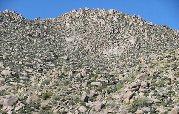
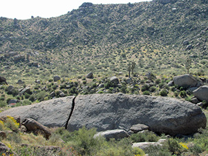
“Well, we’ve been talking about geology and the contributing factors for the past hour, but where is the landslide?” asks Dan. Heads turn in all directions. It’s actually right in front of us now, and extends almost a mile out from the mountain, about 1,650 feet wide, and about 100 feet tall. |
 Scrambling up onto the landslide mass. |
 This rock face even has eyelashes. |
|
The landslide is thought to have been caused by steep slopes combined with water saturation from rain and ice over tens of thousands of years of exposure. The grus acts like ball bearings, helping to carry the large boulders and landslide debris down the mountainside, and the slide may have reached speeds of 15-45 mph (or up to 60 mph, some say). Let’s just say this area (and several areas in the neighborhood on the way to the trailhead) is not really a smart area to have your house. |
|
|
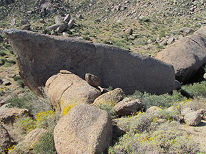
| Submarine Rock | |
|
Once on top of the slidemass, we look up at the mountain, and down the length of the slidemass into the flatlands of McDowell Regional Park below. We stop at what looks like the largest boulder of all: Submarine rock. It has a huge split in it just to the left of its center, and is pretty smooth compared to other boulders in the area. This rock was so massive that it didn’t travel very far compared to the other boulders and debris, so everything just blew right on past it and not only made the boulder smooth, but also carved out an area below the rock that you can supposedly walk under/through. We didn’t venture down that way today, especially having just seen a fairly large herd of javelina dash away from a nearby area. We soon turned around to head back to the trailhead, and luckily had an eagle eye trail tape spotter leading the way. We make a couple of stops to check out some notable rock formations, a large nest up in the rocks with 2 hawks flying overhead and also the wildflowers along the way (lupines, owl clover, poppies, and mostly chuparosa, brittle bush, and golden eye). |
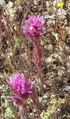 A few sparse patches of Owl Clover. |
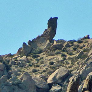 “The Iguana” is a stretch for this rock formation. |
 Don’t sneeze – you might get a headache! |
|
We ended the morning with a nice lunch out on the patio at the Pinnacle Grill. Very tasty! |
|
 Top of Page
Arizona Trailblazers Hiking Club, Phoenix, Arizona
Comments? Send them to the AZHC .
updated December 18, 2018