Outdoor Links
Hike Arizona
Trip Planning Guide
Trip Report Index
Calendar of Events
Library
|
Pine-Geronimo Day Hike Pine October 27, 2012 by Ted Tenny |
|
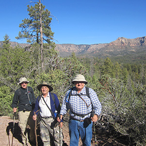
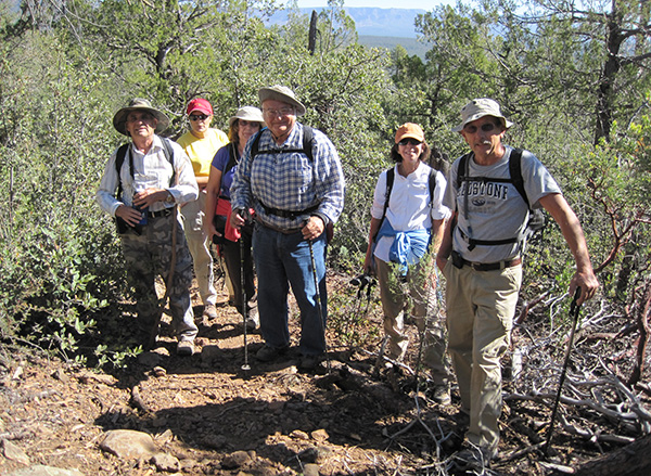 Westbound hikers Arturo, Becky, Monika, Ted, Gene, Vern. [photo by Jim Buyens] |
|
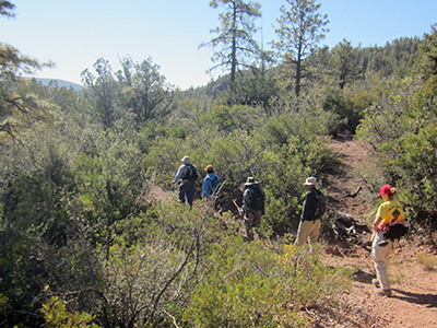
We hoped for colorful autumn foliage on this hike, and the weather co-operated. A crisp, sunny day brought out the best and the brightest of fall colors. Key-exchange hikes are confusing at first. We all met at the junction of the Beeline Highway and Control Road to exchange cars. Westbound hikers drove to Camp Geronimo Trailhead to begin their journey while the eastbound hikers started from Pine Trailhead. Along the way both parties met Scott Green and Jim Buyens, two Trailblazers who were independently hiking the round trip from Pine—an "A" hike made by combining our "C+" hikes. |
|
|
|
|
|
|
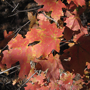
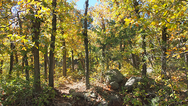
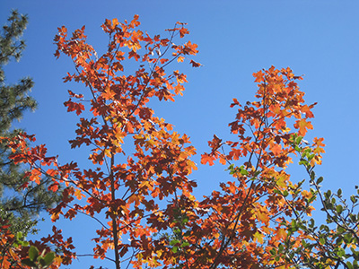
| Autumnal glory! | |
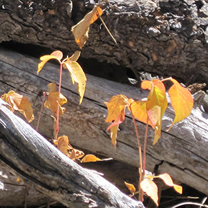
 Many ups and downs on the Highline Trail. [photo by Monika] 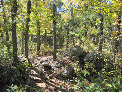 Water and elevation affect the local plant community. |
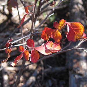
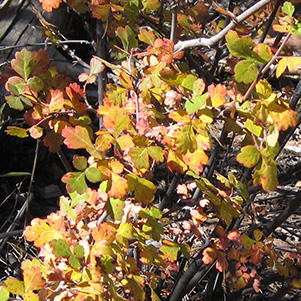
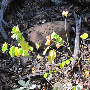
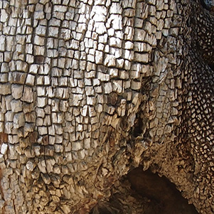
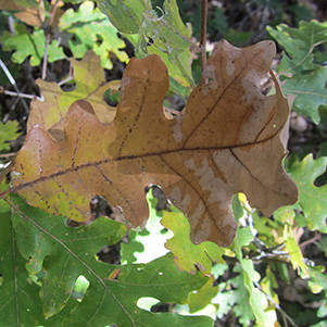
Starting from either Pine Trailhead or Camp Geronimo, the hike begins with a 1000-foot climb consisting of a series of ups and downs, some of them fairly steep. The westbound hikers crossed Weber Creek on stepping stones, then followed the Highline Trail as it meandered upward through a series of temperate vegetation communities. After a mile we were out of the deciduous forest and into a drier region of scrub vegetation, with panoramic views of the dense forest to the south and the Mogollon Rim everywhere else. The autumn leaves were patchy, but very colorful when we found them. Oak, maple, and oh-oh! poison ivy had the brightest colors. Photographers snapped away as we continued our climb. |
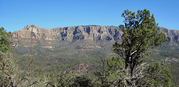
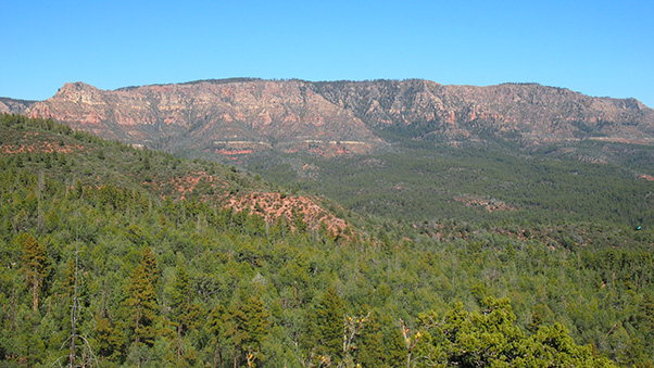 Fantastic views of the Mogollon Rim from the trail. [↑by Quy] [↓by Ted] |
|
|
The first hikers we met were Jim and Scott, a third of the way through their 16-mile ±3200' round trip hike. We took pictures, wished them well, and advised them that they would be meeting the eastbound hikers later on. |
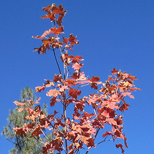
 The brightest leaves were near sources of water. [photo by Quy] |
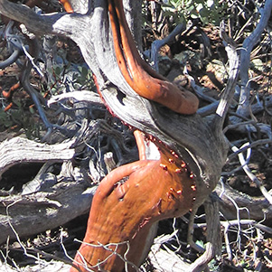
 Alligator Juniper. [photo by Quy] |
 Manzanita [photo by Ted] |
|
Where are those eastbound hikers? When we got into the clear, both Ted and Arturo tried to contact them by 2-way radio. No luck. We stopped in the shade for a snack break, then found Cathy and Quy. They had walked far ahead of their companions. Ted started on down the trail and soon met Anikó, George and Chuck. All accounted for. George and Ted did remember to exchange car keys. |
|
|
| The leaf may be faded but not Vern, Arturo or Ted. [photos by Monika] | |
|
Hard to believe that we were still short of the halfway sign. Finally we passed it, then enjoyed many wide open views on the second half of our one-way hike. |
|
The Highline Trail took us up to one last high point, then down, down, down before leveling off near Pine Trailhead. We were well past the Donahue Trail before we met any other hikers, then lots of people greeted us on the way on in to Pine. Three riders on two horses asked Ted to take their picture – a big guy on the first horse with his son (much smaller) and his preschool grandson on the second horse. |
 We couldn’t have dreamed of prettier fall weather! |
|
After the hike everyone re-convened at Pine Trailhead. Four of us decided to stop for dinner in Payson, while the others headed home. |
|
When sharing our hiking adventure with my husband I mentioned that
there were hound dogs with radio collars in one of the hunting parties,
and without hesitation he said they were hunting a mountain lion.
I think we chased that lion down to them! See you on the trail. Becky Johnson From: George Mansor To: Becky Johnson Sent: 10/28/2012 8:16:40 A.M. US Mountain Standard Time Subj: Re: Yikes! Thanks for the update. Not too surprising. I have a place not far from Pine Trailhead and although I’ve only seen pictures, mountain lions have been spotted in my neighborhood. The good news is, they usually want to avoid people. George Mansor Although most of our hikers probably don’t realize it, quite a few of our hikes are in areas where either bears, mountain lions, or occasionally even both live and hunt. We saw several large piles of bear scat along the trail heading east from the Pine Trailhead, along with many elk hoof prints and droppings. But in all my years of hiking throughout Arizona I have never seen a bear or mountain lion—only their calling cards in the form of scat or an occasional paw print. Thankfully, as George points out, they both typically go out of their way to avoid human contact and so are rarely ever seen. But we still need to exercise a certain degree of caution and awareness whenever hiking in bear or mountain lion country since there is always the possibility, however remote it may be, of an encounter with either animal. And lastly we should know ahead of time how we’re going to react in the event of an actual encounter. Chuck Parsons |
 Top of Page
Arizona Trailblazers Hiking Club, Phoenix, Arizona
Comments? Send them to the AZHC .
updated July 22, 2019