Outdoor Links
Hike Arizona
Trip Planning Guide
Trip Report Index
Calendar of Events
Library
|
Prescott Circle Trail Day Hike Prescott May 20, 2017 by Dave French |
|
 Dave’s group from White Spar Trailhead [photo by Dave] |
| Ralph, Marilyn, Michael, Carl, Darrell, April, Lin, David M, Biljana, Diva, Billie, Mark, Michelle |
|
First, thanks to Quy who had identified and planned this hike for April, but due to personal reasons had to cancel and asked me to take over and reschedule. This is a nice hike of moderate length and well suited for a large group key-swap one-way hike. Twenty hikers loaded into six cars at I-17 and Bell Road at 7 AM on a beautiful and somewhat cooler day than average for this time of year. We drove to Prescott and reassembled at the Safeway parking lot on US 89 south of downtown Prescott. There we met 5 additional hikers there and then sorted out the carpool swaps so that 14 hikers went with me to the White Spar trailhead and 11 hikers went with Jim to the Aspen Creek trailhead on Copper Basin Road. Jim has a supplementary report below. |
 Trying to get organized. [photo by Billie] |
 OK, you go with that group. [photo by Billie] |
|
We parked just outside the White Spar campground in an unpaved parking lot, put on our gear and headed back across US 89 to the 9415 Trail. There we took our group picture and started the climb up to the ridge. The trail is a single track and easy to follow. Once on the ridge, we could see evidence of the 2002 Indian fire that wiped out most of the tall pines and opened up some nice views to the north. We could see many house scattered through the trees, Thumb Butte and Granite Mountain and then much further to the northeast was Bill Williams Mountain, Kendrick Peak and the San Francisco Peaks. The area is revegetating nicely but the tall trees will take decades to reach their typical height. |
 It’s that-a-way. [photo by Lin] |
 We’ll go as soon as everyone is ready. [photo by Lin] |
 Isn’t this the berries? [photo by Lin] |
 The insects around here are boring. [photo by Lin] |
 Are there woodpeckers? |
 Colorful oak leaves. |
 Great view at the beginning of the hike. [photo by Lin] |
 Trailblazers on the march. |
|
One hiker was not feeling well and took a long rest. Most of the other hikers continued on to the agreed meet-up place at the junction of trails 9415 and 9415A which leads to Quartz Mountain summit. The group from Aspen Creek trailhead had a shorter hike and arrived first. By the time we got there, they were ready to head on up to Quartz Mountain summit. I had been in phone contact with the ailing hiker and her friend and found that they were moving well and would meet us at that junction. There is shade and some logs to sit on. |
 Let’s all sing, “Wolverton Mountain”. [photo by Lin] |
 Snack break. [photo by Ralph] |
| Now don’t just sit there like a lump on a log. [photos by Lin] |

|

|

|
| Echinocereus spp. - Claret-cup Cactus. [photos by Lin] |

|

|

|

|

|
|
Quartz Mountain is the highlight of this hike. It is capped with white quartz and quartz lines the trails in that area. We all scrambled up to the summit and spread out across the top. There was no opportunity to take a group photo but lots of photos were taken. For future information, you take 9415A to a road, bear left on the road for a little ways and look for an informal trail to your right that gets you to the top easily. Some hikers started right up to the summit from the road and encountered a bit of rock scrambling. |
 We made it! Let’s celebrate! [photo by Lin] |
 Top of the world. [photo by Ralph] |
 At the peak. |
 Trailblazers atop Quartz Peak. [photo by Cyd] |
 US 89 winds through the trees toward Wickenburg. |
 Eileen shows us how it’s done. |
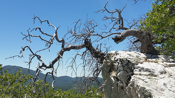 Twisted tree has a great view from the top. [photo by Lin] |
 The road and the Bradshaw Mountains. [photo by Lin] |
 Claret-cup cactus. [photo by Lin] |
 Jumping for joy! [photo by Lin] |
|
Jim’s Group departed first and my group departed in small groups and reassembled at the junction. The ailing hiker had made it there just fine and was great the rest of the hike. From the junction, we headed west on 9415 and climbed and climbed. We pasted by Wolverton Mountain on our right. The trail became an old road for a mile or so to a gate and sign that directed us to take Trail 48 to the right to reach Copper Basin Road and the Aspen Creek trailhead. I was thankful for the downhill grade for most of the remaining 3/4 mile of the hike. We descended to Aspen Creek where there was a little water flowing and the vegetation was very lush. The trailhead was a short climb up from there. |
 Billie takes a photo of lush vegetation. |
 The woods are lovely, dark and deep. |
 The trail is smooth. [photo by Lin] |
 A tree fell. Did anyone hear it? [photo by Lin] |
 We’re almost there. [photo by Lin] |
|
We returned to the Safeway and met Jim’s group. Some of the hikers departed for home while 19 of us went to Murphy’s for lunch and drinks. I had contacted the restaurant the day before to make sure they could accommodate about 20 hikers at 2 PM, and then confirmed from the Safeway parking lot. They had the table all set up for us in the loft and provided excellent service. We returned to Phoenix at 5 PM. |
 Lunch at Murphy’s. [photo by Lin] |
 Lunch at Murphy’s. [photo by Lin] |
 Yum! [photo by Lin] |
|
The hike was just over 7 miles long and took about 4 hours. You could do this hike from either trailhead as an in and out hike of modest length. The hike from Aspen Creek is shorter about 6 miles, including the climb to Quartz Mountain summit. From White Spar it would be about 8 miles. |
|
Supplemental Report by Jim Buyens |
|||||||||||||||||||||||||||||||||||||||||||||||||||||||
|
Once again it was great seeing everyone for another outstanding hike. Special thanks go to Quy, who first discovered the hike, and to you, Dave, for leading it when Quy was called away. I also want to thank you, Dave, for assigning my half of the group to hike west to east. This saved us about 875 feet of climbing that your group had to endure. But I suppose they’ll boast about getting more exercise. A group photo was taken but is not available. The attendees were: Jim, Cecelia, Mimi, Sharyn, Gretchen, Cyd, Lili, Susan, Eileen, Mark P, Jeanne. Again, thanks to everyone; you’re truly a great bunch. See you next time, and happy trails. Jim |
|||||||||||||||||||||||||||||||||||||||||||||||||||||||
|

|
||||||||||||||||||||||||||||||||||||||||||||||||||||||
 Top of Page
Arizona Trailblazers Hiking Club, Phoenix, Arizona
Comments? Send them to the AZHC .
updated May 22, 2017