Outdoor Links
Hike Arizona
Trip Planning Guide
Trip Report Index
Calendar of Events
Library
|
Woodchute Trail Day Hike Jerome May 28, 2016 by John Richa |
|
|
Tucked in the Prescott National Forest, small and often overlooked, the Woodchute Wilderness offers uncrowded hiking along some spectacular vistas. Woodchute Mountain history:Mining in Arizona was no problem, but local smelting of the ores called for vast amounts of fuel. Fuel in Jerome smelters was supplied by timber from Woodchute Mountain. The logs were cut and sent sliding down the mountain via a log chute. Hence the name “Woodchute”. The lumber was used for open roasting to remove the Sulphur from the ores. While the mines owners benefited from the abundance of wood, between the resultant killing fumes and the unceasing demand for timber, the mountain became denuded of most of large wood, tall ponderosa pines. The Woodchute Mountain mesa overlooks Jerome and the Verde Valley to the east. The green tree line along the banks of the Verde River is quite visible in pictures from high above especially when the landscape in the Verde River valley area is desert. One can see on a clear day, the San Francisco Peaks, the Mogollon Rim, and Sedona Red Rock country, Sycamore Canyon, Bill William Mountain and the more distant Kendrick Mountain. To the west, one can see Prescott Valley. The vegetation along the Woodchute trail consisted of ponderosas pine, pinyon pine, alligator juniper and shrub live oak. Now that I set the stage for today’s hike, fifteen Trailblazers met early Saturday morning at Bell Road and I-17. The weather forecast for the day was for clear skies and no rain predictions for the Jerome area. Carpools organized, four vehicles started their drive north towards Prescott and the Woodchute trailhead further north on State Route 89A, just 10 miles shy of Jerome. We reached our destination at about 9:00 AM and greeted our sixteenth trailblazer who met us at the trailhead. We saddled up our backpacks and made the names introductions and posed for our traditional group picture. |

|
|
Back row, Left to Right:
Joe, Ben, Gail, Gary, Dottie, Darrell, Kim, Carol, Jim.
Front row, Left to Right: John, Louis, Billie, Jeanne, Rudy, Karen, Cecilia. |
 Welcome to the wilderness! [photo by John] |
 The trail is well marked. [photo by John] |
|
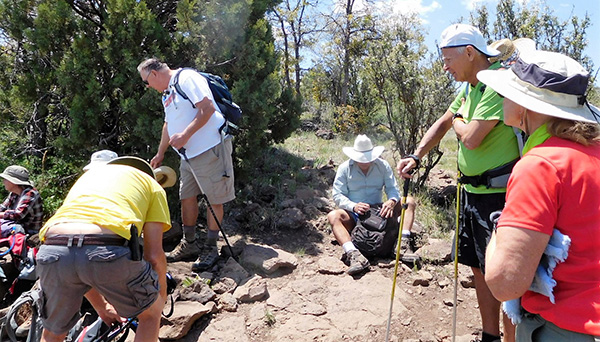
We will be amiss here if we did not mention that we had an out of town guest, from north of the border, specifically, Canada. Louis, we are delighted that you could join us on this hike and we hope, on your future winters in Arizona, that you will look us up and join us on our weekly weekends’ hikes. Louis confided with me that he was happy with our group’s age. He was fearful that he may be joining a “teeny boppers” group of hikers. We are glad that you approve of our age. Please note that the hike’s narrative and description follow a GPS graph that was captured by Jim Buyens’ GPS instrument and who kindly shared it with us. It is interesting to look back and retrieve scenes from our memory based on the graph and correlate them to the actual hike. At 9:20 AM we started our hike under clear skies and cool temperature of 65 degrees. Except for a few of us who have hiked this trail before, for the rest of us it was a brand new trail and experience. The trail was well marked and easy to follow. The starting point on the trail was flat and under the canopy of tall ponderosa pine trees. |
 Trailblazers heading out. [photo by Ben] |
 The trail starts out easy. [photo by John] |
 Hiking on a gentle slope. [photo by Ben] |
 We can see the highway down below us. [photo by Ben] |
|
Then the trees become sparse and you enter a zone of shrub live oak and other thick vegetation. But we also came across sections of the trail that seems to have been denuded because of the cutting down of the large trees that were used as fuel for the smelting plant in Jerome, but some alligator junipers survived the ax man. |

|

|
| Hikers on the Woodchute Trail. [photos by Ben] | |
 The vegetation is healthy on this mountain. [photo by Ben] |
 The mountains and clouds make a grand panorama. [photo by Ben] |
 Heading for the pass. [photo by John] |
 Duck! [photo by John] |
 Just passing by. [photo by John] |
 The tree has a fine root structure. [photo by John] |
 Alligator juniper. [photo by John] |
 Rudy takes a stand. [photo by John] |
|
The trailhead first starts in a wooded area, climbs a little then descends to the first saddle, one of several such saddles. It then climbs a steep side hill, the western side of the mountain, overlooking the Prescott Valley and Granite Mountain. Then the trail swings around to the north side of the hill and highway 89A comes into view. |
 How far does the wilderness extend? [photo by Ben] |
 Overview of the Verde Valley. [photo by Ben] |
 We can see the San Francisco Peaks from here. [photo by Ben] |
 Jerome and Clarkdale. [photo by Ben] |
|
From high above the mountain you could see as far as the horizon extends. The horizon seemed to be hugging the earth far out in the distant expanse of central Arizona. |
 Crossroads to somewhere. [photo by John] |
 Looking down on the highway. [photo by John] |
 Could we make it over that ridge? [photo by John] |
 The trail takes us up the side of Woodchute Mountain. [photo by John] |
 The original woodchute? Nope, just a road. [photo by John] |
|
Here is some of the vegetation we encountered along the trail: other than the ponderosa pines, there were pinyon pines, alligator Juniper, shrub live oak and a whole host of other greeneries that presented themselves. Photos by Ben: |

|

|

|

|

|

|
|
At about 1.5 mile marker, based on Jim’s GPS chart, we come to a saddle just east of a small peak and the trail drops again and crosses a dry creek. A short distance beyond the creek, you reach the Woodchute Tank, on your left, a hallowed area which allowed the rain water to accumulate and serve as a watering tank for wildlife. |
 Woodchute Tank. [photo by John] |
|
Beyond the Woodchute Tank, the trail begins to climb through the meadows along the side of Woodchute Mountain. The climb appears on Jim’s GPS graph at mile marker 2.0 and, by the time we reach mile marker 2.5, we had made a 400 foot climb in about half a mile of hiking. It was a steep climb and due to the elevation reached at the top of the mesa, we stood at 7,500 feet above sea level. And if you are just being introduced to such an elevation, no doubt some of us felt sluggish or tired. This was expressed to me by several hikers. For us folks who live year round in the Valley, we are not accustomed to thin air. And when you add to this the physical exertion of the climb, you can see why some of us felt a little tired prematurely. Just for your information, our average elevation in Phoenix is only 1,100 feet. As in any group of hikers, we had a group of hikers with diverse strength and experiences. Some hikers were very strong and they just took off. Others were slower and this is commonly encountered on any hike especially in the high elevation environment. Our two way radios though kept us in touch with each other at all times. But by being too fast, for better or worse, one can miss certain events along the trail. All the hikers in the spearhead missed a six foot black rattlesnake that was just two feet off the trail. Now whether this critter was there or not when the fast hikers went by, we will never know. However, when the “sweep” or “rear guard” hikers went by this spot, this black rattlesnake made it clear to them that it did not want us two legged humans trespassing into its hunting ground. Doug heard it rattling its tail and Joe was right behind him and snapped two pictures of the snake. Good eyes, Gary. Good work, Joe. |

|

|
| Don’t tread on me. [photos by Joe] | |
|
Luckily, this pointed horned toad was not near the rattlesnake habitat and it will live for another day. |
 “Horned toad” is really a lizard. [photo by Joe] |
|
Now we reach mile marker 2.5 and it is at the top of the highest elevation point on the trail, and begin our 1.3 mile flat trek on top of a mesa where the trail continues through alternating forest and meadows until about half a mile into the trek on this mesa, we reach a fork in the trail. We follow the Woodchute Trail sign, and take the right fork which leads us to the mesa’s edge. |
 Onward, brave hearts! [photo by John] |
 On top of Woodchute Mountain. [photo by John] |
|
And what a grand view appears in front of us of Cottonwood, Jerome, Sycamore canyon, the Sedona area and beyond. At 7,600 feet in elevation, a light breeze refreshed and invigorated us for the return hike. By now the spearhead group of hikers reached the final destination on the trail, some 3.7 miles from our starting point. This spot is called “Picnic Overlook” and we intended to rest for a few minutes, eat our snacks and take pictures of the scenes below us of Jerome and the current smelting plant, the Verde Valley to the north east and even the Sedona Red Rock Country in the distant north. |
 Yes, we made it to the top. [photo by Ben] |
 Now here’s a picnic with a view! [photo by Ben] |
 Did you hear what I hear? [photo by Ben] |
 Let me make some fine adjustments. [photo by Ben] |
 This is the life! [photo by Ben] |
 Are you sure you know the way back? [photo by Ben] |
|
Now, the rear guard contingent of hikers started to arrive to the Picnic Overlook. They eat their snacks while being serenaded by Rudy, our only “Rudy” playing his harmonica. |
 High-level conference. [photo by John] |
 It gets pretty rock down there. [photo by John] |
 Picnic in Paradise. [photo by John] |

|

|
| Rudy plays the harmonica. [photos by John] | |
 We’re going soon. Get ready. [photo by John] |
 Joe can find the way. [photo by John] |
 Let’s get back to the trail. [photo by John] |
|
From this vantage point one could see where the blue skies with white silver-lined clouds on the horizon meet the mountain tops to the east of our location. Way down below us, we could see the smelting plant in Jerome. We could not however locate the “chute” on the mountain for which name sake this trail was named. It may have been overtaken by new vegetation growth. From this vantage point, one could easily see and recognize highway 89A, way down below us and you could even hear the roar of motorcycles. |
 Overview of the Verde Valley. [photo by John] |
 The view eastward. [photo by John] |
 Industry on parade. [photo by John] |
 The road to Jerome. [photo by John] |
 Looking down from the mountain. [photo by Ben] |
|
After about half an hour of rest and recharging our energies, it was time to head back. |

|

|
| Homeward bound. [photos by Ben] | |
|
Here are some of the varieties of vegetation we saw on our return hike: |
|

|

|
| So that’s the long and short of it. [photos by John] | |
 Springtime on Woodchute Mountain. [photo by John] |
|
At the trailhead we rejoin our carpools and head to Leff-T’s Steakhouse and Grill where we had a 2:00 PM late lunch appointment. The restaurant’s name is somewhat catchy. The story goes as follows: the founder of the restaurant’s name was Leff-T and he was a golfer but a left handed golfer. A befitting name association. The service at the restaurant was very good and it seems that everybody liked their meal. |
 Everybody made it back to the trailhead. [photo by John] |
 Leff-T’s. [photo by John] |
 Trailblazers chow down after the hike. [photo by John] |
 Yum! [photo by John] |
|
Oh, and one other item of interest: how does one find the restrooms in a steakhouse where you are supposed to be a real “macho” man with a big appetite for a big steak dinner? Just follow the signs on the doors. |
 Clever. [photo by John] |
|
Trip Report by: John Richa, Hike Leader. |
|
Supplemental Report by Jim Buyens |
|||||||||||||||||||||||||||||||||||||||||||||||||
|
Hi, everyone and thanks for joining together on this hike. I hope each and every one of you had a great time. Jim |
|||||||||||||||||||||||||||||||||||||||||||||||||
|

|
||||||||||||||||||||||||||||||||||||||||||||||||
 Top of Page
Arizona Trailblazers Hiking Club, Phoenix, Arizona
Comments? Send them to the AZHC .
updated September 21, 2018