Outdoor Links
Hike Arizona
Trip Planning Guide
Trip Report Index
Calendar of Events
Library
|
Hangman Trail Loop Mogollon Rim June 25, 2016 by Bill Zimmermann |
|
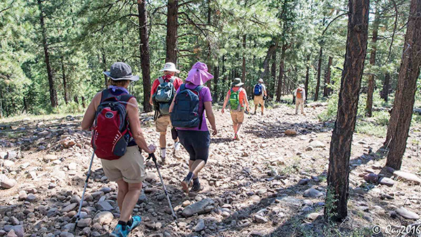
 Eleven Trailblazers [photo by Quy] Deirdre, Biljana, Dave, Arturo, Joe, Quy, Sandy, Bill, Andy, Mary, Carol |
 Let’s go. [photo by Quy] |
 We aren’t going to hang you, Arturo. [photo by Quy] |
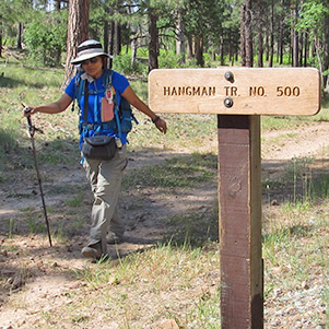 Quy passes a civilized trail sign. [photo by Bill] |
|
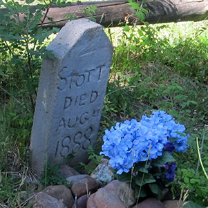
Ten Hikers left the valley at 6:10. We met Mary in Payson and at 7:40 were on our way. After one wrong turn we found the Black Canyon Lake exit just east of Forest Lake, we drove FR 300 to a campground at the intersection with FR 86. Quy took the group picture. Time to hike. We headed east on FR 300 for about a quarter mile. After regrouping we turned left onto the Hangman trail #500. Here we were treated to blue skies and a rocky remnants of an old road. Tall pines provided tree cover until we reached the cemetery. Photo time. See attached links for the historical importance. As we continued we lost some tree cover. Naked ridgelines on both the left and right were the results of previous fire damage. |
 Trailblazers visit a pioneer cemetery. [photo by Bill] |
|

|
| The folks buried here were residents of Arizona Territory. [photos by Bill] | |
 Quy finds a hillside devastated. [photo by Bill] |
 The devastation was caused by a forest fire. [photo by Quy] |
|
The hike plan had an “out-back” option with the entire group having lunch at the lake before splitting up. At “RX” we connected with the road. We shared the road with vehicle traffic going to and from the lake. On the east side of the lake we hiked narrow paved path that led to the dam. We stopped at “L” for a lunch and photo break. Bill asked Dave to lead the out-back option. He gave Dave the waypoint for another possible gravesite for his group to check out. |
 Traffic kicking up dust in our faces doesn’t help. [photo by Quy] |
 It’s much nicer without motor traffic. [photo by Bill] |
 What a fine place for a picnic lunch! [photo by Quy] |
 Joe, Andy, Bill, Mary, Quy, Deirdre, Carol, Sandy, Arturo, Biljana, Dave [photo by Bill] |
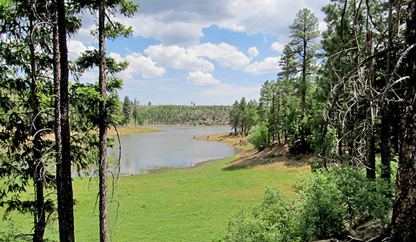 Black Canyon Lake. [photo by Bill] |
 Black Canyon Lake. [photo by Quy] |
|
Let the bushwhacking begin. About 10:30 Bill and five hikers headed out. We found a ridgeline with great tree cover. It was somewhat east of the plotted waypoints. Easy walking until we got somewhat south of “G3”. At that point the chosen route was thick with deadfall and spiny Locust plants. It was steep. Slow going. Carol and Bill took turns at this point. We regrouped at frequent intervals, since the thick vegetation blocked our vision of each other. Before reaching the top was saw elk and bear scat. |
 Andy leads the way. [photo by Bill] |
 Arturo and Andy begin climbing. [photo by Bill] |
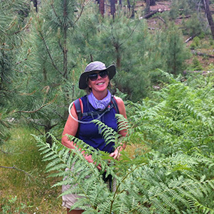 Sandy in a fern grove. [photo by Carol] |
|
At the top, the Lookout Campground was occupied with Motorola ham radio people. Arturo was happy like a pig in mud. Andy and Carol rested. Bill, Sandy, and Mary climbed the tower. Bill posed for picture with a forest service tower volunteer named Mercedes. |
 Carol scouts the route. [photo by Bill] |
 Andy finds a comfortable boulder. [photo by Bill] |
 Mary on the way up. [photo by Bill] |
 Sandy climbed the tower. [photo by Bill] |
 What a great view! [photo by Bill] |
 Mercedes and Bill. [photo by Bill] |
 Better hold your nose, Arturo. [photo by Bill] |
|
We took a group picture at the tower base. Observing all the body scathes, Bill suggested we avoid the canyon to the south and return on FR 300. Enough adventure. No objections. At 2:00 we were in the vehicle headed to Christopher Creek for a midday lunch. Rain showers followed us home through Payson to Rye. The rain did a good job cleaning Andy’s windshield. |
 Columbine. [photo by Quy] |
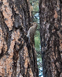 Woodpecker. [photo by Quy] |
 Dandelion. [photo by Carol] |
 This one has be stumped. [photo by Carol] |
 Venus Flytrap. [photo by Quy] |
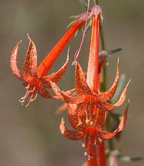 Scarlet Gilia. [photo by Quy] |
 It was a good day for hiking. [photo by Quy] |
|
8.4 miles, +-890 feet. Thanks to Andy and Dave for driving. Read Arizona’s Dark and Bloody Ground by Earle Forrest, University of Arizona Press, 1984. See also: Hangman History. |
|
Supplemental Report by Dave McLaughlin |
|
At the lake, after lunch, the two groups split up. The out and back group started heading back the way we came. Biljana, Deirdre, Quy, Joe and myself stayed on the road, bypassing the Hangman Trail, with the idea of finding another grave site and adding some distance. A few times we felt a couple drops of rain, but the clouds were kind. The number of vehicles on the road increased the dust in the air. When we arrived at the location to leave the road we had two path choices. With one hiker ahead and out of communication and another wanting to go to the car, I decided we were done. We arrived back at the car with 7.4 miles. Thanks to Bill for leading the hike. We should go back and find the other two grave sights. Dave M. |
 Top of Page
Arizona Trailblazers Hiking Club, Phoenix, Arizona
Comments? Send them to the AZHC .
updated June 29, 2016