Outdoor Links
Hike Arizona
Trip Planning Guide
Trip Report Index
Calendar of Events
Library
Saguaro National Forest, Tucson
January 23, 1999
by Jeannie Van Lew
|
|
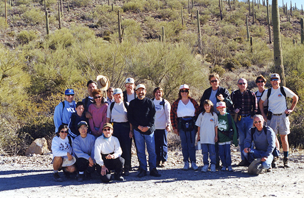
On Saturday, January 23, 1999, twenty people joined us on the King Canyon Hike. We met early in the morning at Einstein Bagels where nearly everyone filled up on good coffee, bagels and some even had eggs. After handing out maps and radios then arranging car pools we all headed south to Tucson. Those that went were: Tom and Jeannie Van Lew, Chuck and Peggy Giovanniello, Ralph and Margie Solorzano with Daniel Vazquez, Dee and Dave Pressler with Courtney and Brittney, Frank Carpenter, Rudy Arredondo, Gail Roberts, Marti Porter, Ellen Lan, Monica Cde Baca, Chuck Parsons, Joyce Parrish and Ben Velasquez. We all met at the trailhead, took our group shot and began the trek up the hill. The trail began as an old Jeep trail, which was a rocky walk along the ridge. Tom checked the GPS and kept us informed of our progress. Soon we were dropping down to the creek where we met up with the Mam-a-Gah picnic area and rock building that serves as a restroom. We crossed the creek again and soon were on a more narrow part of the trail. I was glad I had my hiking boots, as the trail was now very rocky. We could see the old mine road off to the east. |
|
|
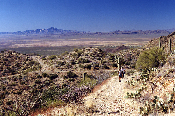
We received word from Dee Pressler, who was lagging to the back of the pack that her daughter Courtney was not feeling well. We radioed ahead to the group in the front to wait up so Dave could catch up with their other daughter and together they would return home. After that we met up with the Sweetwater Trail and saw the sight post that said 1.2 miles to Wasson Peak. We could also see the series of switchbacks we needed to take to accomplish our goal. There were many large rocks in the trail, placed there to prevent erosion, that we needed to navigate around as we climbed higher and higher up the hill. We saw two fenced mines and another open shaft along the side of the trail. Soon we arrived at the intersection of the Hugh Norris Trail and turned left (north) to continue our climb to Wasson Peak. 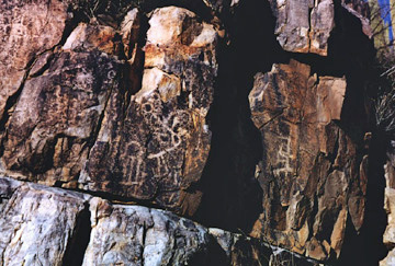
Once back to the Mam-A-Gah picnic area we detoured down the drainage where we soon spotted many petroglyphs in both sides of the drainage. These etched drawings were made by the Hohokam Indians who lived in these mountains from 900 to 1300 AD. Some of the drawings were intricate and others looked like a child’s scribbling. Some of us wondered if this were the “art school”. We continued down the wash. Just past the overhead power lines, we found a trail that led us back up to the parking lot. |
 Top of Page
Arizona Trailblazers Hiking Club, Phoenix, Arizona
Comments? Send them to the AZHC .
updated August 14, 2019