Outdoor Links
Hike Arizona
Trip Planning Guide
Trip Report Index
Calendar of Events
Library
|
Mesquite Flat Day Hike Tonto National Forest March 6, 2010 by Ted Tenny |
|
 Karen, Eileen, Mike, Garth, Anita, Michael, Cyd, Shannon, Wendy, Gary, Chip, Ajay |
|
The morning is cool and cloudy as 13 Trailblazers set out from the Mesquite Flat campground east of Tortilla Flat. After crossing Mesquite Creek we start our climb on a primitive road that leads up to a sweeping overview of the canyon country. The sun shines off and on then ducks behind the clouds. With Arizona’s winter rains the vegetation is green and there isn’t a speck of dust. We cross a pleasant stream and turn right at a three-way junction. |
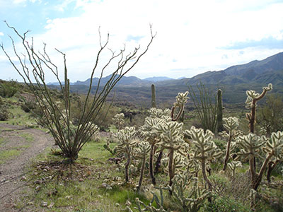 Ocotillo and jumping cholla glisten in the morning sun. |
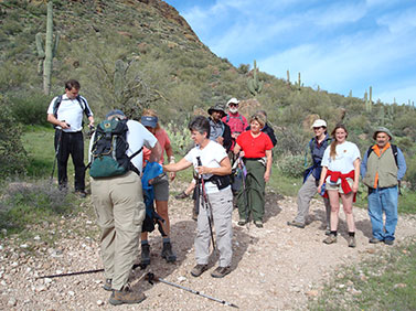 Eileen and Michael help adjust a wayward hydration pack. |
The road climbs steadily and takes us up to a vista point overlooking the foothills of Canyon Lake and a rocky tributary of Crucifix Canyon far below. What a great picture spot! Photographers take advantage of the brief interludes of sunshine to snap away at the awesome canyon country all around us. Everyone wants more, so we decide to walk the other road up to a vista point farther west. |

|

|
| Lavender and gold wildflowers brighten our passage. | |
 The Four Peaks rise majestically over a canyon tributary. |
|
On the way we are greeted by the first wildflowers of spring. “The flowers are great when we have lots of rain in November and December,” Ted explains, “but this time the rain didn’t come until January.” Although the road dead-ends, the best overlook is on a smooth cholla-choked ridge to the east. Several Trailblazers brave the Teddy bear cactus to enjoy the view. This is our turnaround point. Since it’s pretty much downhill from here, hikers begin to leave in small groups and start down the road, each at their own pace. |
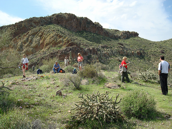 A scenic vista is our snack break and turnaround. |
|
At the three-way junction we turn right. Ted makes sure everyone makes the turn, then we enjoy a leisurely walk back to Mesquite Flat. The weather can’t decide what to do. |
|
Several past and upcoming Trailblazer hikes are visible from the road: Mesquite Ridge to the southeast, Coronado Mesa to the east, and Crucifix Canyon to the north. Everyone arrives at the trailhead in good spirits. Some decide to stop for snacks at nearby Tortilla Flat while others head on back to our meeting place. We all enjoy stories and magnificent scenery on the drive back. |
 Quiet reflections of the clouds grace our return. |
|
This hike is described in Footloose from Phoenix by Ted Tenny, pages 104-108. |
|
 Top of Page
Comments? Send them to the AZHC .
updated May 31, 2020