Outdoor Links
Hike Arizona
Trip Planning Guide
Trip Report Index
Calendar of Events
Library
|
Fish Creek Canyon Day Hike Superstition Wilderness March 21, 2009 by Michael Humphrey |
|
|
There are 5 persons who got up early this morning to meet for the Fish Creek hike at 5:30 AM. We are going to see if we can have a fun hike and get out before dark. It is still dark out, but sunrise is at 6:30 when we will start hiking. When we start hiking it is cool and we can see the morning colors on the rocks as we start at the Tortilla Trailhead. This is a road that with 4 wheel drive and skid plates you could drive. As we walk we can see places where people tried it without skid plates and lost their oil pan. We stay on this road for 4 miles as we walk to the back of Fish Creek Canyon. We can see the top edge of the canyon we will be walking in the bottom of. |
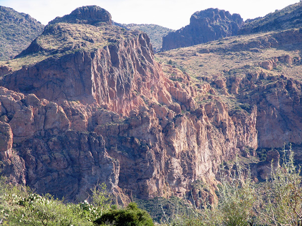 Mighty rugged down there, wouldn’t you say? |
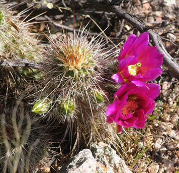 Why, it’s a bloomin’ hedgehog! |
There are some cactus in bloom as we get to the end of the dirt rood. This is where we are going to start our off-trail adventure. The exit to the top of Fish Creek is unmarked, but I have my GPS with me, so it is an easy find. We then walk over to the rim of the canyon and look down to where we will be going. This is a steep slope, but easy to traverse. At this point you can see the high cliffs that make up Fish Creek Canyon. As we make our way down we cut across an animal trail that will lead us all the way down to the creek. The creek has water in it this year. |
|
We take a rest at this point, because we have gone half the distance. We now have the hardest part of the hike coming up. This part of the hike will take the rest of the day. We continue on down the canyon having to cross the creek several times before coming to a place where I was in 2007. |
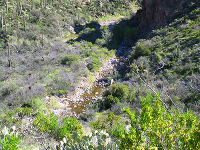 Fish Creek isn’t half bad at this elevation. |
 March 10, 2007 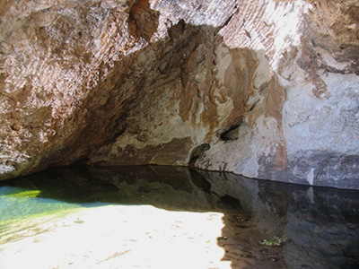 March 21, 2009 |
This shows the difference two years make. In the March 2007 picture the person in the orange shirt would have been total covered in water in the March 2009 picture. He is almost 6 feet tall, so there was plenty of water in 2009. We continue on down the canyon until we get to a nice spot for lunch. We stop here and rest. I get out my water filter and fill up my and a couple of other persons’ water bottles. We could have make it the rest of the way on the water we had, but it was better to be safe than sorry later. We now get to the part where we have to scramble over boulders. |
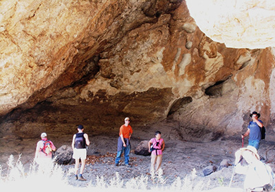
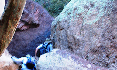 Boulder dash! Does anyone have a rope? Yes the hike leader has a rope, to control the speed you go down the slide. There is a nice boulder at the top to loop the rope around, so at the bottom we can just pull on one end to get the rope down. We are though the boulder field and the rest of the trail is easy as we continue to switch which side of the creek the trail is on. The bridge over Fish Creek is just ahead, so you have to look behind you to see the trail up to Hacksaw Tom’s cave and the exit from Fish Creek Canyon. We get to my truck that I left down here the previous night by 4:30 PM and have some beer from the cooler. We can see a mountain climber going up the cliff high above the road. It is slow going up there; he is still at it when we get in my truck to head up to where we parked the cars at Tortilla Trailhead. We get back to Tortilla Trailhead by 5:30 PM and get persons and gear switched between the vehicles so we can head back to town. This was a fun hike in a slot canyon with a very tough boulder scramble at the end. The town of Tortilla Flat has too many persons in it today, so we continue to Mesa. |
 Top of Page
Arizona Trailblazers Hiking Club, Phoenix, Arizona
Comments? Send them to the AZHC .
updated January 15, 2020