Outdoor Links
Hike Arizona
Trip Planning Guide
Trip Report Index
Calendar of Events
Library
|
Coronado Mesa Day Hike Tonto National Forest February 23, 2008 by Ted Tenny |
|
 Look before you leap, Trailblazers. |
|
Perfect hiking weather and spirited companionship made this hike memorable. Recent rains had washed the sky and settled the dust. The desert colors were vibrant and the air was cool and invigorating. We drove to the parking area just off the road to Horse Mesa Dam and left two cars there to take the drivers back Tortilla Trailhead at the end of the hike. Then we drove on down the road to Tortilla Trailhead to begin hiking. |
 I took a likin’ to the lichens.  Mesquite Ridge beckons us on a hike for another day. Some of the best scenery is nearby. Lichens decorate the rocks in their many bright colors. Each color is a different species of lichen, which is itself a symbiotic plant community of algae and fungus. After several overlooks we leave the highway and head down into the valley toward a tributary of Mesquite Creek. There’s a primitive road, marked as “Jeep Trail” on the map, which takes us by a power line in a generally northwest direction. The road goes nowhere, but was probably built to maintain the power line. When the road bends to the west we leave it to resume our bushwhacking as we follow a smooth ridge down to a stream crossing. To get up on Coronado Mesa we have to gain back all the elevation we just lost on our way down from the highway. |
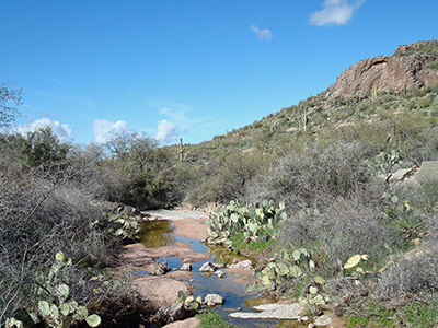 Recent rains have left water in the streamlets. |
The direction is mostly northwest as we cross two little streambeds and climb up on a ridge. A Gila Monster pokes his head out from under a rock, but then makes a hasty retreat when he sees us. Although we can’t see the highway from here, traffic noise assures us that it isn’t far away. |
|
After crossing the highway we head east over a tributary to Fish Creek Canyon and proceed to our first overview. |
 Fish Creek Peak dominates the southeastern skyline. |
|
The view is wildly panoramic! Fish Creek is flowing down in the bottom of the canyon. We can hear the rapids. The canyon walls, intricately carved by eons of erosion, are frosted with green vegetation and bright golden poppies. If this were anywhere but Arizona it would be a national park! |
 Fish Creek Canyon, from the top.  I say! Climbing up to the pinnacle was easy enough. “Now how do we get down from here?” The rocks aren’t too steep, but everyone finds their own approach to getting by that scary drop-off. All make a safe descent. In the southeast we can see Fish Creek Peak in the distance, on the other side of our hike to upper Fish Creek Canyon a year ago. Ted doesn’t know anyone who has climbed Fish Creek Peak, but someone probably has. There are more overviews of the canyon, each a little farther downstream. We climb back to the main part of Coronado Mesa and make our way out to several more of them. Each overview has its unique perspective and photo-ops. Each of the hikers has their own style of approaching the canyon overview. Some climb down to the most precarious perch with the most spectacular drop-off, while others are content to compose their pictures from a safe and sane vantage point up on the rim. |
 Erosion is the master sculptor of Fish Creek Canyon. |
Finally we head south, to one of the high points of the mesa. From the top we get a distant view of the Flatiron and hoodoos on peak 5024 of the Superstitions. Then we walk farther and see the parking lot where the hike ends. Ted shuttles the other drivers back to Tortilla Trailhead to pick up their cars, explaining to them the secrets of navigation on this off-trail hike. “You’ve got to watch for those road signs.” |
|
The remaining hikers walk over to the junction of the Horse Mesa Dam road and the Apache Trail highway. Here we separate those who want to visit Tortilla Flat from those who want to go straight home, and wish each other a pleasant afternoon. |
|
This hike is described in Footloose from Phoenix, by Ted Tenny, pages 93-98. |
 Top of Page
Comments? Send them to the AZHC .
updated September 30, 2018