Outdoor Links
Hike Arizona
Trip Planning Guide
Trip Report Index
Calendar of Events
Library
|
Barnhardt Canyon Day Hike Mazatzal Wilderness April 12, 2008 by Ted Tenny |
|
 The Trailblazers are about to start for Barnhardt Canyon. |
|
We couldn’t have dreamed about a nicer day! The air was sparkling clear, the morning brisk and breezy as 14 fantastic Trailblazers set out on the Barnhardt Trail. |
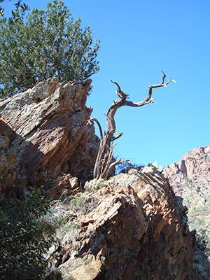 A burned tree stands on the rocks. |
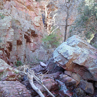
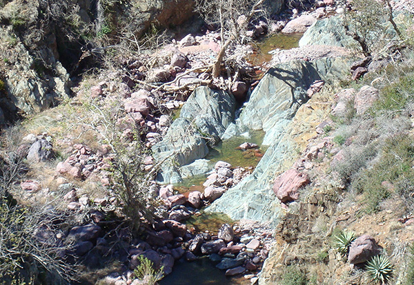
The trail, wide and rocky at first, takes us westward from Barnhardt Mesa through a wilderness gate and gradually over to the edge of Barnhardt Canyon. Some of us have been here before. But Ted, our temeritous hike leader, is seeing it for the first time, so he listed it as an exploratory hike. Some of the vegetation is green, but we see dead trees everywhere, many of them charred black by the Willow fire in 2004. Other trees survived the fire, but it’s evident that rocks are going to provide most of our shade on today’s hike. The rich colors of Barnhardt Canyon surprise all of the first-time visitors. Eons of flood waters have cut through brightly colored mineral layers, leaving the bottom of the canyon full of pink and green boulders. |
|
On the other side of the canyon, variegated layers of rock have been folded like taffy, reminding us that the rocks which seem so solid are quite pliable, given enough time. |
 Pastels color the streambed in Barnhardt Canyon. |
|
Ted has three maps of the Barnhardt Trail, but never looks at them. After walking along the canyon for about a mile we turn abruptly south to begin a major climb up to the waterfall on switchbacks. We can hear water rushing far below us as we start climbing. A major tributary of Barnhardt Canyon flows in from the southwest, and hikers can get around it only by climbing almost all the way up to the ridge. |
 High above the rugged rocks the ragged rascals climb. |
|
The switchbacks turn out to be wide and easy, with only an occasional steep place. On the way up there are several springs, with lush green vegetation. Other parts of the trail are bare rock. On the west side we can look down into the canyon and see the trees and rushing water. |
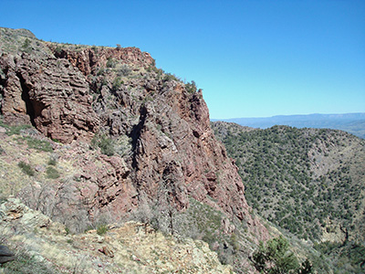
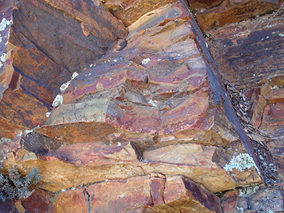 Eons of weathering have exposed every color in the rocks. 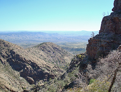 Rye and the Hellsgate Wilderness are ’way off in the distance. |
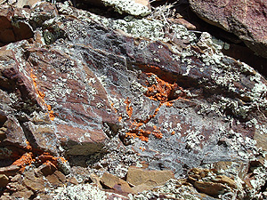
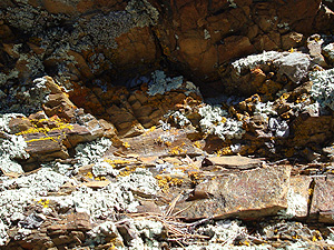
Faults and cracks in the rocks are everywhere. Some of the cracks are filled with quartz, which has a lower melting point than the other minerals and flows freely. To the east we enjoy sweeping panoramas of the Tonto Basin, with the town of Rye in the foreground and the mighty Mogollon Rim on the horizon. Trees grow precariously out of the canyon walls. Lichens cheer us with their brilliant colors. Some of the hikers are back on the trail, so we stop at an overhang to let everybody catch up. But no one wants to stay there very long. It’s shady, windy, and rather cold. Soon everyone is together and climbing once again. The topography is changing. As we get to higher elevations the trail starts to even out and we cross a grassy meadow. Canyon overlooks are no longer bare rock, but covered with grass and trees. The trail is wet from a nearby spring. |
|
We cross a tiny stream, then climb on up to the waterfall.
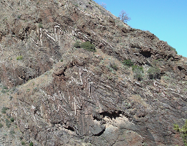
The side canyon is narrow at this point, forming a series of falls all the way down into Barnhardt Canyon. The waterfall by the trail is shaded in the morning, but upstream the sunlight streams through narrow rock walls. Everyone stops to rest from our climb and take pictures. Above the waterfall we climb through a forest of dead trees and a slope of jagged red cobblestones. We’re above the scenically eroded rock formations, contouring our way around a smooth hill with panoramic views to the north. |
 Rectangular notches appear above the waterfall. |
|
|
| Brilliant lichens grace the rocks high above Barnhardt Canyon. | |
 You’re a good man, Charlie Brown. |
 The stream flows through colorful rocks. |
 Nature has painted Barnhardt Canyon in pastels. |
|
A side trail branches off to the right, heading downhill. Is it the Sandy Saddle Trail? Santara has been here before and remembers it, but the trail is faint and the sign, if it was here, evidently fell victim to the fire. |
 We found our lunch spot west of the Sandy Saddle Trail. 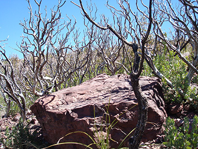 Life shall renew the Mazatzal Wilderness. |
GPS readings suggest that we’ve gone far enough. So we walk a little way past the junction and find some rocks to serve as benches for our picnic lunch. It’s cool and breezy. We can see the Mazatzal Divide off to the west and Sandy Saddle to the northwest. There are a few patches of trees on the mountainside, but mostly grass. After lunch we decide to head on down. We found our lunch spot west of the Sandy Saddle Trail. The waterfall glistens in the afternoon. On a round-trip hike it’s a good idea to start from the east end, so the sun with be at your back in both directions. Rock formations which were shaded in the morning are brightly illuminated in the afternoon sun. |
|
“Everyone go at your own pace, but stay on the trail,” Ted advises.
“I will sweep.” On the way down we try to talk on the 2-way radios,
but something prevents them from getting a clear signal until the end of the
hike.
Chuck and Ted take pictures along the way. The afternoon has warmed up, but it’s all downhill. When we get to the cars, some of the hikers decide to stop in Rye while others drive on back to our meeting place in Fountain Hills. It was a colorful hike on a pleasant spring day in the Mazatzal Wilderness. |
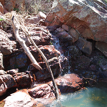 A waterfall glistens in the afternoon sun. |
 Top of Page
Arizona Trailblazers Hiking Club, Phoenix, Arizona
Comments? Send them to the AZHC .
updated June 2, 2018