Outdoor Links
Hike Arizona
Trip Planning Guide
Trip Report Index
Calendar of Events
Library
|
Zimmerman Point Loop Day Hike Sierra Ancha October 17, 2015 by Bill Zimmermann |
|
 We’re not lumps on a log, we’ll have you know! |
| Michael, Christina, Carol, Chris, Bill, Amanda, Jessica |
|
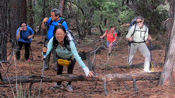
Trailblazers welcome new members Chris and Amanda. Threatening forecast of rain and storms resulted in three cancellations and two no shows. However, seven hikers left the valley in two cars at 6:15. We drove SR 288 to milepost 277, then shuttled one car to the Parker Creek Trailhead #160. With boots on at 8:30 AM we headed up FR 489. Michael commented that he thought the road had deteriorated quite a bit since we last hiked it in October of 2013. It was wet with some puddles from recent rains. Jessica and Amanda found a souvenir car part. It was too big for a backpack. |
 I think they’ve had some rain on FR 489. |
 Gratham Peak. [photo by Carol] |
 There it is! Zimmerman Point! |
 Takes some bushwhacking to get us there. |
|
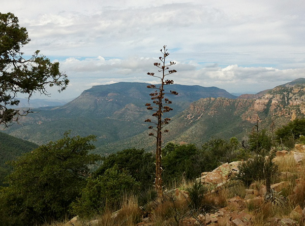
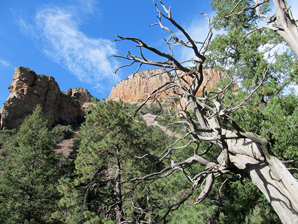
The weather was cool and cloudy with a tease of sunshine as we hiked the road After 1500 feet of climbing we reached the spot where we decided to leave the road and begin the bushwhack “LT”. Our boots sunk in a soft cushion of leaves and pine needles as we tax our quadriceps muscles on the steep ascent. At “F” we had our first look at Zimmerman Point and the valley below. Clouds, haze, and lack of contrast caused Roosevelt Lake to blend into the sky. From “F” we had one down dip before the final assault to “Z” (the point). It was photo time. We had light clouds, darks clouds, thin clouds, thick clouds, and wind, lots of wind. |
 Now which way is it from here? |
| Chris, Amanda, Bill, Michael, Christina, Carol, Jessica |
 Agave. [photo by Carol] |
 Bill and Carol enjoy the view. [photo by Christina] |
 Roosevelt Lake and Asbestos Point. |
 Jessica has a fine overview of Cherry Canyon. |
|
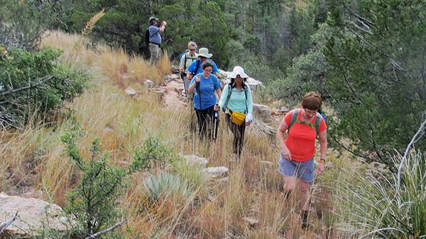
The goal was enjoy the views and complete the ridgeline before and bad weather comes in. The ridgeline was wide but not wide enough to dodge all the Manzanita. We just had to plow through some of the patches. It made for slow travel. We had or first food break out of the wind at saddle “SA”. We had great views of the Cherry Creek Valley to the east and Four Peaks and Roosevelt Lake to the west. |
|
As we reached “R5” we experienced a sense of relief. Among the pines and junipers we were no longer the tallest feature on the ridge. We zigged and zagged across an abandoned barbwire fence line as we headed north. At “SBS” we came across some very soft bear scat. Bill asked for a volunteer to stick their finger in to see if was still warm. No takers. This time we stayed on the ridge until we connected to the trail at “PC TOP”. It was longer but easier than our butt sliding adventure in 2013. |
 Bear scat. |
 Easy on the down grade. |
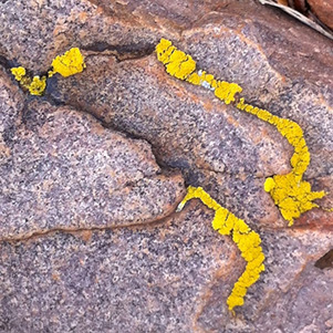 These lichens took a likin’ to granite. [Carol] |
 Parker Trail rock slide. [photo by Carol] |
 Twisted tree in a prickly pear. [photo by Jessica] |
 Life is a picnic! |
 Raindrops keep falling on the Parker Trail. |
 Parker Trail, I salute you! |
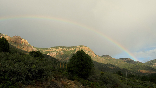 Rainbow in the afternoon — a good omen. |

|

|
| Bright colors of the rainbow cheer us. | |
|
Sprinkles accompanied with very distant thunder was the clue to dawn our rain gear. For about twenty minutes we experienced a beautiful steady rain shower as we hiked down the Parker Trail. The following sunshine reflecting on the alternating maple and oaks leaves and solid rock cliffs glistened like diamonds. We experience a second light rain shower as we all packed into Bill’s Van. On the drive back to FR 489 we stopped the van to get some great rainbow pictures. The Cook House restaurant in Globe satisfied our hunger pains before returning to the valley. Thanks to Jessica for driving. |
 Top of Page
Arizona Trailblazers Hiking Club, Phoenix, Arizona
Comments? Send them to the AZHC .
updated May 27, 2020