Outdoor Links
Hike Arizona
Trip Planning Guide
Trip Report Index
Calendar of Events
Library
|
AZT Passages 31 and 33 Day Hike Flagstaff June 27, 2015 by Dave French |
|
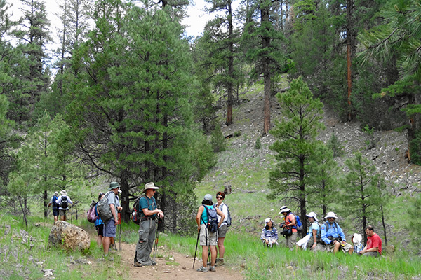
 Front: Quy, Bill, Tamar, Christina, Sana, Monika Back: Dave M, Al, John M, Linda, Deirdre, Scott, Rudy, Jim, Dan, Sarah, Michael, John S, Dave F, Jim |
 My brew is the best! [photo by Dave F.] 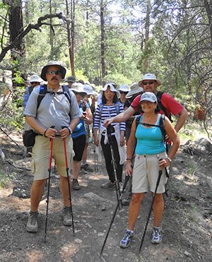 Arizona Trail, passage 31. [photo by Dave F.] |
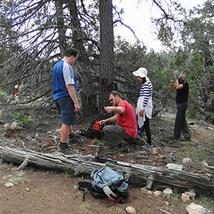
The motivation for this hike was to do a chunk of the Arizona Trail that we have not done before. Well, we accomplished that with about 13 miles of AZT, that’s about 1.6% of the whole 800 miles. Passages 31 and 33 are the only place where the AZT splits into alternative routes. Passages 31 and 32 provide the rural route around the eastern side of Flagstaff, while passage 33 is the urban route that goes right through Flagstaff. This hike consisted of portions of passages 31 and 33. Thanks to John S. for assisting me in scoping out the hike and providing maps to the hikers. Thanks also to Jim Buyens for meeting the hikers in Phoenix, getting them signed in and arranging the carpools. Twenty AZ Trailblazers and guest showed up by 8:30 AM at the designated meeting place at Butler and Babbitt drives in Flagstaff. Earlier, we had parked two cars at the designated hike ending point about a miles away, so we quickly arranged carpools to the trailhead which is several miles to the east. We were able to get all 20 hikers into four vehicles and drove I-40 east to Walnut Canyon Road and then south to Old Walnut Canyon Road. The latter road is not paved but passable by all vehicles, and passes along the northern boundary of the Walnut Canyon National Monument. The trailhead is on AZT Passage 31 near its northerly end. The group of 20 stayed together for the most part by stopping occasionally in the shade to let everyone catch up. We took a side trail to an overlook of Walnut Canyon. |
 Yes, this is the Arizona Trail. [photo by Bill] |
|
This little jaunt added 0.4 miles to the trip. The relatively flat terrain allowed us to set a fast pace. We reached Fisher point just after noon, having traveled slightly over 7 miles in less than 3 hours. |
 San Francisco Peaks from the Arizona Trail. [photo by Quy] |
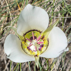 Doubting Mariposa Lily [photo by Quy] |
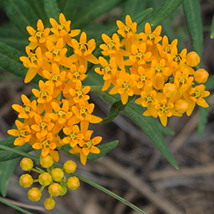 Butterfly Milkweed [photo by Quy] |
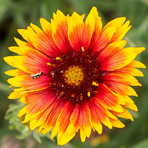 Firewheel [photo by Quy] |
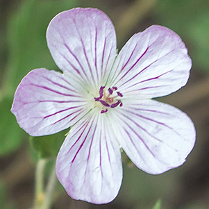 Lewis Flax [photo by Quy] |
 Doubting Mariposa Lily [photo by Bill] |
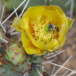 Cactus Apple [photo by Jim] |
 Quy found a friend. [photo by Quy] |
 Tree overlooks Walnut Canyon. [photo by Dave M.] |
 Passing through a fence to get to the Walnut Canyon overlook. [photo by Quy] |
|
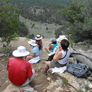
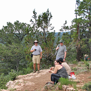
Fisher Point offers a great view of the beginning of Walnut Canyon to the left and Sandy’s Canyon straight ahead. We could see the junction of AZT passages 31 and 33 below. Passage 31 continues south through Sandy’s Canyon to Marshall Lake. Passage 33 begins here and goes northwest to and through Flagstaff. After lunch and a well-deserved rest, we started down the trail from Fisher Point to the junction of the passages. The clouds had built up, thunder in the distance and light sprinkles as we headed down. The clouds provided a much welcome break from the intense sun and fortunately no rain or lightening. |
 Fisher Point is the entrance to Walnut Canyon. [photo by Dave F.] |
|
|
| Lunch break at Fisher Point. [photos by Dave F.] | |
|

|
| Enjoying the view from Fisher Point. [photos by Jim] | |
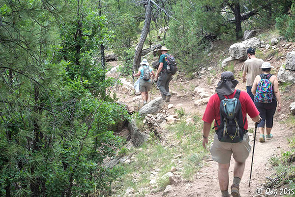 Trailblazers descending from Fisher Point. [photo by Quy] |
 Remarkable rocks of Walnut Canyon. [photo by Quy] |
|
We headed northwest on passage 33 passing by Fay Canyon and Skunk Canyon to our left. The climb out was much more gradual than I expected and the forest appeared to be more dense than in the early going on passage 31. The cloud cover may have affected that perception. We proceeded along at a good pace until we encountered a trail that was not on our map. It created some confusion because it crossed our trail about where we knew we had to turn right. We stopped some mountain bikers to ask their opinion about the best route. Finally we decided to proceed straight ahead and then saw the turn to the right in just a short distance, so we had made the right choice. We continued northward and saw some airplanes descending to Pullium Municipal Airport and then starting hearing the sweet sounds of traffic on I-40, so we knew we were getting close. We dropped down into the Rio de Flag drainage to find a very pleasant riparian area and pond just south of I-40. We crossed under the eastbound bridge to the junction of AZT 33 and the Flagstaff city trail that goes along the riparian area. We waited there a few minutes for everyone to arrive and presented an alternative. This was an amazingly pleasant place to sit between the two barrels of I-40 surrounded by wetlands but only minor traffic noise. |
 Taking a break on passage 33 of the Arizona Trail. [photo by Dave F.] |
 Let’s check the map. [photo by Bill] |
 Now, guys, which trail is it? [photo by Dave M.] |
 This is the right trail. [photo by Dave M.] |
 Flagstaff city trail goes along a riparian area. [photo by Dave F.] |
 The Arizona Trail goes under I-40 at Rio de Flag. [photo by Bill] |
|
Here we had a choice. We could take the trail to the right which is AZT 33 that leads to Babbitt Drive where we had met that morning and left some cars, or we could go left as originally planned and follow the city trail along the riparian area to where we had stashed 2 cars earlier. The AZT route is about a half mile and the other way is about a mile. Some went one way and some the other. Those that took the riparian route did not take the turn off to get us directly back to the two cars. We ended up going to Lone Tree Road and then backtracked to where the cars were parked so we added at least another half mile to the hike. Despite these minor glitches, we all ended up fine. One vehicle carried the drivers back to the east trailhead and the other vehicle took the remainder of the hikers to meet those hikers that took the shorter route and stayed on AZT 33. John S. arranged for us to eat at the OakMount Restaurant in the Continental Country Club. The restaurant had set up for a group of 20 prior to our arrival and give us great service and good food. |
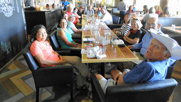 OakMount Restaurant in the Continental Country Club. [photo by Dave F.] |
 What a fine view out the window. [photo by Bill] |
|
Jim provided his statistics on the hike below. GPS is a great tool but sometimes not real accurate based on the variety of trip lengths we get from various individuals units. Mine always measures less than Jim’s, so I think the real length is about 13.5 miles for most of us. |
|
Supplemental Report by Jim Buyens |
|||||||||||||||||||||||||||||||||||||||||||||||||
|
Thanks, everyone, for joining us on yesterday’s hike. Once again it was a little longer than we expected but a great adventure nevertheless. The high temperature in Flagstaff as we hiked was 84°, but I’m sure that was before the sky clouded over as we descended from Fisher Point. Both Daves, John, Linda, Monika, Sana, Scott, and Tamar, congratulations for completing the whole hike with me as planned. Those who took the shortcut back to Taco Bell, you earned a victory nevertheless. Thanks again for hiking with Arizona Trailblazers and see you next time. Jim |
|||||||||||||||||||||||||||||||||||||||||||||||||
|
|
||||||||||||||||||||||||||||||||||||||||||||||||
 Top of Page
Arizona Trailblazers Hiking Club, Phoenix, Arizona
Comments? Send them to the AZHC .
updated July 1, 2015