Outdoor Links
Hike Arizona
Trip Planning Guide
Trip Report Index
Calendar of Events
Library
|
Prospector’s View Day Hike Superstition Mountains February 28, 2015 by Ted Tenny |
|
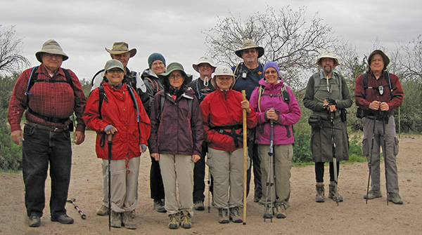 Ted, Sana, Dave, Steffie, Gabrielle, Ray, K.G., Richard, Lise, Jim, Chuck |
|
All week I agonized over Saturday’s weather forecast, which seemed to be getting worse day by day. Finally it got to be Friday, mid-day, when I had to decide once and for all whether to cancel the hike. 40% chance of rain. But then I stepped outside. The sun was shining, with very few clouds in the sky. “The hike is on. Bring rain gear.” |
|
So it was that eleven enlightened Trailblazers started out from Crosscut Trailhead on a cool, cloudy, breezy Saturday morning. There were other hikers all along our route, and many signs of horse traffic. Jacob’s Crosscut Trail runs north-south from Crosscut Trailhead on First Water Road to Broadway Trailhead in Apache Junction. We hiked across an old road, down into a valley, and then up to a thicket of chain fruit cholla where an unmarked side trail branches off toward the Green Boulder. |
 Crossing a wash on Jacob’s Crosscut Trail. |
 Our climb begins gently on an unmarked trail branching off to the south. |
 Better not hug these Teddy Bears. You’ll really get stuck on them. |
 Holes in the cliff are for the birds, if you ask me. |
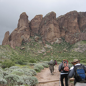 Onward and upward! |
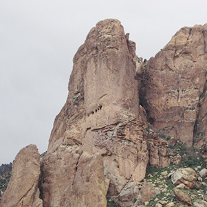
 Praying hands for climbers on those cliffs. |
 I took a likin’ to the lichens. |
Soon we join the Treasure Trail and make the steepest part of our climb, above the Green Boulder. Two trails branch off to the left. The first is a trail to the Massacre Grounds. It starts east, loops around a butte and turns southward toward an arroyo crossing. “Then the trail fizzles out. You have to bushwhack the rest of the way to the Massacre Grounds,“ I explain. The second trail is for rock climbers who want to try their ropes on the Praying Hands. None of them are out today – probably just as well with a stiff wind blowing. |
|
We continued west on the Treasure Trail and then the Prospector’s View Trail, re-convening by the bench below the Capstone Arch. It can be reached by a steep off-trail climb, but there were no daredevils who wanted to try it today. |
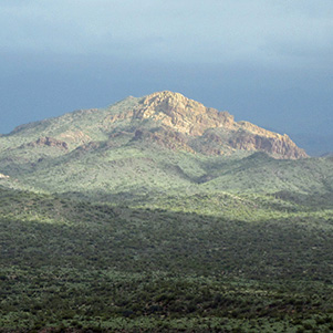 Sunshine, over on Apache Gap Mountain. |
 No one climbing to the Capstone Arch today? |
|
The Prospector’s View Trail goes on down to meet Jacob’s Crosscut Trail. Along the way an unmarked trail branches off to the left, where it goes by the Palmer Mine and on over to the Siphon Draw Trail. Although there weren’t a lot of wildflowers, the canyon south of the Prospector’s View Trail had plenty of them. The red flowers were intriguing. Finally, down at the trail junction, we got close enough to identify them. |
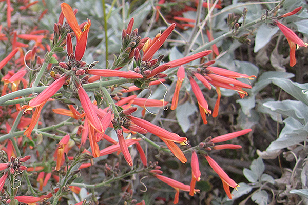 Justicia californica - aka Beloperone, Chuparosa, or Hummingbird Bush. |
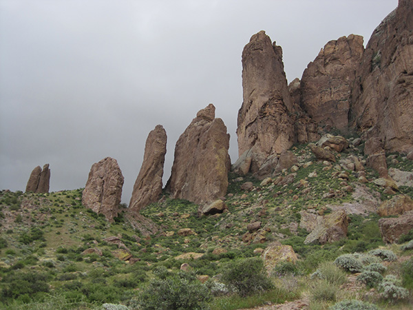
 Rugged northern cliffs of the Superstitions. |
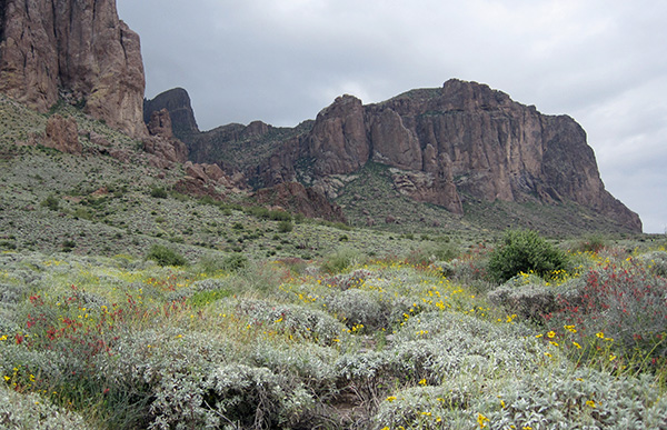 Flatiron stands above a field of flowers, south of Lost Dutchman State Park. |
|
We swung by the amphitheater where Hike Leader Training wasn’t held this year, crossed the Treasure Trail twice, and found the junction where we had branched off this morning to walk the loop clockwise. On the way back to Crosscut Trailhead there was a good view of the dancing saguaros, close-up of Fiddleneck, and one last crossing of the abandoned road that’s a good route down from the Massacre Grounds. |
 Saguaros dance for joy. |
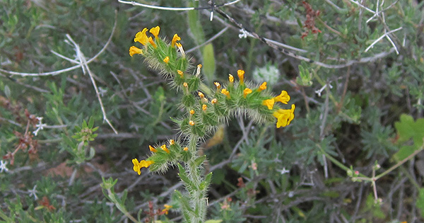 Amsinckia menziesii var. intermedia - Fiddleneck fiddles a merry tune. |
|
We beat the rain! Actually there were a few patches of blue sky, and some patches of sunshine off in the distance in the Goldfield Mountains. |
|
| → More pictures and commentary, by Jim Buyens. | |
 Top of Page
Arizona Trailblazers Hiking Club, Phoenix, Arizona
Comments? Send them to the AZHC .
updated May 12, 2018