Outdoor Links
Hike Arizona
Trip Planning Guide
Trip Report Index
Calendar of Events
Library
|
Apache Leap Day Hike Superior November 1, 2015 by Andy Zaharchuk |
|
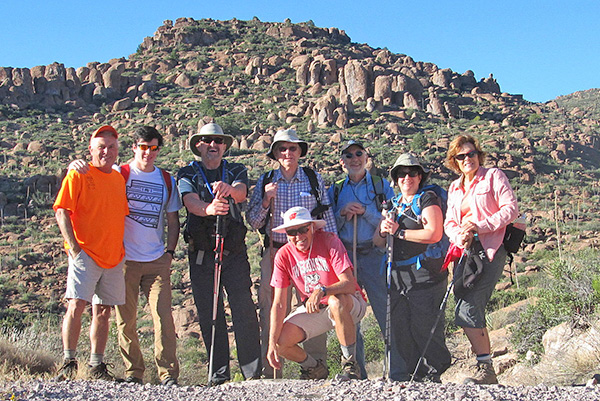 Rick, Dustin, John, Andy, Bill, Mark, Tamara, Becky [photo by Bill] |
|
This hike was short and this trip report is likewise. From the start, we followed a route that differed from that given in the original hike writeup which Ted provided. Our starting point was just a few yards before the gate and guard shack, located at the boundary of the mine property line. We parked there on the left side of the road, at a small but convenient parking place. Just below the parking area, a trail through the shrubs was evident, and that is where we started our hike to Apache Leap. Our path took us westward and up a gradual incline. After a few hundred yards, cairns were occasionally seen and followed. To our right were many picturesque hoodoos, which one of the hikers indicated were very similar to those in the Chiricahuas, though not as large. After a while we reached the cliffs, where we paused and admired the panoramic view. The town of Superior was down below and to the right, Picketpost Mountain was more or less straight ahead, and to the southwest were various hills and valleys. Before us and below us was route 177, leading to the small towns to the south such as Kearney and Winkleman. |
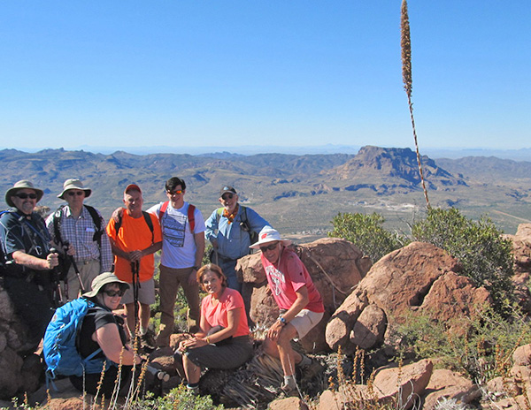 John, Andy, Tamara, Rick, Dustin, Becky, Mark, Bill [photo by Bill] |
|
After our first break, we tromped slowly southward staying near the cliff, except where the going made it too difficult. We stopped at a few more places to look out over the cliffs. After a while we headed cross country to a saddle, at which point we collectively decided we had seen enough, and chose our way back to our vehicles going down one of the several washes that we might have followed back. The hiking distance was only 2.79 miles, our moving average was only 0.5 miles per hour, and our elevation change was 1415 ft. It took us about 5 hours, including breaks. The distance travelled was less than planned, as the going was so very slow due to the very rough terrain. We basically boulder-hopped the entire way. During this hike we saw a lot of cairns. Apparently there were several trails leading from the cliff edge to the road, indicating that there are many choices for hikers to make their way to and from the Apache Leap cliffs. We had a day with cool and beautiful weather, and the hike was enjoyed by all. My thanks to Bill for providing the pictures and the GPS track. |
 Top of Page
Arizona Trailblazers Hiking Club, Phoenix, Arizona
Comments? Send them to the AZHC .
updated November 13, 2015