Outdoor Links
Hike Arizona
Trip Planning Guide
Trip Report Index
Calendar of Events
Library
|
Mount Elden Loop Day Hike Flagstaff June 15, 2014 by Jim Buyens |
|
On a beautiful day in June six Trailblazers set out to scale Mount Elden, one of the more popular and visible peaks around Flagstaff.
I’m not sure I’d have scheduled this hike if I’d realized it was Father’s Day. Whoever heard of Father’s day falling as early as the 15th? But what’s done is done and so we did it.
The mountain is named for one of the region's earliest white settlers, John Elden. In the late 19th century he and his family built a homestead on the mountain’s lower slopes and grazed sheep on the open grasslands below. Geologically, the mountain is a lava dome formed by flows emerging from several vents.
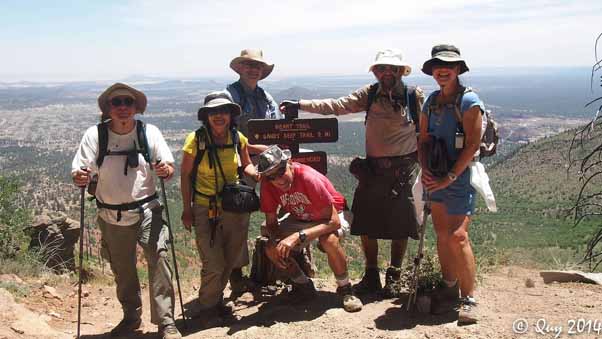
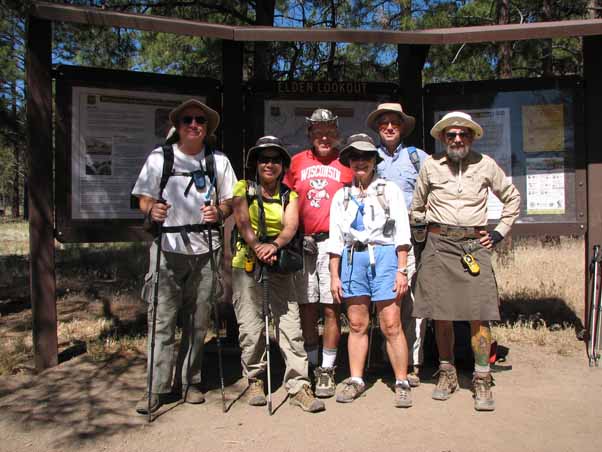 Chuck, Quy, Bill, Linda, Mark, and Jim ready to go. My hat's making me look a little like Clem Cadidlehopper or Gabby Hayes there but oh well. |
We reached the trailhead at about 9:30 and found it packed; we were lucky to get a space. Most of the hikers seemed to be ground-huggers, though, as we saw very few after we started climbing.
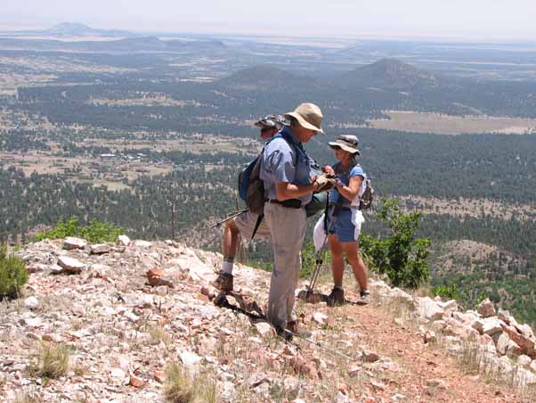
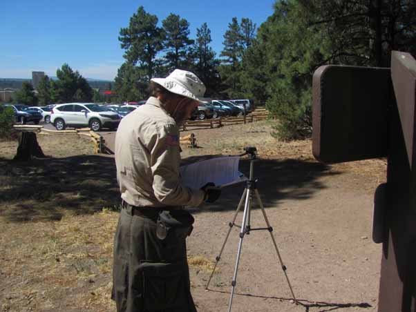 Jim takes care of some last-minute paperwork, one of the joys of being the leader... [photo by Bill] |
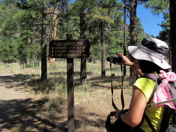 Quy records our location. Nice flat trail, eh? [photo by Bill] |
The most common way of scaling Mount Elden is a straight up-and-back on the Elden Lookout Trail #4, which rises 2208 feet in only three miles. To ease the ascent and lengthen the hike, though, we swung wide, reaching the summit via the Fat Man’s Loop, Christmas Tree, Sandy Seep, Heart, and Sunset trails. To finish we then dropped down the Elden Lookout Trail, which is much easier going down than up.
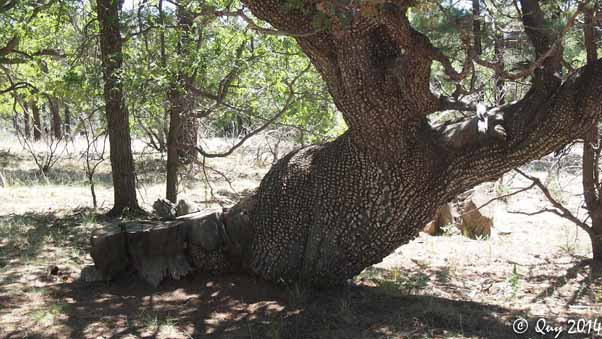 An alligator juniper tree twisted like taffy. [photo by Quy] |
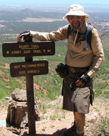
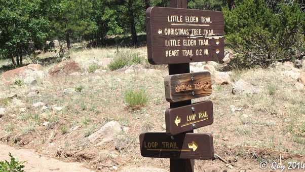 The trail was well-signed. Which way's Mount Fuji? [photo by Quy] |
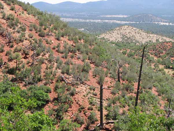
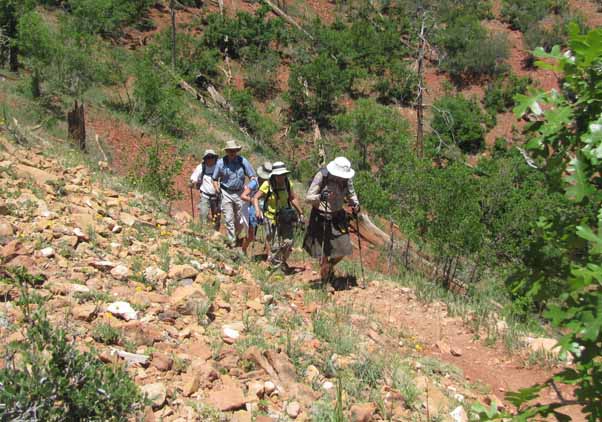
The sections of the Fat Man’s Loop, Christmas Tree, and Sandy Seep trails leading to the Heart were pleasant, wooded, and easy. The Heart trail itself, though, rose a fairly rocky 1300 feet in just two miles, and it was mostly open because of the Radio fire in 1977. We were expecting a workout and we got it.
 Ah, now some elevation, along the Heart trail. |
 Chuck, Mark, Quy, Jim, and Linda ascend the Heart trail. Can you spot all five? [photo by Bill] |
 Our view of Bill. He's in the top right corner. Of the photo. Not the bush or the mountain. |
 Bill's view of us. We let him get ahead. [photo by Bill] |
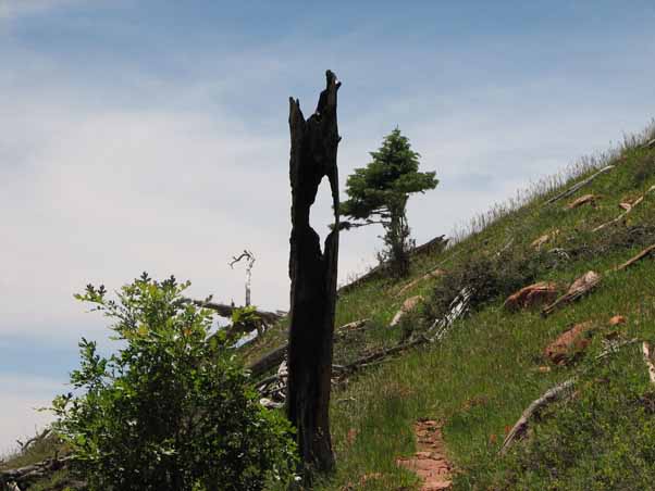 A striking remnant of a past forest fire. |
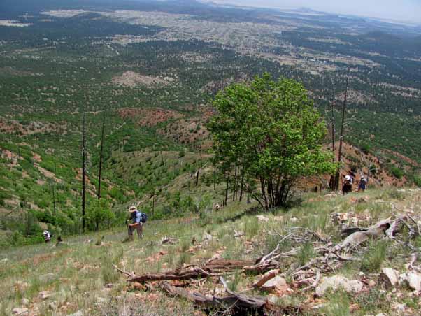
 Bill, Mark, and Linda pause to enjoy the view. Not bad, eh? |
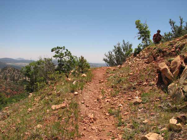
 Here we're getting close to the top of the Heart trail, and to the tree line. And no, those aren't toothpicks. [photo by Quy] |
 Success! Chuck, Quy, Mark, Bill, Jim, and Lynda at the top of the Heart trail. [photo by Quy] |
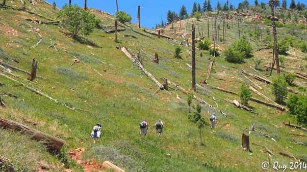
After finishing the Heart trail we followed the Sunset trail to reach the Mount Elden summit. This trail was mostly wooded and fairly level despite occasional ups and downs. This is where we stopped for lunch.
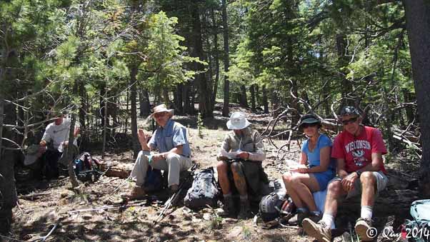 Chuck, Mark, Jim, Linda, and Bill stop for lunch.[photo by Quy] |
 The Sunset trail spans a fairly level ridge to Mt. Elden. [photo by Bill] |
 Our first view of the final Mt. Elden ascent. [photo by Bill] |
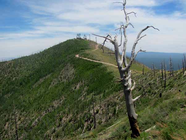
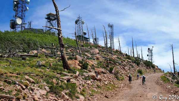
Approaching the summit and its cluster of radio antennas we encountered some very high winds. Amateur meteorologist and human anemometer Mark estimated gusts up to sixty miles an hour! The winds was coming from the west and we were crossing a saddle north to south, so the west side of the mountain acted like a giant scoop funneling air into our location. Chuck believed someone could stand into the wind at a forty five degree angle but, in the interest of not being blown away, no one tried it.
 The top is only a hundred feet or so of elevation from here. (huff... puff...) [photo by Quy] |
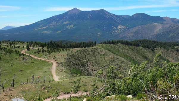 The view from the top looking west, at the end of a long and winding road. Or trail. The tall one is Mount Humphreys.[photo by Quy] |
 Chuck, Quy, Linda, Bill, Mark, and Jim at the top. Pfew! [photo by Bill] |
The summit provided spectacular views in all directions, as summits often do. The radio antennas were a minor obstacle but we could easily go around them. Seeing Mount Humphreys and the other San Francisco peaks from that angle is a rare treat. The lookout tower, unfortunately, was closed.
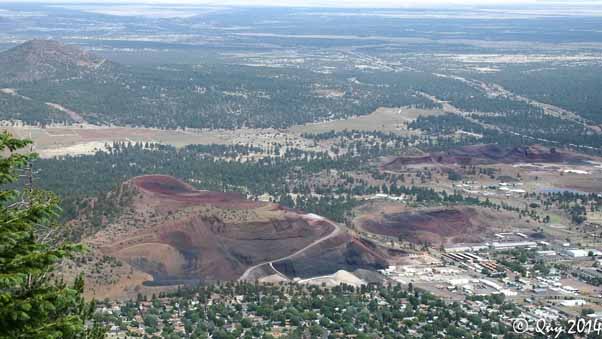 Another view from the top, this time looking east. Looks like a long way down, eh? [photo by Quy] |
We expected the trail down to be steep and weren’t disappointed. Considering the drop and distance, however, the trail is remarkably easy to hike. There are plenty of switchbacks, stone steps, and erosion barriers that help to avoid slips, and the trail is mostly wooded.
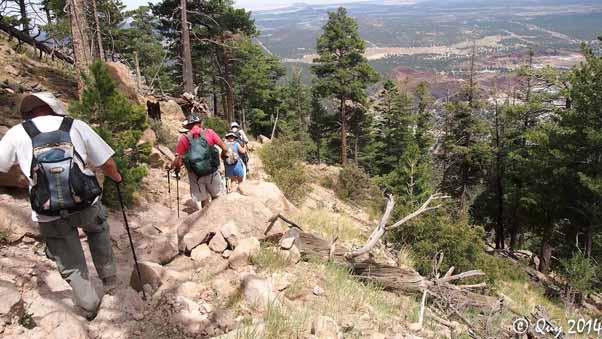 Yes, it was a long way down, and steeper than coming up. However, the footing was generally pretty good. [photo by Quy] |
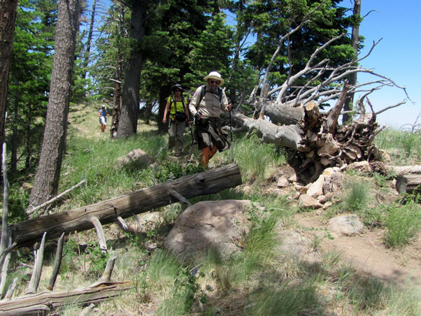
After reaching the bottom we took another section of the Fat Man’s Loop back to the trailhead and this time the trail wasn’t so flat. There were no major climbs or descents but plenty of minor ones, especially after descending so far so quickly from the summit.
 Another delicious respite with all hands accounted for. Trailblazers rule! [photo by Quy] |
After the hike we stopped at Mamma Luisa Italian Restaurante in Flagstaff at the corner of Route 180 and Stevens Blvd. We got there a little before they opened for dinner but they let us in anyway. The rest of the service was good too, and the food was great. It's a great little local restaurant that I'd stop in again. The only caution is that they aren't open for lunch.
See you next time!
| Jim's Statistics | ||
| Total Distance: | 9.09 mi |
|
| Moving Time: | 4:20 | |
| Stopped Time: | 1:46 | |
| Avg. Speed Moving: | 2.1 mph | |
| Avg. Speed Overall: | 1.5 mph | |
| Starting Elevation: | 6917 ft | |
| Maximum Elevation: | 9305 ft | |
| Total Ascent: | 3496 ft | |
| Starting Time: | 9:44 AM | |
| Finishing Time: | 3:50 PM | |
| Starting Temperature: | 68° | |
| Finishing Temperature: | 78° | |
 Top of Page
Arizona Trailblazers Hiking Club, Phoenix, Arizona
Comments? Send them to the AZHC .
updated June 30, 2014