Outdoor Links
Hike Arizona
Trip Planning Guide
Trip Report Index
Calendar of Events
Library
|
Massacre Site Rock Day Hike Superstition Mountains March 29, 2014 by Ted Tenny |
|
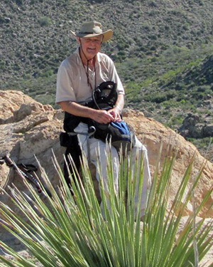
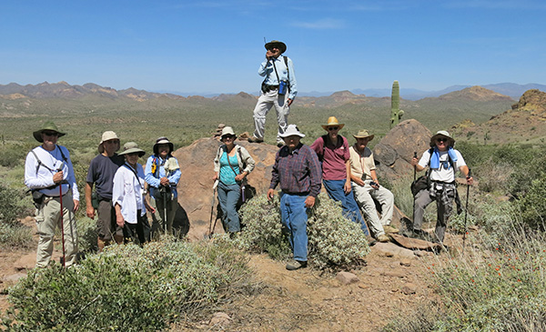
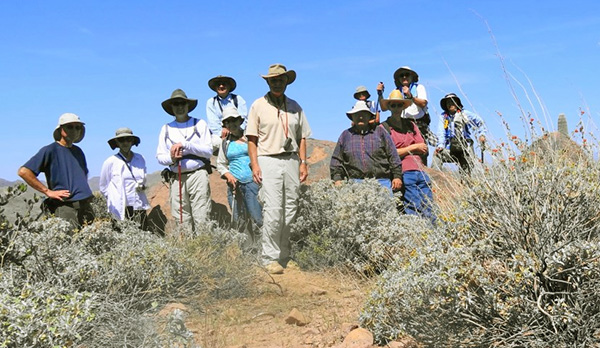
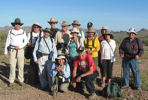 Gene, Chuck, Arturo, Tim, Quy, Dave, Jeanne, Duane, Bill, Brent, Betty, Chuck, Estella, Ted [photo by Bill] |
|
After closing the notorious Massacre Grounds road (a good idea!), the trail has been extended northwest to Crosscut Trailhead. Earlier this month I had scouted the extension of the trail, and a shortcut trail that connects with the abandoned road. So it was that 13 Trailblazers started from Crosscut for the Massacre Grounds on a cool Saturday morning. We passed the old Massacre Grounds Trailhead and continued past the Wine Bottle, across canyons, and on up to the historic and highly scenic Massacre Grounds. |
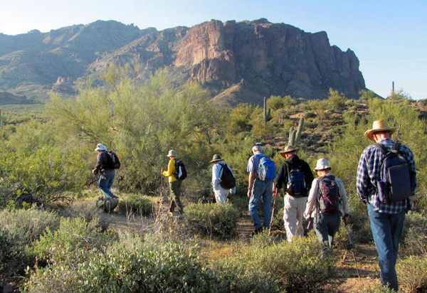 By starting early, we enjoy a cool morning. [photo by Bill] |
 The Wine Bottle is an important landmark. |
 Bill explores the higher slopes of the Wine Bottle. |
 Steep climb up out of the canyon. [photo by Quy] |
 Shoot the gap in the direction of the Four Peaks (well, not today). |
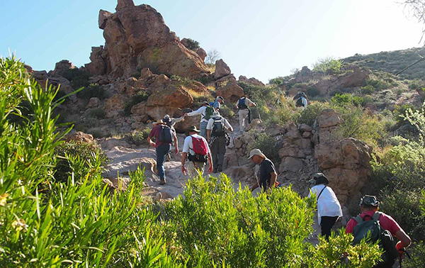
 Continuing our climb to the Massacre Grounds. [photo by Bill] |
 Birthday Cake, baked for a senior citizen. |
 Intricate formations mark our final approach. |
|
At the Massacre Grounds there are trails going in different directions, but one point that is definitely the highest. “Let’s re-convene at the top,” I advised them. Then I walked along the north side, which is a flower garden this time of year. |
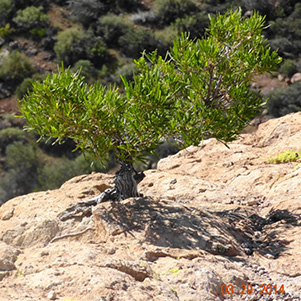
 Dodonaea viscosa - Hopseed Bush |
 Calliandra eriophylla - Fairy Duster |
 Dudleya saxosa - Rock Echeveria |
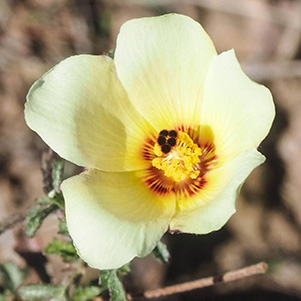
 Sphaeralcea emoryi - Emory’s Globemallow |
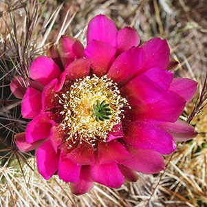
 Echinocereus engelmannii - Hedgehog Cactus |
 Antheropeas lanosum - Woolly Daisy |
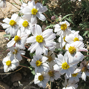 Antheropeas lanosum - Woolly Daisy |
 Calochortus kennedyi - Desert Mariposa Lily |
 Tree on the edge of forever. [photo by Dave] |
 Seated soldier inspects the butte. [photo by Quy] |
|
When I got to the top everyone was taking pictures, enjoying snacks, and talking. Every time I go here with a group, I read them the story of the massacre of the Peralta miners. |
 As comfortable as it looks, Dave? [photo by Bill] |
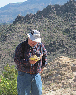 Ted reads the legend, on location. [photo by Bill] |
| Wildflower pictures by Quy: |
 Fouquieria splendens - Ocotillo |
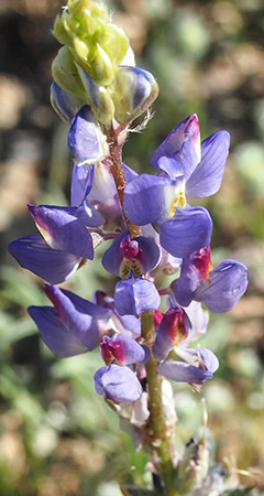 Lupinus sparsiflorus - Lupine |
 Erigeron divergens - Fleabane |
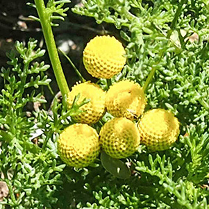 Oncosiphon piluliferum - Globe Chamomile |
 Oenothera caespitosa - Stemless Primrose |
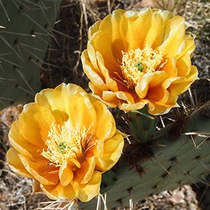
 Echinocereus fasciculatus - Hedgehog Cactus |
 Eriastrum diffusum - Miniature Woollystar |
 Opuntia engelmannii - Cactus Apple |
 Baileya multiradiata - Desert Marigold |
 Acourtia wrightii - Brownfoot |
 Castilleja integra - Indian Paintbrush |
|
“We’re hiking down a different way,” I had advised the group. It isn’t obvious where to leave the Massacre Grounds Trail and start bushwhacking. But I did remember a boulder with a cairn on top. If you go past that boulder, you have missed the turn. So we left the trail when the boulder was in sight, threading our way northwest among the rocks and vegetation down a smooth ridge toward hill 2759. |
 Praying Hands — for us — on our way down. [photo by Quy] |
|
For now we’re going with the grain, so the ridge is easy walking. Bill, who as been taking side trips all day, goes ahead of us and starts climbing the pass beside 2759. Brent and Duane are with him. By radio I advise them that the rest of us are going a different way, which Bill acknowledges. Then the three of them disappear over the pass. Later, Bill assures me that they made it back to the trailhead. After resting on the rocks for a few minutes we head southwest, where we have two arroyos to cross before we can resume our course for the Massacre Site Rock. Everyone stays together as we look for reasonable places to cross the arroyos. Then we turn right and start downhill. On previous hikes, carrying a picture and matching the background scenery helped us find our destination. So I brought two pictures of the Massacre Site Rock from our hike three years ago. We found it again, took pictures, and resumed our downhill walk back to the trailhead. |
 Gene, Chuck, Estella, Quy, Jeanne, Arturo, Ted, Tim, Dave, Chuck At the Massacre Site Rock. |
 Trailblazers leaving the Massacre Site Rock. |
|
On the way up to the Massacre Grounds I made good time, pausing to take pictures and point out interesting scenery along the way. But now I was tired. Everyone but Jeanne got way up ahead of me. At least they weren’t out of sight. Talking on the radio I advised them which way they should be going. But, after acknowledging my advice, they just kept going the same direction. I knew where to find the abandoned road that takes us back to Crosscut Trailhead, walking to the exact spot where it begins. By this time the others were out of sight except for occasional glimpses of them from the road. Also we could see that they were getting divided into separate groups. Both Jeanne and I talked to them on the radio. “Go west,” I advised them, a turn which would have brought them to the road Jeanne and I were on. But not even Horace Greeley could persuade them to go west: they all just kept going the way they were going. At least they have three hike leaders — Quy, Dave, and Chuck, I rationalized. We left the road and turned right on a trail that takes a shortcut to Crosscut. By now we had lost sight of everyone but Chuck and Tim, whom we coached by radio on how to get down into a wash that flows back to the trailhead. The wash turned out to be easy walking once they climbed down from the ridge. In the end everyone made it back to Crosscut Trailhead, by their separate ways. |
|
Supplemental Report by Bill Zimmermann |
|
Peaks and bumps just look at me and and say “Try me if you can.” Duane and Brent were agreeable ... so we did. The bushwhack up to the saddle was easy. The west side of 2759 was steeper but Duane found a nice route down. |
 Brent, Bill, and Duane pause by an ocotillo. |
|
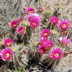 Hedgehog blossoms brighten our passage. |
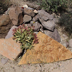 Memorial Maker. |
|
Following a GPS heading back to the trail head was uneventful, but no trail treats (bones). We did come across a memorial maker just prior to entering the wash near the end. |
|
Supplemental Report by Chuck Parsons |
|
“The hike from here back to the trailhead will be off-trail and the route will not always be easy to follow, so let’s all stay together from here on,” admonishes Ted on more than one occasion as we begin our long descent from Massacre Grounds. This sacred and historical place is the high point of our hike today as we all take a rest and snack break and listen to Ted read a few fascinating passages from The Story of Superstition Mountain and the Lost Dutchman Mine, recounting the tragic end for the Peralta Brothers and their men as they came under vicious attack by a group of Apaches in 1848 while transporting their precious cargo of gold ore by mule out of the Superstitions and back to Mexico. Our next major goal before reaching the trailhead, however, is to locate Massacre Site Rock itself, where the remaining victims of the attack met their final demise at the hands of the Apaches. Their sun-bleached bones would not be discovered for another fourteen years, when a routine Calvary patrol in the area happened upon them in 1862. With the use of a couple of pictures Ted brought from an earlier hike in the area as reference, a lot of exploring and dead ends, and ultimately a bit of patience and luck, we are finally able to locate the Massacre Site Rock where several group pictures are taken to record the event. Despite Ted’s repeat reminder to stay together as one group from here back to the trailhead, we somehow manage to drift apart as time goes on and eventually break up into four or five smaller sub-groups of hikers as we all continue to make our way back in the same general direction. “The best laid plans of mice and men...” Ted must be thinking to himself at this point. Thankfully, our TalkAbout radios come to the rescue once again, as we stay in touch with one another and assess each other’s progress and direction. The going gets tough from time to time as we slowly and carefully make our way across boulder and plant choked washes and arroyos and maneuver through long stretches of thick desert vegetation across rolling hills. The Superstitions are also thick with rattlesnakes, which are becoming more and more active as the temperatures continue to warm up across the desert. So I keep wondering how much longer before one of us encounters one of these slithery serpents as we make our way through the thick brush that offers them ideal shade and refuge from the heat of the sun. After quite a bit of communications over our radios, updates and directions from Ted, and fine-tuning our individual courses, we all finally manage to converge on the trailhead and our vehicles fairly close together — all hikers safe and accounted for. Thankfully we have enjoyed a cooling breeze for most of the hike, and there are no rattlesnake encounters to report. All in all, it has been another beautiful spring day for hiking the Superstitions, mysterious land of myths and legends, and listening to Ted recount the history of the tragic massacre that occurred here so many years ago and gave this site its name. Thanks for another great Superstition adventure, Ted. |
|
Supplemental Report by Dave French |
|
||
|
As we left the Massacre Site Rock, I checked my GPS map and noted the bearing to the start of our hike. I also noted landmarks in the distance, which consisted of some buildings along SR 88. With that in mind, several of us headed in a straight line to our destination. Bushwhacking was easy, as the land had a gentle slope and the bushes were spaced far apart. |
|||
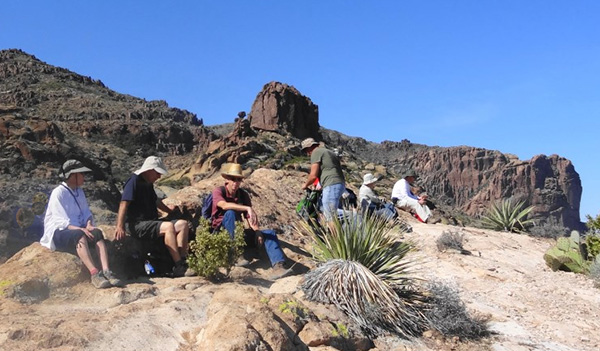 Rock benches at the top of the Massacre Grounds. |
|
 We were still together when we got to the Massacre Site Rock. |
|
|
I could see from the GPS map that we needed to cross a major wash. As we approached the wash I found some recent tracks left by equestrians going up the far side of the wash, so that’s where I headed. Once we were on the other side of the wash, we continued on our general bearing and soon spotted the parking lot. We had to drop down into the wash that borders the south side, then we were back at our cars. This straight line proved to be not only the shortest distance but also the fastest. |
|
|
See Also:
|
 Top of Page
Arizona Trailblazers Hiking Club, Phoenix, Arizona
Comments? Send them to the AZHC .
updated January 27, 2018