Outdoor Links
Hike Arizona
Trip Planning Guide
Trip Report Index
Calendar of Events
Library
|
LaBarge Narrows Day Hike Superstition Mountains November 15, 2014 by John Richa |
|
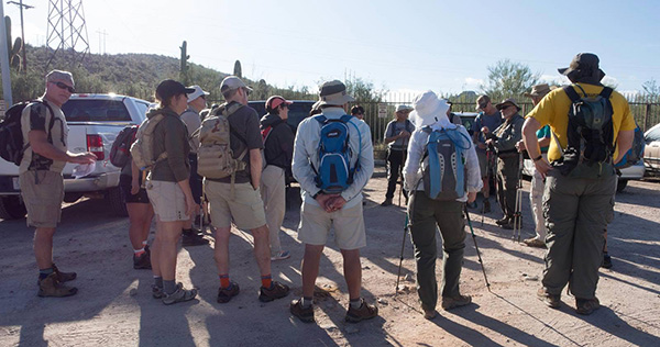
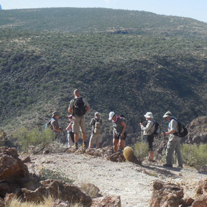
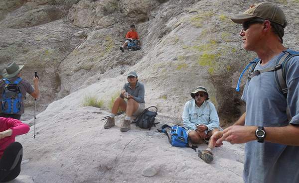
 Trailblazers pass muster at Canyon Lake. [photo by Quy] |
|
L to R: Wayne, Jim B, Rebecca, Chuck, Dave, Jim J, Monika, Helene, Greg,
Sally, Michael, Cindy, Kevin, George, Sana, Jim S, Chris S, Kathy, Bill. Front Row: John, Funyung. Not seen, Quy, photographer. |
|
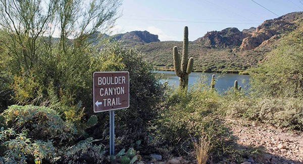
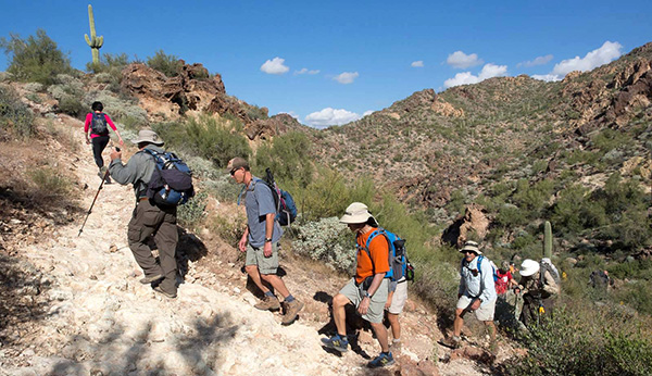
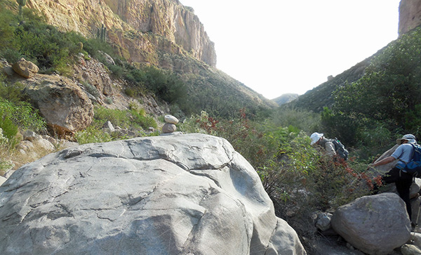
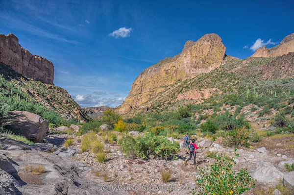
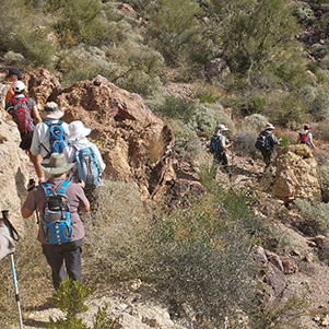
At 8:00 AM sharp some of the Trailblazers’ hikers gathered at Red Mountain Park in Mesa for the first leg of our day hike: carpooling to the trailhead. Five remaining hikers were to meet us at Canyon Lake Marina parking lot by the trailhead where Boulder Canyon Trail # 103 begins. And yes, “boulders” is appropriate for the trail as the pictures in this report will demonstrate. LaBarge Narrows is our target destination and “La Piece de Resistance”. |

|
|
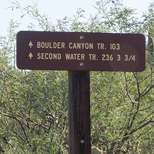
| [photo by John] The trails are well marked here at Canyon Lake. [photo by Quy] | |
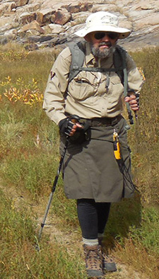
 John tells us what to expect on the trail ahead. [photo by Quy] |
 It’s this a’ way, folks. [photo by Quy] |
 Onward and upward, to hill 2351. [photo by John] |
|
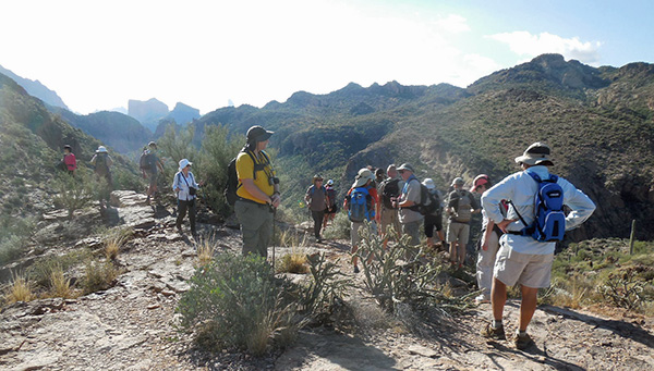
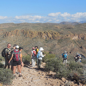
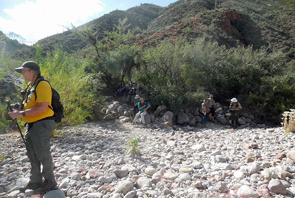
Carpools and after hike dinner arrangements made, we proceed to the Marina where we warmly greet our remaining fellow hikers. We certainly enjoyed two couples of hikers who have joined us for this hike: Greg and Helene from Ottawa, Canada and Jim and Chris Sharp, from Michigan, friends of Bill Bauer and his fiancée Kathy Koehl, but not for much longer the remain as “fiancées” because they will tie the knot today after their hike with us. We hope we can get them back to town in time before dark so that they could attend their own wedding! Stay tuned. Everyone gears up: introductions and instructions given out, hiking boots laced up, water hydration hoses checked and positioned, sunblock applied, hats and sun glasses adorned our head and face, backpacks saddled up and the last remaining check off item from our list is of course, our traditional group picture taken by our illustrious photographer Quy. There were 22 hikers in all and all were ready and eager to start the hike of Boulder Canyon Trail #103 and explore the Narrows. But before we get to the Narrows there would be an arduous effort to climb a mountain and a few other hills before reaching the dry wash in the canyon that will take us eastwardly to the Narrows. Except for 4 or 5 of us who have hiked to the Narrows before, none of the other hikers had attempted this trail before. And we were in for a surprise as some hikers intimated to me that the trail was rugged and challenging. |
 Guess we’ll take the direct route to hill 2351. [photo by Quy] |
 Pretty good walking on this stretch. [photo by Quy] |
 Oh oh. It gets steeper near the top. [photo by Quy] |
 Bill does a stomp dance to celebrate the summit. [photo by Quy] |
 Michael leads the next group over the top. [photo by John] |
 There’s Battleship Mountain, but we’re going up LaBarge Creek. [photo by John] |
 Let’s breathe for a minute before moving on. [photo by John] |
|
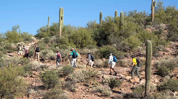
It is 9:30 AM, a late start, and with a beaming hot sun, we exit the parking lot, cross highway 88 and begin our ascent to the top of a mountain on the Boulder Canyon Trail. |
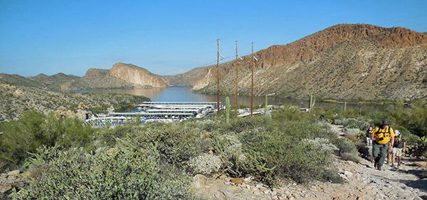
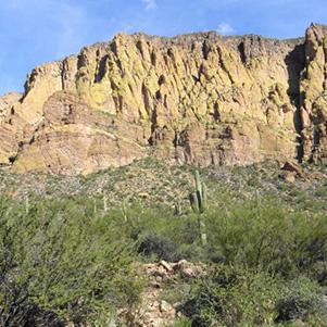
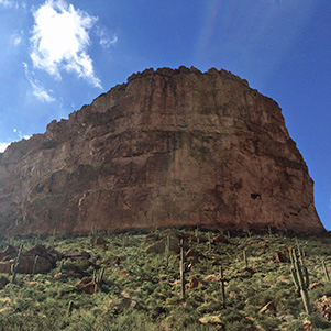
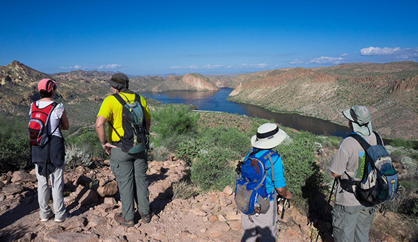
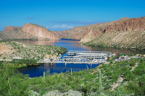
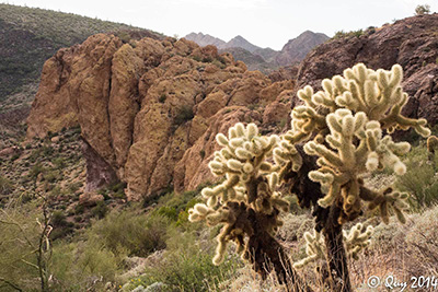 Won’t you hug me? [photo by Quy] The landscape around the trail is typical Arizona’s desert with no shade but with plenty of short and thorny bushes and a variety of cacti. We were surrounded with barren desert terrain with unusual rock formations and colors. The skies were blue but with intermittent patches of clouds – not enough to hide the sun and cool off the trail. On several occasions, we would stop and look back at our departure point and Canyon Lake we left behind us. What a beautiful view to see in the midst of an arid and harsh desert environment, this man-made lake with its dark blue waters. As the lake drew smaller in the distant horizon, it seemed that it was shrinking under the morning sun. The following pictures will better describe the awesome desert environment that surrounded us while trekking up the mountain. |
 Hill 2276 and the edge of Mormon Flat Dam across Canyon Lake. [photo by Kevin] |
 Saguaros light the way to Geronimo Head. [photo by Wayne] |
 Flatiron, Hackberry Mesa, and LaBarge Creek. [photo by Kevin] |
|
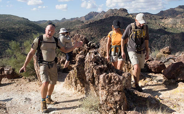
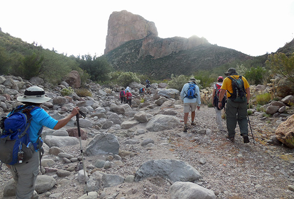
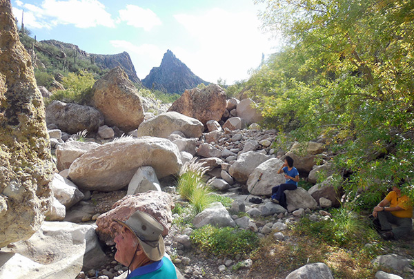
From the top of the mountain and looking south east into the distance, we could see what was awaiting us but not before more challenging hiking lay in store ahead of us. Looking down into the valley below, you could see the dry wash, like a white dirt road, meandering peacefully eastward towards the Narrows. You could see Weaver’s Needle, a long spire, in the background and Battleship Mountain in the forefront. Though the latter might look small from distance, in reality when you stand beneath it in the dry wash as we did on our way to the Narrows, and looked up at the rock formation, it became clear on how “little people” we are in the scheme of mother nature grandiose order of things. |
 Geronimo Head. [photo by Dave] |
 Battleship Mountain. [photo by Dave] |
 Weaver’s Needle. [photo by Dave] |
 Battleship Mountain. [photo by Kevin] |
|
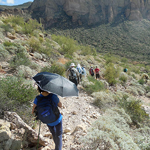
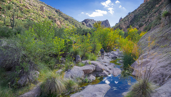
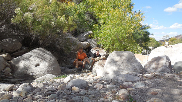
What goes up must come down. Now we snake our way down on the other side of the mountain. The sun is getting ever hotter with no shade amongst the desert cacti and shrubs. But, one of our hikers had the bright idea of using an umbrella to shield herself from the sun. Not until we reach the bottom of the canyon and the dry wash called LaBarge Creek that we find some shade. There, due to past flowing water, most recently in early September when a hurricane hit the southwest and caused substantial flooding in the Phoenix metro area, we encountered some leafy trees that provided some relief from the sun’s rays. Some of us decided to take a respite from the heat and the 4 miles hike down and rest their weary feet and take in some nourishment. The hardest part of the hike, yet unknown to most of us, lies ahead, all the way to the Narrows. All 22 hikers accounted for; we proceed eastwardly by following the dry wash which seems to be the only “highway” to the Narrows short of bushwhacking our way. |
 Summit Conference. [photo by John] |
 Mmmm, my favorite energy bar. [photo by John] |
 Yes, I tell you, this is it! [photo by John] |
 We found sugar frosted rocks. [photo by John] |
 Can’t wait to get moving. [photo by John] |
 There’s no shade on this trail ... [photo by John] |
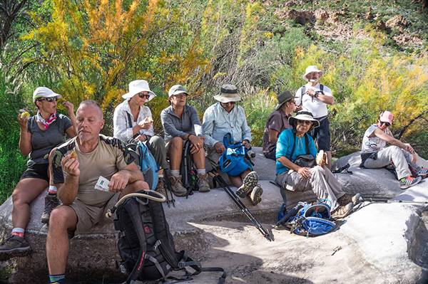 Trailblazers take a snack break in LaBarge Creek. [photo by Wayne] |
 Can I have a taste? [photo by Wayne] |
 Jim bides his time on a comfortable boulder. [photo by John] |
 Now pay attention! Michael knows the way. [photo by John] |
|
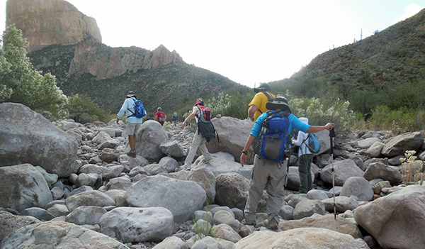
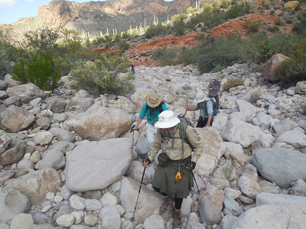
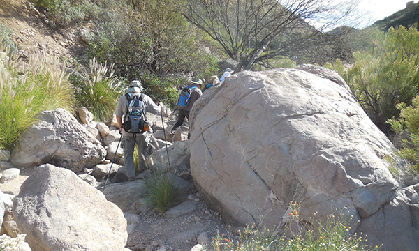
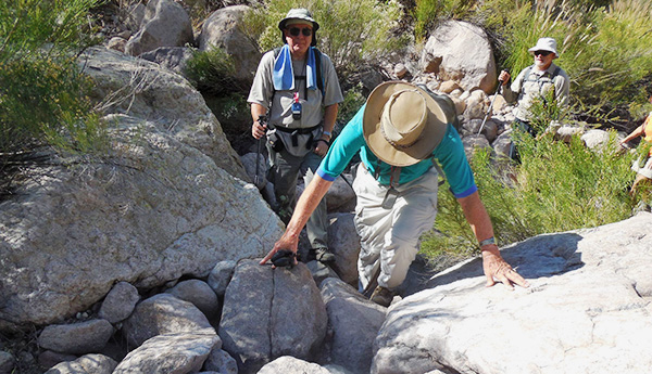
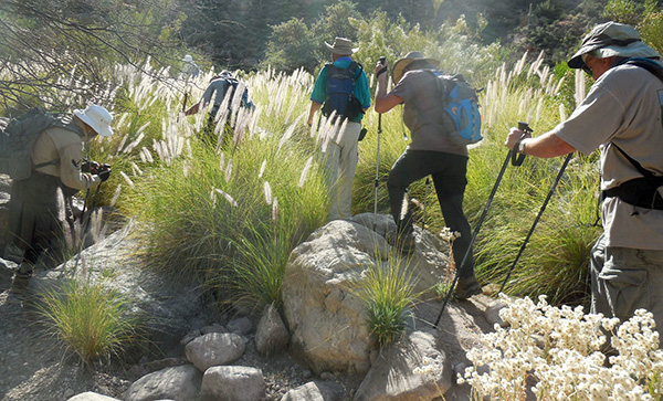
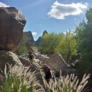
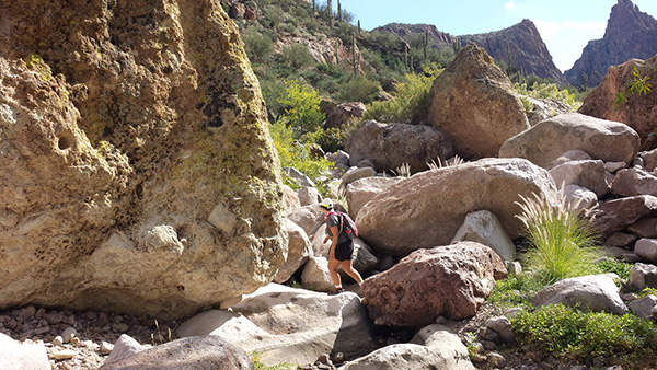
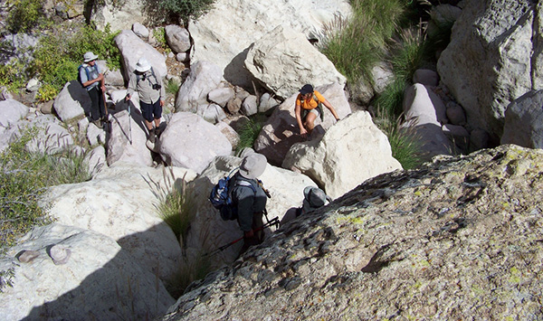
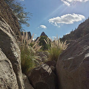
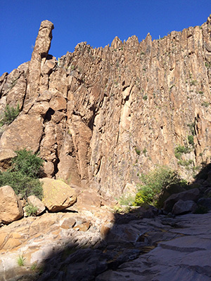
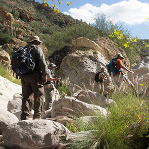
No wonder this trail is called “Boulder Canyon Trail”. At first, we encounter small and polished rocks, eroded over millions of years by the effects of rain and floods in the LaBarge Creek. Gradually, the rocks increase in size and become first moderate size boulders then really big boulders whereby we were not hiking anymore but rather hopping from boulder to boulder, weaving our path in the dry wash in our effort to find an easy way to move forward. We came across tall grass, thorny bushes, and stagnating pools of water from the September hurricane rains and big boulders where one needed someone else’s help to climb over these boulders. |
 It gets kind of bushwhacky up the creek. [photo by John] |
 Watch your step on those boulders! [photo by John] |
 Jim has the right idea for rock-hopping. [photo by John] |
 A cairn! We must be going the right way. [photo by John] |
 It isn’t all boulder-whacking. [photo by John] |
 Glad I was somewhere else when this rock rolled. [photo by John] |
 Chuck and Greg stand by as Dave shows them how it’s done. [photo by John] |
|
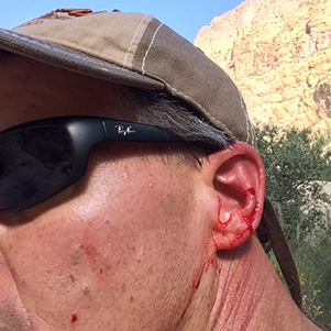
Some of the hikers managed to sprint forward, bush whacking their way over and around the big boulders in their attempt to reach the Narrows. These thorny bushes can inflict serious bleeding on your arms, legs and face, if not properly protected, as evidenced by Kevin’s experience. |
 There must be water, for all this vegetation. [photo by John] |
 Enough. I’m taking a break right here. [photo by John] |
 Thornscrub? Ha! [photo by Bill] |
 Should have ducked that branch. [photo by Kevin] |
 Kathy finds a way through the rocks. [photo by Bill] |
 Yes, you have to climb all the way up here. [photo by Bill] |
 Let me give you a helping hand. [photo by Quy] |
 Can Quy keep her toes dry? [photo by John] |
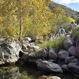
 Autumn color cheers us in the canyon. [photo by Wayne] |
|
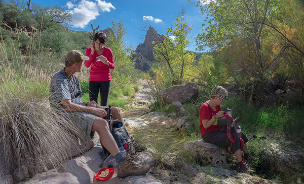
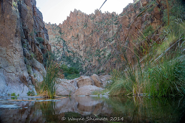
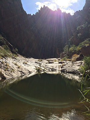
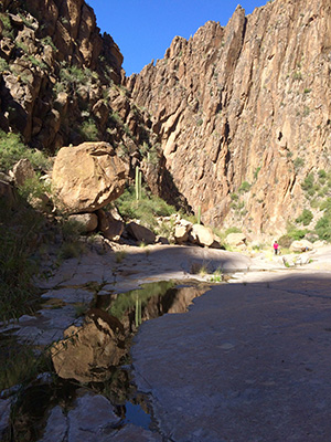
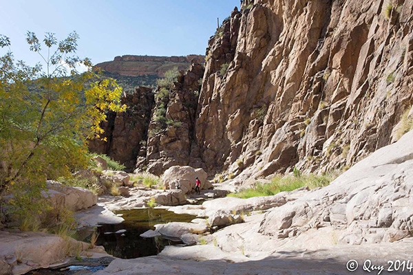
One hour into our boulder hopping and rock climbing experience, most of us decided that enough was enough. We stopped and ate our lunches and rested in the shade while a cool and refreshing breeze blew over us. The narrows were only one half mile ahead of us. Except for five hardy hikers, it was not meant to be for the rest of us to see the Narrows. Disappointing. It was getting late by now and we needed to get back before dark. We just had to satisfy ourselves vicariously the exhilaration of victory and the awesomeness of the sights through the camera lenses of our five hikers who made it to the mouth of the Narrows. The Narrows’ formations are in the shape of the letter “U”, where the loose dirt, once inside it, was washed away over millions of years of rain and floods. What were left are smooth and tall canyon walls, as tall as 800 feet. The floor of the canyon has been smoothed out by the erosional force of rain waters. Small depressions in the canyon floor accumulate rain waters and create pools of stagnating water. The Narrows extend for a few short miles inside the Superstition Mountains. The following are pictures taken by these “invincible five” Trailblazers. Carefully observe in the pictures the smooth and eroded bottom of the canyon mentioned above and the green colored pools of stagnating waters. |
 We found some shade in the canyon. [photo by John] |
 Energy! I need some. [photo by John] |
 Dave has had enough. [photo by John] |
 It’s just as rocky from here on in. [photo by John] |
 But these rocks are so soft and cushiony ... [photo by John] |
 This says it all. [photo by Bill] |
 The down grade isn’t so bad. [photo by Bill] |
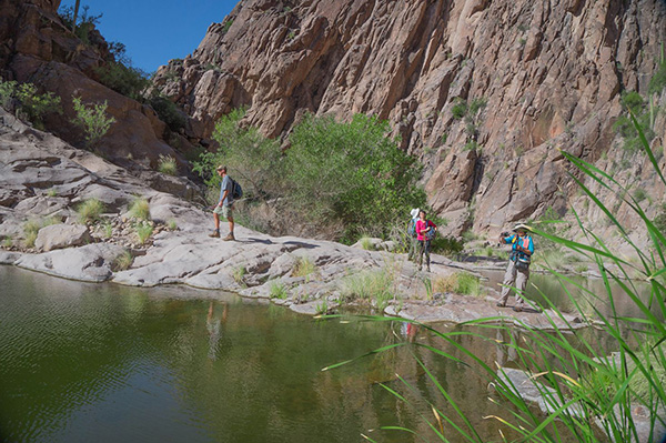 The rocks lead down to tranquil waters. [photo by Wayne] |
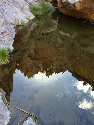
 Quiet pool reflects on the day’s adventure. [photo by Wayne] |
 Reeds and scouring rushes thrive in the canyon. [photo by Wayne] |
 LaBarge Creek is easier going in this stretch. [photo by Wayne] |
 Mid-afternoon shadows. [photo by Kevin] |
 Cool, clear water. [photo by Kevin] |
 Hoodoos. [photo by Kevin] |
 Sunbeams with convex gleams. [photo by Kevin] |
 Water of life. [photo by Kevin] |
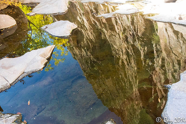
 Face in rock, reflected. [photo by Kevin] |
 Pointillistic cliff reflection. [photo by Kevin] |
 Can you see the sky? [photo by Kevin] |
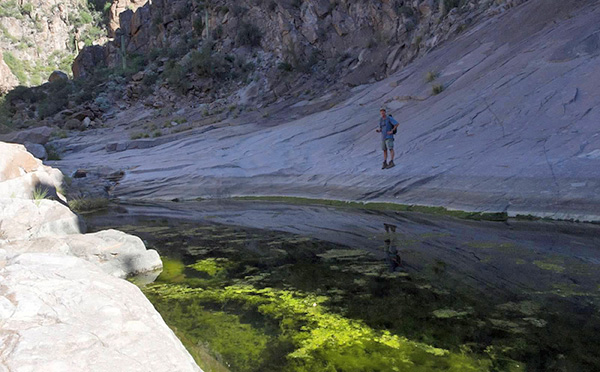 A rolling stream gathers plenty of moss. [photo by Quy] |
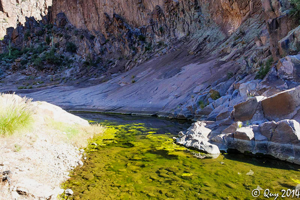 If there’s nothing alive in or near the water, watch out. [photo by Quy] |
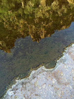
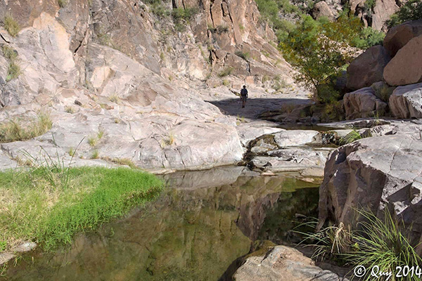 The Narrows’ walls are reflected in the pond’s waters. [photo by Quy] |
 We could spend a lot of time exploring here. [photo by Quy] |
 Sunbeams sparkle on ripples in the water. [photo by Quy] |
 Towering cliffs reflect off still waters. [photo by Quy] |
|
For the rest of us who stopped half a mile short of the Narrows, this would be our furthermost point on this hike. After a restful break and our energies recharged, it was time for us to head back to the marina. At this moment on our time line, hikers start to think about what is awaiting them at the marina: a cold tall glass of beer or two and a scrumptious meal and fellowship at the Lakeside Restaurant and Cantina. On our return hike, we had to hop and climb the same boulders until we reach a point in the dry wash and veer to the right to pick up trail #103. We were tired and the sun was even hotter in the mid-afternoon Arizona desert. After several hesitations and discussions we figured out the spot our trail leaves the dry wash. It was a long uphill trek to the top of the mountain. The uphill climb seemed longer and harder but the thought that the end was near and the cold beer awaiting us seems to energize us to continue the climb. After many turns and twists, all of us at different intervals, reach the top of the mountain. One last look back at where we were and “voila” what a panoramic view of Boulder Canyon, the dry wash at the base of the mountain and all the way to the east are the Narrows’ walls forming the “U” shaped silhouette. |
 Not quite done rock-hopping. [photo by Quy] |
 Finally, we’re on the trail down. [photo by Bill] |
 Have your knees had enough? [photo by Wayne] |
 Our last look at the famous LaBarge Creek photo-op. [photo by Cindy] |
|
From the same vintage point, you turn around and look northwesterly and you will see the Canyon Lake blue waters welcoming you back. It is a pleasant view but we still have one more mile of hiking down a very rocky mountain trail. No big deal, one might think! Typically, we cover one mile every half an hour. In 30 minutes we will be in the parking unsaddling our backpacks and getting into more comfortable shoes. |
 The view from hill 2351 sure looks good on the way down. [photo by Wayne] |
 Canyon Lake, the Marina, and hill 2276. [photo by Wayne] |
 But Wayne, your camera is digital. [photo by Bill] |
 Time to put on comfortable shoes. [photo by John] |
|
By 4:30 PM the last hikers reach the parking lot. Of the 22 hikers, 11 of us had to get back to town for various reasons. However, the most notable pair of hikers who had to rush back to Tempe was none other than Bill Bauer and Kathy Moehl. |
 Now Mr. and Mrs. Bauer. Good news, though! We heard back the next day that Bill and Kathy barely made it in time to say their vows. To Mr. and Mrs. Bauer, we extend our sincere best wishes for a very happy life together and may you be richly blessed. We had a prior reservation at the Lakeside Restaurant & Cantina where the remaining 11 hikers occupied two tables and had dinner but not before toasting our triumphant safe return. The view from the restaurant deck overlooking Canyon Lake was beautiful, the weather got cooler as darkness descended upon us and the beer, Dave French’s selection, tasted great. Two pitchers, Ma’am, per table, was the order for the occasion! Next time we should plan our dinner on a party paddle boat just like the one leaving its mooring. |
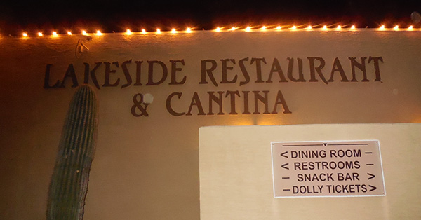 This must be the place. [photo by John] |
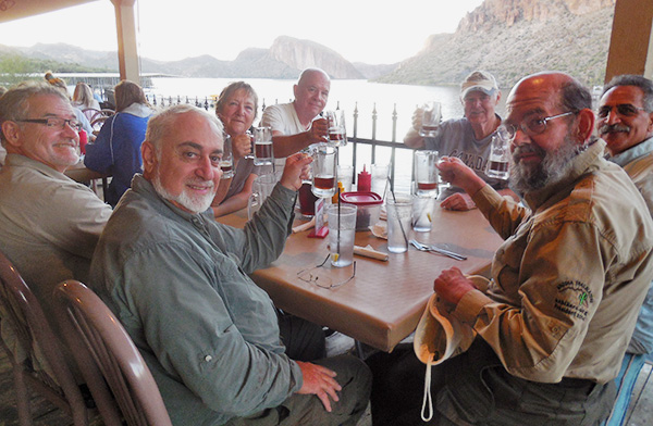 Everybody raise a glass. [photo by John] |
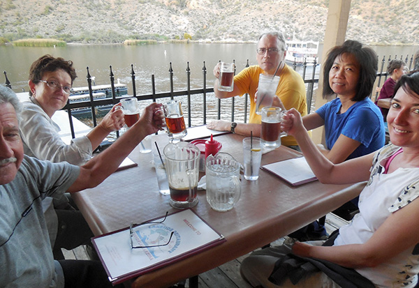 Two pitchers, Ma’am, per table. [photo by John] |
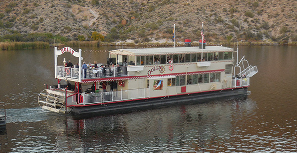 Hello, Dolly! [photo by John] |
|
The following are our chief record keeper’s statistics about our hike, by none other than Jim Buyens. |
|||||||||||||||||||||||||||||||||||||||||||||||||
|
|
||||||||||||||||||||||||||||||||||||||||||||||||
 Top of Page
Arizona Trailblazers Hiking Club, Phoenix, Arizona
Comments? Send them to the AZHC .
updated September 10, 2017