Outdoor Links
Hike Arizona
Trip Planning Guide
Trip Report Index
Calendar of Events
Library
McDowell Sonoran Preserve, Scottsdale
November 10, 2013
by Quy Nguyen

|
|
Left to right: Quy, Michael, Alice, Dottie, Pat, Sally, Becky, Monika, John. Cathy arrived after we took this picture. |
|
This trail is part of new trail system of the northern region of City of Scottsdale’s McDowell Sonoran Preserve. The parking is large enough for over fifty cars. Nice small building with clean restrooms. Even on Sunday, there are a friendly couple of volunteers greeting people and helping them figure out where to go, and handing out an informative map of the trails in the preserve. |
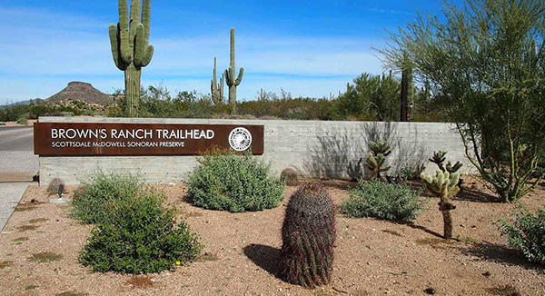 Brown’s Ranch Trailhead welcome sign. |
 A nice small building at the trailhead with clean restrooms. |
|
In the introduction, I handed out the map with the highlighted trail that we’re supposed to hike. Brown’s Mountain Trail is a mixed section: loose gravel, sand, dirt, but it’s relatively flat. We use the map and follow the well-marked signs at every junction. |
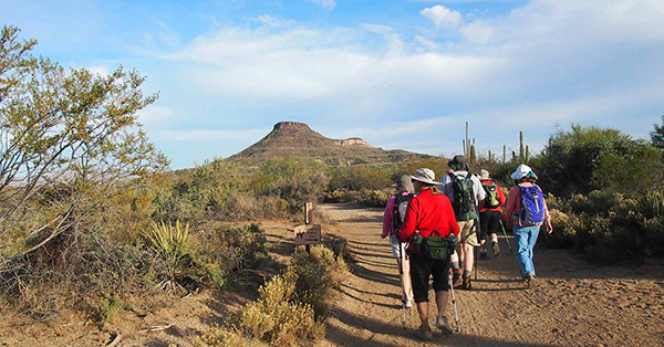 Hikers head out toward Brown’s Mountain |
 Nice hairdo. |
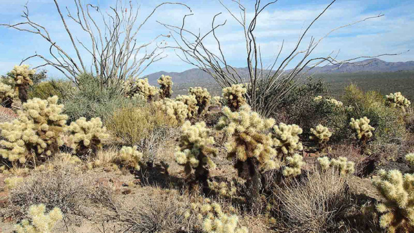
 Rock, Cholla, Saguaro. |
 Are you kidding me? Are we going to hike up that big mountain? |
 many signs |
|
After about a mile, the dirt trail is gradually going up. The view along the trail is wonderful. At the saddle, everybody takes a short break before heading up to the summit. |
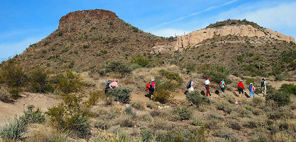 Hiking the Brown’s Mountain Trail. |
 The trail is gradually going up. |
 Don’t be confused: this isn’t Brown’s Mountain. |
 From up here it looks kind of like Picacho Peak. |
|
The part of trail going up to the summit is steep, loose gravel, rocky. But all of us are very determined and committed. From the saddle to the top it’s only 0.2 mile. But it’s almost vertical: straight up. We take short break to catch breath on the way up. |
 Switchbacks take us to the top. |
 Pat is at the saddle. |
 The fun just begins, then it becomes harder. |
 Becky takes a break to enjoy the view. |
|
At the top, the 360 degree scenery is amazing: we can see Cave Creek, Fountain Hills, and the Superstitions. |
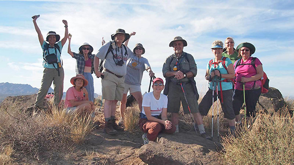 We made it! |
| Left to right: Quy, Cathy, Becky, Michael, Pat, Alice, John, Sally, Dottie, Monika. |
 Tom’s Thumb is visible in the distance. |
 Four Peaks rise behind the Verde River. |
 Sally and Alice enjoy the view. |
 Michael and John capture the scenery. |
 Keep on smiling, Cathy. |
 Pat gets a reward from water. |
 Dottie and Monika. |
 Got some good shots, John? |
|
After a break we hike down with careful footing on this rocky, loose gravel section. |
 Desert garden. |
 We carefully hike down from the summit. [photo by John] |
 Becky and Pat: “What? Have we hiked up to the top?” |
|
We follow Brown’s Mountain trail to reach Cone Mountain trail. This trail is going around Cone Mountain. There is no trail to going up the summit. The Cone Mountain trail is a beautiful hiking area with many ups and downs, and with remarkable views of the Sonoran Desert surroundings. |
 Continuing on the Brown’s Mountain Trail. |
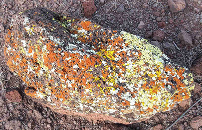 Lichens brighten our passage. |
 Want a hug? |
 Cone Mountain. |
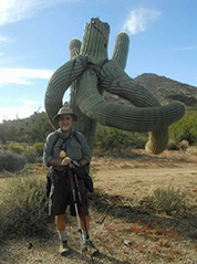
 Nice looking saguaro greets us at Cone Mountain Trail. |
 Not a hug. [photo by John] |
 Cone Mountain Trail winds around saguaros. |
 Another nice arrangement. |
 Traffic speed control. |
 From the Cone Mountain Trail: Brown’s Mountain and Cone Mountain. |
 The trail now winds around big boulders. |
 Artistic cairn. |
 You, too, can be Bicycle Dodgers. |
|
We start at 8:25 AM and finish at 11:20 AM. I don’t have a GPS to record the miles, but according on map the total mileage is about 5 miles, elevation change +-500'. It’s a great workout to substitute the outdoors for the gym with beautiful views, clean air. Thanks to all for coming to support my fourth time in hike leading. Happy Trails. |
 Desert Marigold. |
 Early blooming Ocotillo reaches blue sky. |
 Christmas Cactus. |
 Top of Page
Arizona Trailblazers Hiking Club, Phoenix, Arizona
Comments? Send them to the AZHC .
updated May 31, 2020