Outdoor Links
Hike Arizona
Trip Planning Guide
Trip Report Index
Calendar of Events
Library
|
Brunson Tank Day Hike Mazatzal Mountains February 25, 2012 by Bill Zimmermann |
|

|
||||
|
 The royal gateway to adventure! [photo by Ajay]  OK, Bill, which way are we going? [photo by Ajay] |
Two cars with nine hikers headed north at 8:15. We met George at the trailhead. It was a bit nippy for a T-shirt start. Full sun and uphill hiking soon changed that. By the intersection with Arizona trail “TX244344” those who started with more layers shed them. We were treated to broken shade and some running water at the various creek crossings on our way to “TX!” Here we left the Arizona trail. The planned route was done by leader Bill as an off calendar exploratory hike in January. The promise of bushwhacking through thick scrub oak and manzanita did not materialize as we found the old road to the saddle “L” (dashed line on the TOPO map) that was elusive on the January hike. Bill apologized. |
|
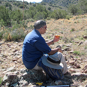
With the easier ascent to the saddle we had more time to kick back for lunch. After lunch we headed up an easy grade before descending to Brunson Tank. The tank was fenced with a gateless opening. We poked around looking at footprints in the mud. |
|
|
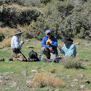
| Picnic in the high country. | |

|
|
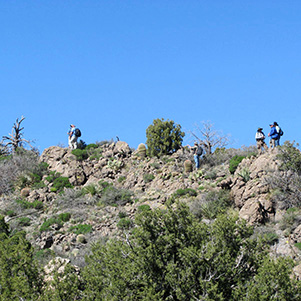
| Topping out. | |
|
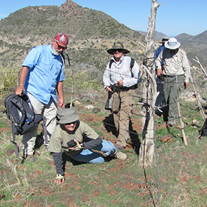
After the tank we crashed 100 yards though thick scrub oak and manzanita to the ridgeline ... at last! Option “B” means bush right? From the ridgeline we were treated to views of the valley below and the Boulder Mountain in the distance. Before our decent down into the valley some of us climbed to what we though was peak 5075. Bill’s GPS read 5044. Close enough. We bushwhacked our way down to “R4” where we picked up a trail. |
 Brunson Tank |
|
When we reached “TOP” and continuing to “R5” we were treated to awesome views of the valley floor below with the prominent Indian Spring Peak as well as Bartlett Lake in the distance. |
 The westward view is awesome! |
 Trailblazers on the down grade. |
 Can I squeeze under that fence? |
|
As we hiked down to “SB” poppies greeted us as well as an occasional Indian paintbrush. We stopped at the saddle for the “Salt Block Group Photo”. We followed the ridgeline to a fence crossing. Some crossed belly down, some belly up, and some stepped over (carefully). With the power line road in sight Bill released the group to pick and chose their own way down, with instructions to meet at the road. We followed the road to our cars, where cold beer awaited. |
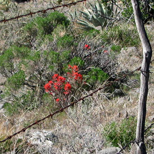 A rancher’s fence frames the Indian Paintbrush. |
 Mexican gold poppies brighten the thornscrub. |
|
We walked 8.0 miles, +-2100 feet at an 2.0 move/1.1 total pace. Special thanks to Ajay for driving and handling the job as sweep. |
 Top of Page
Arizona Trailblazers Hiking Club, Phoenix, Arizona
Comments? Send them to the AZHC .
updated January 6, 2019