Outdoor Links
Hike Arizona
Trip Planning Guide
Trip Report Index
Calendar of Events
Library
|
Bulldog Canyon Loop Day Hike Goldfield Mountains April 30, 2011 by Ted Tenny |
|
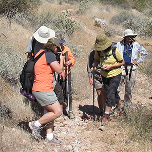
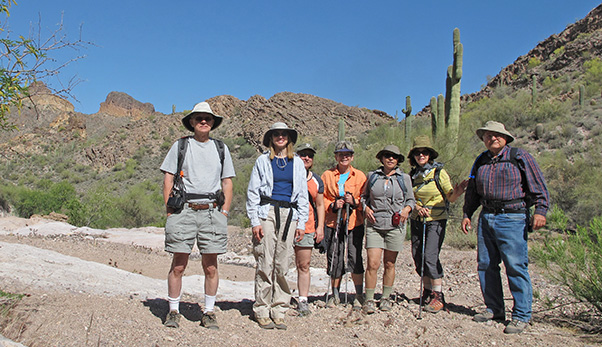 Andy, Debbie, Diane, Sally, Olga, Wendy, Ted |
|
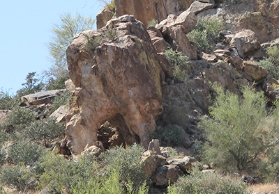
Seven suave Trailblazers start from Dome Mountain Trailhead on a cool, breezy, sunny Saturday morning. With roads and trails serving as alternate routes to Bulldog Canyon we choose the Powerline Trail and the Wolverine Pass Trail, avoiding the Forest Service roads until later in the hike. After the northbound Wolverine Pass Trail crosses F.S. 10, it virtually disappears in an area of washes and recreational Jeep roads. We are going against the grain, so we have to make several steep ups and downs before getting on a dirt road that turns into a horse trail on down to Bulldog Canyon. At the pass, marked by a tall saguaro with many branches, the view opens up to a grand panorama of colorful peak 3269, Dome Mountain (the only peak in the Goldfields with its name on the map), and the peak 3134 ridgeline. Saguaros, prickly pears and chollas are in bloom, though there aren’t many flowers in this dry spring. The trail crosses Bulldog Canyon several times as we make our way westward to the Pyroclastic Cave and the Mask Arches. We stop here for a group picture, then Ted points out salt water taffy by the trail – but it’s only made of rock. |
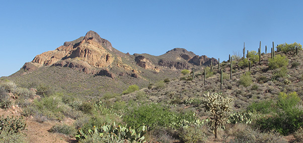 Peak 3269 and Dome Mountain dominate the southern Goldfields. |
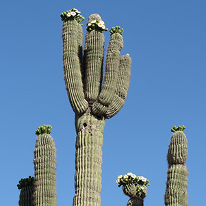 Saguaro blossoms reach for the sky. |
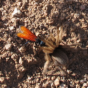 Wasp drags a paralyzed tarantula across the trail. |
|
|
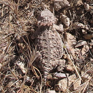
| A horned toad captures our imagination. | |
 Idaho-Bulldog Arch is visible from the trail. 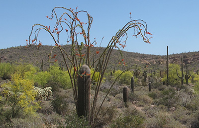 Lacy ocotillos frame a young saguaro. |
A side trail takes us up a wash to F.S. 10. On the way we find a well-camouflaged horned toad who wouldn’t have been noticed if he hadn’t moved. FR 10, once the roughest road in the West, has been tamed by a road grader. Where it intersects the road to the microwave tower, we decide to go back on the Powerline Trail instead of the road. The Powerline Trail was once a road to maintain the electrical transmission towers which connect Apache Junction with the hydroelectric generators at Saguaro Lake. Although fairly smooth, the trail has some steep ups and downs as it goes right between the poles of a wooden tower shaped like goalposts. From there it’s an easy, pleasant walk back to Dome Mountain Trailhead. |
 Top of Page
Arizona Trailblazers Hiking Club, Phoenix, Arizona
Comments? Send them to the AZHC .
updated July 10, 2019