Outdoor Links
Hike Arizona
Trip Planning Guide
Trip Report Index
Calendar of Events
Library
|
Badger Springs Day Hike Agua Fria National Monument December 10, 2011 by Wendy Rennert |
|

|
|
Front Row: Quy, Monika, Olga, Ajay, Wendy K. 2nd Row: Ted, Wendy R., Michael, Debbie, Dave. 3rd Row: Yanis. 4th Row: Dan, Wayne, Eileen, Rudy, Karen, Jean. 5th Row: Amber, Dani, Terri, Arturo |
|
The payoff for our early 7 AM meet-up time was that we all got to see the amazing lunar eclipse as we drove to our carpool meeting location! The funny thing was, there was another group from the Sierra Club gathering in this same parking lot, also on their way to the Agua Fria National Monument area, but to Baby Canyon, just a few miles north of where we were going. |
 Lunar eclipse. [by Dave French] |
 Prehistoric Etch-O-Sketch.  Looking north up the Agua Fria River. We soon reached the junction of the Agua Fria River, which would essentially be our 'trail' for the duration of the hike. But before beginning on our riverbed journey, we paused to take in the views of the petroglyph panels. I saw maybe 50 symbols, but the trailhead info tells us there are at least 86 individual petroglyphs on the rock faces. We also checked out the metate and mano grinding stones that the local Perry Mesa Tradition Native Americans used to grind corn and seeds between about A.D. 1250 and 1450. Some folks speculate that this location was a gateway to the river and may have been seen as a place of special power and significance. The scenic views both up and down the river are spectacular from this point. |
 Ice chunks make for a cool reflection – literally. |
 Unexpected colorful reflections. |
|
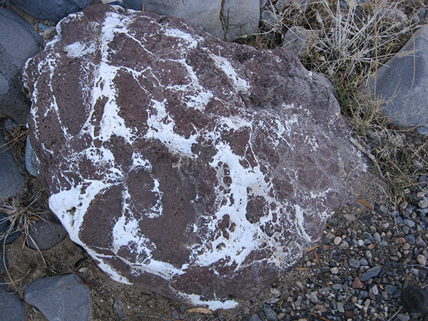
We did not, however, find the remnants of the arrastra tool that miner William Perry used to mine gold back in 1878 (a stone-lined circular pit with groove patterns on the flat stone slabs from crushing the ore). A challenge for another day, perhaps. With Perry Mesa (named after William Perry) across the river to the east, and Black Mesa to the west, we took the southward route down the Agua Fria River. The river bed was mostly dry on this visit, which made the boulder hopping a bit easier. There were pools of water here and there, some with ice sheets starting to form. The boulders were mostly granite and also some lava, all polished smooth from the water that usually flows through here. It is always amazing to see the result of the forces of water erosion on huge slabs of granite – sinuous undulating shapes which are quite artistic. |

|

|
| The Christmas-colored pools of water make for a festive holiday time hike. | |
 On a spring day, you'd be throwing them an inner tube ... Our large group became pretty spread out, as we each traversed the boulders at varying speeds in our own ways. Some concentrated on how to best maneuver the stepping stones, while others went in search of interesting trail treats and treasures. |
 Darn, no cave or mine here! Worth a try. |
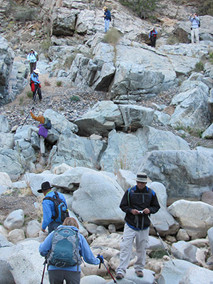 We start to spread out in the canyon. |
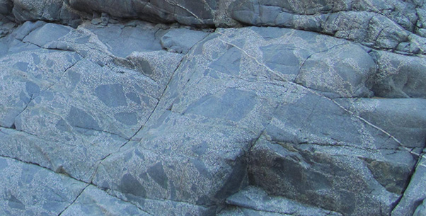 A speckled wonder of conglomerate rock. |
 Is Wilma yelling at Bam Bam? |
 This Badger has a bit of a headache! |
 A few kinks in the plumbing system ...  A colorful South view down the Agua Fria. Turns out, (according to a hiking book at the gift shop in Rock Springs) those pipes were part of the system of the former Richinbar Mining operation, which was situated some 700 feet above us on top of Black Mesa. We could have easily stayed out all day exploring the area, but this was our advertised turnaround point, so we headed back to the trailhead. |
 The sandy soil of Badger Spring Wash are a sight for sore eyes – or feet! |
 Table for 18, please! |
Besides, the pie at Rock Springs Café was calling our name... |
|
Supplemental Report by Ted Tenny |
|
An eclipse of the moon was going on right before me as I drove to I-17 & Bell for Wendy Rennert’s hike along the Agua Fria River. The hike was delightful, in a boulder-strewn river bed with colorful scenery along the way. |
 Hmmm, this looks interesting. [photo by Ted] |
 Ancient artwork. [photo by Ted] |
 Trailblazers in the Agua Fria River bed. [photo by Ted] |
 We move cautiously among the boulders. [photo by Ted] |
 This part of the river forms a canyon. [photo by Ted] |
 Looks yummy, but it tastes like rock. [photo by Ted] |
 Wendy takes the group picture. [photo by Ted] |
 Green for Christmas. [photo by Ted] |
 Red for Christmas. [photo by Ted] |
 There has been water here. [photo by Ted] |
 Top of Page
Arizona Trailblazers Hiking Club, Phoenix, Arizona
Comments? Send them to the AZHC .
updated June 3, 2020