Outdoor Links
Hike Arizona
Trip Planning Guide
Trip Report Index
Calendar of Events
Library
|
Lake Pleasant Kayaking Lake Pleasant March 31, 2025 by Chuck Parsons |
||||||||||||||||||
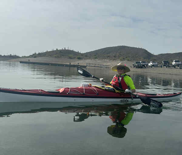
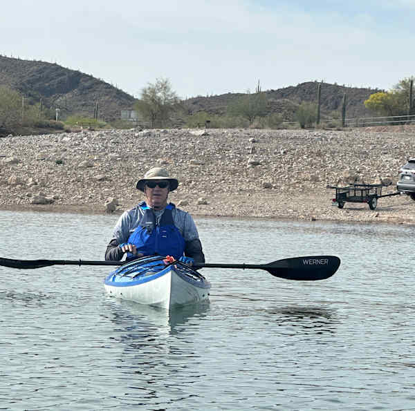
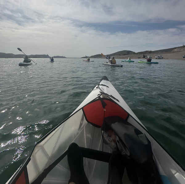
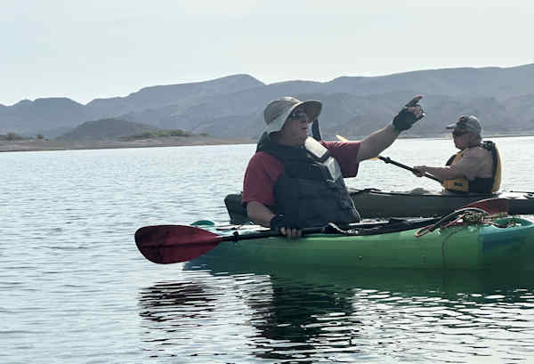
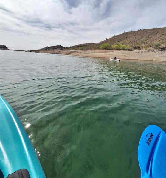
9:30 AM on a partly cloudy Monday morning and the last day of March, as seven intrepid Arizona Trailblazers launch their kayaks from the Castle Creek boat ramp area into the crystal-clear waters of Lake Pleasant. It’s been almost a full year since we last kayaked Lake Pleasant. I had decided against kayaking this lake earlier in the year because of low water levels. Normally at this time of year Lake Pleasant is full or almost full from the millions of gallons of water delivered from the CAP, or Central Arizona Project. Today, the lake is down between 30 and 40 vertical feet, with small islands, normally underwater, popping up everywhere. Numerous large rocks and boulders are also lurking just beneath the surface. Thankfully, they’re plainly visible in the clear waters and easy to navigate around in a kayak.
So, what is happening here, and why is this lake so darned low now? The entire Colorado River Basin, stretching across 250,000 square miles and seven states, continues to experience drought and the ongoing and long-term impacts of hotter and drier conditions. For well over twenty years, more water has been allocated annually from the river than what the Colorado can actually deliver. As a result, the Colorado River Basin is currently in a Tier 1 shortage for 2025. When Colorado River water was reallocated among the lower basin states in 2022, this Tier 1 shortage resulted in a 512,000-acre-foot reduction to Arizona Colorado River water supply, representing about 18% of Arizona’s annual Colorado River supply and just under 8% of the state’s total water use. Nearly all these reductions within Arizona are being borne by the state’s Central Arizona Project water users, primarily large-scale agricultural users.
One acre-foot of water is the amount of water it takes to cover one acre of land to a depth of one foot, which amounts to 325,851 gallons. 512,000 acre-feet of water comes to 167 billion gallons of water, Arizona’s annual reduction of Colorado River water that would normally flow into Lake Pleasant. With very little water flowing into the lake from its two primary sources, the CAP and the Agua Fria River, suspended particles and sediment have had plenty of time to settle out and drift to the bottom of the lake, leaving the water virtually crystal clear in many places. We paddle over water in some areas up to 25 feet or more in depth and can still see clearly right to the very bottom of the lake. This is a somewhat unique experience you certainly do not see every day on almost any lake in Arizona.
Our goal for today is to paddle southeast from the Castle Creek boat ramp to the Scorpion Bay Marina & Restaurant, a distance of almost 3.5 miles. Along the way, we will explore Firemans Cove, Cottonwood Cove, and Pipeline Cove. On all our previous kayaking trips to Lake Pleasant, going back to 2021, we’ve never kayaked all the way to the marina and restaurant before, so this will be a brand-new experience. The main question is whether or not we can safely exit our kayaks along the marina docks near the restaurant and take a well-deserved lunch break. Only one of our kayakers had ever successfully done this before by carefully standing up in his kayak adjacent to the dock and pulling himself up onto the dock without capsizing—not an easy feat by any means.
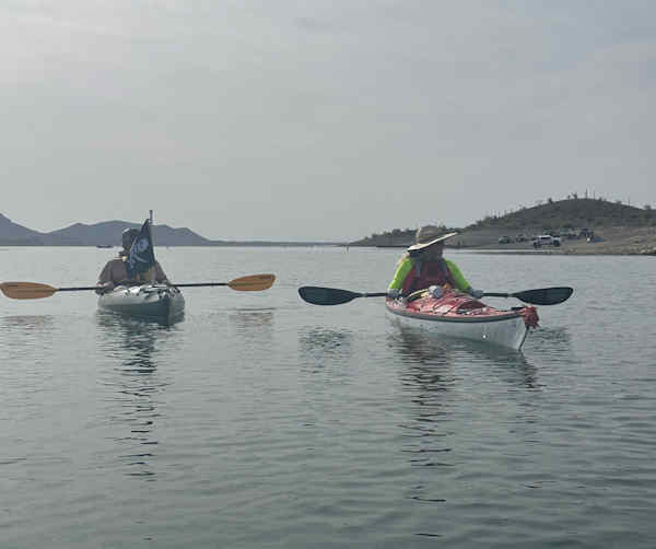
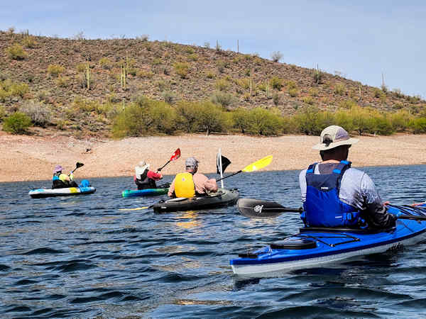
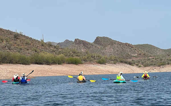
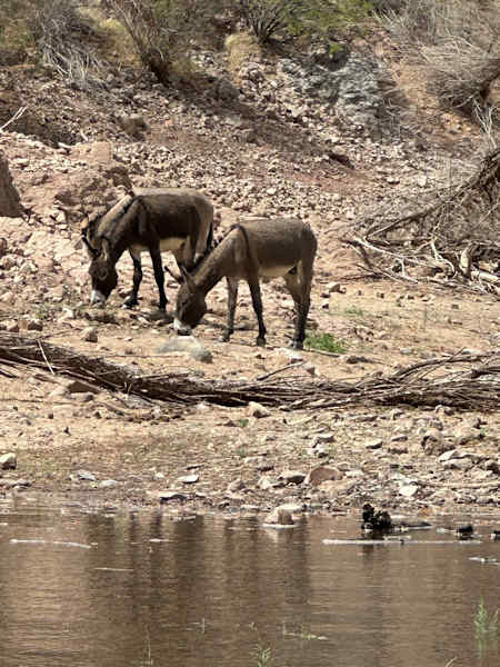
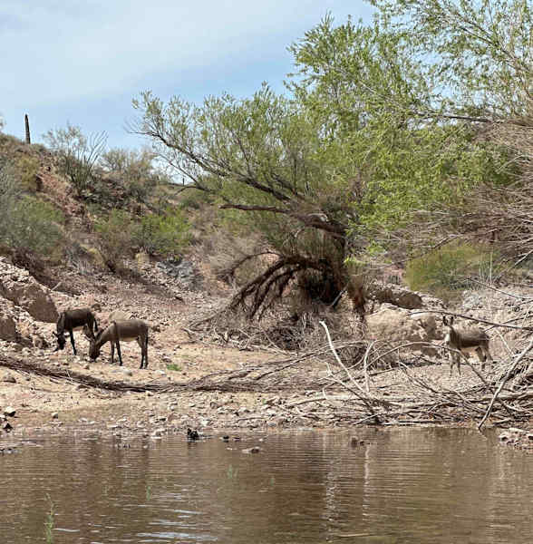
The day starts out as overcast and breezy, as we paddle our way south to Firemans Cove and around the east side of Helms Island toward Cottonwood Cove. We slowly make our way up Cottonwood Cove along the west side of Helm’s Island and see our first burros along the lake shore as they forage for whatever vegetation they can find. The ground almost everywhere looks pretty barren and dry with very little vegetation to support a growing population of wild burros. But somehow these Lake Pleasant burros always manage to find enough to eat since we’ve never seen any scrawny looking burros yet. We continue paddling up Cottonwood Cove to the end and reverse course to paddle back out to the main lake. Soon, we round Yavapai Point and continue paddling south toward Pipeline Cove.
Several of us were hiking with the Thursday hiking group (out of the North Mountain Visitor Center in Phoenix) a few weeks earlier when we hiked the Pipeline Canyon Trail down to Pipeline Cove and saw the old floating bridge, destroyed by a savage summer monsoon storm over ten years ago, still partially submerged in the cove in several pieces. Today, we slowly paddle by the wreckage and see several hikers and a large dog on the shore as we continue to the end of the cove. Although Pipeline Cove is the smaller of the two coves, we all agree that its also the most scenic of the two. After finally leaving Pipeline and the bridge wreckage behind us, we continue paddling south toward the marina and restaurant, growing hungrier by the minute after several hours of steady paddling. Raw fish even sounds a little tempting right now. Carp sushi anyone?
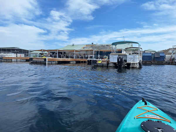
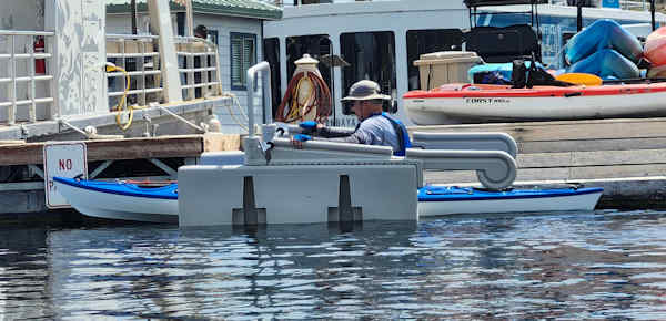
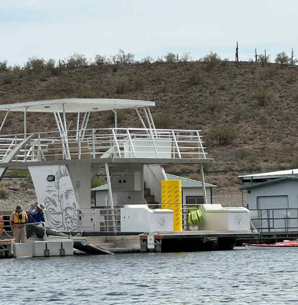
Eventually, Scorpion Bay Marina & Restaurant begins to materialize on the distant horizon, gradually becoming larger as we steadily draw closer. We begin looking for a good place to exit our kayaks, and it’s not looking any too promising with impossibly high docks all around both the marina and restaurant. But before too long Randall spots what appears to be a possible solution. A large light gray object attached to the marina dock and similar to one we saw a few years ago on Watson Lake in the Prescott area looks like it just might work for us. Randall is the first one to check it out. He paddles his kayak up onto this cradle like device and pulls himself up on an overhead bar near the front and is able to easily step out of his kayak onto the marina dock. The picture clearly shows how this device works.
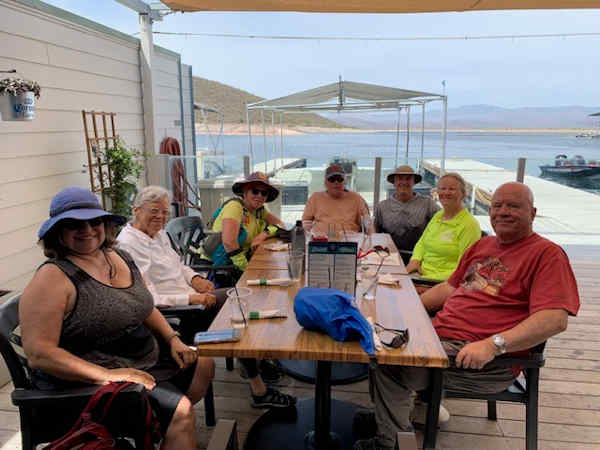
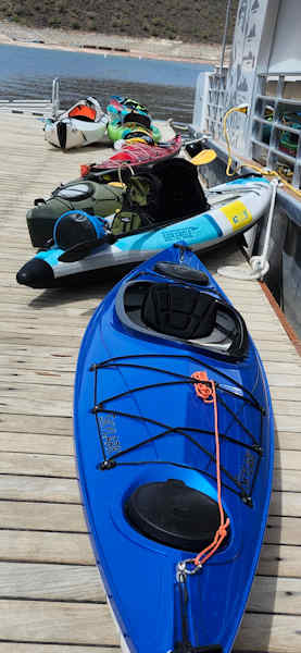
The rest of us take turns paddling onto the cradle, and Randall or Sonny helps us pull our kayaks out of the water and up onto the marina dock and to the side out of everyone’s way. All seven kayaks safely stored to the side of the dock, we all head to the restaurant for lunch. Although quite crowded for a Monday, we where all seated on the outside patio overlooking the lake in about twenty minutes. After a long and relaxing lunch, one by one we climb back aboard our kayaks via the cradle system and begin paddling north back to the Castle Creek boat ramp area. Thankfully, the winds that were mostly facing us on the way to the marina all morning are now to our backs and helping us paddle back to the ramp even quicker. By 3:30 we’re all back and loading up our gear and kayaks for the drive back home. Yet another beautiful day on the lake. Even though Lake Pleasant is almost 40 feet down, it’s still a big lake with plenty of water to move around in.
|
||||||||||||||||||
 Top of Page Top of Page
|
Arizona Trailblazers Hiking Club, Phoenix, Arizona updated May 24, 2025 Comments? Send them to the AZHC . |