Outdoor Links
Hike Arizona
Trip Planning Guide
Trip Report Index
Calendar of Events
Library
|
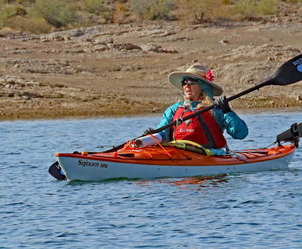
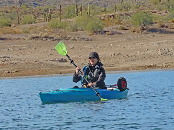
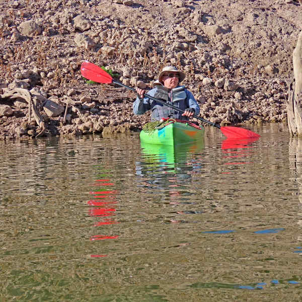
Kayaking Lake Pleasant Regional Park Lake Pleasant January 15, 2024 by Chuck Parsons |
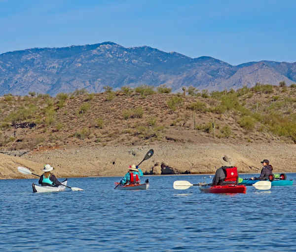 First group of Trailblazers Kayakers. [photo by Ron] |
| Anna, Norma, Lee, Kelley. |
 Second group of Trailblazers Kayakers. [photo by Ron] |
| Sandy, Norma, Anna, Chuck. |
 Third group of Trailblazers Kayakers. [photo by Kelley] |
| Lee, Chuck, Ron. |
 Fourth group of Trailblazers Kayakers. [photo by Kelley] |
| Chuck, Sandy, Norma, Lee, Ron. |
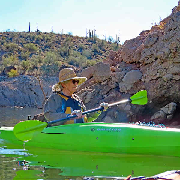
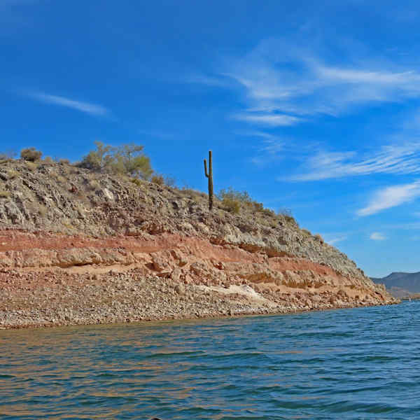
On a cool and partly cloudy morning in mid-January seven Arizona Trailblazer kayakers (Chuck, Norma, Kelley, Anna, Sandy, Ron, and Lee) gather at the Castle Creek boat ramp, located at the northwest corner of Lake Pleasant and near the south end of Castle Creek Bay. At this point we’re about four miles west of where the Agua Fria River flows into the north end of the lake. The Agua Fria and the CAP canal are the primary sources of water for Lake Pleasant. One website I checked earlier indicated the lake was at 100% capacity. But that posting was obviously from many months ago since the lake is currently at least 30 feet or more below full.
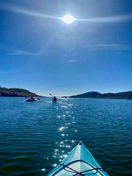 The sun creates a sparkling path on the water. [photo by Kelley] |
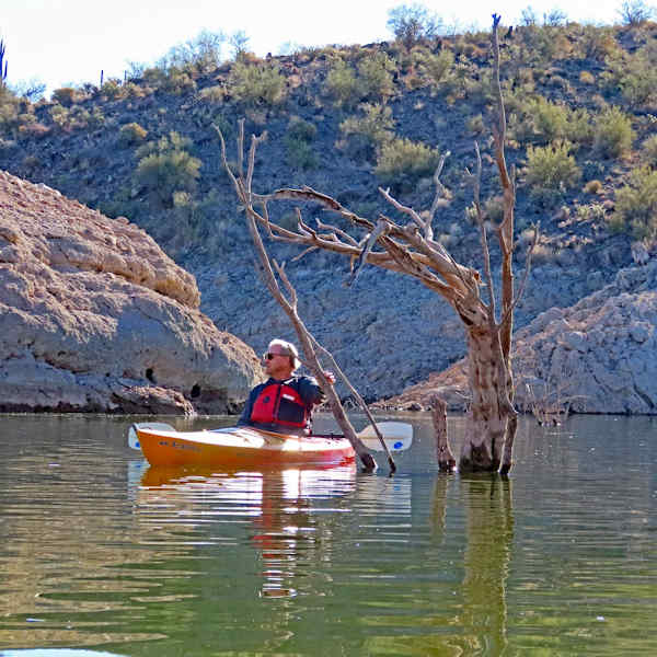
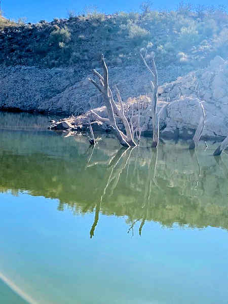 Partially submerged tree reflection. [photo by Kelley] |
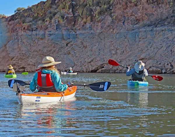
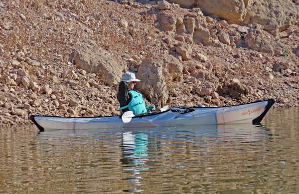
By 9:30 we’re loaded up and ready to launch, so we push off from shore and begin paddling across a near glassy-smooth lake surface. Hardly a ripple in sight, quite remarkable for a notoriously windy lake. We start paddling in a northeast direction and enter a small cove just outside of Bass Bay. This turns out to be the highlight of the day since the water surface here is so incredibly smooth that it appears to be an infinite mirror offering perfect reflections of rock formations and partially submerged trees all around us.
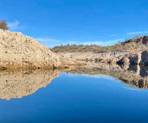 These rock formations and their perfect reflections merge into one seamless image. [photo by Kelley] |
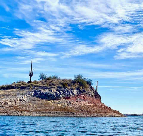 One of numerous small islands on Lake Pleasant. [photo by Kelley] |
We slowly and carefully paddle thru a surreal world where trees appear to be floating in mid-air and rock formations and their reflections on the water merge into one seamless image. I tell one of our kayakers, Kelley, that the rock reflections are so incredible here that one literally cannot tell where the surrounding rock ends and the lake surface begins. She replies that this scene is making her a little nauseous and she must temporarily look away since this reminds her of some sort of Disneyland experience.
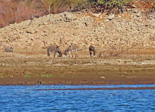 Four wild burros graze along the shoreline. [photo by Ron] |
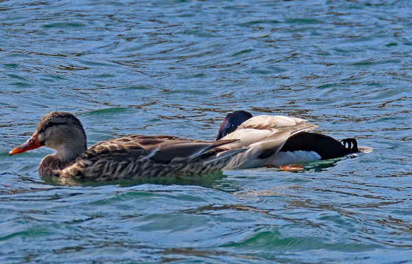 This pair of mallards is enjoying the sunshine. [photo by Ron] |
It reminds me of watching an IMAX film. Before every IMAX film begins, someone always comes out and gives a brief history of IMAX and then tells viewers if they start feeling the least bit nauseous to temporarily look away until the feeling passes.
 Norma. [photo by Ron] |
 Anna. [photo by Ron] |
If you’ve ever seen the Grand Canyon IMAX film that runs continuously at the IMAX Theatre in Tusayan, just south of the canyon, you know exactly what we’re talking about here. The IMAX crew is flying low over land, gradually approaching the lip of the canyon. Suddenly, without any warning, terra firma completely vanishes from view and the viewer sees only empty air space for over 5,000 feet below all the way down to the distant canyon floor. If that doesn’t make you a little nauseous, then nothing will.
 Kelley. [photo by Ron] |
 Sandy. [photo by Ron] |
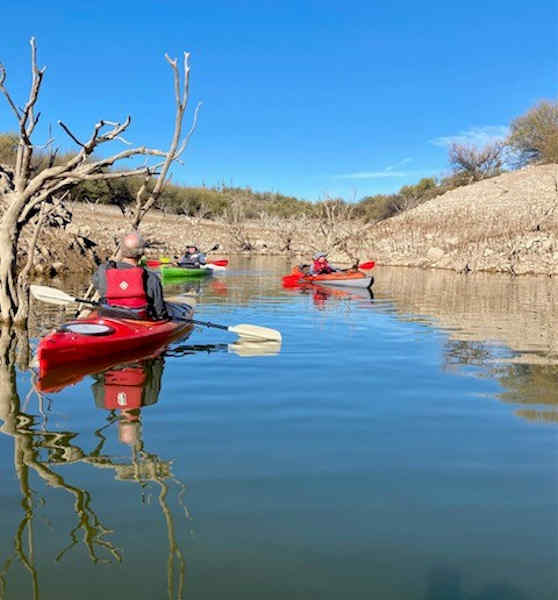
Near the end of the cove, we come to a fork, with a small channel branching off to the right and another to the left. We paddle for about a hundred yards to the ends of both channels where both end in water too shallow to paddle any further and terminate in a quagmire of soft mud. Anyone trying to exit their kayak in this would probably immediately sink in muck up to their knees. So, we turn around and head back out to the main lake body, heading southwest toward the much larger Fireman’s Cove.
 Lee. [photo by Ron] |
 Chuck. [photo by Ron] |
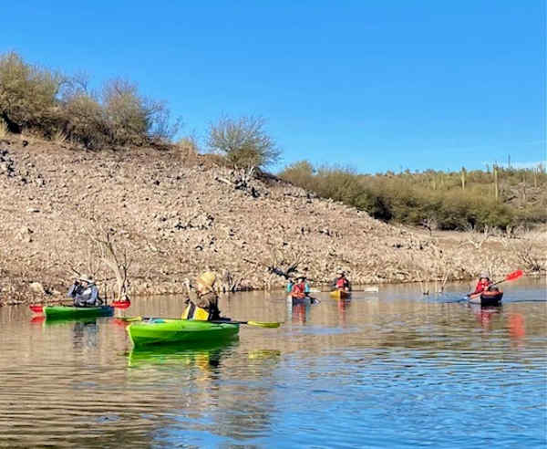
Once in Fireman’s Cove we begin looking for a good place to beach our kayaks and get out to stretch cramped legs and take a short snack and rest break. The winds are still relatively calm and the paddling is easy. We find a shallow place to land and get out. Not exactly the most scenic part of the lake, with nothing but dirt, thousands of scattered cockleburs, a long-abandoned sock and dirty towel, and some dirt-crusted boulders to sit on. If the lake was only a few feet higher, most of this would be completely under water.
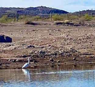 A Snowy Egret stalks the shoreline in search of food. [photo by Kelley] |
 We continue paddling around Helm’s Island. [photo by Ron] |
Break time over, we continue paddling thru Fireman’s Cove and around Helm’s Island by way of Cottonwood Cove, terminating at Yavapai Point. Lots of interesting place names on this lake. From here, we begin paddling north into increasing winds and back to the launch area. By 1:30 we’re all back at the Castle Creek boat ramp. After loading kayaks and gear back into our vehicles, we drive over to the Scorpion Bay Marina and Restaurant for a relaxing lunch before heading back home. Another great day for kayaking one of Arizona’s most beautiful desert lakes.
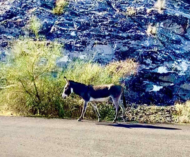 A wild burro ambles along the roadside next to the parking lot.. [photo by Kelley] |
 Top of Page
Arizona Trailblazers Hiking Club, Phoenix, Arizona updated Febuary 2, 2024
Comments? Send them to the AZHC .