Outdoor Links
Hike Arizona
Trip Planning Guide
Trip Report Index
Calendar of Events
Library
|
Triple Arch Day Hike Goldfields March 11, 2023 by Tom Simonick |
|
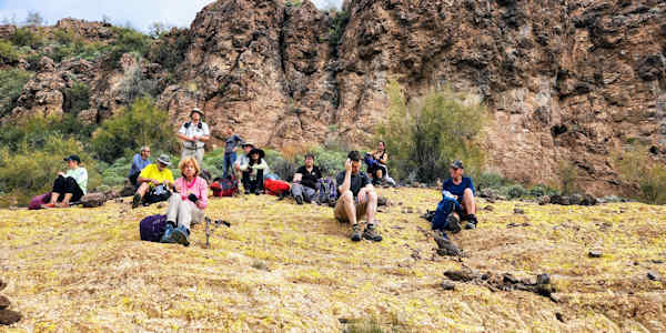
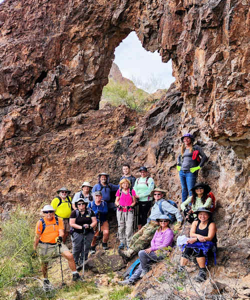 Trailblazers in the Goldfields. [photo by Tom] |
| Bruce, Tamar, Allan, Michael, Sandy, Chris, Nancy, Justin, Carolyn, Robert, Anna, Debbie, Li, Cindy. |
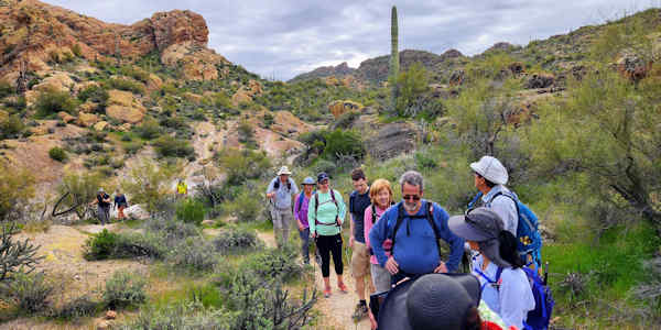
Thirteen members and two guests began the hike from a large parking lot just south of milepost 204 on the Apache Trail. The parking lot has a sign: “Bulldog Canyon Off-Highway Area.”.
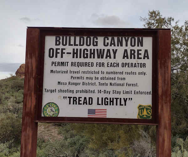 Starting at Bulldog Canyon. [photo by Debbie] |
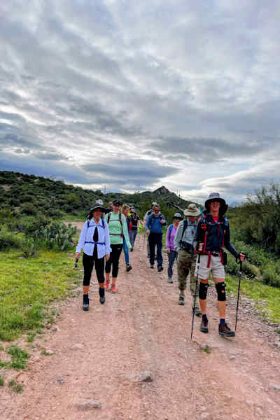
The day was overcast, but the forecast called for mild temperatures and sunny. We headed west, on the Javelina-Willow Springs Crossover Trail (per hikearizona.com), following a series of washes and some easy climbs and descents.
 We start going west. [photo by Debbie] |
 Down the road. [photo by Li] |
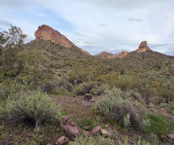
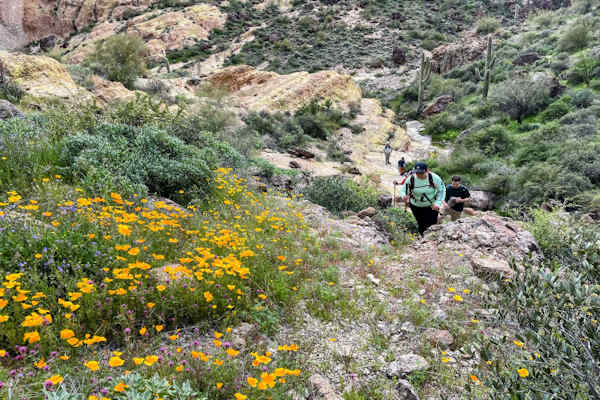
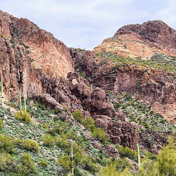
We all enjoyed the color and variety of the rocks in this part of the Goldfield Mountains, contrasting with the amount of green plants. As we hiked, it was evident that we would be seeing a lot of wildflowers that day as it became brighter and warmer.
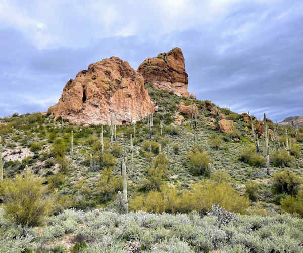 Many colorful rocks in the Goldfields. [photo by Li] |
 Following the trail. [photo by Tom] |
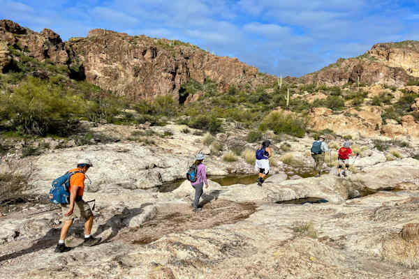 Crossing the wash. [photo by Li] |
We passed junctions with other trails as we continued west and one hiker pointed out an American flag flying at the top of a small rock formation.
 There is water in the Goldfields. [photo by Li] |
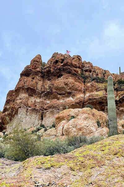 Flag on top of the bluff. [photo by Li] |
We decided that on our way out, we would include a hike up to the flag as an option. At about 3.6 miles, we left the shallow washes and began a climb up a steep arroyo with plenty of loose rock just to make things interesting. This part of the hike was marked by cairns, but it wasn’t difficult to figure a route. In fact, there were several routes up to the saddle. In this area we passed through pretty fairy duster bushes along with purple flowers and poppies that were now open.
 The poppies are now out. [photo by Li] |
 Li climbing the arroyo. [photo by Tom] |
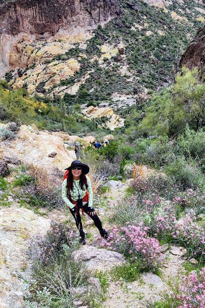
A short distance past the saddle we took our first break. We had gently slopped rock to sit on and a wonderful view of the surrounding buttes and hills.
 Time to get some pictures. [photo by Li] |
 Time for a break. [photo by Tom] |
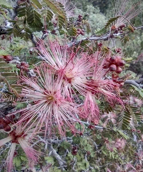 Fairy Duster. [photo by Debbie] |
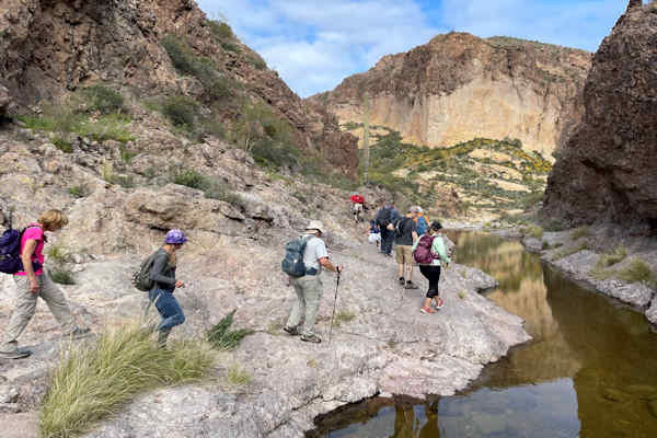
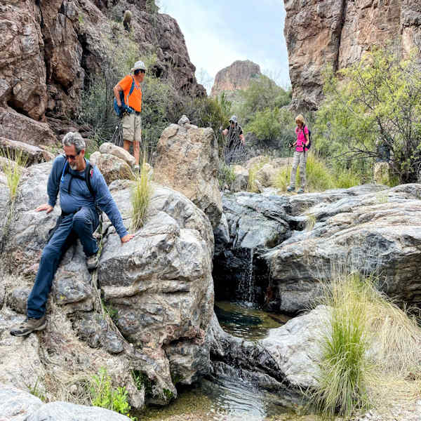
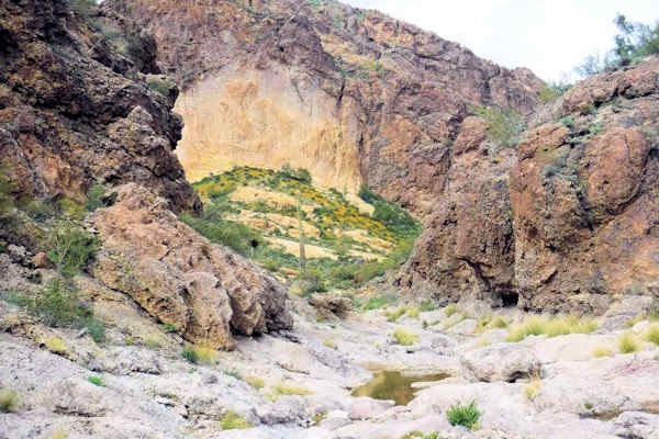
After our break, we hiked down from the saddle along more washes, bordered by green grass and flowers, and containing large boulders. Turning right into Black Glass Canyon, we see the arch in the distance.
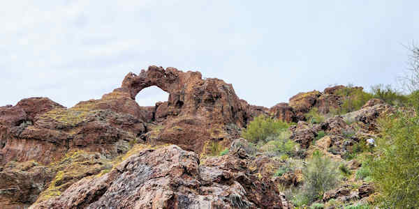
 First view of the main arch. [photo by Tom] |
The canyon is named after the black obsidian rock found there. About 0.3 miles after entering the canyon, we look up and see the main arch.
 Black Glass Canyon. [photo by Li] |
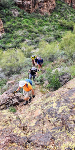 Climbing up to the arch. [photo by Tom] |
Walking slightly past the arch, we start climbing the left side of the canyon. As we climb, we can see the Triple Arch consisting of a large arch with two small arches on either side.
 Triple Arch. [photo by Tom] |
There are numerous paths reaching up to a rock spine that ends in the arches. Some of us climbed down into the arch, while others took some great pictures of us.
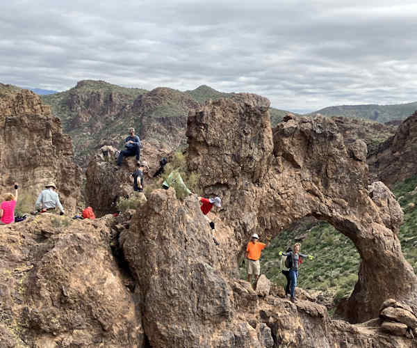 Climbing down to the arch. [photo by Cindy] |
 Poeple in the arch. [photo by Cindy] |
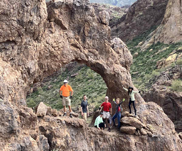
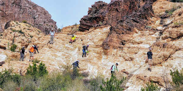
After more pictures and lunch, we left to search out the next arch. Li and I had found it on our exploratory hike, but had not seen it mentioned by anyone online. After a little searching, we found the large arch and took our official group picture. We briefly looked for a third (or fifth) arch which we thought we had seen on our previous hike, however we didn’t find it and continued the hike by walking down from the ridge to the west. It was an easy descent except for walking down slick rock which crumbled easily. Two people did find great seating in the eroded walls.
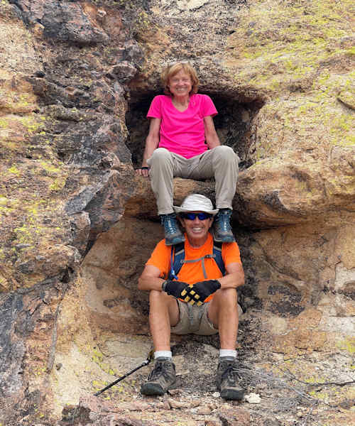 Great seats. [photo by Li] |
 Poeple spreading out on the slick rock. [photo by Tom] |
With everyone spread out on the rock, I took pictures and a video. We safely got to the bottom and walked down a wash that connected us to the point where we entered Black Glass Canyon. At this point, we started hiking back to the trailhead. On the return, we enjoyed all of the flowers that were fully open.
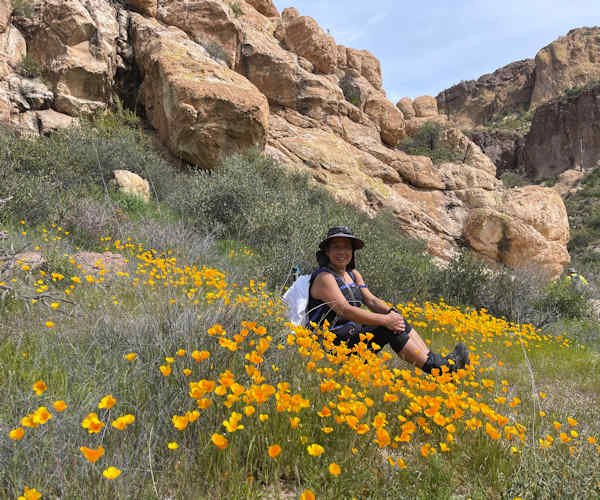 Cindy in the poppies. [photo by Li] |
 Mountainside of poppies. [photo by Michael] |
We also found a “cave” created by erosion. We spread out again on the return, but took time for everyone to gather at the saddle, before we started down the slippery slope. About 1.7 miles from the trailhead, we split up with some of us hiking up to the flag, while the others continued to the trailhead. It was an easy climb up.
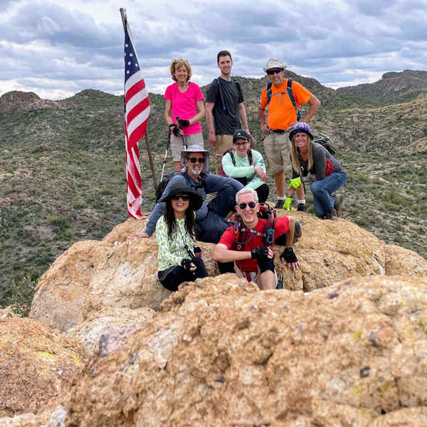 Group at the flag. [photo by Li] |
| Li, Tom, Chris, Nancy, Justin, Bruce, Debbie and Carolyn. |
It’s fair to say that everyone enjoyed this hike and we hiked it on a beautiful day. From this
trailhead there are a number of trails that the Club should explore. Thanks to Li for proposing the
hike and to Ted Tenny who knows the Goldfields intimately. Thanks to Cindy for taking so
many great pictures of people in the arch.
Statistics: 9.9 miles in 7 hours, 23 minutes, with an accumulated elevation gain of 2100 feet.
→ More pictures, by Debbie.
→ More pictures, by Tom & Cindy.
→ More pictures, by Li.
 Top of Page
Arizona Trailblazers Hiking Club, Phoenix, Arizona updated April 19, 2023
Comments? Send them to the AZHC .