Outdoor Links
Hike Arizona
Trip Planning Guide
Trip Report Index
Calendar of Events
Library
|
Barnhardt Canyon Mazatzal Mountains November 26, 2022 by Scott Green |
|
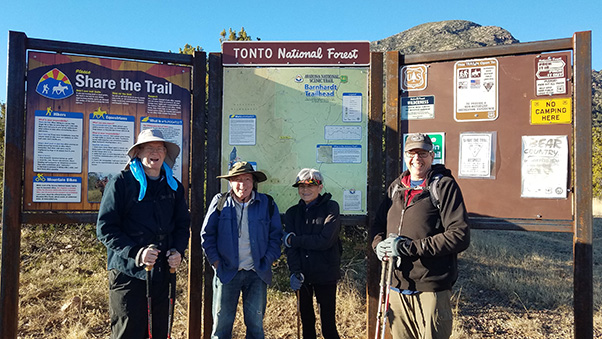 Trailblazers at Barnhardt Trailhead. [photo by Scott] |
| David, Les, Annette, and Burt. Scott is taking the picture. |
Us five hikers met at the Target parking lot. After introductions, we did the vehicle math. Five hikers with 3 midsize cars plus one Chevy Tahoe, which could hold a small marching band. After the obvious became, well obvious, Les and Annette graciously offered to drive their Tahoe!
Up the Beeline road we traveled, expounding on hikes we have taken and pointing out trails yet to be done. We were soon just south of Rye and turned west onto the Barnhardt trail road. Those of us who could have offered our cars for carpooling were very much appreciative of the Tahoe as we bounced along the softball sized rocks which littered the 5 mile road to the trailhead.
Once at the trailhead, we were the first group to arrive for the day and after the obligatory group picture, which ensured an accurate ‘head count’, we all proceed up trail #43.
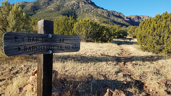 We’re taking the trail on the right. [photo by Scott] |
For those of us who had been here before, the trail seemed overly rocky, with the same softball size rocks found on the road. As the trail climbed, the trail quickly proved its "B" grade as being more than a cakewalk. Due to the angle of attack, a few rock slides, and the higher than Phoenix elevation, two hikers wisely turned around, with the hike leader following to ensure no mishaps.
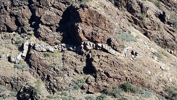 Interesting rock formations. [photo by Scott] |
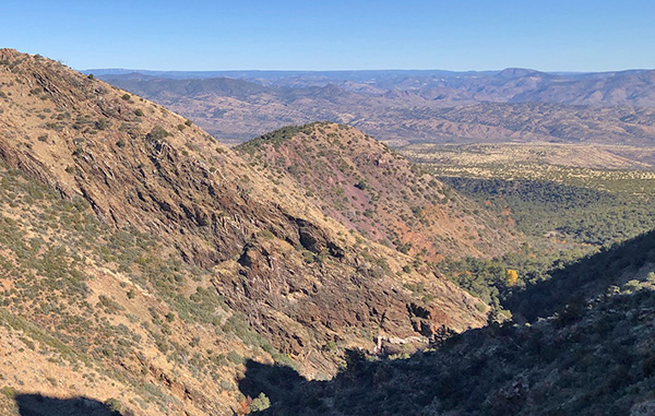 The Charley Brown hillside. [photo by Burt] |
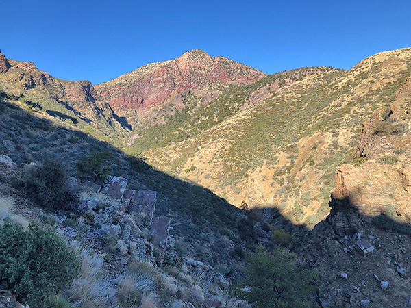 Mazatzal Peak. [photo by Burt] |
The remaining two experienced hikers continued up the well-worn trail. At this point, a big thank you to the club for the two-way radios. They worked very well! One with the hike leader and one with the forward group enabled periodic communication through the day. Once at the parking lot, the two hikers stayed with a third radio, and the leader traversed back up, déjà vu.
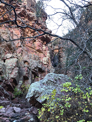
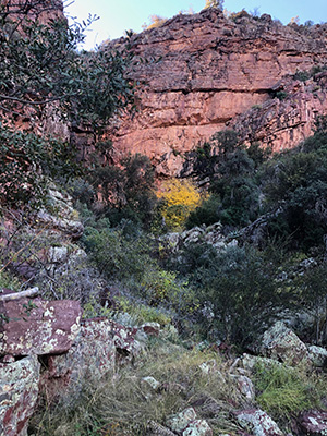
There are many pictures on the internet of the trail’s scenic views east over Rye and to the rim. What may go somewhat unnoticed are unique rock layers and geometric shapes produced by heated rock and uplifting. At a sheer cliff spot, there is a popular waterfall on the trail. Although not flowing well today, in the Spring the fall attracts many hikers and provides impressive pictures. Following is an article from the Payson Roundup, provided by Burt: Barnhardt Trail | Hiking & Trails | paysonroundup.com.
|
|
| Delicate patterns in the rocks and vegetation. [photos by Burt] | |
Once the lead hikers reached the falls, they turned around and radioed their intent to the leader who they easily met up with. Coming down, we met a few other hikers and four trail runners who had ran up the Y Bar trail, looped around, and down the Barnhardt! As we arrived at the parking lot, there were a few more vehicles and people, and fortunately our two turn-around hikers were waiting patiently. We left on the same bouncing road to pavement and turn south back to Target, arriving on time.
Thanks to all for a another great hike.
Note: these links are temporary. Look at the pictures while you can.→ More pictures, by Scott.
→ More pictures, by Burt.
 Top of Page
Arizona Trailblazers Hiking Club, Phoenix, Arizona
Comments? Send them to the AZHC .
updated November 27, 2022