Outdoor Links
Hike Arizona
Trip Planning Guide
Trip Report Index
Calendar of Events
Library
|
Blue Ridge Day Hike Mogollon Rim August 27, 2022 by Tamar Gottfried |
|
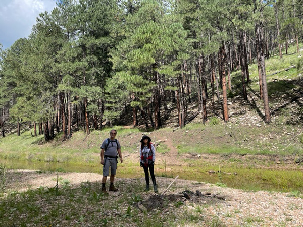
 Blue Ridge, here we come! [photo by Li] |
| Li, Tamar, Chris, Terry, Ann, Maggie |
|
After a few last minute drops and adds to the hiking roster, 6 Trailblazers convened in Pine at the summer cabin to drop off food for lunch. We then arranged ourselves into 2 groups, one heading for the Northern boundary of the hike at the Moqui Campground and one heading out to Forest Roads 300, 123, and 123A. The Northbound group of 3 of us easily drove along the rim road, noting some amazing views and very little traffic. We easily found the 123 turnoff and paid attention as the path got more narrow, going through some pools of leftover rain water. At the 5.9 mile point, we began looking for the 123A and found only a 123E sign. We turned there and followed it for about half a mile until it became increasingly apparent that this wasn’t our road. When I pulled up our hiking route on GPS, we were actually going further away from the Arizona Trail, not closer to it. We turned the Jeep around and headed back to the 123, navigating with GPS open. Turning back the way we came, we saw what looked like a small road just a few minutes back. Following that road, we got closer and finally intersected with the Arizona Trail! We parked the car just off the trail and started our hike. A few minutes into the hike, we finally saw a sign confirming that we were indeed on the 123A road. The trail followed the road for a bit and then passed through a gate. We then followed the trail down to East Clear Creek, which was very clear, but not much of a creek. It was, however, deep enough to wet above our ankles without any stepping stones, so we followed it down a bit to an easier crossing, and then went back to meet the trail. The next bit was a lot of up, and after a little over 3 miles of hiking, we heard from and then ran into the Southbound group of hikers. We stopped for a snack and a photo. They were further into their hike—over 5 miles, because it had taken us an hour on the dirt road to get to our starting point, and they had a much quicker drive to a trailhead right off the highway. |
 Let’s talk this over in the shade. [photo by Tamar] |
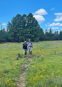 Arizona Trail. [photo by Li] |
We parted ways and continued on our trail with the increased amounts of mud and bugs our compadres had warned about. In most places, we could find a path along the trail without as much mud and water. This area must have received a lot of rain in the past days! We passed through fields full of flowers (which were brown and bare the last time the Club did this hike in 10/2018), and began our descent. We passed through the very nicely groomed Blue Ridge Campground and finally make our way to the waiting car, kindly left by the other group. The car was a welcome sight as the heavens looked ready to drop a bit more rain and the rumbles of thunder were becoming more frequent. |
 Fields full of flowers. [photo by Li] |
|
We drove back down the road towards Pine and convened at the cabin, where the Southbound group had just arrived and where Trail Angel Jim had burgers grilled and ready in case the rain started. We set up a cornucopia of salads and apple cake and had a relaxing lunch before we parted ways. It was a lovely day of green trails, relative solitude, cool breezes and great company! |
 In the kitchen. [photo by Ann] |
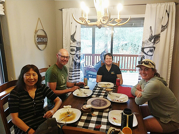 Enjoying the repast. [photo by Ann] |
 Guys relaxing on the porch. [photo by Ann] |
 Top of Page
Arizona Trailblazers Hiking Club, Phoenix, Arizona
Comments? Send them to the AZHC .
updated September 6, 2022