Outdoor Links
Hike Arizona
Trip Planning Guide
Trip Report Index
Calendar of Events
Library
San Tan Regional Park
April 24, 2021
by Rodney Baba
 Trailblazers near Middle Mountain. [photo by Rodney] |
| Rod, Billie, Donna, Laura, Diane, Gail, Carl, Neil |
|
Seven intrepid hikers met early Saturday morning for a hike through San Tan Regional Park. Rod displayed the contents of a first aid kit and a survival kit on the back of his truck while people signed in. The park was extremely congested. In addition to the normal weekend crowd, there were remnants from the Friday night riders ’ group and several groups of Pat Tillman runners. After introductions, Rod reviewed hiking etiquette and safety protocols to ensure that everyone had a safe hike. The hike began with a leisurely stroll south along the broad road like San Tan Trail. After about one mile, we turn SSW onto the Hedgehog Trail. After ½ mile of gentle upslope (~100' elevation gain) we reached a saddle through what the locals call “Middle Mountain”. We paused for a moment to take a group picture while Rod gave a brief history of the area and the park. Rod showed everyone a Fishhook Barrel Cactus and dispelled the myth of getting water from cactus. |

|
|
After another ¼ mile and we reach our first stop for a breathtaking view of the Malpais Hills to the south. Rod talked about how the Malpais Hills and the San Tan range was formed. Rod explained the “rule of three” distress signals, visual distress signals and gave some hiking tips. After short descent, we took the San Tan Trail west and wound our way through the arroyos between Middle Mountain and the Malpais Hills. Rod pointed out a couple of species of Cholla Cactus and dispelled the myth of “Jumping Cholla” and got a big “Au Contraire” from Carl. |
 A tangle of branches. [photo by Rodney] |
 Jumping Cholla. [photo by Rodney] |
 Diane, Gail, Laura, Carl. [photo by Rodney] |
|
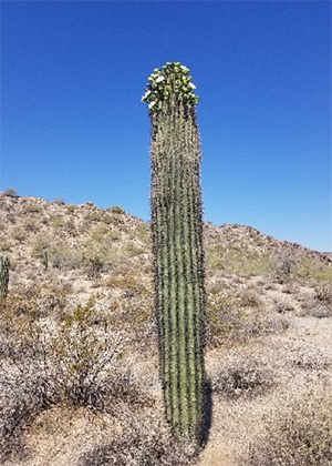
As we hiked, several hikers noticed flower buds on Saguaro Cactus. Rod noted that
the fruit of the Saguaro, Prickly Pear and Prickly Pear pads are edible. |
 Saguaro in bloom. [photo by Rodney] |
 Like this hillside? [photo by Rodney] |
|
After 1½ miles the trail turned north to the top of a rise, where we will take another break and enjoy the view northwest towards Chandler. |
 What a view! [photo by Rodney] |
|
We took a snack break while Rod talked about how most of Arizona was once underwater and the progression to the desert of today. |
 Donna and Billie snacking. [photo by Rodney] |
|
We dropped into a dry streambed and proceeded north through a gap on the west side of Middle Mountain. After a mile, we passed the junction with the Dynamite Trail and continued east. We stopped at a bench and Rod gave away the first aid kit (Gail) and the survival kit (Laura). After the “Its all downhill from here” myth was disproven, we met the Goldmine Trail. Along the way several old roads can clearly be seen on the back of the Goldmine Mountains. We turn south on the Goldmine Trail for a mile back to the trailhead. Several hikers went to see the Desert Tortoise Pens in the Nature Area, but no Tortoises were sighted. 5.86 miles and 400 feet total accumulated elevation gain. Thanks to everyone who accompanied me on my first hike as leader! |
 Top of Page
Arizona Trailblazers Hiking Club, Phoenix, Arizona
Comments? Send them to the AZHC .
updated April 26, 2021