Outdoor Links
Hike Arizona
Trip Planning Guide
Trip Report Index
Calendar of Events
Library
|
Garden Valley Archaeology Superstition Wilderness January 30, 2021 by Ted Tenny |
|
 Trailblazers ar First Water. [photo by Ted] |
| Ted T, Jeanne, Randall, Ken, Li, Ted S, Vicki, Karen, Joe, Jeff, Karen, Tom, Cindy, Tamar, Laura, Quy, Kim |
|
17 fantastic Trailblazers set out from the First Water Horse Staging to seek their fortunes. |
 Apache Gap Mountain. [photo by Ted] |
 Superstition Ridgeline. [photo by Ted] |
|
We split up into three groups at the trailhead:
The Dutchman’s Trail is named after Jacob Waltz. Although he was known as the Lost Dutchman, he was German. On his death bed he mumbled something about “where Weaver’s Needle casts its shadow at 4:00 in the afternoon” (of course, this is a different place every day of the year). Nevertheless mining companies were formed. You can still see the location of Williams Camp on the Bluff Spring Loop hike, and where they went digging in the rocks on Bluff Spring Mountain looking for gold. All they ever found was more rocks. |
 Water, after recent rains. [photo by Joe] |
|

|
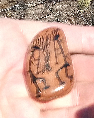
| Some of the rocks have designs on them. [photos by Joe] | |
 Who took a cleaver to the rock? [photo by Ted] |
 Arrowheads. I left them alone. [photo by Ted] |
 This is rugged country. [photo by Ted] |
 They had plenty of building material. [photo by Ted] |
 This Hohokam dwelling once housed 30 people. [photo by Ted] |
|
Quartz has a lower melting point than other minerals. So the quartz stays liquid while the other minerals solidify. It flows between the cracks in the rocks. Eventually the quartz solidifies. It sticks to one of the rocks. When the rocks break apart, we have a sugar-frosted rock. |

|
 Each color of lichen is a different species. [Ted] |
 Vicki finds water by the trail. [photo by Ted] |
 Layers of rock are tilted in the same direction. [photo by Ted] |
 Tuff Dome, Golden Dome, Peak 3141, and explorers on Dog Face Rock. [photo by Ted] |
|
My group hiked to the Hohokam ruin in Garden Valley on the Dutchman’s and Second Water Trails, then we came back the same way. Jeanne, Karen M., and Joe chose to hike the road from First Water Trailhead to the Horse Staging area, while I took the Dutchman’s Trail. Everyone got back to the trailhead safely. → More pictures, by Quy. |
 Laura, Tamar, Kim, Quy, and Karen M. [photo by Quy] |
 Those are rugged cliffs, north of Garden Valley. [photo by Quy] |
|
Supplemental Report by Li Li |
|
Eight of Trailblazers opted to do the 10½-mile Black Mesa loop hike. We started at the same place as the other groups, the Horse Staging Area. After introductions we quickly took off, since we knew that we would have a long way to go. We passed the relatively flat area and then started gradually going up. The trail was slightly muddy due to recent rains, but we did not see many puddles in this area. After about 2 miles we reached the trail junction of Black Mesa and Hackberry Trails. There is Indian ruin in the little hill area. Some group members went up for to look at the ruins, while the rest of us stopped to shed off extra layers of clothes and enjoy our first small break. We could see from far away the the snow covered Four Peaks mountain tops. Tamar’s 5.7-mile group met us here, and after our small break, we parted with them and went right, continuing on the Black Mesa Trail. We started going up the hill, and soon reached a burn area. We were joking that the name Black Mesa came from the area being charred. After we passed some saguaros, the views became more appealing, with Weaver’s Needle ahead of us on the left. We walked fast while absorbing the delightful mountain view and fresh air. After a few ups and downs scrambling through rocks, we reached a flat area where we could see Weaver’s Needle. We took a group picture and had a small snack and water break before continuing southeast on the Black Mesa Trail. We saw a few hikers with their dogs and a few backpackers along the way, though the trail was relatively empty apart from us. Randall who was a fast hiker, stayed in the back to keep Karen and our new members company. Jeff, who was also our new member, joyfully took pictures while staying in the back of the group with them. Cindy, Ted and Ken eagerly flew down the trail. Tom and I stayed in the middle, taking pictures and keeping our eyes in the front and back to make sure everyone was within our view. Despite the recent days of rainy weather, this part of the trail was left relatively dry, and we only saw a few puddles of water on the trail until we reached about 3 miles from the end of the trail. The water crossing was totally dried out this year. Ted pointed out that there are some waterfalls nearby. I was surprised, since I did not realize any waterfalls were near here. It turned out there were some small waterfalls formed from accumulated rain water flowing through this part of the trail, which provided pleasant waterfall sounds that accompanied us along our path. We passed a few burned areas, with the smell of smoke still lingering in the air. After 10.5 miles and about 600 feet elevation change, we all reached the trailhead safely. The whole group of eight had relatively the same speed, so we did not need to wait for each other, since we reached the trailhead at almost the same time. At 1:00 PM we finished the hike, with everyone having a good time! We ended the hike by waving goodbye and parting our ways for the weekend. |
 Trailblazers at Yellow Peak. [photo by Li] |
| Karen B, Randall,Jeff, Ted S, Li, Ken, Cindy, Tom |
 We can see Weaver’s Needle ahead. [photo by Li] |
 Let’s wait here. [photo by Li] |
 We’re leaving Boulder Basin. [photo by Li] |
 The water crossings were easy. [photo by Li] |
 Climbing the Dutchman’s Trail after leaving Boulder Basin. [photo by Li] |
 Randall [photo by Li] |
 Ken [photo by Li] |
 Karen [photo by Li] |
 Cindy [photo by Li] |
 Ted S [photo by Li] |
 Jeff [photo by Li] |
 Tom [photo by Li] |
 Li [photo by Li] |
 Top of Page
Arizona Trailblazers Hiking Club, Phoenix, Arizona
Comments? Send them to the AZHC .
updated February 1, 2021