Outdoor Links
Hike Arizona
Trip Planning Guide
Trip Report Index
Calendar of Events
Library
|
Highlands Trail to Kachina Wetlands Flagstaff June 6, 2020 by David French |
|
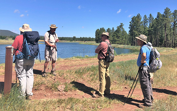
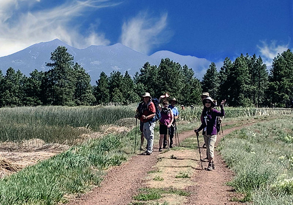
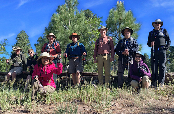 Trailblazers at the junction. [photo by Quy] |
| Dave, Carol, Quy, Michael, Mark, Randall, Chris, Karen, John |
|
On a very cool and breezy morning, nine hikers met at the Yavapai Ramada in the Fort Tuthill County Park just south of Flagstaff. The temperature was about 55 degrees and warmed up to 65 degrees when we completed the hike. With the breeze, it never felt particularly warm. Everyone arrived before 8 AM and we got the hike underway shortly thereafter, sort of. I had hiked this trail once before and had trouble finding the starting point then. We had trouble again today. We started out on the road that led us toward the amphitheater but that soon dead ended so we bushwhacked up a little hill to an unpaved road, and I saw the gate that told me we are on the right route. |
 Finding the trail. [photo by Quy] |
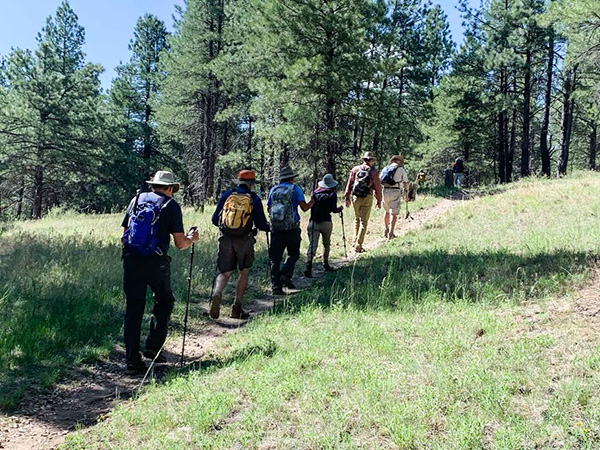 We’re off on the trail. [photo by Quy] |
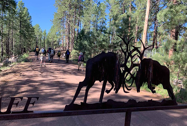 When you can see this gate you’re on the right road. [photo by Quy] |
 Trails are well marked. [photo by Quy] |
 Oh, is it up there? [photo by Quy] |
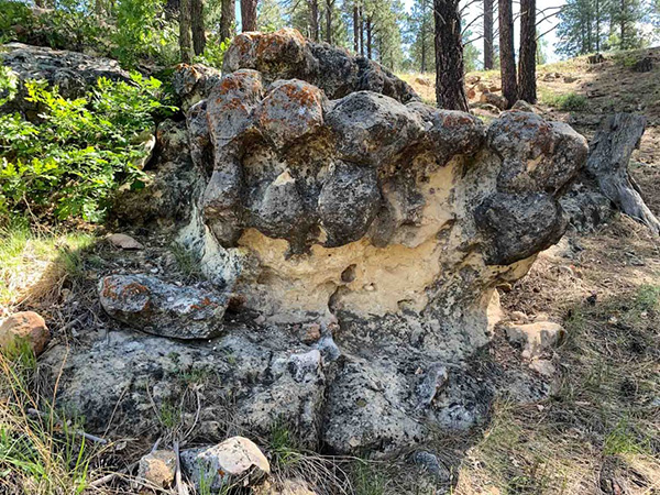 Dragon’s mouth. [photo by Quy] |
 Tall trees provide a little shade. [photo by Quy] |
 Split personality. [photo by Quy] |
 Lean on me. [photo by Quy] |
|
For future use, from the parking area for the Yavapai Ramada, go straight west, the way you came in, turn left on the second road which heads uphill and quickly becomes unpaved. When you see the metal gate with clashing elk for the Flagstaff Archers, you know you are on the correct route. The Soldiers Trail crosses the road and is well signed so turn right and then left onto the Highlands Trail. We hiked a little way south on the Highlands Trail to a junction where you can go left or right on a loop. That is where we took the group photo. I waited to make sure Quy, our primary photographer, got her gear stowed and her pack back on and we headed right to go counterclockwise on the Highland Loop. After hiking about a half mile, I got a call from one of the hikers who asked which way did you go? I said we went right. “Oh, I went left.“ Apparently, she turned her back and was working with her pack and did not see us leave. Reminder to hike leaders: count noses after each break. |
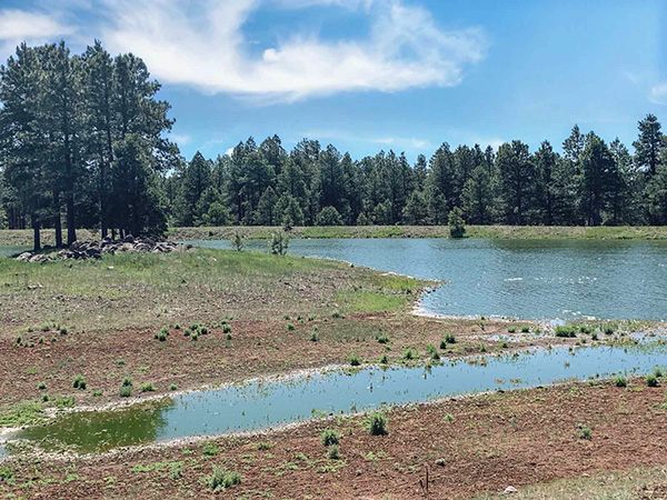 Made it to the Wetlands. [photo by Quy] |
 We have arrived. [photo by Quy] |
 Now listen up. [photo by Carol] |
 Hiking around the wetlands. [photo by Quy] |
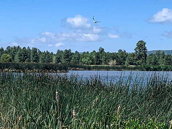
 You can see the San Francisco Peaks from the lake. [photo by Quy] |
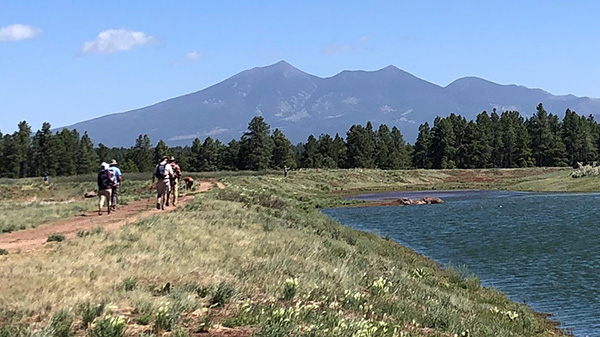 Peaks in the distance. [photo by Carol] |
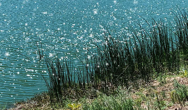 Sunlight sparkles on the water. [photo by Quy] |
|
The Highland Trail loop completes when you get to US 89A. From that point on, the Highland Trail is an in and out to the Kachina Wetlands. Overall, the trail is gently rolling across the San Francisco Plateau. The trail is mostly single track, and in some places, very narrow and rutted by bikers. We encountered a few hikers and bikers along the way. At one point the trail was just outside a few houses that are in the Highlands development. We could also see I-17 a couple of times after we crossed US 89A. Otherwise, the trail is in a nice forest with no development in sight. The Kachina Wetlands is a cooperative effort by the Arizona Game and Fish Department, Coconino County, and the Forest Service. They created a series of ponds to store water and create a wetland to attract birds and mammals. Some of the water is treated effluent from a county sewage treatment plant located just to the south to serve Kachina Village. Besides some great views of the San Francisco Peaks in the distance, we were pleasantly surprised by the size of the ponds and the birds and waterfowl. There was a flock of Canadian geese as well as some ducks, raptors and other birds. Unfortunately, we did not get many photos of the wildlife. |
 The trail is double-track here. [photo by Quy] |
 A lone, wild bird. [photo by Quy] |
 Heading back. [photo by Quy] |
 Crossing US 89A. [photo by Quy] |
|
After hiking around the largest pond, we stopped for a snack break and managed to find the windiest place on the whole hike. Afterwards we returned on the same trail, crossed US 89A and took the other half of the loop back to where we started. We had no trouble finding the path back to our cars. |
 Wildflowers in abundance! [photo by Quy] |
|
Some of the hikers stopped at the Wondering Donkey for Mexican food in Munds Park. Hiking stats: 8.5 miles, 3 hours, 50 minutes, 800' elevation gain, 6819'-7141' elevation range. |
 Top of Page
Arizona Trailblazers Hiking Club, Phoenix, Arizona
Comments? Send them to the AZHC .
updated June 8, 2020