Outdoor Links
Hike Arizona
Trip Planning Guide
Trip Report Index
Calendar of Events
Library
|
Latigo Whiskey Bottle Loop McDowell Sonoran Preserve March 23, 2019 by Quy Nguyen |
|
 Trailblazers at Brown’s Ranch Trailhead. [photo by Quy] |
| Ron, Jim, Ramona, Yanis, Quy, Kimberly, John, Billie, Lin, Carl, Marilyn C, Dale, Marilyn K |
 Plenty of shade at the trailhead. [photo by Lin] |
 What a view! [photo by Quy] |
 Let’s stop and talk this over. [photo by Quy] |
 Barrel cactus growing out of a granite boulder. [photo by Quy] |
 The trail has its ups and downs. [photo by Lin] |
 Hikers pause to enjoy the view. [photo by Lin] |
 Photographers, get ready! [photo by Lin] |
 The Powerline Road is well signed. [photo by Carl] |
 Lin gets the perfect camera angle. [photo by Carl] |
 Don’t fall on me! [photo by Quy] |
From the ramada of Brown’s Ranch Trailhead we walk on the road 0.1 mile to Latigo Trailhead. Turn right, hike a mile, and take the Rustler Trail. The Rustler Trail involves a bit of climbing, but the trail is not rocky. After hiking 0.7 miles on Rustler Trail, we turn right on Wrangler Trail, travel 1.1 miles, and turn right on the Vaquero Trail. The Vaquero Trail is one mile. We see a crested saguaro on Vaquero Trail. At the junction with Whiskey Bottle Trail, we turn right on WB Trail and hike a mile. We take Latigo Trail and hike 2.3 miles back to Brown’s Ranch Trailhead. All of the trails are mostly flat, with some ups and downs but not much elevation gain. Not rocky, either. That’s the reason we encounter other bikers, horseback riders, and runners on the trails. |
 Bugs like the fiddleneck blossoms. [photo by Quy] |
 Poppies, lupine, and granite boulders. [photo by Quy] |
 Poppies mix it up with a cholla. [photo by Quy] |
 Don’t get stuck on the agave. [photo by Quy] |
 A field of lupine. [photo by Quy] |
 Poppies, everywhere. [photo by Quy] |
 A field of chia. [photo by Lin] |
|
A lot of wildflowers along these trails are out of our expectation: All of us enjoy the beauty of large beds of lupine, desert bells, California poppy, fiddleneck, and glover. → More pictures, by Carl.→ More pictures, by Lin. |
|
Supplemental Report by Jim Buyens |
|||||||||||||||||||||||||||||||||||||||||||||||||
|
Quy, thanks for leading such a great hike! I thoroughly enjoyed it and I’m sure everyone else did too. See everyone next time, Jim |
|||||||||||||||||||||||||||||||||||||||||||||||||
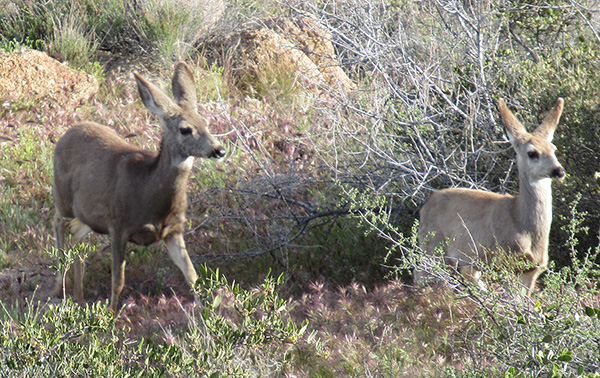 We saw some deer on the hike. [photo by Jim] |
|||||||||||||||||||||||||||||||||||||||||||||||||
 A deer that didn’t run away before my picture. [photo by Jim] |
|||||||||||||||||||||||||||||||||||||||||||||||||
|

|
||||||||||||||||||||||||||||||||||||||||||||||||
 Top of Page
Arizona Trailblazers Hiking Club, Phoenix, Arizona
Comments? Send them to the AZHC .
updated March 27, 2019