Outdoor Links
Hike Arizona
Trip Planning Guide
Trip Report Index
Calendar of Events
Library
|
Phantom Ranch Day Hike Grand Canyon National Park May 26, 2019 by Li Li |
|
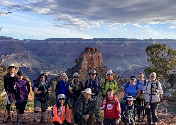
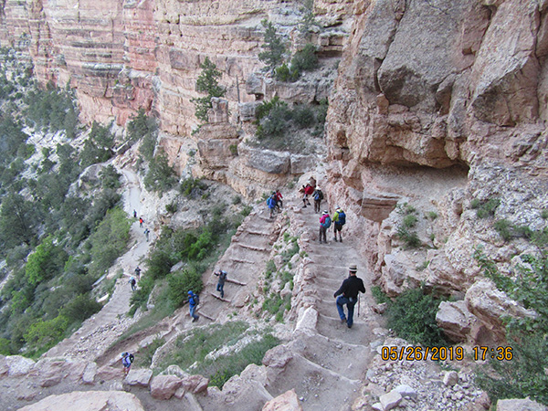
 Trailblazers on the South Kaibab Trail. [photo by Quy] |
| Rudy, Tamar, Debbie, Heather, Tom, Li, Carolyn, Deirdre, Chris, Quy, Terry, Carol |
|
May 25 Conditioning Hike for Grand Canyon 14 Arizona trailblazers headed to Grand Canyon National Park on a Memorial Day weekend. Our plan was to hike Sandy’s Canyon the day before our GC hike to get acclimated and stay at Williams overnight, then head to the Grand Canyon in the early morning for our big hike. Saturday morning, May 25, we met at a Taco Bell parking lot in a chilly morning at Flagstaff for the Sandy’s Canyon hike. Although the temperature was around 50 degrees with little wind, it was cold. We layered up with warm clothes, then did a short introduction after which headed out to the Sandy’s Canyon Trail. I have not hiked from this side of the trail before. We started on the forest road last year. This time we started at Sam’s club parking lot and headed east. After passing a small tunnel under the bridge and walking on the paved road for about half a mile, we saw the signs which directed people to different trails for the inner city hikes. This is also part of the Arizona Trail passage 33, which passes through the Flagstaff area. |
 The trail starts out well enough. [photo by Tom] |
 Which way do we go from here? [photo by Tom] |
|
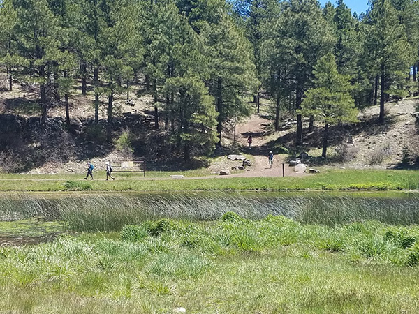
We saw a small pond once the paved road ended. The beautiful tall pine trees in the background and some green grasses in the lake provided some excitement for starting the hike. Then the trail started to gradually ascend a hill. We climbed another mile. Everyone started to feel the heat and began to shed outer layers and sip water. Soon we reached the intersection: one labeled Arizona Trail and another labeled by a name I did not hear of before. Since I’d hiked the Sandy’s Canyon before, I believed that going left was the correct trail, which later proved to be wrong. Other members also thought we should go left, so we took off in that direction. Oops. One more mile in, we saw the opening area with grasses and an open field. We were surprised to see the San Francisco peaks covered with snow. Everyone was excited and started taking pictures and “Ooh” and “Aah”, admiring the natural beauty of the trail. |
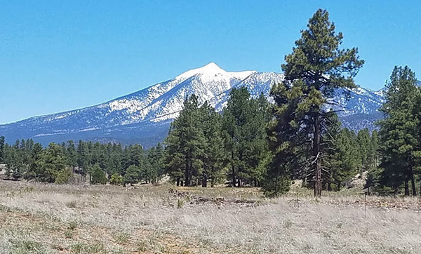 The San Francisco Peaks are snowcapped. [photo by Tom] |
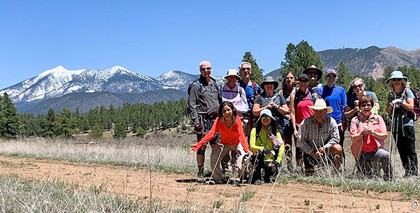 Trailblazers in Flagstaff, with San Francisco Peaks in the background. [photo by Quy] |
|
Suddenly I realized that we were on the wrong trail. After taking group pictures here, we agreed that we would continue this trail until we wanted to stop. This was about 3 miles from our trail starting point. Our goal was to hike 6 miles on Saturday to get conditioned for the Grand Canyon the next day. As we continued this trail, the scene got even better. Although we could not see San Francisco Peaks any more, we saw a creek with the lush green grasses, and the trees were healthy with plenty of water nourishing them. Everyone was happy. In the future we should explore this trail again, since no one in the group had been here before. At about the 3.8 mile mark we turned around, since we had exceeded our mileage goal. |
 Coming down from the hill by a pond. [photo by Tom] |
|
We returned to the trail that we started on and took a small snack break on the way back, then decided to go to the Beaver Street Brewery for lunch. Carol, Terry and Tom took off for REI to purchase a new bladder, poles, and get a backpack fitting respectively, meeting us for lunch afterwards. Everyone had a good time, the service was great and the food was yummy. We cheered for a good hike and went to check out the house at Williams. The house that Michael rented for us was beautiful, sitting on a golf course in the forest land. The house had a rustic look, with log beams and rustic log beds in the bedroom. It was large enough for 8 people but we had 12, so a few had to sleep on air mattresses. After a while, we settled in well, warm and cozy. We had delicious yummy food that everyone cooked for the potluck that covered the dining room table and promised great leftovers. After dinner, Rudy brought out his guitar to give a wonderful performance. We all cheered again for the good day we had in Flagstaff, the first day of our weekend. We ended the evening by 10 PM, because we had to get up at 2:30 AM Sunday morning to prepare for the drive to the Canyon. |
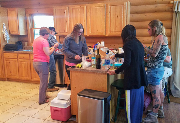 Preparing the potluck. [photo by Tom] |
 Let’s chow down! [photo by Tom] |
|
Grand Canyon Memorial Day Hike: May 26, 2019 The twenty-sixth of May was the day of our big hike. Everyone got up early to catch the 5 AM bus to South Kaibab Trailhead. We could not wait to check out the Grand Canyon’s beauty. Carol, Carolyn and Heather were first timers hiking into the canyon. Although this was the second time for many of us, we were equally as excited. |
 We have to start early. [photo by Tom] |
 South Kaibab Trail, here we come! [photo by Tom] |
 Trailblazers on the South Kaibab Trail. [photo by Quy] |
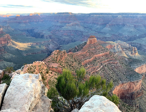 O’Neill Butte is named for Bucky O’Neill. [photo by Tom] |
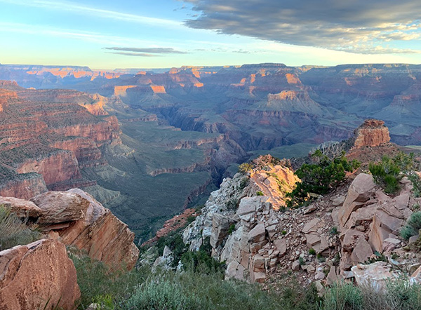 Dawn paints the Grand Canyon. [photo by Li] |
 Abandon elevation all ye who enter here. [photo by Li] |
 The lower slopes are deceptively smooth. [photo by Li] |
 Hikers descending. [photo by Barbara] |
We hiked down the first few miles in no time, even shooting lots of photos, and reached our first stop at Cedar Ridge at 6:30 AM. Rudy waited for his group and howled to signal us that he was there waiting. I caught him in a photo when I was up in the canyon looking down at Rudy sitting on a rock and relaxing. Barbara and Bettye, sweeping in the back, took the best pictures of the group descending into the canyon. We took the group pictures and had a small break at Cedar Ridge. There was no water station but there was a bathroom at this stop. This was the point that our Rim group stopped. From here on you would have a very steep descent. Our Rim group started going back up to the trailhead and explored the upper canyon while my river group continued our journey to our next stop, Phantom Ranch. |
 We’re all in this together. [photo by Tom] |
 A’down we go. [photo by Barbara] |
 Yes, we’re going all the way to the bottom. [photo by Tom] |
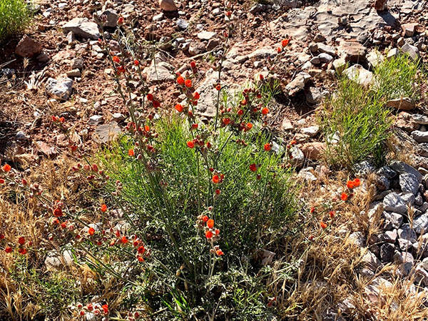 Globemallow cheers us on the way. [photo by Tom] |
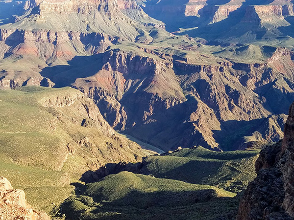 First view of the Colorado River. [photo by Tom] |
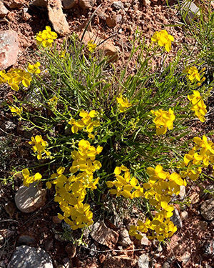 Wildflowers cheer us [photo by Li] |
 There’s the bridge! [photo by Tom] |
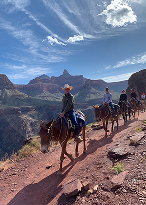 Mules. [photo by Barbara] |
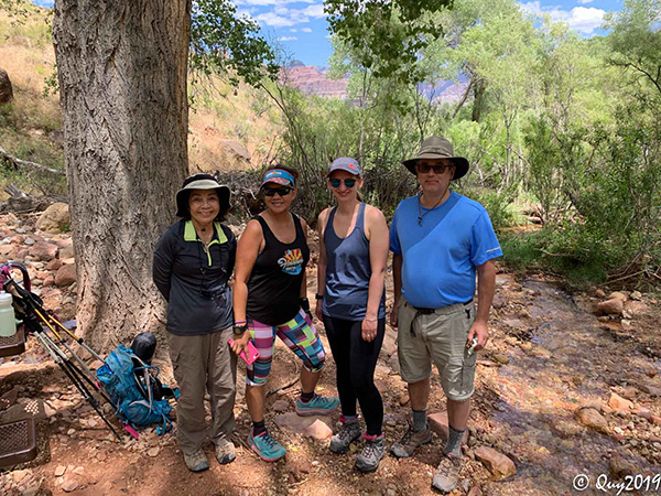
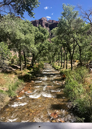 Phantom Ranch Creek. [photo by Diva] |
|
Carolyn and Chris were the strongest hikers in the group. In no time, we could not spot them any more on the trail and they were all the way down into the canyon. I was glad that almost everyone, except Tamar who had a GPS, in our river group had a radio so we could communicate with each other. Quy was our wonderful photographer and was also ahead of us on this hike. Tom, Tamar, Terry, Debbie and I were in a group heading down to the river. We stopped at Skeleton Point, took pictures and shed a layer of clothing and continued down to the Tipoff. This is another big stop with an intersection where the Tonto east and the Tonto west trails separated. In the middle is the trail leading to Phantom Ranch. We normally would see mules train in this area, but not today. Five of us took a small break and continued heading down to the canyon. One mile after the Tipoff we met a mule tour group. The tour guide gave us a description of the history of the canyon. I hope that next year I can do the tour. It seems like a very interesting thing to do for the canyon trip except riding the mule in the canyon might be a challenge for many of us. After miles of descent, we finally saw the Colorado River and the Black Bridge, which means that we were close to Phantom Ranch. Debbie was waiting for us in front of the tunnel before getting on the bridge. There was a guy who also stopped there with whom I had a conversation. He led an international group of hikers to Grand Canyon for a tour. His company name is Pioneer Horizon, located in Williams, Arizona. He told me the night before he had led another group to climb up the canyon with the same route we were doing and finished at 11 PM, so it was pretty tough for him to do the same hike the day after. But he seemed very strong and high spirited. His groups consist of people from South America, Asia, Africa, Europe and the other cities of the United States. I found that on this hike you can meet lots of interesting people and learn their lives and stories. It was a great experience for me. |
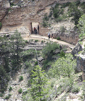
 The tunnel is big enough. [photo by Tom] |
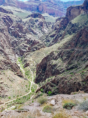 Devil’s Corkscrew. [photo by Tom] |
 Rapids on the Colorado River. [photo by Tom] |
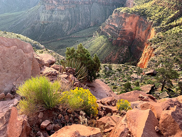
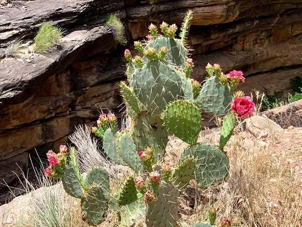 Prickly Pear has a magnificent view. [photo by Tom] |
|
After we passed the short, dark, and cool tunnel, we saw Black Bridge in front of us. This bridge was designed by Ward Webber and constructed by John Lawrence. The bridge was finished in 1928. Tamar, Debbie, and Terry all passed the bridge. Tom and I were busy taking pictures. I did not realize that there were mule trains approaching the bridge from the other direction. I heard the voice from the other end shouting and telling me to go back to the end of the tunnel again after we had reached the halfway point on the bridge. The mule train which carries the mail had come. Since mules have the right of way, we would have to back out the other side of the tunnel where we started. It was discouraging for me but Tom was excited, wanting to see the mules on the bridge. We did not get to take pictures of the mules on the bridge since we had to return all the way past the tunnel. I was able to get the picture of the lady wrangler leading the mules. After successfully passing over the bridge, I met Carolyn, Chris, and Diva, who were ready to climb up the Bright Angel Trail. They had waited a long time for us, but were ready to move on. We took a picture and waved good bye, then headed to Phantom Ranch to meet Tamar, Terry, and Debbie. We had our lunch, drank the best lemonade in the world at Phantom Ranch, wrote our postcards which would be carried by the mule train to the South Rim, and posed for pictures. |
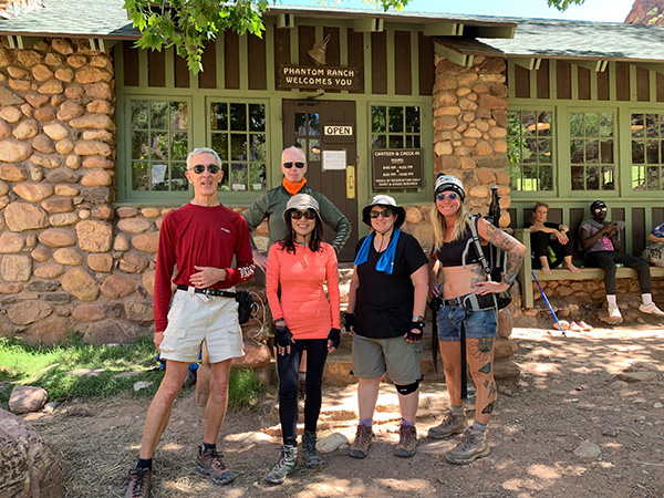 Made it to Phantom Ranch. [photo by Barbara] |
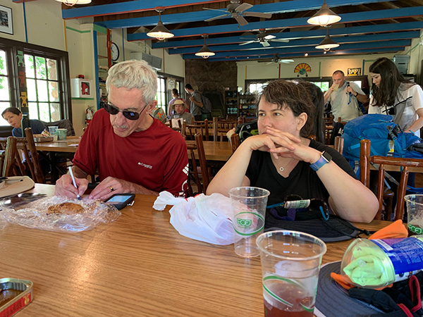 Tom and Tamar at Phantom Ranch. [photo by Barbara] |
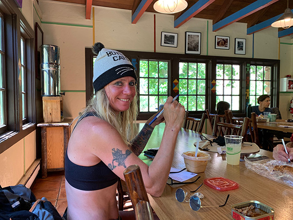 Debbie enjoys the best. [photo by Barbara] |
|
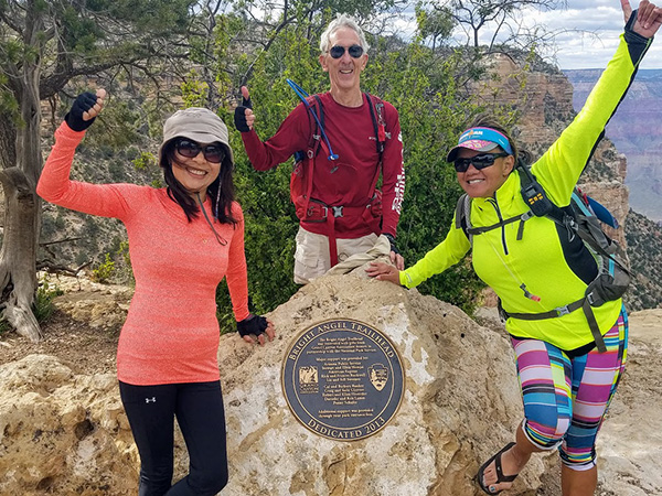
Returning to the top was the hardest part of the hike. Although the total ascension is only 8.4 miles from Phantom Ranch to Bright Angel Trailhead, the elevation change is about 5000 feet. We started ascending on the Silver Bridge. This is a little smaller compared to the Black Bridge, although it may be the same distance above the Colorado River. It was built in the 1960s. Two miles on the Bright Angel Trail, I noticed that the trail is ground from previous loose rocks and compacted dirt changed to soft sand. I was wondering if this was the river bed before, although it is high above the river bed now. The weather started to get hot while we started ascending, which made it more difficult for hikers. Luckily about 1.5 to 2 miles from the Silver Bridge there was a creek along the trail, providing a water source so hikers would stop and soak their clothes and hats in order to keep their core temperatures down and prevent hyperthermia. After the many switchbacks on the Devil’s Corkscrew, I spotted Debbie and Tom in the canyon down below. We communicated through radio since I saw another mule train pass by on this narrow trail. We met again after ascending about 2.5 miles. Here we waited a while for Tamar and Terry, but were not able to see them and decided to move on. I radioed Carolyn and Chris, but was unable to hear anything from Quy. I told Debbie that she could go ahead of us. She found Quy, Carolyn and Chris waiting for us at the Indian Garden stop. |
 The fabulous four. [photo by Quy] |
|
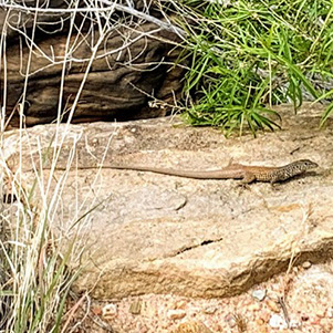
It seemed that the other half of the trail to the Indian Garden was much longer than I thought. The weather was hot at 11:30 AM. I did not see any deer like I had last year. I did see a long tailed lizard posing for a photo opportunity. Tom and I finally saw a waterfall, and I knew that we were close to Indian Garden. The weather now even hotter after our long ascent, Tom dipped his shirt and hat into the cold creek to cool down. He wanted to keep his reputation as a “cool guy”. |
 Now don’t run away before I get a picture. [Tom] |
 Even a cactus needs water. [photo by Tom] |
 4½ miles to go from Indian Garden. [photo by Tom] We stayed in the Indian Garden for about one and a half hours before leaving and starting the big ascent together up Jacob’s Ladder. Soon Tom and I were ahead again when we reached the 3 Mile Resthouse and started noticing more people along the trail that we hiked, now tired and worn out. We huffed and puffed through the many switchbacks and finally saw Mile-and-a-Half Resthouse, the last stop before the trailhead. I had to say that last mile was the hardest for me. If Tom was not there waiting I would have just lain on the rocks, not wanting to go on. I really appreciated his team spirit and his funny jokes kept me going. Also entertaining was watching people from the Rim who were walking down the trail in sandals or tennis shoes. One lady going down carried her large purse and an equally large shopping bag. Apparently, no one was thinking about how hard it would be climbing back to the Rim. |
||||||||||||||||||
 “We Are, Climbing, Jacob’s, Ladder.” [photo by Tom] |
||||||||||||||||||
|
The sun started to set. We saw more people coming down the trail and I realized that we had finally reached the end. Past the two tunnels along the trail, we saw the Kolb Studio on the cliff side. I remembered last year, Mark and Cecilia waited and greeted us at the finish line and the smiles on their faces were like the sunshine brightening our path. This time, Tom and I crossed the finish line together. I truly appreciate his thoughtfulness. Though he could have finished ahead of me, he waited for me to finish at the same time. |
||||||||||||||||||
 Made it to Bright Angel Trailhead. [photo by Tom] |
||||||||||||||||||
|
We met Diva, who was sitting by the trailhead and waiting for the rest of our group coming up. She had stayed at the Phantom Ranch the night before and came up with Carolyn and Chris after meeting them at the Ranch. She showed us way to the Bright Angel Lodge bar. We could finally stop walking and sit down. |
||||||||||||||||||
 It’s all over. Might as well relax. [photo by Quy] |
||||||||||||||||||
|
We met Carolyn, Chris, Quy and Debbie at the bar to celebrate the successful hike. We had beers, drinks, and some food and felt so much better. Tamar and Terry joined us around 6:30 PM. Everyone made it out of this tough hike safe and sound! The weather was getting cold and windy after sunset, and we had to wait for two buses before getting back to our cars. After searching for and finding the cars we headed back to the house for our official potluck dinner. Our Upper Rim group finished their hike earlier and were already heating up food waiting for us. Ralph, who drove from Flagstaff, joined us for the celebration potluck and brought a chocolate cake. We arrived at the house around 9 PM, tired and starving after 18 miles of hard hiking. Food tasted so delicious after the simple food we ate on the trail. We were so happy that we had a memorable hike on this wonderful Memorial Day weekend! P.S.
Li → More pictures, by Tom and Li.→ More pictures, by Quy. → More pictures, by Carolyn. → More Sandy’s Canyon pictures, by Li. → More Grand Canyon pictures, by Li. |
|
Supplemental Report by Rudy Arredondo |
|
After hiking down the South Kabab 1.5 miles to the first rest stop, the whole group took a picture. After a quick break, 7 of us headed back up. Took the shuttle to the Visitors Center and started our hike. Our first stop was Mather Point. Next stop was Yavapai Point and the Geology Museum. When we reached the village, we took a break at the El Tovar porch rocking chairs. Then on for an ice cream at the snack shop. We were in no hurry, it was pretty leisure. Checked out the Bright Angel Lodge, the Kolb studio gallery and Lookout point. We continued on to Maricopa, Powell, Hopi, Mohave points and got a different view of the village down below. Good vistas, but really no spectacular pictures. We did a lot of people watching also. At Hermits Rest there is a huge fireplace, but not as big as the one on the North Rim Lodge. Next we shuttled back to the Bright Angel Trailhead to welcome the river hikers. After communicating with the river hikers and learning everyone was fine and doing well, our group headed out to Tusayan to view the Grand Canyon IMAX movie. I’ve seen it 30 or more times, and still enjoy it. Then we went back to the cabin and Carol and the girls warmed up the remains of our pot luck for the river hikers. Rudy |
 Top of Page
Arizona Trailblazers Hiking Club, Phoenix, Arizona
Comments? Send them to the AZHC .
updated June 20, 2019