Outdoor Links
Hike Arizona
Trip Planning Guide
Trip Report Index
Calendar of Events
Library
|
Mesa Verde Car Camping Colorado June 8-13, 2018 by John Richa |
|
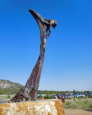
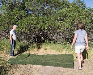
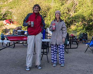
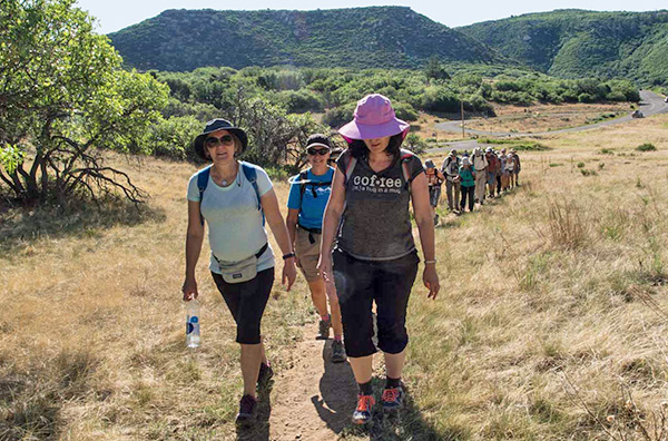
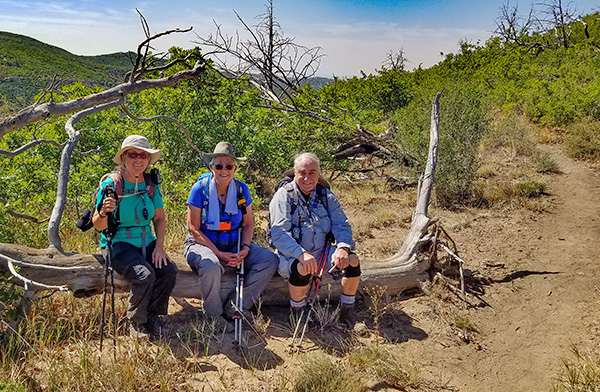
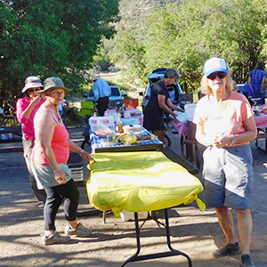
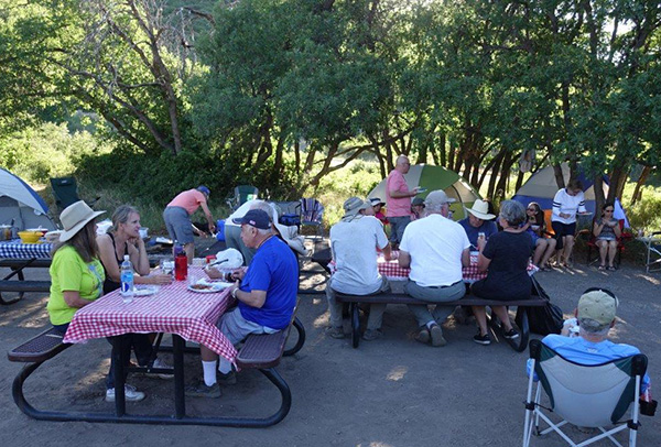
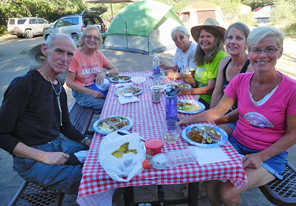
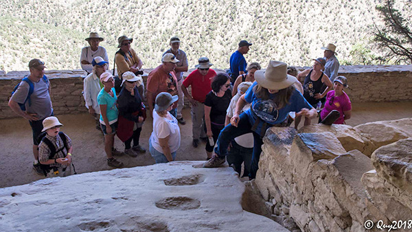
 All together now ... [photo by Quy] |
||||||
|
|
Historical Background of Mesa Verde National Park:
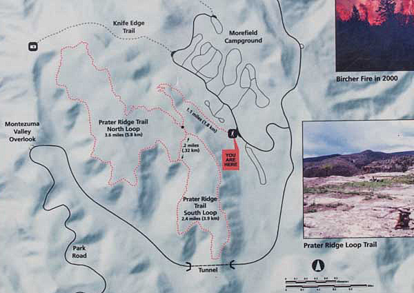
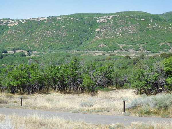
Mesa Verde is a National Park and World Heritage Site located in Montezuma County, Colorado. It protects some of the best preserved Ancestral Puebloan archaeological sites in the United States. Created by President Theodore Roosevelt in 1906, the park occupies 52,485 acres near the Four Corners region of the American Southwest. With more than 4,300 sites, including 600 cliff dwellings, it is the largest archaeological preserve in the U.S. Mesa Verde (Spanish for “green table”) is best known for structures such as Cliff Palace, thought to be the largest cliff dwelling in North America. It is a very popular park with annual visitors of (584,000 in 2016) and its peak visitors’ year was in 1994 with some 700,000 visitors. You will see in the map below that the park is divided into two halves; I would call them east and west halves. Both halves are served with paved narrow roads with lots of ups and downs and curves. The drives are scenic with a number of pull-offs and overlooks that provide spectacular views into four states. As you enter the park your first stop should be the visitors’ center, where you could pick up some maps and brochures and inspect the various displays about the park. That’s your introduction. Starting about 7500 BCE, Mesa Verde was seasonally inhabited by a group of nomadic Paleo-Indians known as the Foothills Mountain Complex. The variety of projectile points found in the region indicates they were influenced by surrounding areas, including the Great Basin, the San Juan Basin, and the Rio Grande Valley. Later, Archaic people established semi-permanent rockshelters in and around the mesa. By 1000 BCE, the Basketmaker culture emerged from the local Archaic population, and by 750 CE the Ancestral Puebloans had developed from the Basketmaker culture. The Mesa Verdeans survived using a combination of hunting, gathering, and subsistence farming of crops such as corn, beans, and squash. They built the mesa's first pueblos sometime after 650, and by the end of the 12th century, they began to construct the massive cliff dwellings for which the park is best known. Using nature to advantage, they built their dwelling beneath the overhanging cliffs. Their basic construction material was sandstone that they shaped into rectangular blocks about the size of a loaf of bread. The mortar between the blocks was a mix of mud and water. Rooms averaged about six feet by eight feet, space enough for two or three persons. Isolated rooms in the rear and on the upper levels were generally used for storing crops. Underground kivas, ceremonial chambers, were built in front of the rooms. The kiva roofs created open courtyards where many daily routines took place. Fires built in summer were mainly for cooking. In winter, when the alcove rooms were damp and uncomfortable, fires probably burned throughout the village. Smoke-blackened walls and ceilings are reminders of the biting cold these people lived with for several months each year. As a matter of fact, the park is closed for tourism from mid-April to mid-October because of the cold weather. The Mesa Verdeans spent much of their time getting food, even in the best years. They were farmers, but they supplemented their crops of beans, corn, and squash by gathering wild plants and hunting deer, rabbits, squirrels, and other game. The soil on the mesa top was fertile and, except in drought, about as well watered as now. The vegetation is also about the same then as it is today, but with less pinyon and juniper. Then, the Ancestral Pueblo people cut pinyon and juniper for building materials and firewood, and to clear land for farming. Their only domestic animals were dogs and turkeys. Fortunately for us, they tossed their trash close by the cliff dwellings. Scraps of food, broken pottery and tools—anything not wanted—went down the slope in front of their homes. Much of what we know about their daily life here comes from these garbage heaps, or kitchen middens (dunghills). By 1285, following a period of social and environmental instability driven by a series of severe and prolonged droughts, they abandoned the area and moved south to locations in Arizona and New Mexico, including Rio Chama, Pajarito Plateau, and Santa Fe. The first occupants of the Mesa Verde region, which spans from southeastern Utah to northwestern New Mexico, were nomadic Paleo-Indians who arrived in the area about 9500 BCE. They followed herds of big game and camped near rivers and streams, many of which dried up as the glaciers that once covered parts of the San Juan Mountains receded. The earliest Paleo-Indians were the Clovis culture and Folsom tradition, defined largely by the way in which they fashioned projectile points. Although they left evidence of their presence throughout the region, there is little indication that they lived in central Mesa Verde during this time. Archaic Period:Besides the Paleo-Indians, the early Archaic people living near Mesa Verde used the atlatl (a stick attached to a sharp object to make it into a spear) and harvested a wider variety of plants and animals than the Paleo-Indians had, while retaining their primarily nomadic lifestyle. They inhabited the outlying areas of the Mesa Verde region, but also the mountains, mesa tops, and canyons, where they created rockshelters and rock art, and left evidence of animal processing and chert knapping. Environmental stability during the period drove population expansion and migration. Major warming and drying from 5000 to 2500 might have led middle Archaic people to seek the cooler climate of Mesa Verde, whose higher elevation brought increased snowpack that, when coupled with spring rains, provided relatively plentiful amounts of water. By the late Archaic, more people were living in semi-permanent rock shelters that preserved perishable goods such as baskets, sandals, and mats. They started to make a variety of twig figurines that usually resembled sheep or deer. The late Archaic is marked by increased trade in exotic materials such as obsidian (black volcanic rock, quickly cooled) and turquoise (soothing to the eye, a sky blue stone/gem). Marine shells and abalone (rock clinging mollusks with flattened shell and slightly spiral in form) from the Pacific coast made their way to Mesa Verde from Arizona, and the Archaic people worked them into necklaces and pendants. Rock art flourished, and people lived in rudimentary houses made of mud and wood. Their early attempts at plant domestication eventually developed into the sustained agriculture that marked the end of the Archaic period, about 1000. Now that you are so well versed in the history and background of Mesa Verde and its inhabitants, let’s delve into the other aspects of our trip. The map shown above is that of the entire Mesa Verde National Park.You will notice on this map that there are two main arteries that divide the park in two halves: The one to the left of the map is the Wetherill Mesa which offers a cluster of hiking trails towards the end of the drive along with sites to visit. The Chapin Mesa road is the one to the right of the map and provides its own unique trails and sites to visit, clustered towards the bottom end of the road shown on the map. Morefield Campground is all the way at the top of the map. The Trip.Seven months in the making. On June 8, 2018., 27 hikers /campers from the Arizona Trailblazers Hiking Club drove up north some 450 miles and converged at Mesa Verde National Park in south west Colorado, for 5 nights of camping and hiking and visiting some historic and archeological sites of early native Indian settlers. Over the next several days, we would learn on the life style, the diet, the abodes, the craft and what caused early settlers to abandon out of the area. Prior to the start of our journey north, we had organized some 13 carpools for the drive north. Some drove straight up on I-17 to 89-A then to Rt. 160 all the way to our final destination. Some others drove up Rt. 87 to I-40 east then took north either Rt. 191 or 491 and finally linked up with Rt. 160. It is an all-day travel. Once you reach the park entrance, you are greeted by a large, very modern and very informative Visitors Center, a must-see center that will serve as an orientation facility as to what to expect. There are several pictorial displays of early native settlers, art, pottery, replicas of various aspects of early life at Mesa Verde. Pictures of the Visitors center will be shown at the end of this report. |
 National Park Service sign. [photo by John R] |
|
|
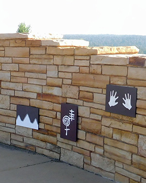
| Artwork at the Visitors’ Center. [photos by John R] | |
 Yes, you should start here. [photo by John R] |
 They have a lot of helpful information. [photo by John R] |
 How’s the view from up there? [photo by John R] |
|
The Campground:
Morefield Campground is seasonally open from April 27 to late October. It is closed for the winter. Located 4 miles inside Mesa Verde, past the Visitors’ Center, it offers 267 camping sites. Each site has a table, benches and a grill. A graveled pad offers a flat surface to pitch a tent. The campsites are situated on loop roads that extend through a high grassy canyon filled with valleys and mountains, amid native Gamble oaks and wild flowers. The trees are short and hence did not provide much shade. The draught has caused the dirt to be pulverized. With no shade provided by trees, the campground was very hot. Several of us brought canopies which helped keep us out of the direct sun. During the day, the tents were extremely hot. Sunset brought a cool breeze. In the early morning as we all started to stir in our sleeping bags, the temperature was in the low 40s, which seemed cold for long time Arizonans. Morefield Campground offered complementary hot showers (18 stalls). There are flush toilets and running potable water. Laundry facilities are also available, as well as a small under equipped grocery store, gift shop and a souvenir shop. |
 Morefield Campground |
|
You can see the general store to the right of the picture. Our group camping sites are at the bottom of the picture to the right. A map of the campground appears below. |
 Morefield Campground |
|
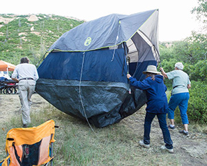
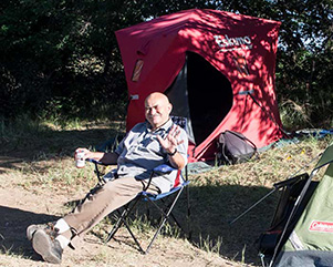
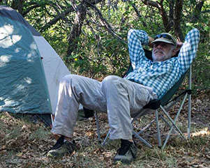
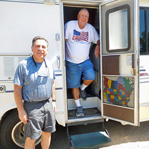
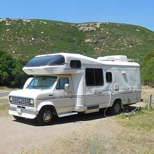
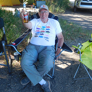
At the top of the campground, there was a large amphitheater where park rangers presented a different topic each night starting at 9:00 PM. Several of us attended these presentations. As participants arrived at the campground, they quickly got busy setting up their tents before darkness sets in. We had two adjacent sites that accommodated most of us, except two folks who wanted to do a motor home camping in style, with air conditioning, shower, flush toilet, TV and a kitchenette among other amenities the rest of us did not have. Once the tents were set up, we relaxed in the cooling evening temperature. First night everyone is for himself/herself as far as dinner was concerned. A few cold beers refreshed our tired souls from a long arduous, hot and tiresome day. |
| This is the life! [photos by Quy] | |
|
|
|

|

|
|
|
|
|

|
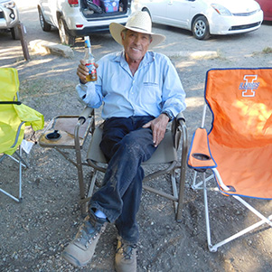
| Camping in style! [photos by John R] | |
|
|
|
Not being able to have a fire pit due to the fire restrictions, by 9:00 PM people started to retire to their tents for a good night’s rest.
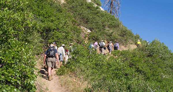
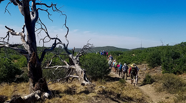
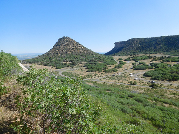
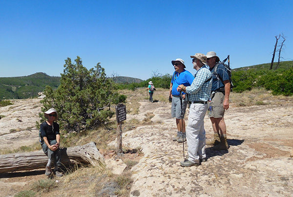
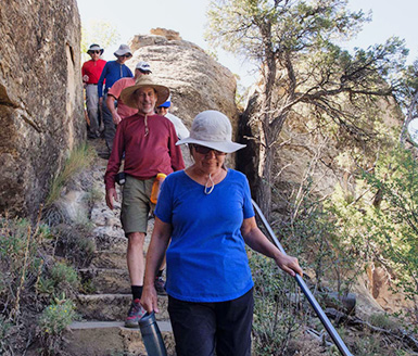
Day One: Saturday, June 9 The roll call for the next morning was set for 8:00 AM. Our traditional group picture was taken and names introductions were made. Instructions were given about our first hike, namely Prator Ridge Trail which started by our campground. It is a 7.3 miles long trail plus access trail. The trail consisted of two loops forming the shape of the numeral 8. The northern loop was slightly longer than the southern loop. Some hikers did the northern loop only, others did the southern loop and the “diehard” hikers did both. It was a hot day with temperatures in the mid 80s. There was no shade on the trail and the sun was punishingly glaring and blazingly hot. Moreover, we were exerting physical effort and carrying some 20 lbs. of water and other supplies in our backpacks. The high elevation and rarefication of oxygen exacerbated our endeavor. But it was worthy of the effort considering the great view of the surrounding landscape from an elevation of 8,500 feet. Below are pictures of the same landscape the native Indians saw every day. |
 Parker Ridge Loop Trail. [photo by Quy] |
 Trailblazers on the march. [photo by Quy] |
 The trail makes a climb. [photo by Quy] |
 The mesa and Prator Ridge trail from campground. [photo by John R] |
 Our campground from the mesa. [photo by John S] |
 Our campground from the mesa. [photo by John S] |
 The long and short trail folks. [photo by John S] |
 Eileen, Sandy, and John take a break. [photo by John S] |
 The view from the mesa. [photo by John R] |
 Getting high (topographically). [photo by John R] |
 The view from the mesa. [photo by John R] |
 They’ve had a fire up here. [photo by John R] |
 Let’s enjoy the view. [photo by John R] |
|

|
| Mid-point on top of the mesa where the two trails meet. [photos by John R] | |
|
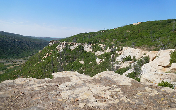
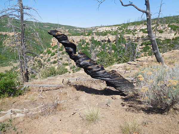
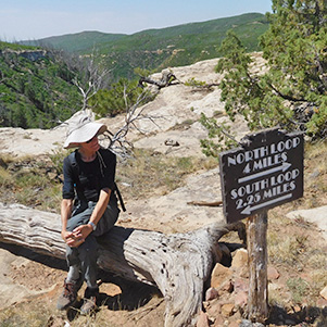
Here is where hikers had to decide to cut it short and return to base camp or continue on the southern loop for a total of a 9 miles hike. Kudos to those diehard hikers. You will notice in the pictures that a wild forest fire several years ago had burned most of the trees on the mesa. |
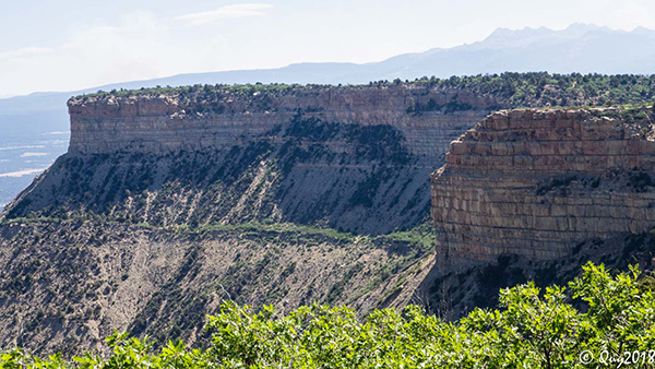 Actually there are many mesas. [photo by Quy] |
 We have a commanding view from the top. [photo by Quy] |
 It’s a long way down from here. [photo by Quy] |
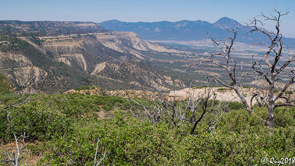 Great views in all directions. [photo by Quy] |
 They don’t call it “Mesa Verde” for nothing. [photo by Quy] |
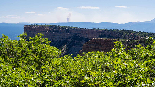 Looks like an Indian smoke signal! [photo by Quy] |
|
Actually this smoke is from the nearby #416 Durango fire. More about it later on. After a long and hot day it is nice to end the day relaxing at the campground, catching what little shade one can find and raise a toast to a successful day. |
| Let’s go easy now. [photos by John R] | |

|
|
|
|

|
|
|
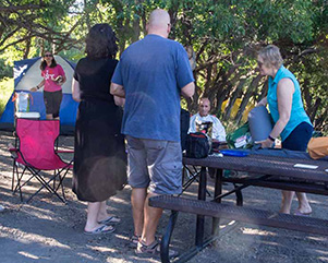
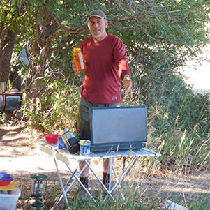
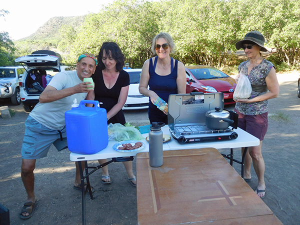
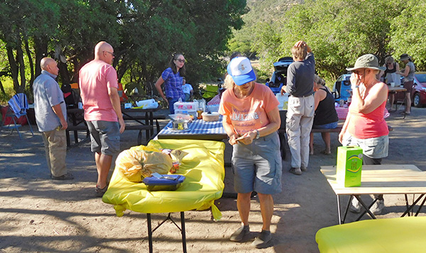
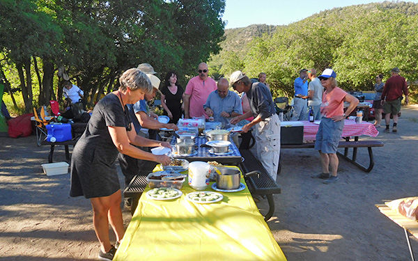
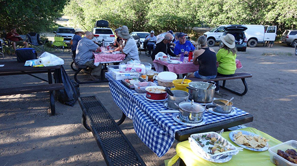
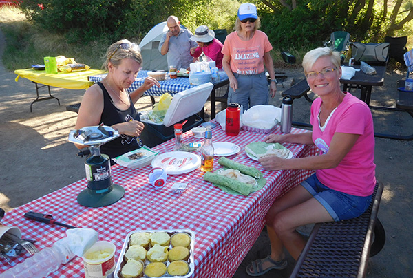
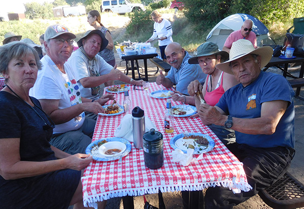
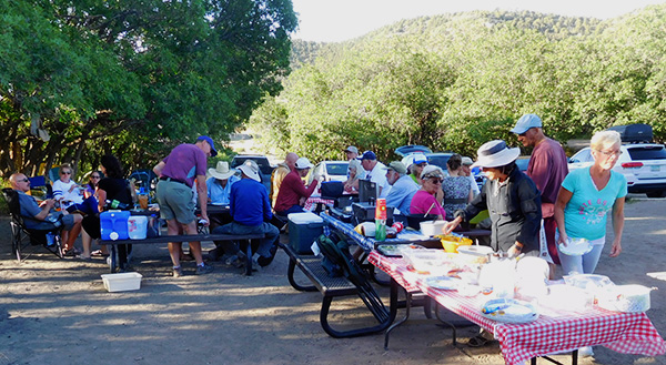
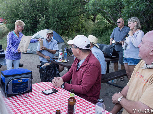
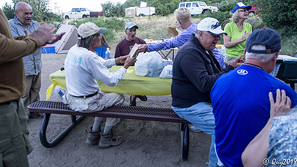
6:00 PM is potluck dinner time. A 2 nights’ menu was pre-agreed upon several weeks before the start of our trip and now it is the moment of truth, of sampling the food. There was a large array of delicious food. The dinner tables set up crew jumped to tackle their task. There was no shortage of help as all idle hands pitched in to help even when they were not scheduled. Ah, what hunger will make people do! After all, the sooner we can set up, the sooner we can start to eat! We were all very hungry. |
| Yum! [photos by John R] | |

|

|

|
|
|
|
|
|
|
|
| Bring on the food! [photos by Yanis] |
|

|
|
| Now this is what you call a potluck. [photos by John R] |
|

|
|
|
 Looks good to me. [photo by Quy] |
 Ah! The desert table! [photo by John R] |
|
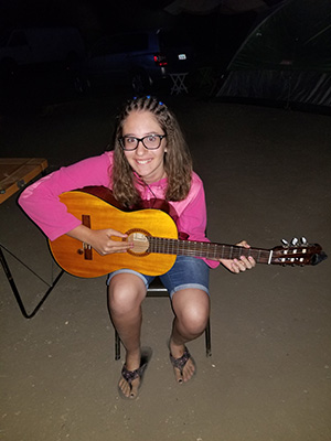
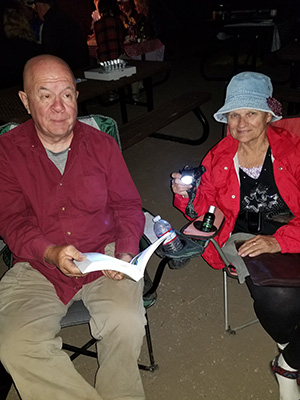
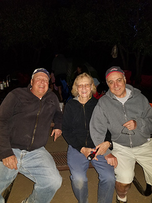
At around 8:00 PM darkness fell upon us. Usually we gather around a pit fire and visit with each other, sing, play games, tell stories, drink our own favorite brew or Rudy’s traditional bottle of brew passed around from mouth to mouth etc. However, this time, due to fire restrictions our pit fire activities for the trip have been scrapped. We then improvised by having a quasi-talent night. Some folks played cards, some played the guitar while some sang along, other celebrated the evening with a cold brew or a glass of wine or some Christian Brothers’ liqueur, and some just shied away from the camera and hid under a sheet. We won’t mention that person’s name though! 9:00 PM or thereby, some folks started to filter out and retire to their tents for a good night’s rest. |
| Talent and social night. [photos by John R] | |
|

|

|
|
|

|
|
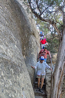
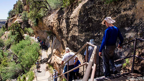
Day Two: Sunday, June 10 Day two was devoted to visiting two park rangers’ guided tours of two cliff dwellings at the Chapin Mesa corridor. The first house was Cliff Palace at 10:00 AM. The drive to Cliff Palace was exciting, as the narrow road meandered along the mountains like a snake. The drive was some 20 miles, with several stopovers for a panoramic views of the surrounding area, akin to what the native Indians saw everyday but without the small towns down in the valley and plains, or modern highways seen from above, dissecting the landscape below, or hear the occasional noise of the rotors of a helicopter circling above or see the contrail of jet engines high above in the skies, At the rendezvous location, we waited for a short period of time for the group ahead of us to proceed with its tour and for our park ranger to arrive. After a short introductory note by the ranger we proceeded to go down a narrow flight of steps and a walkway to reach the cliff dwelling. |
 Cliff Palace, here we come! [photo by John R] |
 We get a distant view from here. [photo by John R] |
 Consider yourself warned. [photo by John R] |
 We can get closer here. [photo by John R] |
 A park ranger tells us all about it. [photo by John R] |
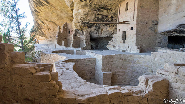
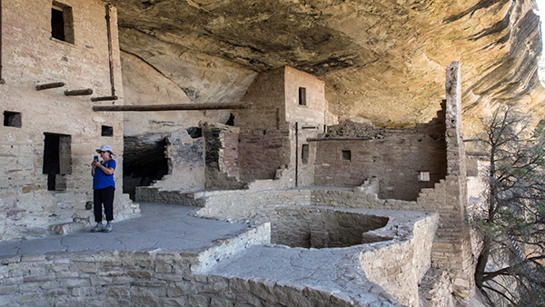
 Cliff Palace [photo by John R] |
 Cliff Palace [photo by John R] |
 Theirs was a magnificent setting. [photo by Quy] |
 Ranger-led tour of the Cliff Palace. [photo by John R] |
|
|
| Easy does it down those stairs. [photos by Quy] | |
 Hmmm, that ladder looks substantial enough. [photo by Quy] |
 Here’s a ranger to explain it. [photo by Quy] |
 You can walk through the door. [photo by Quy] |
 Looks like a fine place to live. [photo by Quy] |
 Let’s see what’s around the bend. [photo by Quy] |
 Cliff Palace. [photo by Quy] |
 Was the ball game played here? [photo by Quy] |
 This is a cause for celebration! [photo by Quy] |
 Ceremonial pit. [photo by Quy] |
 Tower of stone. [photo by Quy] |
 Are you sure you could get through there? [photo by Quy] |
 The artist is gone, but his work remains. [photo by Quy] |

|
|
| It’s a steep climb getting out. [photos by Quy] | |
|
|
| Are you sure this is on the up and up? [photos by Eileen] | |
|
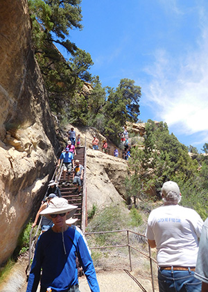
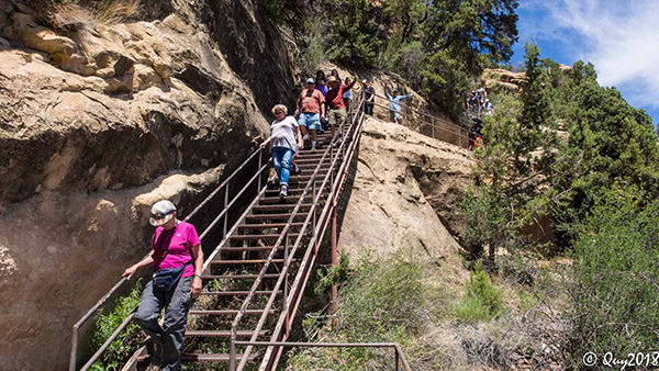
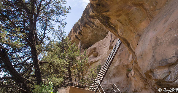
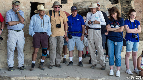
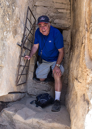
It is an awesome feeling standing in this dwelling and trying to imagine the noise and the daily chores the early settlers did all day long. They had a language but it was never codified so we do not know what the voices uttered as they spoke to each other and the words said by the children playing together. The Greeks, the Romans, the Chinese, the Egyptians and many other civilizations developed languages, alphabets, and wrote down their history, but not the native Indian Americans. A posted sign warned the visitor that cliff dwelling climbing can be strenuous and dangerous. These dwellings were at an elevation of 7,000 feet. The trails and walkways leading to them were steep and uneven, with steps and ladders to climb. The guided tour lasted one hour for each of the cliff dwellings we visited. Cliff Palace is the largest such a dwelling at Mesa Verde. This dwelling would have been comprised of several families. Each family had its own rooms. There were also rooms used for food storage. The natives subsisted on beans, squash, corn and small game animals such as rabbits, turkeys and squirrels. The round rooms below grade that you see in the dwellings are called Divas and were used as ceremonial rooms. Once we finished our visit to Cliff Palace, we drove a short distance away for our next cliff dwelling visit: Balcony House. |
 I want to hear it all. [photo by Eileen] |
 The pathway has been improved somewhat. [photo by Joe] |
 Look before you leap. [photo by Joe] |
 Made it to the Balcony House. [photo by John R] |
 Shade, at last! [photo by John R] |
 We have a grand overview. [photo by John R] |
|

|
| Mother of all inventions: knee pad protection for tunnel crawl. [photos by John R] | |
 They say the tunnel is this way. [photo by John R] |
 Let’s stop here and take pictures. [photo by John R] |
|

|
| Abandon elevation all ye who enter here, [photos by John R] | |
 Some of the trails are paved. [photo by Quy] |
 A’down we go. [photo by Quy] |
 We hit a level stretch. [photo by Quy] |
 Will the stairs ever end? [photo by Quy] |
 Apparently not. [photo by Quy] |
 Are you sure those rungs are securely fastened? [photo by Quy] |
 Looks OK. Let’s go. [photo by Quy] |
 Balcony House. [photo by Quy] |
 See, they’ve cut steps into the rock. [photo by Quy] |
 Cheer up! We’re almost there. [photo by Quy] |
 What a great place for pictures! [photo by Quy] |
|
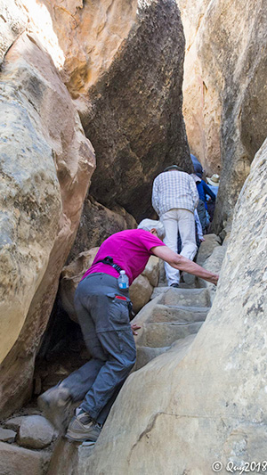
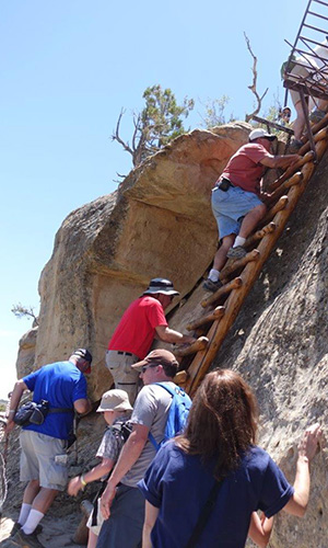
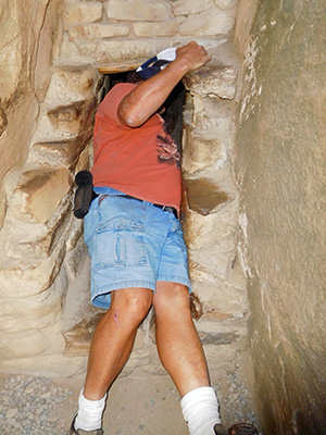
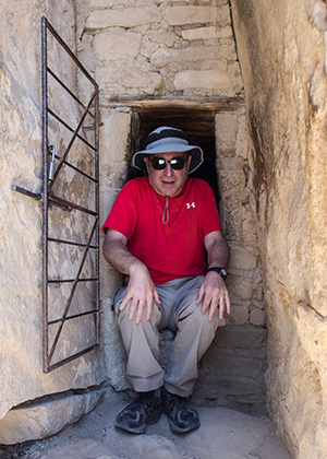
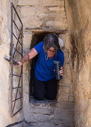
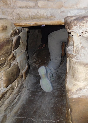
Balcony House was interesting. Not only did we have to squeeze through tight passages in the rock walls, but we also had to climb up steep ladders. The trickiest part, in order to exit the dwelling, was had to crawl through a narrow rectangular cut in the rock nicknamed “the tunnel”. You will see a picture of the tunnel framing Quy, just to highlight the narrowness of the tunnel. |
 What’s this? I’ve been framed. [photo by John S] |
 Well here’s the frame. [photo by Quy] |
| Now let’s squeeze through the tunnel. [photos by Quy] | |

|
|
|
|
|
|
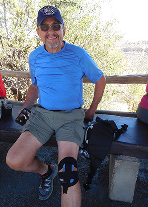
 Yes, that knee brace worked. [photo by Dave] |
|
|
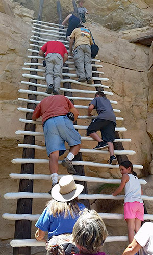
John S. improvised a knee protection pad to protect his knee for when he crawled in the tunnel. The tunnel is 12 feet long by 18 inches wide. We all made it through without any problem. No one got stuck there. On the other side of this tunnel, we had to clamber up ladders to reach the top of the mesa. |
 Here; let me take your picture before we start climbing out. [photo by John R] |
 It’s a steep climb. [photo by John R] |
 Up we go. [photo by Quy] |
 |
 They provided cables to hold on to. [photos by John R] |
|
Once we exited the dwelling and reached the mesa, the early exited hikers formed a cheering committee. Sitting under the shade of a tree, they applauded the late arrivals as they climbed up the ladders. |
 Let’s welcome them up here. [photo by John R] |
 Something to cheer about! [photo by John R] |
 ... and here is Yanis |
 Eileen |
 Chuck |
 Michael |
 The Park Ranger |
|
At the conclusion of the visits to the cliff dwellings, we visited a nearby Chapin Mesa Archeological Museum. A 25 minute video gives the visitor an orientation and an excellent overview of the history of Mesa Verde. The auditorium was so comfortable, and with the lights out and with a southing soft music accompanying the video, it was not very difficult for some of us to take a short snooze. Outside the auditorium there were many rooms displaying various artifacts and pictures of the early settlers. |
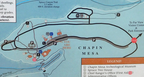 You are here. [photo by John R] |
 The museum has some great exhibits. [photo by John R] |
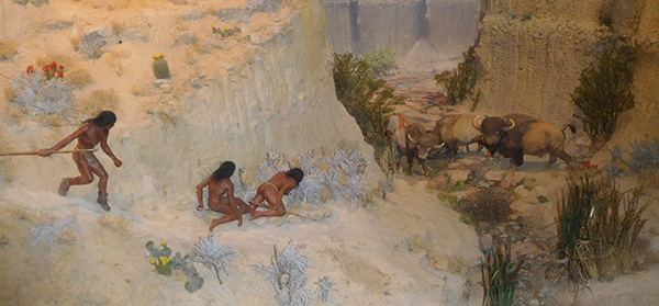 Bring my atlatl. We’re hunting buffalo. [photo by John R] |
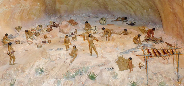 Community life. [photo by John R] |
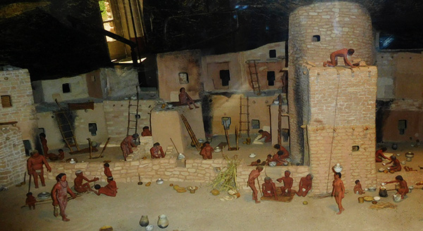 This is our home. [photo by John R] |
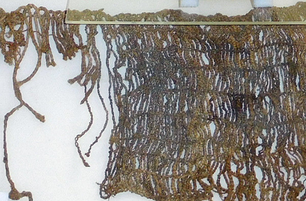 Can you weave cloth so fine? [photo by John R] |
 We were expert pottery makers. [photo by John R] |
 I’m not a buzzard, thank you. [photo by John R] |
|
Back at base camp it was time for our second night of pot luck dinner, but first we have to unwind from our day’s activities. |
 What a day! [photo by Yanis] |
 Let me tell you the latest. [photo by Yanis] |
 Now let’s eat. [photo by John R] |
 Here, have some. [photo by Quy] |
 This is my special recipe. [photo by Quy] |
 Sure, I’ll drink to that. [photo by Quy] |
 A toast to our leader. [photo by Quy] |
|
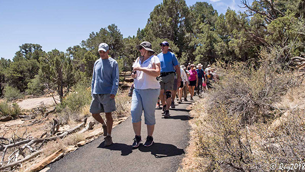
Day Three: Monday, June 11 On day three we were scheduled to visit the Wetherill Mesa, a flat top that provides a 5 miles paved loop trail hike. At the campground we held a quick heads up meeting for the day’s activities and off we go on a 27 mile drive to the end of the road that leads to Wetherill Mesa hiking area and more cliff dwellings. Before we launched ourselves on the hike, we stopped for another group picture and we were off on a 5 miles hike called Long House Looped Trail. Several cliff dwellings dot the trail. We first take a one mile side trail to visit from distance the Nordinski site #16. From across the canyon we could see the cliff dwelling that once was buzzing with humans. |
 Trailblazers get ready for a big day. [photo by Quy] |
 Everybody smile for the camera. [photo by Quy] |
 We’re off to see the wizard ... [photo by Quy] |
 The only traffic on this road is us. [photo by Quy] |
 A fire burned through here. [photo by Quy] |
 The road to ruins. [photo by Quy] |
 How the Kodak House got its name. [photo by Quy] |
 People lived in cliff houses for protection. [photo by Quy] |
 Plenty of green at the bottom. [photo by Quy] |
 Lots of rocks fell off the Kodak House. [photo by Joe] |
 Trailblazers enjoy the view. [photo by Joe] |
 The fence is there for your protection. [photo by Joe] |
 Rangers will take you inside. [photo by Joe] |
|
We also came upon Long House and Kodak House. The mesa top is flat, however, due to a forest fire several years ago, all the trees burned down. There was total defoliation of the land. The new vegetation has not taken root. Hence, the sun was beating down hard on us with no shade anywhere. Noon time was approaching. A quick lunch break would be greatly welcome. Luckily, knowing their climate, the park management, on more than one location, erected canopies and equipped the locations with a restroom and picnic benches for the weary hikers. The shade was quite welcome. |
 A fire devastated the mesa. [photo by Quy] |
 Follow the winding road. [photo by John R] |
 Eventually we get to the Long House Overlook. [photo by John R] |
 Let’s enjoy the view. [photo by John R] |
 Great place for a snack. [photo by John R] |
 Marching on. [photo by John R] |
 The #416 Durango fire from 40 miles away. [photo by John S] |
 Hydration is very important. [photo by John S] |
|
Not all Indian tribes lived in cliff dwellings. Some lived right here on the mesa and cultivated the land around them. |
 Far View Community. [photo by Quy] |
 A lot of stone blocks were used to build this. [photo by Quy] |
 The good life. [photo by Quy] |
 City on the edge of forever. [photo by Quy] |
 But I live somewhere else. [photo by Quy] |
 That’s the idea. Let’s move it indoors. [photo by Eileen] |
 They need a floor covering. [photo by Eileen] |
|
At the end of Long House Looped Trail, there was a large covered area with a park information center stand and a refreshment kiosk. Cold drinks never tasted better! Nearby, some of us who did not have enough of the cliff dwellings took a short stride to visit Step House for a self-guided tour. |
 The trail begins here. [photo by Quy] |
 It gets steep and narrow. [photo by Quy] |
 Kim, remember to duck. [photo by Quy] |
 Desert varnish. [photo by Quy] |
 At least they have stairs. [photo by Quy] |
 Meanwhile, let’s enjoy the view. [photo by Quy] |
 Oh, this is steep! [photo by Quy] |
 Got past that one. [photo by Quy] |
 Here’s a big overhang. [photo by Quy] |
 Climbing the stairs. [photo by Quy] |
|
By mid-afternoon we return to our campground. It is hot and the sun is sizzling. We had a reservation at the Brewery restaurant in Cortez, a town of about 10 miles away. Everybody has plenty to eat and is pleased with the service. |
 Rudy plays the harmonica. [photo by John R] |
 Michael takes pictures. [photo by John R] |
 Brewery Restaurant. [photo by John R] |
 Brewery Restaurant. [photo by John R] |
|
Day Four: Tuesday, June 12 This was our last full day. Several sets of people would return to Phoenix, understandably so, because of work requirements. For the rest of us, this was an easy day: do whatever your heart desires. Some of us stayed around the campground and did laundry. Others took a quick drive, 35 miles away, to visit Durango, the steam locomotive museum and the narrow gauge train. Durango is a historic town, organized in 1880 to serve the San Juan mining district. The Denver and Rio Grande Railroad chose the site on the Animas River for its depot. The railroad line from Durango to Silverton has run continuously since 1881, although it is now only a tourist and heritage line hauling passengers, and is one of the few places in the U.S. which has seen continuous use of steam locomotives. In the winter, Durango is a snow skiing country and during the summer, hiking in the surrounding mountains is a relief from hot climate cities, or you can take long walks along the banks of the Animas River which dissects the town, or stroll along Main Ave. and visit various historic hotels, eat at quaint restaurants to appease any palate, or visit the train museum where you will see a collection of various steam locomotives, fire trucks, antique cars and trucks, and a ton of pictures and train-related artifacts. Are you old to remember the trains’ roundhouse? The Silverton railroad was narrow gauge, which suits better the sharp mountain curves where speed was not required as compared to the regular gauge train. Do you know the measurements, or better yet, the distance between the two rails of the two types of rail gauges: the narrow and standard gauges? Here is the answer for you: the narrow gauge is 3 feet from rail to rail and the standard is 4 feet 8.5 inches! You are now so much smarter! Now you may quiz your friends’ knowledge and act like a real smart dude! Several of our group had wanted to take a train ride to Silverton, a one hour ride to north of Durango, just for nostalgic reasons. Unfortunately, due to the fire # 416 burning just outside of Durango, the train rides were cancelled. You could not get close enough to see the burning fire, but you could see the town engulfed in smoke. Below are some pictures of smoke filled Durango, smoke billowing from across town, on the other side of a mountain ridge. |
 Smoke is billowing up from the fire. [photo by Dave] |
 Glad the wind is blowing the other way. [photo by John R] |
 The D&RGW Depot in Durango. [photo by John R] |
 No. 481 won’t be rolling today. [photo by John R] |
 How a steam locomotive works. [photo by John R] |
 Narrow-gauge train to Silverton. [photo by John R] |
 Bridge over the Animas River. [photo by John R] |
 Dottie, framed by Durango. [photo by John R] |
 Downtown Durango. [photo by John R] |
|
|
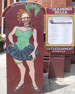
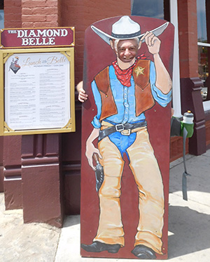
| The Diamond Belle Saloon. [photos by John R] | |
|
Oh yes, there were several diehard hikers who wanted to do some more hiking on our last day. So, on Tuesday they decided to drive back to Chapin Mesa and hike the 2.4 mile Petroglyph Trail. |
 People once lived here. [photo by John S] |
 Looks like an icicle, but it isn’t. [photo by John S] |
 Let the sun shine in. [photo by John S] |
 All those cavities in the rock would make my dentist nervous. [photo by John S] |
 Hmmm, what do we have here? [photo by John S] |
 An artist made intricate designs on the rock, [photo by John S] |
 Too bad we can’t talk with the artist. [photo by John S] |
|
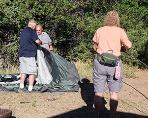
Day Five: Wednesday, June 13 Everybody was up by 6:00 AM. We started to take down the tents and pack it all away in our cars. Everything that came up with us must go back down with us. By 8:00 AM, our cars were fully packed for the 450 mile drive back to Phoenix, but not before hugging and kissing each other “goodbyes” and wishing safe travel. And as they say “all good things must come to an end”, when one adventure ends it is time to lay the grounds for the next camping trip adventure! Where and when will it be? |

|
|

|
|
 Farewell, fellow Trailblazers. Parting is such sweet sorrow. [photos by John R] |
|
|
On the drive out of Mesa Verde, it will be unjust if you did not stop by and pay a visit to the Visitors’ Center. It is rich in history of the early Indian settlers of Mesas Verde. Here are some photos. |
 Preserving the Past. [photo by John R] |
 We had turkeys. [photo by John R] |
 A lot of wisdom to share. [photo by John R] |
 I can make pottery, too. [photo by John R] |
 You grind grain with a mano. [photo by John R] |
 How to grow corn. [photo by John R] |
 It was this way, you see. [photo by John R] |
 We liked to climb rocks. [photo by John R] |
|
To the few hikers who sent in some of their pictures for this report, thank
you for sharing them with us. → more pictures |
 Top of Page
Arizona Trailblazers Hiking Club, Phoenix, Arizona
Comments? Send them to the AZHC .
updated July 9, 2018